Nsawam
| Nsawam | ||
|---|---|---|
| Town | ||
| ||
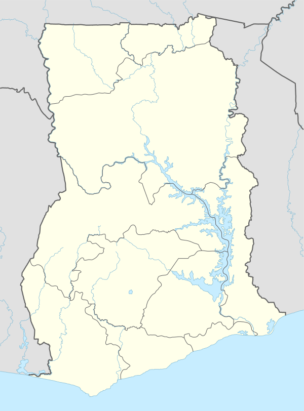 Nsawam Location of Nsawam in Eastern Region, Ghana | ||
| Coordinates: 05°48′00″N 00°21′00″W / 5.80000°N 0.35000°W | ||
| Country |
| |
| Region | Eastern Region | |
| District | Akwapim South Municipal | |
| Population (2013) | ||
| • Total | 44,522[1] | |
| Time zone | GMT | |
| • Summer (DST) | GMT (UTC) | |
Nsawam is a town in south Ghana and is the capital of the Akuapim South Municipal District, a district in the Eastern Region of south Ghana. The main ethnic group is Akan, followed by Ga and then Ewe.[2] Nsawam is controlled by Akuapim South Municipal District (ASMD). As of 2013, Nsawam has a settlement population of 44,522 people.[1] Nsawam is situated on a main railway and highway to Kumasi.[2] It has a major river acting as a border between itself and Adoagyir. Densu River, is the main source of water for both domestic and industrial purposes for people in and around Nsawam.
Name
There are two other places in Ghana with the same name.[2]
Security Prison
Nsawam is the location of Ghana's Security Prison "Nsawam Medium Security Prison".[2]
Education
Secondary education
Nsawam has two major secondary schools - St. Martins Secondary School (SMARTS) and Nsawam Secondary School (NSASCO). Nsawam also has several prominent and great junior high schools; debatably Nana Osae Djan and Perseverance School complex being the most prominent among the others which are Rev. Father wieggers Roman Catholic school, Anglican A & C Basic school, Good foundation international school.[2]
Higher education
Nsawam has two major secondary schools - St. Martins Secondary School (SMARTS) and Nsawam Secondary School (NSASCO). Other schools like Prince Boateng Memorial school which runs from the nursery to senior high school and a vocational institute, in addition to BOPA College of Arts and Sciences is also situated in Nsawam. BOPA College of Arts is a private vocational school for young women. They learn sewing, catering and designing of clothing. Nsawam also has several prominent and great junior high school; debatably Nana Osae Djan and Perseverance school complex being the most prominent. In Nsawam there is also a Business Complex School dedicated to the grooming of Secretaries and entry-level business students. This school, Millennium Kings Academy, located on the Court Street, Nsawam, was established almost 30 years ago.[2]
Climate
| Climate data for Nsawam | |||||||||||||
|---|---|---|---|---|---|---|---|---|---|---|---|---|---|
| Month | Jan | Feb | Mar | Apr | May | Jun | Jul | Aug | Sep | Oct | Nov | Dec | Year |
| Average high °C (°F) | 32 (90) |
32 (90) |
32 (90) |
32 (89) |
31 (87) |
29 (85) |
28 (82) |
28 (82) |
28 (82) |
30 (86) |
32 (89) |
31 (88) |
32 (90) |
| Average low °C (°F) | 24 (75) |
24 (75) |
24 (76) |
24 (76) |
24 (75) |
23 (73) |
23 (73) |
23 (73) |
23 (73) |
23 (73) |
23 (73) |
23 (73) |
23 (73) |
| Average precipitation mm (inches) | 8 (0.3) |
25 (1.0) |
25 (1.0) |
102 (4.0) |
152 (6.0) |
152 (6.0) |
76 (3.0) |
25 (1.0) |
76 (3.0) |
76 (3.0) |
25 (1.0) |
5 (0.2) |
749 (29.5) |
| Source: Myweather2.com[3] | |||||||||||||
Healthcare
The town of Nsawam is the most preferred hotspot for health care in the Akuapim South Municipal District as it houses the Nsawam Government Hospital, not far from the Nsawam Medium Security Prisons, and over five other recognised health centres.[2]
Transport
Train and road
Nsawam is served indirectly by a railway station on the Ghana national railway network, which serves as a link between Accra and Kumasi. Over the last decade however, the coaches run, on the Accra-Nsawam route as the only relic from the glorious days of rail transport.[2]
Nsawam serve as the major business center for most farming communities such as Pakro, Fotobi, Asiaw-Krom, Dobro, Nkyenekyene, Ahodjo, etc.
See also
References
- 1 2 "World Gazetteer online". World-gazetteer.com.
- 1 2 3 4 5 6 7 8 Akuapim South Municipal
- ↑ "Nsawam Weather Averages". Myweather2. 2013. Retrieved 21 June 2013.
External links
| Municipal |
|  |
|---|---|---|
| District |
| |
Coordinates: 05°48′00″N 00°21′00″W / 5.80000°N 0.35000°W