Koforidua
| Koforidua City of Koforidua | ||
|---|---|---|
| City | ||
| ||
| Nickname(s): Kof Town | ||
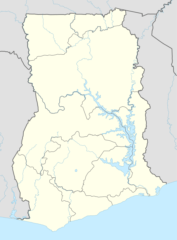 Koforidua Location of Koforidua in Eastern region, Ghana | ||
| Coordinates: 6°06′N 0°16′W / 6.100°N 0.267°W | ||
| Country |
| |
| Region | Eastern Region | |
| District | New-Juaben Municipal | |
| Elevation | 238 m (781 ft) | |
| Population (2012) | ||
| • Total | 127,334[1] | |
| Time zone | GMT | |
| • Summer (DST) | GMT (UTC) | |
| Area code(s) | 034 | |
Koforidua, also popularly known as K-dua, is a city and capital of Eastern Region in south Ghana. Koforidua has a settlement population of 127,334 people in 2012.[1]
Koforidua serves as a commercial centre for the Eastern region and New-Juaben Municipal District. The city is home to many businesses, with the exception of heavy duty industries, and the recent construction of the four-lane highway road linking Adawso and Koforidua to Oyoko brings commerce to the city. The highway also serves as a valid alternative route to reach Kumasi.
Etymology
Oral tradition has it that Koforidua owes its name to an Akan man, Kofi Ofori, who had built his hut under a huge mahogany tree. This tree provided shelter for weary farmers who were returning from their farms after a hard day's work. Overtime it became common for the farmers to say that they were going to rest under Kofi Ofori's tree. In Akan, the south country's native language, the word for tree is "dua". An amalgamation of Kofi Ofori's name and tree, therefore, becomes "Koforidua."
History
Koforidua was founded in 1875 by Akan migrants from Asanteman. The completion in 1923 of the Kumasi railway saw Koforidua become an important road and rail junction. Koforidua is one of the country's oldest cocoa-producing centres. It is also noted today for its weekly Thursday bead market, which draws bead buyers and sellers from all over the Eastern region.
Geography and climate
The New Juaben Municipality falls within the Eastern Region of South Ghana. The municipality covers an estimated area of 110 square kilometres, constituting 0.57% of the total land area of the Eastern Region.[2] The municipality has 48 electoral areas.
Koforidua has an annual rainfall ranging from 50 – 120 inches and 20 – 32 Celsius mean annual temperatures.
The New-Juaben municipality shares boundaries with East-Akim Municipality to the northeast, Akwapim North District to the east and south, and Suhum-Kraboa-Coaltar District to the west. The city of Koforidua (New Juabeng) is made up of several neighbourhoods and settlements, including Effiduase, Asokore, Oyoko, Jumapo, Suhyen, Dansuagya, Betom, and Srodae. Koforidua is two hours by road from Accra.
| Climate data for Koforidua | |||||||||||||
|---|---|---|---|---|---|---|---|---|---|---|---|---|---|
| Month | Jan | Feb | Mar | Apr | May | Jun | Jul | Aug | Sep | Oct | Nov | Dec | Year |
| Average high °C (°F) | 32 (90) |
32 (90) |
33 (92) |
32 (89) |
32 (90) |
29 (85) |
28 (82) |
28 (82) |
28 (82) |
30 (86) |
32 (89) |
31 (88) |
33 (92) |
| Average low °C (°F) | 24 (75) |
24 (75) |
26 (78) |
24 (76) |
25 (77) |
23 (73) |
23 (73) |
23 (73) |
22 (72) |
23 (73) |
23 (73) |
23 (73) |
22 (72) |
| Average precipitation mm (inches) | 8 (0.3) |
25 (1.0) |
51 (2.0) |
102 (4.0) |
127 (5.0) |
152 (6.0) |
76 (3.0) |
25 (1.0) |
76 (3.0) |
76 (3.0) |
25 (1.0) |
8 (0.3) |
752 (29.6) |
| Source: Myweather2.com[3] | |||||||||||||
Demographics
Presently the city's population is 127,334 people[1] and is dominated by Akans. The 'Akwantukese' (The Big Journey Festival) is celebrated yearly to mark the movement of the inhabitants of Koforidua's ancestors from 'Asanteman' to their present location of Koforidua.
Economy

Industries
Industrial activities of Koforidua include textiles, crafts, soap, carpentry and joinery, traditional medicine, pottery and ceramics, and the production of alcoholic and non-alcoholic beverages.[4][5]
Agriculture
Koforidua's favourable weather conditions, as well as suitable soil types, constitute a recipe for the production of food and cash crops. Agricultural crops include: cassava, kola, maize, plantain, cocoa, yam, citrus, palm oil, kennel oil, tomatoes, onions, black pepper, mushrooms and spices.[4]
Cocoa production
Koforidua produces cocoa. However, as cocoa production has moved westward to the Ashanti Region and Brong-Ahafo Region areas of virgin soil, Koforidua has become increasingly dependent upon its commercial and business administrative functions. The city of Koforidua has only small-medium scale industries today.[4]

Tourism

.ogv.jpg)
Koforidua's predominant tourism attractions include such natural features as Obuo Tabri Mountain, which is considered sacred. Nearby is Akosombo Dam, which holds Lake Volta, the world's largest man-made lake.
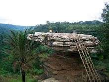
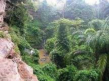
Waterfalls in the area, such as Akaa Falls and Boti Falls, and the Umbrella Rock attract tourists to the Eastern region. Even though such tourist sites are functioning all year round, tourists are at times encouraged to visit the place at certain times of the year, especially during the rainy seasons. At such times, the Boti Falls in particular is fully at its peak beauty and very interesting to visit.
Education
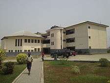
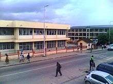
Koforidua remains a major hub of education in Ghana. It is home to over 70 basic schools and a number of prominent senior high schools in the country. In 2012, one of its schools; Pope John Senior High School and Minor Seminary, was ranked 9th of the over 200 senior high schools in Ghana. The city also has a Technical University (Koforidua Technical University) and a private university (All Nations University College).

See also
References
- 1 2 3 "World Gazetteer online". World-gazetteer.com.
- ↑ "New-Juaben Municipal". New Juaben Municipal. Retrieved 25 January 2010.
- ↑ "Koforidua Weather Averages". Myweather2. 2013. Retrieved 20 June 2013.
- 1 2 3 "Agricultural sector". New Juaben Municipal. Retrieved 25 January 2010.
- ↑ Latest Ghana News. Vibe Ghana
External links
| Wikimedia Commons has media related to Koforidua. |
Coordinates: 6°05′00″N 0°15′00″W / 6.08333°N 0.25000°W