New Jersey's 3rd congressional district
"NJ-3" redirects here. NJ-3 may also refer to New Jersey Route 3.
| New Jersey's 3rd congressional district | |
|---|---|
|
District map as of 2013 | |
| Current Representative | Tom MacArthur (R) |
| Distribution |
|
| Population (2000) | 647,258 |
| Median income | 55,282 |
| Ethnicity |
|
| Occupation | |
| Cook PVI | R+1 |
.svg.png)
New Jersey's Third Congressional District is represented by Republican Tom MacArthur.
Counties and municipalities in the district
For the 113th and successive Congresses (based on redistricting following the 2010 Census), this congressional district contains all or portions of two counties and 53 municipalities:[1]
Burlington County: (36)
- Beverly, Bordentown City, Bordentown Township, Burlington City, Burlington Township, Chesterfield Township, Cinnaminson Township, Delanco Township, Delran Township, Eastampton Township, Edgewater Park Township, Evesham Township, Fieldsboro, Florence Township, Hainesport Township, Lumberton Township, Mansfield Township, Medford Lakes, Medford Township, Moorestown Township, Mount Holly Township, Mount Laurel Township, New Hanover Township, North Hanover Township, Pemberton Borough, Pemberton Township, Riverside Township, Riverton Borough, Shamong Township, Southampton Township, Springfield Township, Tabernacle Township, Westampton Township, Willingboro Township, Woodland Township and Wrightstown
Ocean County: (17)
- Barnegat Township, Beachwood, Berkeley Township, Brick Township, Island Heights, Lacey Township, Lavallette, Mantoloking, Ocean Gate, Ocean Township, Pine Beach, Point Pleasant (part), Seaside Heights, Seaside Park, South Toms River, Stafford Township (part) and Toms River Township
Voting
| Election results from presidential races | ||
|---|---|---|
| Year | Office | Results |
| 2008 | President | Obama 52 – 47% |
| 2004 | President | Bush 51 – 49% |
| 2000 | President | Gore 54 – 43% |
List of representatives
| Representative | Party | Years | District home | Note |
|---|---|---|---|---|
| District organized from New Jersey's At-large congressional district in 1799 | ||||
 James Linn James Linn |
Democratic-Republican | March 4, 1799 – March 4, 1801 | Hunterdon and Somerset Counties | |
| District organized to New Jersey's At-large congressional district in 1801 | ||||
1813–1815: Two seats
From 1813 to 1815, two seats were apportioned, elected at-large on a general ticket. This district was organized from New Jersey's At-large congressional district.
Seat A
| Representative | Party | Years | District home | Note |
|---|---|---|---|---|
| William Coxe, Jr. |
Federalist | March 4, 1813 – March 4, 1815 | Burlington | Burlington, Cape May, Cumberland, Gloucester, and Salem Counties |
Seat B
| Representative | Party | Years | District home | Note |
|---|---|---|---|---|
| Jacob Hufty |
Federalist | March 4, 1813 – May 20, 1814 | Salem | Redistricted from the At-large congressional district, died |
| Vacant | May 20, 1814 – November 2, 1814 | |||
| Thomas Bines |
Democratic-Republican | November 2, 1814 – March 4, 1815 | Pennsville | |
District organized to New Jersey's At-large congressional district in 1815
1843–present: One seat
| Representative | Party | Years | District home | Note |
|---|---|---|---|---|
| District organized from New Jersey's At-large congressional district | ||||
| Isaac G. Farlee |
Democratic | March 4, 1843 – March 4, 1845 | Flemington | Hunterdon, Sussex, and Warren Counties |
| John Runk |
Whig | March 4, 1845 – March 4, 1847 | Kingwood | Hunterdon, Mercer, Middlesex, and Somerset Counties |
| Joseph E. Edsall |
Democratic | March 4, 1847 – March 4, 1849 | Hamburg | Redistricted from the 4th congressional district (return to 1843 alignment) |
| Isaac Wildrick |
Democratic | March 4, 1849 – March 4, 1853 | Blairstown | |
| Samuel Lilly |
Democratic | March 4, 1853 – March 4, 1855 | Lambertville | Hunterdon, Middlesex, Somerset, and Warren Counties |
| James Bishop |
Opposition | March 4, 1855 – March 4, 1857 | New Brunswick | |
 Garnett Adrain Garnett Adrain |
Democratic | March 4, 1857 – March 4, 1859 | New Brunswick | |
| Lecompton Democrat | March 4, 1859 – March 4, 1861 | |||
| William G. Steele |
Democratic | March 4, 1861 – March 4, 1865 | Somerville | Union County added 1862 |
| Charles Sitgreaves |
Democratic | March 4, 1865 – March 4, 1869 | Phillipsburg | |
 John T. Bird John T. Bird |
Democratic | March 4, 1869 – March 4, 1873 | Flemington | |
 Amos Clark, Jr. Amos Clark, Jr. |
Republican | March 4, 1873 – March 4, 1875 | Elizabeth | Middlesex, Monmouth, and Union Counties |
 Miles Ross Miles Ross |
Democratic | March 4, 1875 – March 4, 1883 | New Brunswick | |
 John Kean John Kean |
Republican | March 4, 1883 – March 4, 1885 | Elizabeth | |
 Robert S. Green Robert S. Green |
Democratic | March 4, 1885 – January 17, 1887 | Elizabeth | resigned after being elected Governor of New Jersey |
| Vacant | January 17, 1887 – March 3, 1887 | |||
| John Kean |
Republican | March 4, 1887 – March 4, 1889 | ||
| Jacob A. Geissenhainer |
Democratic | March 4, 1889 – March 4, 1895 | Middlesex, Monmouth, and Somerset Counties from 1892 | |
 Benjamin F. Howell Benjamin F. Howell |
Republican | March 4, 1895 – March 4, 1911 | Middlesex, Monmouth, and Ocean Counties from 1902 | |
| Thomas J. Scully |
Democratic | March 4, 1911 – March 4, 1921 | ||
| T. Frank Appleby |
Republican | March 4, 1921 – March 4, 1923 | ||
| Elmer H. Geran |
Democratic | March 4, 1923 – March 4, 1925 | ||
| Vacant | March 3, 1925 – November 3, 1925 | |||
 Stewart H. Appleby Stewart H. Appleby |
Republican | November 3, 1925 – March 4, 1927 | Installed after special election due to death of rep-elect T. Frank Appleby | |
| Harold G. Hoffman |
Republican | March 4, 1927 – March 4, 1931 | ||
| William H. Sutphin |
Democratic | March 4, 1931 – January 3, 1943 | Part of Middlesex County north of the Raritan River removed 1932 | |
 James C. Auchincloss James C. Auchincloss |
Republican | January 3, 1943 – January 3, 1965 | Remainder of Middlesex County to the new 15th District 1962 | |
 James J. Howard James J. Howard |
Democratic | January 3, 1965 – March 25, 1988 | died From 1966 election New Jersey Districts no longer follow county lines. | |
| Vacant | March 25, 1988 – November 8, 1988 | |||
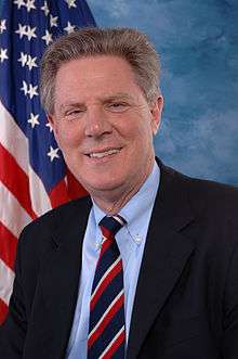 Frank Pallone, Jr. Frank Pallone, Jr. |
Democratic | November 8, 1988 – January 3, 1993 | Long Branch | Redistricted to the 6th congressional district |
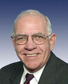 H. James Saxton H. James Saxton |
Republican | January 3, 1993 – January 3, 2009 | Mount Holly | Redistricted from the 13th congressional district |
 John Adler John Adler |
Democratic | January 3, 2009 – January 3, 2011 | Cherry Hill | |
 Jon Runyan Jon Runyan |
Republican | January 3, 2011 – January 3, 2015 | Mount Laurel Township | |
 Tom MacArthur Tom MacArthur |
Republican | January 3, 2015 – | Toms River | Incumbent |
References
- ↑ Plan Components Report, New Jersey Redistricting Commission, December 23, 2011. Accessed November 6, 2016.
- Martis, Kenneth C. (1989). The Historical Atlas of Political Parties in the United States Congress. New York: Macmillan Publishing Company.
- Martis, Kenneth C. (1982). The Historical Atlas of United States Congressional Districts. New York: Macmillan Publishing Company.
- Congressional Biographical Directory of the United States 1774–present
Coordinates: 39°51′48″N 74°50′59″W / 39.8633°N 74.8498°W
This article is issued from Wikipedia - version of the 11/7/2016. The text is available under the Creative Commons Attribution/Share Alike but additional terms may apply for the media files.