New Jersey Route 3
| |||||||
|---|---|---|---|---|---|---|---|
 | |||||||
| Route information | |||||||
| Maintained by NJDOT | |||||||
| Length: | 10.84 mi[1] (17.45 km) | ||||||
| Existed: | 1927 – present | ||||||
| Major junctions | |||||||
| West end: |
| ||||||
|
| |||||||
| East end: |
| ||||||
| Location | |||||||
| Counties: | Passaic, Bergen, Hudson | ||||||
| Highway system | |||||||
| |||||||

Route 3 is a state highway in the northern part of New Jersey in the United States. The route runs 10.84 miles (17.45 km) from U.S. Route 46 in Clifton, Passaic County to U.S. Route 1/9 in North Bergen, Hudson County. Route 3 is sometimes called the Secaucus Bypass within Secaucus. The route is a divided highway for its entire length, with most of the highway considered a freeway, except the westernmost part, which contains direct access to a few businesses. Route 3 intersects many major roads, including the Garden State Parkway and Route 21 in Clifton, the western spur of the New Jersey Turnpike (Interstate 95) in East Rutherford, the eastern spur of the New Jersey Turnpike in Secaucus, and Route 495 in North Bergen. A commuting route for northern New Jersey to the Lincoln Tunnel into New York City by way of Route 495, Route 3 also provides access to the Meadowlands Sports Complex in East Rutherford. The road inspired a story in The New Yorker in 2004 by Ian Frazier.
Route 3 was originally established in 1927 to run from the New York border on the west shore of Greenwood Lake to Secaucus. In 1929, the western terminus was cut back to Paterson when the alignment west of there was planned to become part of Route S4B. Route 3 originally followed present-day Route 20 through Paterson and ran along local streets to East Rutherford, where it followed present-day Route 120 and the Paterson Plank Road to Secaucus. It was extended east to the Lincoln Tunnel in 1939. The freeway section of Route 3 between U.S. Route 46 in Clifton and East Rutherford was completed in the 1940s as Route S3 as well as the Secaucus Bypass, which was designated a bypass of Route 3. Route 3 was moved to the Route S3 freeway and the Secaucus Bypass in 1953 and was truncated to U.S. Route 1/9 in North Bergen in 1959 when the Lincoln Tunnel approach was designated as Interstate 495. The Route 3 freeway has seen many improvements over the years such as widening and interchange reconstructions. It underwent a major reconstruction, completed in 2016, to modern highway standards with bridge replacements, including a new Passaic River bridge between Clifton and Route 17 in Rutherford.
Route description
Passaic County
Route 3 heads to the southeast, from an interchange with U.S. Route 46 and County Route 621 (Valley Road) as a six-lane divided highway with a Jersey barrier. It is not up to freeway standards, as it contains a few businesses with right-in/right-out access.[2] The route interchanges with County Route 623 (Grove Street) and County Route 509 (Broad Street), then the Garden State Parkway, where it interchanges with the southbound lanes and then the northbound lanes. All interchange movements are present between Route 3 and the Garden State Parkway, except from the southbound Garden State Parkway to westbound Route 3 and from eastbound Route 3 to the northbound Garden State Parkway.[1]
Past the Garden State Parkway, Route 3 eventually turns into a six-lane freeway that is not designed to Interstate Highway standards.[3] It interchanges with County Route 622 (Bloomfield Avenue), then intersects County Route 603 (Passaic Avenue), which heads south into Nutley to become Route 7. The next interchange is for County Route 601 (Main Avenue). Past that interchange, Route 3 comes to an interchange with Route 21, then passes over the route.[1]
Bergen County
Route 3 crosses the Passaic River on a fixed bridge, which replaced a double-leaf trunnion bascule bridge in 2013, into Rutherford, Bergen County.[1][2][4] Just after crossing the river, the route interchanges with County Route 507 (Riverside Avenue). The freeway continues through a residential area and comes to an exit that provides access to southbound Route 17. Past this interchange, Route 3 is closely paralleled by Route 17 to the south until Route 3 interchanges again with Route 17, which continues to the north of Route 3.[1]
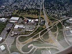
The route widens to eight lanes and enters the New Jersey Meadowlands, crossing into East Rutherford and then passing over the Berrys Creek. Route 3 passes to the south of the Meadowlands Sports Complex and has access to Route 120, MetLife Stadium, and the Meadowlands Racetrack in the eastbound direction and to MetLife Stadium and the Meadowlands Racetrack in the westbound direction.[1][2] The route narrows back to six lanes and comes to a ramp which provides access to the western spur of the New Jersey Turnpike (Interstate 95). Route 3 interchanges with Route 120 and the carriageways separately. The route passes under the western spur of the New Jersey Turnpike and becomes eight lanes again.[1]
Hudson County
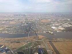
Route 3 crosses the Hackensack River into Secaucus, Hudson County. It interchanges with the Meadowlands Parkway and continues southeast into a residential area with the carriageways joining back together.[1][2] At the interchange with County Route 681 (Paterson Plank Road), Route 3 widens into a local-express lane configuration with three express lanes and local lanes each in the eastbound direction and two express lanes and three local lanes in the westbound direction. The route passes by the Mill Creek Mall and crosses under the mainline of the New Jersey Turnpike (Interstate 95).[1][2] Route 3 comes to an eastbound exit and entrance with Harmon Meadow Boulevard and features a cloverleaf interchange with Paterson Plank Road. The route crosses the Penhorn Creek into North Bergen. In North Bergen, the route comes to a truck-restricted eastbound ramp for eastbound Route 495. Route 3 then interchanges with Route 495, which provides access to the New Jersey Turnpike and the Lincoln Tunnel. Past this interchange, the local-express lane configuration ends and Route 3 heads southeast as a four-lane highway. The route meets a westbound exit and entrance for the Lincoln Tunnel Park & Ride and comes to its terminus at a traffic light with U.S. Route 1/9 south, with no direct access from Route 3 east to U.S. Route 1/9 north. (Both 1/9 north and 1/9 south do have connectors to the start of Route 3 west.)[1]
History
Route 3 was legislated by the 1927 New Jersey state highway renumbering to run from the New York border on the west shore of Greenwood Lake to Route 1 (now U.S. Route 1/9) in Secaucus.[5][6] In 1929, the route west of Paterson was designated to become part of Route S4B, a spur of Route 4, and Route 3 was modified to end at Route S4B north of Paterson. Route S4B was never built west of Paterson while the portion that was built became Route 208 in 1953.[7][8]
Following the 1929 amendments, Route 3 ran from Paterson along today's Route 20, through Clifton, Passaic, Wallington, Carlstadt, and East Rutherford along local streets, and finally down Paterson Plank Road (part of which is today's Route 120) to Secaucus.[9][10] In 1939, Route 3 was extended east along present-day Route 495 to the Lincoln Tunnel into Manhattan, New York City.[11]
.svg.png)
The section of what is now Route 3 from U.S. Route 46 in Clifton to Route 120 in East Rutherford was planned to be built as a freeway in the mid-1930s designated as Route S3, a spur of Route 3. Construction started in 1940, but it was interrupted by World War II.[12] It would resume, with the first section of freeway opening between Route 17 to Route 3 (now Route 120) in 1942. The freeway was completed by 1949, including a bypass of Secaucus that was designated as a bypass of Route 3. The freeway had cost a total of $10 million to build and cut commuting times between Northern New Jersey and Manhattan.[13] Before the freeway was completed, Route S3 was designated to follow Allwood Road between Hepburn Road and Bloomfield Avenue in Clifton; the road was later returned to Passaic County and is currently County Route 602.[12] In 1942, a spur of Route S3 in Clifton was commissioned; this became Route S3 Spur in 1948 and Route 161 in 1953.[8][14][15]
In the 1953 New Jersey state highway renumbering, Route 3 was realigned to follow the entire length of the Route S3 freeway. In addition, Route 3 in Secaucus was shifted off the Paterson Plank Road to the newly built Secaucus Bypass. The original alignment of Route 3 became Route 153.[8] Only the section west of Paterson Plank Road was state-maintained after the renumbering, and the entire route was eliminated by the 1990s.[16][17] In the mid-1950s, Route 3 was planned as one of the original routes of the Interstate Highway System; however, the New Jersey State Highway Department had deemed it too expensive to bring it up to Interstate Highway standards and Interstate 280 was favored instead.[18] In 1959, the Lincoln Tunnel approach was designated as Interstate 495 and Route 3 was truncated back to U.S. Route 1/9 in North Bergen.[19][20]
)_at_the_east_end_of_New_Jersey_Route_3_(Secaucus_Bypass)_in_North_Bergen%2C_New_Jersey.jpg)
Many improvements have occurred to the Route 3 freeway. In the 1970s, the interchanges with Route 17, the New Jersey Turnpike western spur, and Route 120 were improved with the construction of the Meadowlands Sports Complex in the area. The bridge over the Berrys Creek, originally built in 1948, was reconstructed in the mid-1990s and Route 3 was widened to eight lanes in the area near the bridge.[21] In 2003, the interchange with Route 495 and the intersection with U.S. Route 1/9 was improved at a cost of $16 million.[22]
Plans were made to improve Route 3 near the Meadowlands Sports Complex with the construction of American Dream Meadowlands. An overpass between eastbound Route 3 and northbound Route 120 was completed in May 2009 at a cost of $38.1 million, a flyover from southbound Route 120 to eastbound Route 3 was completed in early 2010 at a cost of $13 million, and improvements to the New Jersey Turnpike interchange was completed in the later part of 2010 at a cost of $49 million.[23][24]
Route 3 underwent a major reconstruction to modern highway standards with noise walls installed and bridge replacements, including the new Passaic River bridge that is now functional, between Main Avenue in Clifton and Route 17 in Rutherford. All work was completed by 2016.[25] In a separate project, the roadway was resurfaced in 2013 from just west of the Route 17 north interchange to U.S. Route 1/9 in North Bergen.[26]
The NJDOT is rebuilding the interchange at U.S. Route 46 and Valley Road in Clifton. This project will reconfigure ramps, bring bridges up to standard, and will provide for three-lane connections between Route 3 and U.S. Route 46. It is projected to cost more than $150 million. Construction on the first contract started in December 2015 and is expected to be completed in mid-2018. The second contract is in the final design stage.[3][27]
In popular culture
Route 3 was the inspiration for a story in The New Yorker in 2004 by Ian Frazier.[28] In this story, Frazier describes a bus journey along the route, mentioning scenes along the road such as traffic congestion, the Meadowlands Sports Complex, and the Tick Tock Diner off Route 3 in Clifton. He also described a walking journey he once took into New York City along Route 3, encountering heavy, noisy traffic speeding by and debris along the side of the road.[28]
In a Saturday Night Live sketch featuring Horatio Sanz and Derek Jeter, the fictional business "Derek Jeter's Taco Hole" is on Route 3 in Nutley, New Jersey between Kinko's and "El Duque's Shoe Repair".[29]
Exit list
All exits are unnumbered.
| County | Location | mi[1] | km | Destinations | Notes |
|---|---|---|---|---|---|
| Passaic | Clifton | 0.00 | 0.00 | ||
| Valley Road (CR 621) – Montclair, Paterson | Westbound exit and eastbound entrance | ||||
| 0.51 | 0.82 | Grove Street (CR 623) – Montclair, Paterson | |||
| 1.26 | 2.03 | Broad Street (CR 509) – Bloomfield, Paterson | |||
| 1.44 | 2.32 | Exit 153 on G.S. Parkway | |||
| 1.53 | 2.46 | Westbound exit and eastbound entrance; exit 153 on G.S. Parkway | |||
| 2.64 | 4.25 | Bloomfield Avenue (CR 622) – Bloomfield, Passaic | |||
| 3.41 | 5.49 | ||||
| 3.82 | 6.15 | Main Avenue (CR 601) – Nutley, Passaic | |||
| 4.70 | 7.56 | Western terminus of freeway section | |||
| Bergen | Rutherford | 5.01 | 8.06 | Eastbound exit and westbound entrance | |
| 5.67 | 9.12 | No eastbound exit | |||
| 6.36– 6.39 | 10.24– 10.28 | ||||
| East Rutherford | 7.21 | 11.60 | Meadowlands Sports Complex – Racetrack, Stadium | No westbound exit | |
| 7.27 | 11.70 | Exit 16W of the Western Spur | |||
| 7.58– 7.96 | 12.20– 12.81 | No eastbound exit | |||
| Hudson | Secaucus | 8.60 | 13.84 | Meadowlands Parkway | |
| 9.12 | 14.68 | Eastbound exit and westbound entrance | |||
| 9.89 | 15.92 | Harmon Meadow Boulevard | Westbound exit is from Route 495 only | ||
| 10.04 | 16.16 | Paterson Plank Road (CR 681) – North Bergen, Secaucus | Westbound exit is from Route 495 only | ||
| North Bergen | 10.33 | 16.62 | Eastbound exit and westbound entrance, no trucks | ||
| 10.46 | 16.83 | Access to the Eastern Spur via Route 495 | |||
| 10.50 | 16.90 | Eastbound exit only | |||
| 10.70 | 17.22 | Westbound exit and entrance | |||
| 10.84 | 17.45 | At-grade intersection; no southbound access to US 1-9 north | |||
1.000 mi = 1.609 km; 1.000 km = 0.621 mi
| |||||
See also
 U.S. Roads portal
 New Jersey portal
References
- 1 2 3 4 5 6 7 8 9 10 11 "Route 3 straight line diagram" (PDF). New Jersey Department of Transportation. Retrieved 2007-04-08.
- 1 2 3 4 5 Google (2008-12-01). "overview of New Jersey Route 3" (Map). Google Maps. Google. Retrieved 2008-12-01.
- 1 2 Anderson, Steve. "NJ 3 Freeway". Eastern Roads. Retrieved 2008-11-17.
- ↑ Greenberg, Adam (February 15, 2013). "Route 3 project will be completed spring 2014". Clifton Journal. nj.com. Retrieved 2013-10-10.
- ↑ State of New Jersey, Laws of 1927, Chapter 319.
- ↑ 1927 New Jersey Road Map (Map). State of New Jersey. Retrieved 2008-10-08.
- ↑ State of New Jersey, Laws of 1929, Chapter 126.
- 1 2 3 "1953 renumbering". New Jersey Department of Highways. Retrieved July 31, 2009.
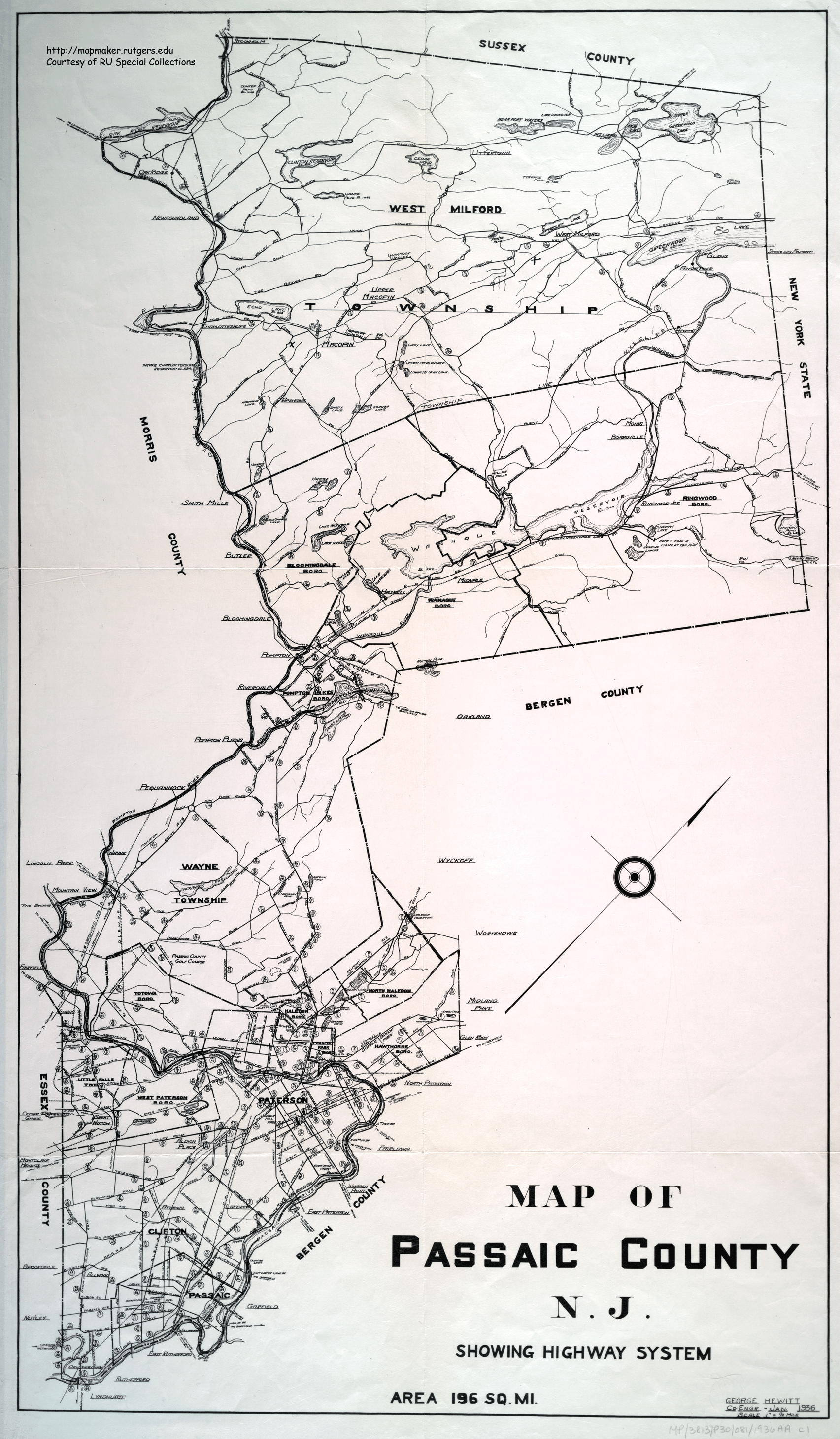
- ↑ Map of Passaic County N.J. (Map). Rutgers University Cartography Services. 1936. Retrieved 2009-03-28.
- ↑ Map of Bergen County New Jersey (Map). Rutgers University Cartography Services. 1949. Retrieved 2009-03-30.
- ↑ "Approach to Open for Lincoln Tube: New Jersey's Latest Highway Which Will be Opened Today". The New York Times. June 30, 1939. p. 6. Retrieved 2013-10-11. (subscription required)
- 1 2 Mathieu, George M. (August 10, 1941). "To Aid Users of Tunnel: Road Work in New Jersey Also Will Cut Time to the Bridge". The New York Times. p. XX5. Retrieved 2013-10-11. (subscription required)
- ↑ "Secaucus Road To Open: Jersey's New By-Pass Will Cut Commuting Time of Thousands". The New York Times. July 31, 1949. p. 17. Retrieved 2013-10-11. (subscription required)
- ↑ State of New Jersey, Laws of 1942, Chapter 77.
- ↑ State of New Jersey, Laws of 1948, Chapter 221.
- ↑ State Farm Road Atlas (Map). Cartography by Rand McNally. State Farm Insurance. 1983.
- ↑ United States-Canada-Mexico Road Atlas (Map). Rand McNally. 1996.
- ↑ FAI 105 Interstate Highway Corridor: Recommendation Report. New Jersey State Highway Department. 1957.
- ↑ Wright, George Cable (September 19, 1958). "New Roads with New Numbers Will Parallel Old U.S. Routes". The New York Times. p. 29. Retrieved 2013-10-11. (subscription required)
- ↑ "Route 495 Straight Line Diagram" (PDF). Internet Archives WayBack Machine. New Jersey Department of Transportation. 2006. Archived from the original (PDF) on March 21, 2006. Retrieved 2013-05-11.
- ↑ "Route 3 Passaic River Crossing Project - Construction Updates". New Jersey Department of Transportation. Retrieved 2012-04-02.
- ↑ Route 3: Passaic River Crossing. New Jersey Department of Transportation. 2001.
- ↑ Brennan, John (May 1, 2009). "Newstracker: Road, rail improvements on track for Xanadu project". The Record. Highbeam Research. Retrieved 2013-10-11. (subscription required)
- ↑ Brennan, John (November 17, 2008). "Finally on Track: Sports complex rail, roads racing to the finish line". The Record. vLex. Retrieved 2013-10-11. (subscription required)
- ↑ "Route 3 Passaic River Crossing". New Jersey Department of Transportation. Archived from the original on December 23, 2007. Retrieved 2008-11-17.
- ↑ Stein, Ron (March 18, 2013). "Feds announce $8.6 million project to resurface four miles of Route 3 in Secaucus, North Bergen". The Jersey Journal. Retrieved 2013-10-10.
- ↑ "Route 46/Route 3/Valley Road and Notch Road Interchanges". New Jersey Department of Transportation. Retrieved 2008-11-17.
- 1 2 Frazier, Ian (February 16, 2004). "Route 3: What I saw on the road through New Jersey". The New Yorker. Retrieved 2013-10-11.
- ↑ "Derek Jeters Taco Hole Saturday Night Live Lyrics". MetroLyrics. Retrieved 2010-05-18.
External links
| Wikimedia Commons has media related to New Jersey Route 3. |
- An enlarged view of road jurisdiction at the confluence of NJ 3 and NJ 46 in Clifton
- An enlarged view of road jurisdiction at the confluence of NJ 3 and NJ 17 in Rutherford
- An enlarged view of road jurisdiction at the confluence of NJ 3, NJ 120 and I 95 in East Rutherford
- An enlarged view of road jurisdiction at the confluence of NJ 3, NJ 495, I 95 / NJ Turnpike, US 1 in Secaucus and North Bergen
- New Jersey Roads: Route 3
- Police Scanner Frequencies for Route 3
- Speed Limits for State Roads