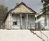
| [3] |
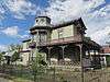
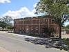
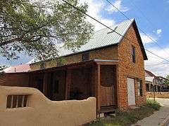
Name on the Register[4] |
Image |
Date listed[5] |
Location |
City or town |
Description |
|---|
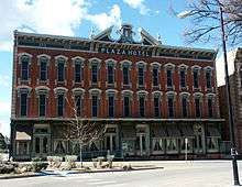
| 1 |
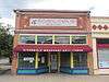
Acequia Madre |
Upload image |
000000001987-03-19-0000March 19, 1987
(#87001118) |
Roughly from the Gallinas River to the intersection of S. Pacific and U.S. Route 85
35°35′05″N 105°13′26″W / 35.584722°N 105.223889°W / 35.584722; -105.223889 (Acequia Madre) |
Las Vegas |
|
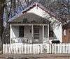
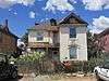
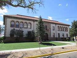
| 2 |
Arturo Angel House |
|
000000001985-09-26-0000September 26, 1985
(#85002604) |
926 S. Pacific
35°35′12″N 105°13′22″W / 35.586667°N 105.222778°W / 35.586667; -105.222778 (Arturo Angel House) |
Las Vegas |
|
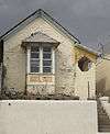
| 3 |
E. N. Charles and Lewis Arthur House |
Upload image |
000000001985-09-26-0000September 26, 1985
(#85002605) |
Douglas Ave.
35°35′37″N 105°13′02″W / 35.593611°N 105.217222°W / 35.593611; -105.217222 (E. N. Charles and Lewis Arthur House) |
Las Vegas |
|
| 4 |
AT & SF Roundhouse |
|
000000001985-09-26-0000September 26, 1985
(#85002621) |
Northeast of Grand Ave.
35°35′12″N 105°12′53″W / 35.586667°N 105.214722°W / 35.586667; -105.214722 (AT & SF Roundhouse) |
Las Vegas |
|
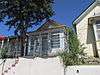
| 5 |
Baca-Korte House |
Upload image |
000000001985-09-26-0000September 26, 1985
(#85002658) |
615 S. Pacific
35°34′58″N 105°13′15″W / 35.582778°N 105.220833°W / 35.582778; -105.220833 (Baca-Korte House) |
Las Vegas |
|
| 6 |
Bean-Newlee House |
|
000000001985-09-26-0000September 26, 1985
(#85002625) |
1045 5th St.
35°36′04″N 105°13′04″W / 35.60108°N 105.21789°W / 35.60108; -105.21789 (Bean-Newlee House) |
Las Vegas |
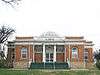
|
| 7 |
Bell Ranch Headquarters |
Upload image |
000000001970-10-06-0000October 6, 1970
(#70000407) |
North and east of the Conchas Reservoir
Coordinates missing |
Tucumcari |
|
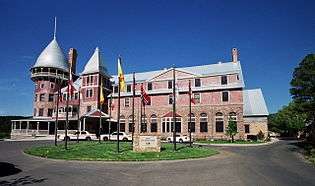
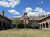
| 8 |
Bridge Street Historic District |
|
000000001978-07-26-0000July 26, 1978
(#78001824) |
100 block of Bridge St.
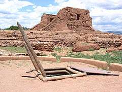
35°35′36″N 105°13′27″W / 35.593333°N 105.224167°W / 35.593333; -105.224167 (Bridge Street Historic District) |
Las Vegas |
|
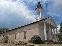
| 9 |
Building at 1202 9th Street |
Upload image |
000000001985-09-26-0000September 26, 1985
(#85002632) |
1202 9th St.
35°36′02″N 105°13′20″W / 35.600556°N 105.222222°W / 35.600556; -105.222222 (Building at 1202 9th Street) |
Las Vegas |
|
| 10 |
Building at 1214 Bridge |
|
000000001985-09-26-0000September 26, 1985
(#85002660) |
1214 Bridge
35°35′41″N 105°13′22″W / 35.594722°N 105.222778°W / 35.594722; -105.222778 (Building at 1214 Bridge) |
Las Vegas |
|
| 11 |
Building at 2005 Montezuma |
Upload image |
000000001985-09-26-0000September 26, 1985
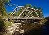
(#85002655) |
2005 Montezuma
35°35′31″N 105°13′57″W / 35.591944°N 105.2325°W / 35.591944; -105.2325 (Building at 2005 Montezuma) |
Las Vegas |
|
| 12 |
Building at 1406 Romero |
Upload image |
000000001985-09-26-0000September 26, 1985
(#85002656) |
1406 Romero
35°35′15″N 105°13′51″W / 35.5875°N 105.230833°W / 35.5875; -105.230833 (Building at 1406 Romero) |
Las Vegas |
|
| 13 |
Lowery Clevenger House |
|
000000001985-09-26-0000September 26, 1985
(#85002594) |
1013 2nd
35°36′05″N 105°12′49″W / 35.60139°N 105.21372°W / 35.60139; -105.21372 (Lowery Clevenger House) |
Las Vegas |
|
| 14 |
Conchas Dam Historic District |
Upload image |
000000002005-05-22-0000May 22, 2005
(#05000454) |
Roughly bounded by the State Park South Area, State Park North Area, Conchas Reservoir, and Bell Ranch
35°23′00″N 104°11′47″W / 35.383333°N 104.196389°W / 35.383333; -104.196389 (Conchas Dam Historic District) |
Conchas Dam |
|
| 15 |
James Cook House |
|
000000001985-09-26-0000September 26, 1985
(#85002647) |
1017 11th
35°35′49″N 105°13′23″W / 35.59706°N 105.22317°W / 35.59706; -105.22317 (James Cook House) |
Las Vegas |
|
| 16 |
Distrito de las Escuelas |
|
000000001980-03-18-0000March 18, 1980
(#80002567) |
S. Pacific and S. Gonzales Sts.
35°35′32″N 105°13′31″W / 35.592222°N 105.225278°W / 35.592222; -105.225278 (Distrito de las Escuelas) |
Las Vegas |
|
| 17 |
Douglas Avenue School |
|
000000001983-08-05-0000August 5, 1983
(#83001625) |
900 Douglas Ave.
35°35′35″N 105°13′06″W / 35.593056°N 105.218333°W / 35.593056; -105.218333 (Douglas Avenue School) |
Las Vegas |
|
| 18 |
Douglas-Sixth Street Historic District |
|
000000001983-07-21-0000July 21, 1983
(#83001626) |
Roughly bounded by Grand, Lincoln, and 7th Sts., and University Ave.
35°35′41″N 105°12′14″W / 35.594722°N 105.203889°W / 35.594722; -105.203889 (Douglas-Sixth Street Historic District) |
Las Vegas |
|
| 19 |
Eldorado Hotel |
|
000000001985-09-26-0000September 26, 1985
(#85002626) |
514 Grand
35°35′39″N 105°12′48″W / 35.594167°N 105.213333°W / 35.594167; -105.213333 (Eldorado Hotel) |
Las Vegas |
|
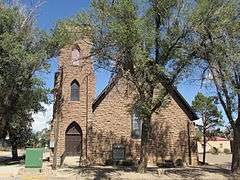
| 20 |
First Baptist Church |
|
000000001985-09-26-0000September 26, 1985
(#85002612) |
700 University
35°35′44″N 105°13′02″W / 35.59556°N 105.21717°W / 35.59556; -105.21717 (First Baptist Church) |
Las Vegas |
|
| 21 |
Eugenio Gatignole House |
Upload image |
000000001985-09-26-0000September 26, 1985
(#85002606) |
1114 S. Gonzales
35°35′18″N 105°13′24″W / 35.588333°N 105.223333°W / 35.588333; -105.223333 (Eugenio Gatignole House) |
Las Vegas |
|
| 22 |
Glorieta Baldy Lookout Tower |
Upload image |
000000001988-01-27-0000January 27, 1988
(#87002492) |
Santa Fe National Forest
35°39′00″N 105°47′57″W / 35.65°N 105.799167°W / 35.65; -105.799167 (Glorieta Baldy Lookout Tower) |
La Cueva |
|
| 23 |
Glorieta Pass Battlefield |
|
000000001966-10-15-0000October 15, 1966
(#66000486) |
10 miles southeast of Santa Fe on U.S. Routes 84/85
35°33′36″N 105°47′08″W / 35.56°N 105.785556°W / 35.56; -105.785556 (Glorieta Pass Battlefield) |
Santa Fe |
|
| 24 |
Esperansa Herrera House |
Upload image |
000000001985-09-26-0000September 26, 1985
(#85002613) |
2231 Church
35°35′41″N 105°13′51″W / 35.594722°N 105.230833°W / 35.594722; -105.230833 (Esperansa Herrera House) |
Las Vegas |
|
| 25 |
House at 913 2nd |
|
000000001985-09-26-0000September 26, 1985
(#85002597) |
913 2nd
35°36′02″N 105°12′47″W / 35.60042°N 105.21308°W / 35.60042; -105.21308 (House at 913 2nd) |
Las Vegas |
|
| 26 |
House at 915 2nd |
|
000000001985-09-26-0000September 26, 1985
(#85002596) |
915 2nd
35°36′02″N 105°12′47″W / 35.60056°N 105.21317°W / 35.60056; -105.21317 (House at 915 2nd) |
Las Vegas |
|
| 27 |
House at 919 2nd |
|
000000001985-09-26-0000September 26, 1985
(#85002595) |
919 2nd
35°36′02″N 105°12′48″W / 35.60067°N 105.21325°W / 35.60067; -105.21325 (House at 919 2nd) |
Las Vegas |
|
| 28 |
House at 1513 8th |
|
000000001985-09-26-0000September 26, 1985
(#85002634) |
1513 8th
35°36′19″N 105°13′30″W / 35.60536°N 105.22511°W / 35.60536; -105.22511 (House at 1513 8th) |
Las Vegas |
|
| 29 |
House at 1616 8th |
|
000000001985-09-26-0000September 26, 1985
(#85002645) |
1616 8th
35°36′24″N 105°13′31″W / 35.60678°N 105.22517°W / 35.60678; -105.22517 (House at 1616 8th) |
Las Vegas |
|
| 30 |
House at 1717 8th |
|
000000001985-09-26-0000September 26, 1985
(#85002646) |
1717 8th
35°36′29″N 105°13′36″W / 35.60792°N 105.22664°W / 35.60792; -105.22664 (House at 1717 8th) |
Las Vegas |
|
| 31 |
House at 1114 10th |
Upload image |
000000001985-09-26-0000September 26, 1985
(#85002649) |
1114 10th
35°35′53″N 105°13′16″W / 35.598056°N 105.221111°W / 35.598056; -105.221111 (House at 1114 10th) |
Las Vegas |
|
| 32 |
House at 1007 11th Street |
|
000000001985-09-26-0000September 26, 1985
(#85002648) |
1007 11th St.
35°35′48″N 105°13′22″W / 35.59653°N 105.22283°W / 35.59653; -105.22283 (House at 1007 11th Street) |
Las Vegas |
|
| 33 |
House at 821 12th |
|
000000001985-09-26-0000September 26, 1985
(#85002643) |
821 12th
35°35′42″N 105°13′24″W / 35.595°N 105.22342°W / 35.595; -105.22342 (House at 821 12th) |
Las Vegas |
|
| 34 |
House at 933 12th |
|
000000001985-09-26-0000September 26, 1985
(#85002642) |
933 12th
35°35′45″N 105°13′26″W / 35.59583°N 105.22389°W / 35.59583; -105.22389 (House at 933 12th) |
Las Vegas |
|
| 35 |
House at 921 Chavez |
Upload image |
000000001985-09-26-0000September 26, 1985
(#85002653) |
921 Chavez
35°35′09″N 105°13′27″W / 35.585833°N 105.224167°W / 35.585833; -105.224167 (House at 921 Chavez) |
Las Vegas |
|
| 36 |
House at 1116 Columbia |
|
000000001985-09-26-0000September 26, 1985
(#85002641) |
1116 Columbia
35°35′44″N 105°13′23″W / 35.5955°N 105.223°W / 35.5955; -105.223 (House at 1116 Columbia) |
Las Vegas |
|
| 37 |
House at 810 Douglas |
|
000000001985-09-26-0000September 26, 1985
(#85002603) |
810 Douglas
35°35′47″N 105°13′02″W / 35.596389°N 105.217222°W / 35.596389; -105.217222 (House at 810 Douglas) |
Las Vegas |
|
| 38 |
House at 812 Douglas |
|
000000001985-09-26-0000September 26, 1985
(#85002602) |
812 Douglas
35°35′39″N 105°13′02″W / 35.594167°N 105.217222°W / 35.594167; -105.217222 (House at 812 Douglas) |
Las Vegas |
|
| 39 |
House at 814 Douglas |
|
000000001985-09-26-0000September 26, 1985
(#85002601) |
814 Douglas
35°35′38″N 105°13′03″W / 35.593889°N 105.2175°W / 35.593889; -105.2175 (House at 814 Douglas) |
Las Vegas |
|
| 40 |
House at 818 Douglas |
|
000000001985-09-26-0000September 26, 1985
(#85002600) |
818 Douglas
35°35′38″N 105°13′03″W / 35.593889°N 105.2175°W / 35.593889; -105.2175 (House at 818 Douglas) |
Las Vegas |
|
| 41 |
House at 822 Douglas |
|
000000001985-09-26-0000September 26, 1985
(#85002599) |
822 Douglas
35°35′38″N 105°13′04″W / 35.593889°N 105.217778°W / 35.593889; -105.217778 (House at 822 Douglas) |
Las Vegas |
|
| 42 |
House at 12 Grand |
|
000000001985-09-26-0000September 26, 1985
(#85002622) |
12 Grand
35°35′17″N 105°12′54″W / 35.588056°N 105.215°W / 35.588056; -105.215 (House at 12 Grand) |
Las Vegas |
|
| 43 |
House at 16 Grand |
|
000000001985-09-26-0000September 26, 1985
(#85002623) |
16 Grand
35°35′18″N 105°12′53″W / 35.588333°N 105.214722°W / 35.588333; -105.214722 (House at 16 Grand) |
Las Vegas |
|
| 44 |
House at 613 Mora |
Upload image |
000000001985-09-26-0000September 26, 1985
(#85002650) |
613 Mora
35°35′45″N 105°14′02″W / 35.595833°N 105.233889°W / 35.595833; -105.233889 (House at 613 Mora) |
Las Vegas |
|
| 45 |
House at 618 Mora |
Upload image |
000000001985-09-26-0000September 26, 1985
(#85002651) |
618 Mora
35°35′21″N 105°14′02″W / 35.589167°N 105.233889°W / 35.589167; -105.233889 (House at 618 Mora) |
Las Vegas |
|
| 46 |
House at 2203 New Mexico |
Upload image |
000000001985-09-26-0000September 26, 1985
(#85002654) |
2203 New Mexico
35°35′40″N 105°13′57″W / 35.594444°N 105.2325°W / 35.594444; -105.2325 (House at 2203 New Mexico) |
Las Vegas |
|
| 47 |
House at 521 S. Pacific |
|
000000001985-09-26-0000September 26, 1985
(#85002659) |
521 S. Pacific
35°34′54″N 105°13′12″W / 35.581667°N 105.22°W / 35.581667; -105.22 (House at 521 S. Pacific) |
Las Vegas |
|
| 48 |
House at 921 S. Pacific |
Upload image |
000000001985-09-26-0000September 26, 1985
(#85002608) |
921 S. Pacific
35°35′10″N 105°13′22″W / 35.586111°N 105.222778°W / 35.586111; -105.222778 (House at 921 S. Pacific) |
Las Vegas |
|
| 49 |
House at 800 Pecos |
Upload image |
000000001985-09-26-0000September 26, 1985
(#85002633) |
800 Pecos
35°35′48″N 105°12′30″W / 35.596667°N 105.208333°W / 35.596667; -105.208333 (House at 800 Pecos) |
Las Vegas |
|
| 50 |
House at 931 Prince |
|
000000001985-09-26-0000September 26, 1985
(#85002620) |
931 Prince
35°35′18″N 105°12′59″W / 35.588333°N 105.216389°W / 35.588333; -105.216389 (House at 931 Prince) |
Las Vegas |
|
| 51 |
House at 119 Railroad |
Upload image |
000000001985-09-26-0000September 26, 1985
(#85002624) |
119 Railroad
35°35′20″N 105°12′51″W / 35.588889°N 105.214167°W / 35.588889; -105.214167 (House at 119 Railroad) |
Las Vegas |
|
| 52 |
House at 309 Railroad |
|
000000001985-09-26-0000September 26, 1985
(#85002628) |
309 Railroad
35°35′29″N 105°12′49″W / 35.591389°N 105.213611°W / 35.591389; -105.213611 (House at 309 Railroad) |
Las Vegas |
|
| 53 |
House at 733 Railroad |
|
000000001985-09-26-0000September 26, 1985
(#85002629) |
733 Railroad
35°35′52″N 105°12′45″W / 35.59769°N 105.21244°W / 35.59769; -105.21244 (House at 733 Railroad) |
Las Vegas |
|
| 54 |
House at 919 Railroad |
|
000000001985-09-26-0000September 26, 1985
(#85002630) |
919 Railroad
35°36′01″N 105°12′42″W / 35.60031°N 105.21164°W / 35.60031; -105.21164 (House at 919 Railroad) |
Las Vegas |
|
| 55 |
House at 1025 Railroad |
Upload image |
000000001985-09-26-0000September 26, 1985
(#85002631) |
1025 Railroad
35°36′06″N 105°12′39″W / 35.601667°N 105.210833°W / 35.601667; -105.210833 (House at 1025 Railroad) |
Las Vegas |
|
| 56 |
House at 1221 San Francisco |
Upload image |
000000001985-09-26-0000September 26, 1985
(#85002644) |
1221 San Francisco
35°35′49″N 105°13′28″W / 35.596944°N 105.224444°W / 35.596944; -105.224444 (House at 1221 San Francisco) |
Las Vegas |
|
| 57 |
House at 2501 Taos Alley |
Upload image |
000000001985-09-26-0000September 26, 1985
(#85002652) |
2501 Taos Alley
35°35′48″N 105°14′05″W / 35.596667°N 105.234722°W / 35.596667; -105.234722 (House at 2501 Taos Alley) |
Las Vegas |
|
| 58 |
House at 312 Tecolote |
|
000000001985-09-26-0000September 26, 1985
(#85002609) |
312 Tecolote
35°35′10″N 105°13′25″W / 35.586111°N 105.223611°W / 35.586111; -105.223611 (House at 312 Tecolote) |
Las Vegas |
|
| 59 |
House at 508 University |
|
000000001985-09-26-0000September 26, 1985
(#85002611) |
508 University
35°35′47″N 105°12′54″W / 35.59647°N 105.21508°W / 35.59647; -105.21508 (House at 508 University) |
Las Vegas |
|
| 60 |
House at 514 University |
|
000000001985-09-26-0000September 26, 1985
(#85002610) |
514 University
35°35′47″N 105°12′55″W / 35.59631°N 105.21539°W / 35.59631; -105.21539 (House at 514 University) |
Las Vegas |
|
| 61 |
Adele Ilfeld Auditorium |
|
000000001980-01-08-0000January 8, 1980
(#80002568) |
900 University Avenue[6]
35°35′41″N 105°13′11″W / 35.59472°N 105.21978°W / 35.59472; -105.21978 (Adele Ilfeld Auditorium) |
Las Vegas |
|
| 62 |
Charles Ilfeld Memorial Chapel |
Upload image |
000000001985-09-26-0000September 26, 1985
(#85002657) |
Colonias and Romero
35°35′48″N 105°14′16″W / 35.596667°N 105.237778°W / 35.596667; -105.237778 (Charles Ilfeld Memorial Chapel) |
Las Vegas |
|
| 63 |
Johnsen House |
|
000000001985-09-26-0000September 26, 1985
(#85002635) |
1523 8th
35°36′20″N 105°13′31″W / 35.60564°N 105.22528°W / 35.60564; -105.22528 (Johnsen House) |
Las Vegas |
|
| 64 |
Johnsen Mortuary |
|
000000001985-09-26-0000September 26, 1985
(#85002607) |
801 Douglas
35°35′37″N 105°13′00″W / 35.593611°N 105.216667°W / 35.593611; -105.216667 (Johnsen Mortuary) |
Las Vegas |
|
| 65 |
Norman L. King Memorial Stadium |
Upload image |
000000001999-09-17-0000September 17, 1999
(#99001172) |
2.7 miles northwest of the junction of State Road 65 and Mill Ave.
35°36′40″N 105°15′31″W / 35.611111°N 105.258611°W / 35.611111; -105.258611 (Norman L. King Memorial Stadium) |
Las Vegas |
|
| 66 |
Las Vegas Municipal Building |
Upload image |
000000002007-10-24-0000October 24, 2007
(#07001107) |
727 Grand Ave.
35°35′52″N 105°12′47″W / 35.597778°N 105.213056°W / 35.597778; -105.213056 (Las Vegas Municipal Building) |
Las Vegas |
|
| 67 |
Las Vegas Plaza |
|
000000001974-12-16-0000December 16, 1974
(#74001202) |
Bounded by Valencia and Moreno Sts. and the rear property line of the building on Gonzales St. and Hot Springs Boulevard
35°35′34″N 105°13′35″W / 35.592778°N 105.226389°W / 35.592778; -105.226389 (Las Vegas Plaza) |
Las Vegas |
|
| 68 |
Las Vegas Railroad and Power Company Building |
Upload image |
000000001985-09-26-0000September 26, 1985
(#85002640) |
12th and San Francisco
35°35′52″N 105°13′25″W / 35.597778°N 105.223611°W / 35.597778; -105.223611 (Las Vegas Railroad and Power Company Building) |
Las Vegas |
|
| 69 |
Library Park Historic District |
|
000000001979-03-12-0000March 12, 1979
(#79001549) |
Liberty Park and environs
35°35′52″N 105°12′52″W / 35.597778°N 105.214444°W / 35.597778; -105.214444 (Library Park Historic District) |
Las Vegas |
|
| 70 |
Lincoln Park Historic District |
|
000000001979-08-06-0000August 6, 1979
(#79001550) |
7th, 8th, Lincoln and Jackson Sts
35°35′33″N 105°12′57″W / 35.5925°N 105.215833°W / 35.5925; -105.215833 (Lincoln Park Historic District) |
Las Vegas |
|
| 71 |
Montezuma Hotel Complex |
|
000000001974-05-03-0000May 3, 1974
(#74001203) |
6 miles northwest of Las Vegas in Gallinas Canyon
35°39′15″N 105°16′53″W / 35.654167°N 105.281389°W / 35.654167; -105.281389 (Montezuma Hotel Complex) |
Las Vegas |
|
| 72 |
Nolan House |
Upload image |
000000001985-09-26-0000September 26, 1985
(#85002619) |
110 10th St.
35°35′22″N 105°13′03″W / 35.589444°N 105.2175°W / 35.589444; -105.2175 (Nolan House) |
Las Vegas |
|
| 73 |
North New Town Historic District |
|
000000001983-08-18-0000August 18, 1983
(#83001627) |
Roughly bounded by National, Friedman, 3rd, and 8th Sts.
35°35′58″N 105°13′05″W / 35.599444°N 105.218056°W / 35.599444; -105.218056 (North New Town Historic District) |
Las Vegas |
|
| 74 |
Old Las Vegas Post Office |
|
000000001985-09-26-0000September 26, 1985
(#85002598) |
901 Douglas
35°35′36″N 105°13′05″W / 35.593333°N 105.218056°W / 35.593333; -105.218056 (Old Las Vegas Post Office) |
Las Vegas |
|
| 75 |
Old Town Residential Historic District |
|
000000001983-10-28-0000October 28, 1983
(#83004161) |
Roughly bounded by Perey St. to Mills Ave., and from New Mexico to Gonzales St.
35°35′31″N 105°13′42″W / 35.591944°N 105.228333°W / 35.591944; -105.228333 (Old Town Residential Historic District) |
Las Vegas |
|
| 76 |
Our Lady of Sorrows Church |
|
000000001976-09-08-0000September 8, 1976
(#76001197) |
W. National Ave.
35°35′31″N 105°13′43″W / 35.591944°N 105.228611°W / 35.591944; -105.228611 (Our Lady of Sorrows Church) |
Las Vegas |
|
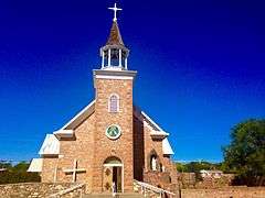
| 77 |
Pecos National Historical Park |
|
000000001966-10-15-0000October 15, 1966
(#66000485) |
State Road 63 southwest of its junction with State Road 50
35°33′00″N 105°41′04″W / 35.55°N 105.684444°W / 35.55; -105.684444 (Pecos National Historical Park) |
Pecos |
Designated a National Historic Landmark District on July 2, 1991
|
| 78 |
Pecos River Bridge at Terrero |
|
000000001997-07-15-0000July 15, 1997
(#97000739) |
State Road 63 over the Pecos River
35°44′26″N 105°40′40″W / 35.740556°N 105.677778°W / 35.740556; -105.677778 (Pecos River Bridge at Terrero) |
Terrero |
|
| 79 |
Pendaries Grist Mill |
Upload image |
000000001979-02-02-0000February 2, 1979
(#79001552) |
1 mile (1.6 km) east of Rociada off State Road 105
35°50′35″N 105°23′45″W / 35.843056°N 105.395833°W / 35.843056; -105.395833 (Pendaries Grist Mill) |
Rociada |
|
| 80 |
Pimter-O'Neil Rooming House |
|
000000001985-09-26-0000September 26, 1985
(#85002627) |
313 Railroad
35°35′31″N 105°12′49″W / 35.591944°N 105.213611°W / 35.591944; -105.213611 (Pimter-O'Neil Rooming House) |
Las Vegas |
|
| 81 |
Presbyterian Mission Church |
|
000000001978-11-17-0000November 17, 1978
(#78001825) |
1413 Chavez St.
35°35′22″N 105°13′34″W / 35.589444°N 105.226111°W / 35.589444; -105.226111 (Presbyterian Mission Church) |
Las Vegas |
|
| 82 |
Railroad Avenue Historic District |
|
000000001979-08-06-0000August 6, 1979
(#79001551) |
U.S. Route 85
35°35′38″N 105°12′45″W / 35.593889°N 105.2125°W / 35.593889; -105.2125 (Railroad Avenue Historic District) |
Las Vegas |
|
| 83 |
Rogers Administration Building |
|
000000001988-09-22-0000September 22, 1988
(#88001559) |
National Ave., on the New Mexico Highlands University campus
35°35′43″N 105°13′10″W / 35.595278°N 105.219444°W / 35.595278; -105.219444 (Rogers Administration Building) |
Las Vegas |
|
| 84 |
Rowe Pueblo |
Upload image |
000000002000-05-26-0000May 26, 2000
(#00000547) |
Address Restricted
|
Rowe |
|
| 85 |
St. Anthony's Hospital Annex |
Upload image |
000000001985-09-26-0000September 26, 1985
(#85002592) |
700 Friedman
35°36′10″N 105°13′19″W / 35.602778°N 105.221944°W / 35.602778; -105.221944 (St. Anthony's Hospital Annex) |
Las Vegas |
|
| 86 |
St. Paul's Memorial Episcopal Church and Guild Hall |
|
000000001976-11-07-0000November 7, 1976
(#76001198) |
714-716 National Ave.
35°35′46″N 105°13′04″W / 35.596111°N 105.217778°W / 35.596111; -105.217778 (St. Paul's Memorial Episcopal Church and Guild Hall) |
Las Vegas |
|
| 87 |
Vidal and Elisa Salazar House |
Upload image |
000000001985-09-26-0000September 26, 1985
(#85002637) |
824 Railroad
35°35′55″N 105°12′39″W / 35.598611°N 105.210833°W / 35.598611; -105.210833 (Vidal and Elisa Salazar House) |
Las Vegas |
|
| 88 |
San Antonio de Padua Church |
|
000000001978-09-13-0000September 13, 1978
(#78001826) |
State Road 63
35°34′59″N 105°40′31″W / 35.583056°N 105.675278°W / 35.583056; -105.675278 (San Antonio de Padua Church) |
Pecos |
|
| 89 |
San Geronimo Historic District |
Upload image |
000000001983-11-15-0000November 15, 1983
(#83004163) |
Off State Road 283
35°34′47″N 105°23′44″W / 35.579722°N 105.395556°W / 35.579722; -105.395556 (San Geronimo Historic District) |
San Geronimo |
|
| 90 |
San Miguel del Vado Historic District |
|
000000001972-07-17-0000July 17, 1972
(#72000809) |
Southeast of San Jose on State Road 3, off U.S. Route 84
35°21′47″N 105°27′01″W / 35.363056°N 105.450278°W / 35.363056; -105.450278 (San Miguel del Vado Historic District) |
San Jose |
|
| 91 |
Santa Fe Trail-San Miguel County Trail Segments |
Upload image |
000000001994-04-21-0000April 21, 1994
(#94000326) |
West of Interstate 25, south of Tecolote
35°27′08″N 105°16′49″W / 35.452222°N 105.280278°W / 35.452222; -105.280278 (Santa Fe Trail-San Miguel County Trail Segments) |
Tecolote |
|
| 92 |
Santa Fe Trail-West San Jose Segment |
Upload image |
000000002014-08-08-0000August 8, 2014
(#14000481) |
Address restricted
|
San Jose vicinity |
|
| 93 |
Schmitt-Laemmle House |
|
000000001985-09-26-0000September 26, 1985
(#85002639) |
1106 Columbia
35°35′45″N 105°13′21″W / 35.5957°N 105.2224°W / 35.5957; -105.2224 (Schmitt-Laemmle House) |
Las Vegas |
House no longer there; site occupied by parking lot
|
| 94 |
Serna-Blanchard House |
Upload image |
000000001985-09-26-0000September 26, 1985
(#85002614) |
2203 N. Gonzales
35°35′46″N 105°13′41″W / 35.596111°N 105.228056°W / 35.596111; -105.228056 (Serna-Blanchard House) |
Las Vegas |
|
| 95 |
Shawn-Guerin House |
Upload image |
000000001985-09-26-0000September 26, 1985
(#85002615) |
140 Delgado
35°35′47″N 105°13′39″W / 35.596389°N 105.2275°W / 35.596389; -105.2275 (Shawn-Guerin House) |
Las Vegas |
|
| 96 |
M. M. Sundt House |
|
000000001985-09-26-0000September 26, 1985
(#85002638) |
1607 8th
35°36′22″N 105°13′32″W / 35.60611°N 105.22556°W / 35.60611; -105.22556 (M. M. Sundt House) |
Las Vegas |
|
| 97 |
Taichert Building |
|
000000001985-09-26-0000September 26, 1985
(#85002616) |
1201 National
35°35′37″N 105°13′20″W / 35.593611°N 105.222222°W / 35.593611; -105.222222 (Taichert Building) |
Las Vegas |
|
| 98 |
Taichert Warehouse |
|
000000001985-09-26-0000September 26, 1985
(#85002618) |
623 12th
35°35′35″N 105°13′19″W / 35.593056°N 105.221944°W / 35.593056; -105.221944 (Taichert Warehouse) |
Las Vegas |
|
| 99 |
Truder Park |
Upload image |
000000001985-09-26-0000September 26, 1985
(#85002661) |
Roughly bounded by 2nd, Washington, and Grand
35°36′03″N 105°12′43″W / 35.600833°N 105.211944°W / 35.600833; -105.211944 (Truder Park) |
Las Vegas |
|
| 100 |
Trujillo-Gonzales House |
Upload image |
000000001985-09-26-0000September 26, 1985
(#85002617) |
935 New Mexico
35°35′10″N 105°13′36″W / 35.586111°N 105.226667°W / 35.586111; -105.226667 (Trujillo-Gonzales House) |
Las Vegas |
|
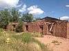
| 101 |
Valencia Ranch Historic Archaeological District |
Upload image |
000000001984-02-09-0000February 9, 1984
(#84002975) |
Address Restricted
|
Pecos |
|
| 102 |
Variadero Bridge |
Upload image |
000000001997-07-22-0000July 22, 1997
(#97000736) |
State Road 104 over Rio Conchas
35°23′21″N 104°27′33″W / 35.389167°N 104.459167°W / 35.389167; -104.459167 (Variadero Bridge) |
Variadero |
|
| 103 |
C. W. G. Ward House |
|
000000001985-09-26-0000September 26, 1985
(#85002593) |
1301 8th
35°36′09″N 105°13′23″W / 35.60247°N 105.22303°W / 35.60247; -105.22303 (C. W. G. Ward House) |
Las Vegas |
|
_2.JPG)
_5.JPG)
_1.JPG)
_from_E_1.JPG)

_from_SW_1.JPG)
_from_NE_2.JPG)
_06.jpg)
_from_E_1.JPG)
_from_NE_1.JPG)