| [2] |
Name on the Register |
Image |
Date listed[3] |
Location |
City or town |
Description |
|---|
| 1 |
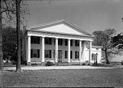
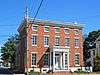
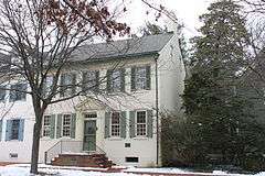
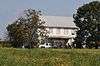
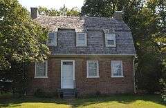
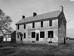
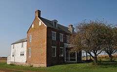
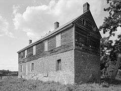
Allee House |
|
000000001971-03-24-0000March 24, 1971
(#71000220) |
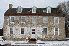
Off Delaware Route 9 on Dutch Neck Rd.
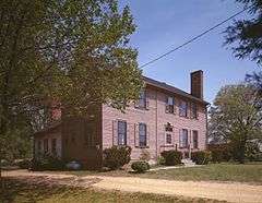
39°17′05″N 75°30′32″W / 39.284722°N 75.508889°W / 39.284722; -75.508889 (Allee House) |
Dutch Neck Crossroads |
|
| 2 |
Archeological Site K-875 (7K-D-37/C) |
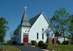
|
000000001979-05-22-0000May 22, 1979
(#79003223) |
Address restricted
|
Kitts Hummock |
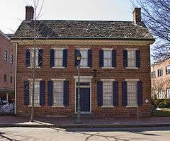
|
| 3 |
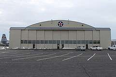
Archeological Site K-873 (7K-D-35/A, B and D) |
|
000000001979-05-22-0000May 22, 1979
(#79003228) |
Address restricted
|
Magnolia |
|
| 4 |
Archeological Site K-876 (7K-D-38/C) |
|
000000001979-05-22-0000May 22, 1979
(#79003222) |
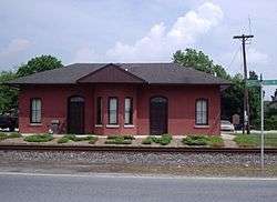
Address restricted
|
Kitts Hummock |
|
| 5 |
Archeological Site K-880 (7K-D-42/F) |
|
000000001979-05-22-0000May 22, 1979
(#79003225) |
Address restricted
|
Magnolia |
|
| 6 |
Archeological Site K-891 (7K-D-45/A and B) |
|
000000001979-05-22-0000May 22, 1979
(#79003226) |
Address restricted
|
Magnolia |
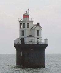
|
| 7 |
Archeological Site K-913 (7K-D-47/C, D and E) |
|
000000001979-05-22-0000May 22, 1979
(#79003229) |
Address restricted
|
Kitts Hummock |
|
| 8 |
Archeological Site K-914 (7K-D-48/F and G) |
|
000000001979-05-22-0000May 22, 1979
(#79003221) |
Address restricted
|
Kitts Hummock |
|
| 9 |
Archeological Site K-915 (7K-D-86/C) |
|
000000001979-05-22-0000May 22, 1979
(#79003224) |
Address restricted
|
Kitts Hummock |
|
| 10 |
Archeological Site K-916 (7K-D-49/C) |
|
000000001979-05-22-0000May 22, 1979
(#79003230) |
Address restricted
|
Kitts Hummock |
|
| 11 |
Archeological Site K-920 (7K-D-52/A and C) |
|
000000001979-05-22-0000May 22, 1979
(#79003227) |
Address restricted
|
Kitts Hummock |
|
| 12 |
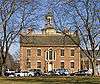
Archeological Site No. 7K F 4 and 23 |
|
000000001982-06-03-0000June 3, 1982
(#82002320) |
Address restricted
|
Milford |
|
| 13 |
George Arnold House |
Upload image |
000000001983-06-27-0000June 27, 1983
(#83001360) |
7 Hickories Road
39°13′22″N 75°39′19″W / 39.222648°N 75.655296°W / 39.222648; -75.655296 (George Arnold House) |
Kenton |
Demolished in 2001
|
| 14 |
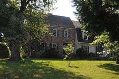
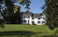
Aspendale |
|
000000001970-04-15-0000April 15, 1970
(#70000170) |
1 mile west of Kenton on Delaware Route 300
39°13′18″N 75°41′09″W / 39.221667°N 75.685833°W / 39.221667; -75.685833 (Aspendale) |
Kenton |
|
| 15 |
Thomas Attix House |
Upload image |
000000001983-06-27-0000June 27, 1983
(#83001361) |
Road 140
39°13′31″N 75°42′28″W / 39.225278°N 75.707778°W / 39.225278; -75.707778 (Thomas Attix House) |
Kenton |
|
| 16 |
Bank House |
|
000000001978-07-31-0000July 31, 1978
(#78000890) |
119 N. Walnut St.
38°54′55″N 75°25′43″W / 38.915278°N 75.428611°W / 38.915278; -75.428611 (Bank House) |
Milford |
|
| 17 |
Bannister Hall and Baynard House |
|
000000001973-04-11-0000April 11, 1973
(#73000503) |
South of Smyrna off Delaware Route 300
39°17′22″N 75°37′19″W / 39.289444°N 75.621944°W / 39.289444; -75.621944 (Bannister Hall and Baynard House) |
Smyrna |
|
| 18 |
Barratt Hall |
Upload image |
000000001973-04-13-0000April 13, 1973
(#73000492) |
South of Frederica off Road 372
39°01′29″N 75°26′24″W / 39.024722°N 75.44°W / 39.024722; -75.44 (Barratt Hall) |
Frederica |
|
| 19 |
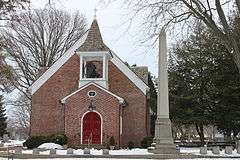
Barratt's Chapel |
|
000000001972-10-10-0000October 10, 1972
(#72000281) |
North of Frederica on Delaware Route 1
39°01′29″N 75°27′34″W / 39.024722°N 75.459444°W / 39.024722; -75.459444 (Barratt's Chapel) |
Frederica |
|
| 20 |
Belmont Hall |
|
000000001971-12-16-0000December 16, 1971
(#71000223) |
1 mile south of Smyrna on U.S. Route 13
39°17′40″N 75°35′46″W / 39.294444°N 75.596111°W / 39.294444; -75.596111 (Belmont Hall) |
Smyrna |
|
| 21 |
Bethel Methodist Protestant Church |
Upload image |
000000001998-09-14-0000September 14, 1998
(#98001093) |
Junction of Roads 61, 114, and 304
38°51′49″N 75°38′13″W / 38.863611°N 75.636944°W / 38.863611; -75.636944 (Bethel Methodist Protestant Church) |
Andrewsville |
|
| 22 |
J. F. Betz House |
Upload image |
000000001983-08-29-0000August 29, 1983
(#83001362) |
Delaware Route 6
39°17′02″N 75°40′29″W / 39.283889°N 75.674722°W / 39.283889; -75.674722 (J. F. Betz House) |
Kenton |
|
| 23 |
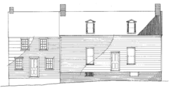
Benjamin Blackiston House |
|
000000001983-06-27-0000June 27, 1983
(#83001363) |
Off Delaware Route 6
39°15′07″N 75°44′13″W / 39.251944°N 75.736944°W / 39.251944; -75.736944 (Benjamin Blackiston House) |
Kenton |
|
| 24 |
Bonwell House |
Upload image |
000000001973-03-20-0000March 20, 1973
(#73000493) |
4 miles west of Frederica on Road 380
39°01′23″N 75°30′34″W / 39.023056°N 75.509444°W / 39.023056; -75.509444 (Bonwell House) |
Frederica |
|
| 25 |
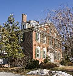
Bradford-Loockerman House |
|
000000001972-11-30-0000November 30, 1972
(#72000277) |
419 S. State St.
39°09′19″N 75°31′24″W / 39.155278°N 75.523333°W / 39.155278; -75.523333 (Bradford-Loockerman House) |
Dover |
|
| 26 |
Brecknock |
|
000000001974-12-24-0000December 24, 1974
(#74000596) |
0.5 miles north of Camden off U.S. Route 13
39°07′26″N 75°32′10″W / 39.123889°N 75.536111°W / 39.123889; -75.536111 (Brecknock) |
Camden |
|
| 27 |
Building 1301, Dover Air Force Base |
|
000000001994-12-07-0000December 7, 1994
(#94001377) |
Dover AFB, E. Dover Hundred
39°07′07″N 75°27′24″W / 39.1187°N 75.4567°W / 39.1187; -75.4567 (Building 1301, Dover Air Force Base) |
Dover |
|
| 28 |
John Bullen House |
|
000000001975-04-14-0000April 14, 1975
(#75000542) |
214 S. State St.
39°14′27″N 75°31′28″W / 39.24092°N 75.52439°W / 39.24092; -75.52439 (John Bullen House) |
Dover |
|
| 29 |
W. D. Burrows House |
Upload image |
000000001983-06-27-0000June 27, 1983
(#83001364) |
Delaware Route 42
39°14′10″N 75°40′30″W / 39.236111°N 75.675°W / 39.236111; -75.675 (W. D. Burrows House) |
Kenton |
|
| 30 |
Byfield Historic District |
|
000000001979-05-22-0000May 22, 1979
(#79003232) |
Address restricted
|
Kitts Hummock |
|
| 31 |
Byrd's AME Church |
|
000000001982-10-19-0000October 19, 1982
(#82001023) |
Smyrna Ave.
39°17′32″N 75°37′38″W / 39.292222°N 75.627222°W / 39.292222; -75.627222 (Byrd's AME Church) |
Clayton |
|
| 32 |
Camden Friends Meetinghouse |
|
000000001973-04-03-0000April 3, 1973
(#73000485) |
Commerce St.
39°06′52″N 75°32′54″W / 39.114444°N 75.548333°W / 39.114444; -75.548333 (Camden Friends Meetinghouse) |
Camden |
|
| 33 |
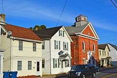
Camden Historic District |
|
000000001974-09-17-0000September 17, 1974
(#74000595) |
Both sides of Camden-Wyoming Ave. and Main St.
39°06′49″N 75°32′34″W / 39.113611°N 75.542778°W / 39.113611; -75.542778 (Camden Historic District) |
Camden |
|
| 34 |
Carey Farm Site |
|
000000001977-10-20-0000October 20, 1977
(#77000384) |
Address restricted
|
Dover |
|
| 35 |
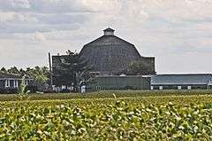
Cherbourg Round Barn |
|
000000001978-12-22-0000December 22, 1978
(#78000888) |
Southwest of Little Creek off Delaware Route 9
39°09′04″N 75°27′27″W / 39.151111°N 75.4575°W / 39.151111; -75.4575 (Cherbourg Round Barn) |
Little Creek |
|
| 36 |
Scene of Cheyney Clow's Rebellion |
Upload image |
000000001974-01-14-0000January 14, 1974
(#74000598) |
West of Kenton on Delaware Route 300
39°12′15″N 75°44′35″W / 39.204167°N 75.743056°W / 39.204167; -75.743056 (Scene of Cheyney Clow's Rebellion) |
Kenton |
|
| 37 |
Christ Church |
|
000000001973-05-08-0000May 8, 1973
(#73000502) |
3rd and Church Sts.
38°54′56″N 75°25′55″W / 38.915556°N 75.431944°W / 38.915556; -75.431944 (Christ Church) |
Milford |
|
| 38 |
Christ Church |
|
000000001972-12-04-0000December 4, 1972
(#72001500) |
S. State and Water Sts.
39°09′16″N 75°31′20″W / 39.154444°N 75.522222°W / 39.154444; -75.522222 (Christ Church) |
Dover |
|
| 39 |
Clark-Pratt House |
Upload image |
000000001983-06-27-0000June 27, 1983
(#83001365) |
Main St.
39°13′34″N 75°40′39″W / 39.226111°N 75.6775°W / 39.226111; -75.6775 (Clark-Pratt House) |
Kenton |
|
| 40 |
Clayton Railroad Station |
Upload image |
000000001986-11-06-0000November 6, 1986
(#86003066) |
Bassett St.
39°17′28″N 75°38′00″W / 39.291111°N 75.633333°W / 39.291111; -75.633333 (Clayton Railroad Station) |
Clayton |
|
| 41 |
Coombe Historic District |
Upload image |
000000001982-04-08-0000April 8, 1982
(#82002313) |
West of Felton on Delaware Route 12 and Road 281
39°00′09″N 75°37′10″W / 39.0025°N 75.619444°W / 39.0025; -75.619444 (Coombe Historic District) |
Felton |
|
| 42 |
Cooper House |
Upload image |
000000001973-03-20-0000March 20, 1973
(#73000495) |
Delaware Route 300
39°13′40″N 75°39′49″W / 39.227778°N 75.663611°W / 39.227778; -75.663611 (Cooper House) |
Kenton |
|
| 43 |
Thomas B. Coursey House |
Upload image |
000000001990-07-23-0000July 23, 1990
(#90001069) |
5578 Canterbury Road
38°59′27″N 75°30′42″W / 38.990833°N 75.511667°W / 38.990833; -75.511667 (Thomas B. Coursey House) |
Felton |
|
| 44 |
Cow Marsh Old School Baptist Church |
Upload image |
000000001976-06-24-0000June 24, 1976
(#76000571) |
Northeast of Sandtown on Delaware Route 10
39°02′31″N 75°41′42″W / 39.041944°N 75.695°W / 39.041944; -75.695 (Cow Marsh Old School Baptist Church) |
Sandtown |
|
| 45 |
David J. Cummins House |
Upload image |
000000001983-10-06-0000October 6, 1983
(#83003504) |
East of Smyrna
39°17′20″N 75°34′18″W / 39.288889°N 75.571667°W / 39.288889; -75.571667 (David J. Cummins House) |
Smyrna |
|
| 46 |
Timothy Cummins House |
|
000000001983-10-06-0000October 6, 1983
(#83003505) |
East of Smyrna
39°16′44″N 75°32′25″W / 39.278889°N 75.540278°W / 39.278889; -75.540278 (Timothy Cummins House) |
Smyrna |
|
| 47 |
Thomas Davis House |
Upload image |
000000001983-02-28-0000February 28, 1983
(#83001366) |
Delaware Route 6
39°17′15″N 75°39′26″W / 39.2875°N 75.657222°W / 39.2875; -75.657222 (Thomas Davis House) |
Kenton |
|
| 48 |
Delaware Boundary Markers |
|
000000001975-02-18-0000February 18, 1975
(#75002101) |
Maryland and Pennsylvania state boundary lines
|
Not applicable |
|
| 49 |
Delaware State Museum Buildings |
|
000000001972-02-01-0000February 1, 1972
(#72000278) |
316 S. Governors Ave.
39°09′22″N 75°31′39″W / 39.156111°N 75.5275°W / 39.156111; -75.5275 (Delaware State Museum Buildings) |
Dover |
|
| 50 |
T.H. Denny House |
Upload image |
000000001983-06-27-0000June 27, 1983
(#83001367) |
2466 7 Hickories Road
39°12′46″N 75°37′22″W / 39.212717°N 75.622856°W / 39.212717; -75.622856 (T.H. Denny House) |
Kenton |
|
| 51 |
John Dickinson House |
|
000000001966-10-15-0000October 15, 1966
(#66000258) |
5 miles southeast of Dover and 3 miles east of U.S. Route 13 on Kitts Hummock Rd.
39°06′09″N 75°26′55″W / 39.1025°N 75.448611°W / 39.1025; -75.448611 (John Dickinson House) |
Dover |
|
| 52 |
Dill Farm Site |
|
000000001978-10-02-0000October 2, 1978
(#78000893) |
Address restricted
|
Sandtown |
|
| 53 |
Dover Green Historic District |
|
000000001977-05-05-0000May 5, 1977
(#77000383) |
Bounded by Governors Ave., North, South, and East Sts.
39°09′17″N 75°31′26″W / 39.154722°N 75.523889°W / 39.154722; -75.523889 (Dover Green Historic District) |
Dover |
|
| 54 |
N. C. Downs House |
Upload image |
000000001983-06-27-0000June 27, 1983
(#83001368) |
Road 141
39°14′04″N 75°42′03″W / 39.234444°N 75.700833°W / 39.234444; -75.700833 (N. C. Downs House) |
Kenton |
|
| 55 |
Duck Creek Village |
|
000000001972-02-01-0000February 1, 1972
(#72000282) |
Road 65 between Duck Creek and Green's Branch
39°18′28″N 75°37′15″W / 39.307778°N 75.620833°W / 39.307778; -75.620833 (Duck Creek Village) |
Smyrna |
|
| 56 |
Durham-Shores House |
Upload image |
000000002001-09-21-0000September 21, 2001
(#01001005) |
Eastern side of Delaware Route 15
39°11′46″N 75°33′49″W / 39.196111°N 75.563611°W / 39.196111; -75.563611 (Durham-Shores House) |
Dupont Station |
|
| 57 |
Eden Hill |
|
000000001973-05-08-0000May 8, 1973
(#73000487) |
Western end of Water St.
39°09′05″N 75°32′13″W / 39.151389°N 75.536944°W / 39.151389; -75.536944 (Eden Hill) |
Dover |
|
| 58 |
Felton Historic District |
|
000000001988-01-26-0000January 26, 1988
(#87002433) |
Roughly bounded by North, Walnut, Main, and Niles Sts.
39°00′27″N 75°34′56″W / 39.0075°N 75.582222°W / 39.0075; -75.582222 (Felton Historic District) |
Felton |
Consists of buildings completed between 1856 and 1940, encompassing much of downtown.
|
| 59 |
Felton Railroad Station |
Upload image |
000000001981-07-13-0000July 13, 1981
(#81000191) |
E. Railroad Ave.
39°00′39″N 75°34′33″W / 39.010815°N 75.575802°W / 39.010815; -75.575802 (Felton Railroad Station) |
Felton |
|
| 60 |
Fennimore Store |
|
000000001982-05-24-0000May 24, 1982
(#82002314) |
Main, Lombard, and Front Sts.
39°14′27″N 75°30′51″W / 39.240833°N 75.514167°W / 39.240833; -75.514167 (Fennimore Store) |
Leipsic |
|
| 61 |
Fourteen Foot Bank Light |
|
000000001989-03-27-0000March 27, 1989
(#89000286) |
On Fourteen Foot Bank in Delaware Bay, 12 miles east of Bowers
39°02′54″N 75°10′57″W / 39.048333°N 75.1825°W / 39.048333; -75.1825 (Fourteen Foot Bank Light) |
Bowers |
|
| 62 |
Frederica Historic District |
|
000000001977-11-09-0000November 9, 1977
(#77000385) |
Market, Front, and David Sts.
39°00′27″N 75°28′03″W / 39.0075°N 75.4675°W / 39.0075; -75.4675 (Frederica Historic District) |
Frederica |
|
| 63 |
George Farmhouse |
|
000000001982-10-19-0000October 19, 1982
(#82001862) |
East of Smyrna off Delaware Route 6
39°18′41″N 75°33′00″W / 39.311389°N 75.55°W / 39.311389; -75.55 (George Farmhouse) |
Smyrna |
|
| 64 |
Golden Mine |
Upload image |
000000001978-08-24-0000August 24, 1978
(#78000891) |
West of Milford on Road 443
38°54′19″N 75°29′08″W / 38.905278°N 75.485556°W / 38.905278; -75.485556 (Golden Mine) |
Milford |
|
| 65 |
Governor's House |
|
000000001972-12-05-0000December 5, 1972
(#72000279) |
Kings Hwy.
39°09′41″N 75°31′25″W / 39.161389°N 75.523611°W / 39.161389; -75.523611 (Governor's House) |
Dover |
|
| 66 |
Great Geneva |
|
000000001973-03-26-0000March 26, 1973
(#73000489) |
3 miles south of Dover on Road 356
39°07′03″N 75°30′32″W / 39.1175°N 75.508889°W / 39.1175; -75.508889 (Great Geneva) |
Camden |
|
| 67 |
Green Mansion House |
Upload image |
000000001983-06-27-0000June 27, 1983
(#83001369) |
Main St.
39°13′37″N 75°40′37″W / 39.226944°N 75.676944°W / 39.226944; -75.676944 (Green Mansion House) |
Kenton |
|
| 68 |
Greenwold |
|
000000001973-03-20-0000March 20, 1973
(#73000488) |
625 S. State St.
39°09′06″N 75°31′19″W / 39.151667°N 75.521944°W / 39.151667; -75.521944 (Greenwold) |
Dover |
|
| 69 |
Griffith's Chapel |
Upload image |
000000001983-10-29-0000October 29, 1983
(#83001370) |
Junction of Roads 442 and 443
38°53′45″N 75°30′30″W / 38.895833°N 75.508333°W / 38.895833; -75.508333 (Griffith's Chapel) |
Williamsville |
|
| 70 |
Robert Hill House |
Upload image |
000000001983-08-29-0000August 29, 1983
(#83001371) |
Delaware Route 6
39°16′33″N 75°41′21″W / 39.275833°N 75.689167°W / 39.275833; -75.689167 (Robert Hill House) |
Kenton |
|
| 71 |
Hoffecker-Lockwood House |
|
000000001983-06-27-0000June 27, 1983
(#83001372) |
Delaware Route 6
39°13′36″N 75°35′53″W / 39.226667°N 75.598056°W / 39.226667; -75.598056 (Hoffecker-Lockwood House) |
Kenton |
|
| 72 |
Alfred L. Hudson House |
Upload image |
000000001983-06-27-0000June 27, 1983
(#83001373) |
Road 90
39°16′10″N 75°37′24″W / 39.269444°N 75.623333°W / 39.269444; -75.623333 (Alfred L. Hudson House) |
Kenton |
|
| 73 |
Hughes Early Man Sites |
|
000000001979-07-24-0000July 24, 1979
(#79000623) |
Address restricted
|
Felton |
|
| 74 |
Hughes-Willis Site |
|
000000001978-11-21-0000November 21, 1978
(#78000887) |
Address restricted
|
Dover |
|
| 75 |
Island Field Site |
Upload image |
000000001972-02-01-0000February 1, 1972
(#72000283) |
South of the mouth of the Murderkill River, near Delaware Bay[4]:146
39°02′34″N 75°23′17″W / 39.042778°N 75.388056°W / 39.042778; -75.388056 (Island Field Site) |
South Bowers |
Includes the site of a village occupied during the ninth century AD[4]:157
|
| 76 |
Ivy Dale Farm |
Upload image |
000000001973-04-24-0000April 24, 1973
(#73000504) |
South of Smyrna off Delaware Route 9
39°17′13″N 75°34′47″W / 39.286944°N 75.579722°W / 39.286944; -75.579722 (Ivy Dale Farm) |
Smyrna |
|
| 77 |
Enoch Jones House |
Upload image |
000000001973-06-19-0000June 19, 1973
(#73000486) |
Southwest of Clayton off Delaware Route 300
39°16′45″N 75°39′37″W / 39.279167°N 75.660278°W / 39.279167; -75.660278 (Enoch Jones House) |
Clayton |
|
| 78 |
KATHERINE M. LEE (Schooner) |
Upload image |
000000001983-04-25-0000April 25, 1983
(#83001375) |
Fox's Dock at Front and Lombard Sts.
39°14′31″N 75°30′51″W / 39.241944°N 75.514167°W / 39.241944; -75.514167 (KATHERINE M. LEE (Schooner)) |
Leipsic |
|
| 79 |
Kenton Historic District |
|
000000001983-08-29-0000August 29, 1983
(#83001396) |
Commerce St.
39°13′36″N 75°39′13″W / 39.226667°N 75.653611°W / 39.226667; -75.653611 (Kenton Historic District) |
Kenton |
|
| 80 |
Kenton Post Office |
Upload image |
000000001983-06-27-0000June 27, 1983
(#83001376) |
Main St.
39°13′38″N 75°39′54″W / 39.227222°N 75.665°W / 39.227222; -75.665 (Kenton Post Office) |
Kenton |
|
| 81 |
Thomas Lamb Farm |
Upload image |
000000001983-08-29-0000August 29, 1983
(#83001374) |
Road 130
39°17′35″N 75°41′04″W / 39.293056°N 75.684444°W / 39.293056; -75.684444 (Thomas Lamb Farm) |
Kenton |
|
| 82 |
Thomas Lamb House |
Upload image |
000000001983-08-29-0000August 29, 1983
(#83001385) |
Roads 129 and 130
39°16′53″N 75°42′26″W / 39.281389°N 75.707222°W / 39.281389; -75.707222 (Thomas Lamb House) |
Kenton |
|
| 83 |
Alexander Laws House |
|
000000001983-04-25-0000April 25, 1983
(#83001377) |
Front and Walnut Sts.
39°14′27″N 75°31′00″W / 39.240833°N 75.516667°W / 39.240833; -75.516667 (Alexander Laws House) |
Leipsic |
|
| 84 |
Lewis Family Tenant Agricultural Complex |
Upload image |
000000001986-08-13-0000August 13, 1986
(#86001506) |
Road 227
39°06′15″N 75°36′30″W / 39.104167°N 75.608333°W / 39.104167; -75.608333 (Lewis Family Tenant Agricultural Complex) |
Wyoming |
|
| 85 |
Jefferson Lewis House |
Upload image |
000000001983-06-27-0000June 27, 1983
(#83001349) |
2191 Seeneytown Road
39°12′48″N 75°37′58″W / 39.213297°N 75.632669°W / 39.213297; -75.632669 (Jefferson Lewis House) |
Kenton |
|
| 86 |
John B. Lindale House |
|
000000001973-05-08-0000May 8, 1973
(#73002231) |
24 Walnut St.
39°04′12″N 75°29′11″W / 39.07°N 75.486389°W / 39.07; -75.486389 (John B. Lindale House) |
Magnolia |
|
| 87 |
Little Creek Hundred Rural Historic District |
Upload image |
000000001984-11-07-0000November 7, 1984
(#84000286) |
Delaware Route 9
39°10′47″N 75°28′31″W / 39.179722°N 75.475278°W / 39.179722; -75.475278 (Little Creek Hundred Rural Historic District) |
Little Creek |
|
| 88 |
Little Creek Methodist Church |
|
000000001982-05-24-0000May 24, 1982
(#82002316) |
Main St.
39°09′49″N 75°26′49″W / 39.163611°N 75.446944°W / 39.163611; -75.446944 (Little Creek Methodist Church) |
Little Creek |
|
| 89 |
Peter Lofland House |
|
000000001982-04-22-0000April 22, 1982
(#82002321) |
417 N. Walnut St.
38°55′03″N 75°25′43″W / 38.9175°N 75.428611°W / 38.9175; -75.428611 (Peter Lofland House) |
Milford |
|
| 90 |
Logan School House K-834 |
Upload image |
000000001979-05-22-0000May 22, 1979
(#79003231) |
Road 68
39°06′01″N 75°25′49″W / 39.100278°N 75.430278°W / 39.100278; -75.430278 (Logan School House K-834) |
Kitts Hummock |
|
| 91 |
Loockerman Hall |
|
000000001971-06-21-0000June 21, 1971
(#71000218) |
Delaware State University campus
39°11′06″N 75°32′44″W / 39.185°N 75.545556°W / 39.185; -75.545556 (Loockerman Hall) |
Dover |
|
| 92 |
Matthew Lowber House |
|
000000001971-04-16-0000April 16, 1971
(#71000221) |
East of Main St.
39°04′21″N 75°28′50″W / 39.0725°N 75.480556°W / 39.0725; -75.480556 (Matthew Lowber House) |
Magnolia |
|
| 93 |
Lower St. Jones Neck Historic District |
|
000000001979-05-22-0000May 22, 1979
(#79003233) |
Address restricted
|
Kitts Hummock |
|
| 94 |
Macomb Farm |
|
000000001974-12-02-0000December 2, 1974
(#74000597) |
Long Point Rd. off Delaware Route 8
39°10′58″N 75°28′38″W / 39.182778°N 75.477222°W / 39.182778; -75.477222 (Macomb Farm) |
Dover |
|
| 95 |
MAGGIE S. MYERS (schooner) |
Upload image |
000000001983-04-25-0000April 25, 1983
(#83001378) |
Killen's Dock at Front and Lombard Sts.
39°14′30″N 75°30′53″W / 39.241667°N 75.514722°W / 39.241667; -75.514722 (MAGGIE S. MYERS (schooner)) |
Leipsic |
|
| 96 |
McClary House |
Upload image |
000000001983-04-25-0000April 25, 1983
(#83001353) |
Main and McClary Sts.
39°14′23″N 75°30′49″W / 39.239722°N 75.513611°W / 39.239722; -75.513611 (McClary House) |
Leipsic |
|
| 97 |
James McColley House |
|
000000001983-01-07-0000January 7, 1983
(#83001354) |
500-502 NW. Front St.
38°54′46″N 75°26′07″W / 38.912778°N 75.435278°W / 38.912778; -75.435278 (James McColley House) |
Milford |
|
| 98 |
Delaplane McDaniel House |
Upload image |
000000001983-06-27-0000June 27, 1983
(#83001379) |
Road 92
39°13′36″N 75°35′53″W / 39.226667°N 75.598056°W / 39.226667; -75.598056 (Delaplane McDaniel House) |
Kenton |
|
| 99 |
Mifflin-Marim Agricultural Complex |
|
000000001984-11-07-0000November 7, 1984
(#84000269) |
Delaware Route 9
39°12′40″N 75°30′06″W / 39.211111°N 75.501667°W / 39.211111; -75.501667 (Mifflin-Marim Agricultural Complex) |
Dover |
|
| 100 |
Mount Pleasant |
Upload image |
000000001992-09-11-0000September 11, 1992
(#92001134) |
Sunnyside Rd. (Road 90) in Duck Creek Hundred
39°16′38″N 75°36′27″W / 39.277222°N 75.6075°W / 39.277222; -75.6075 (Mount Pleasant) |
Smyrna |
|
| 101 |
Milford New Century Club |
|
000000001982-04-22-0000April 22, 1982
(#82002322) |
6 S. Church Ave.
38°54′44″N 75°25′53″W / 38.912222°N 75.431389°W / 38.912222; -75.431389 (Milford New Century Club) |
Milford |
|
| 102 |
Mill House |
|
000000001983-01-07-0000January 7, 1983
(#83001380) |
414 NW. Front St.
38°54′47″N 75°26′05″W / 38.913056°N 75.434722°W / 38.913056; -75.434722 (Mill House) |
Milford |
|
| 103 |
Moore House |
Upload image |
000000001982-10-19-0000October 19, 1982
(#82001022) |
511 W. Mt. Vernon St.
39°17′45″N 75°36′52″W / 39.295833°N 75.614444°W / 39.295833; -75.614444 (Moore House) |
Smyrna |
|
| 104 |
Mordington |
|
000000001973-04-13-0000April 13, 1973
(#73000494) |
South of Frederica on Canterbury Rd.
38°58′07″N 75°29′39″W / 38.968611°N 75.494167°W / 38.968611; -75.494167 (Mordington) |
Frederica |
|
| 105 |
North Milford Historic District |
|
000000001983-01-07-0000January 7, 1983
(#83001357) |
Roughly bounded by Mispillion River, Silver Lake, N. Walnut and NW. 3rd Sts.
38°54′53″N 75°25′52″W / 38.914722°N 75.431111°W / 38.914722; -75.431111 (North Milford Historic District) |
Milford |
|
| 106 |
Octagonal Schoolhouse |
|
000000001971-03-24-0000March 24, 1971
(#71000217) |
East of Cowgill
39°11′44″N 75°28′21″W / 39.195556°N 75.4725°W / 39.195556; -75.4725 (Octagonal Schoolhouse) |
Cowgill's Corner |
|
| 107 |
Old Fire House |
|
000000001983-01-07-0000January 7, 1983
(#83001381) |
Church Ave.
38°54′52″N 75°25′50″W / 38.914444°N 75.430556°W / 38.914444; -75.430556 (Old Fire House) |
Milford |
|
| 108 |
Old Statehouse |
|
000000001971-02-24-0000February 24, 1971
(#71000219) |
The Green
39°09′23″N 75°31′23″W / 39.156389°N 75.523056°W / 39.156389; -75.523056 (Old Statehouse) |
Dover |
|
| 109 |
Old Stone Tavern |
|
000000001973-07-02-0000July 2, 1973
(#73000499) |
Main St.
39°09′51″N 75°26′51″W / 39.164167°N 75.4475°W / 39.164167; -75.4475 (Old Stone Tavern) |
Little Creek |
|
| 110 |
Palmer Home |
|
000000001988-09-13-0000September 13, 1988
(#88001443) |
115 American Ave.
39°09′50″N 75°31′31″W / 39.163889°N 75.525278°W / 39.163889; -75.525278 (Palmer Home) |
Dover |
|
| 111 |
Peterson and Mustard's Hermitage Farm |
Upload image |
000000001982-10-26-0000October 26, 1982
(#82001027) |
East of Smyrna off Road 325
39°17′32″N 75°34′13″W / 39.292222°N 75.570278°W / 39.292222; -75.570278 (Peterson and Mustard's Hermitage Farm) |
Smyrna |
|
| 112 |
Poinsett House |
Upload image |
000000001983-06-27-0000June 27, 1983
(#83001350) |
Delaware Route 6
39°15′46″N 75°44′34″W / 39.262778°N 75.742778°W / 39.262778; -75.742778 (Poinsett House) |
Kenton |
|
| 113 |
Port Mahon Lighthouse |
|
000000001979-10-25-0000October 25, 1979
(#79000624) |
Northeast of Little Creek
39°11′05″N 75°24′04″W / 39.184722°N 75.401111°W / 39.184722; -75.401111 (Port Mahon Lighthouse) |
Little Creek |
|
| 114 |
Rawley House |
|
000000001983-04-25-0000April 25, 1983
(#83001352) |
Main St.
39°14′26″N 75°30′51″W / 39.240556°N 75.514167°W / 39.240556; -75.514167 (Rawley House) |
Leipsic |
|
| 115 |
Raymond Neck Historic District |
|
000000001982-11-08-0000November 8, 1982
(#82001026) |
North of Leipsic between Leipsic River and Road 85
39°14′53″N 75°30′32″W / 39.248056°N 75.508889°W / 39.248056; -75.508889 (Raymond Neck Historic District) |
Leipsic |
|
| 116 |
Reed House |
|
000000001983-04-25-0000April 25, 1983
(#83001351) |
Lombard St.
39°14′31″N 75°30′47″W / 39.241944°N 75.513056°W / 39.241944; -75.513056 (Reed House) |
Leipsic |
|
| 117 |
Jehu Reed House |
|
000000001973-06-04-0000June 4, 1973
(#73000500) |
Delaware Route 1
39°02′30″N 75°27′27″W / 39.041667°N 75.4575°W / 39.041667; -75.4575 (Jehu Reed House) |
Little Heaven |
|
| 118 |
Ruth Mansion House |
|
000000001973-04-11-0000April 11, 1973
(#73000496) |
Main St.
39°14′25″N 75°30′51″W / 39.240278°N 75.514167°W / 39.240278; -75.514167 (Ruth Mansion House) |
Leipsic |
|
| 119 |
St. Paul A.M.E. Church |
Upload image |
000000002016-10-17-0000October 17, 2016
(#16000726) |
103 W. Mispillion St.
38°55′21″N 75°34′58″W / 38.922394°N 75.582739°W / 38.922394; -75.582739 (St. Paul A.M.E. Church) |
Harrington |
|
| 119 |
Savin-Wilson House |
Upload image |
000000001992-09-11-0000September 11, 1992
(#92001135) |
Road 326, between Road 12 and Road 83, in Duck Creek Hundred
39°17′11″N 75°32′09″W / 39.286389°N 75.535833°W / 39.286389; -75.535833 (Savin-Wilson House) |
Smyrna |
|
| 120 |
Saxton United Methodist Church |
|
000000001990-07-23-0000July 23, 1990
(#90001070) |
Junction of Main and Church Sts.
39°03′30″N 75°24′14″W / 39.058333°N 75.403889°W / 39.058333; -75.403889 (Saxton United Methodist Church) |
Bowers |
|
| 121 |
Short's Landing Hotel Complex |
Upload image |
000000001983-10-17-0000October 17, 1983
(#83003506) |
Northeast of Smyrna
39°20′49″N 75°32′20″W / 39.346944°N 75.538889°W / 39.346944; -75.538889 (Short's Landing Hotel Complex) |
Smyrna |
|
| 122 |
Sipple House |
|
000000001982-05-24-0000May 24, 1982
(#82002315) |
Denny and Front Sts.
39°14′27″N 75°31′04″W / 39.240833°N 75.517778°W / 39.240833; -75.517778 (Sipple House) |
Leipsic |
|
| 123 |
Smyrna Historic District |
|
000000001980-05-23-0000May 23, 1980
(#80000930) |
Delaware Route 6 and U.S. Route 13
39°17′59″N 75°36′24″W / 39.299722°N 75.606667°W / 39.299722; -75.606667 (Smyrna Historic District) |
Smyrna |
|
| 124 |
Snowland |
|
000000001973-03-20-0000March 20, 1973
(#73000497) |
Delaware Route 42
39°13′46″N 75°31′39″W / 39.229444°N 75.5275°W / 39.229444; -75.5275 (Snowland) |
Leipsic |
|
| 125 |
Somerville |
Upload image |
000000001974-12-31-0000December 31, 1974
(#74000599) |
1073 7 Hickories Road
39°13′18″N 75°38′45″W / 39.221536°N 75.645967°W / 39.221536; -75.645967 (Somerville) |
Kenton |
|
| 126 |
St. Joseph's Industrial School |
|
000000002002-12-12-0000December 12, 2002
(#02001491) |
355 W. Duck Creek Rd.
39°17′37″N 75°38′13″W / 39.293611°N 75.636944°W / 39.293611; -75.636944 (St. Joseph's Industrial School) |
Clayton |
|
| 127 |
St. Stephen's P.E. Church |
Upload image |
000000002014-10-08-0000October 8, 2014
(#14000825) |
110 Fleming St.
38°55′30″N 75°34′42″W / 38.9250°N 75.5784°W / 38.9250; -75.5784 (St. Stephen's P.E. Church) |
Harrington |
|
| 128 |
Star Hill AME Church |
|
000000001994-11-25-0000November 25, 1994
(#94001389) |
Road 366 southeast of Camden
39°06′06″N 75°32′10″W / 39.101667°N 75.536111°W / 39.101667; -75.536111 (Star Hill AME Church) |
Camden |
|
| 129 |
William Stevens House |
Upload image |
000000001983-08-29-0000August 29, 1983
(#83001406) |
Delaware Route 6
39°16′33″N 75°40′30″W / 39.275833°N 75.675°W / 39.275833; -75.675 (William Stevens House) |
Kenton |
|
| 130 |
Elizabeth Stubbs House |
Upload image |
000000001982-05-24-0000May 24, 1982
(#82002317) |
Main St.
39°09′48″N 75°26′51″W / 39.163333°N 75.4475°W / 39.163333; -75.4475 (Elizabeth Stubbs House) |
Little Creek |
|
| 131 |
Thomas Sutton House |
Upload image |
000000001973-04-11-0000April 11, 1973
(#73000505) |
Road 79, with Woodland Beach Wildlife Area
39°19′31″N 75°30′22″W / 39.325278°N 75.506111°W / 39.325278; -75.506111 (Thomas Sutton House) |
Woodland Beach |
|
| 132 |
Tharp House |
Upload image |
000000001973-03-20-0000March 20, 1973
(#73000491) |
East of Farmington on U.S. Route 13
38°52′17″N 75°34′35″W / 38.871389°N 75.576389°W / 38.871389; -75.576389 (Tharp House) |
Farmington |
|
| 133 |
Thomas' Methodist Episcopal Chapel |
Upload image |
000000001994-01-26-0000January 26, 1994
(#93001516) |
Road 206 west of Chapeltown, West Dover Hundred
39°05′55″N 75°42′15″W / 39.098611°N 75.704167°W / 39.098611; -75.704167 (Thomas' Methodist Episcopal Chapel) |
Chapeltown |
|
| 134 |
Parson Thorne Mansion |
|
000000001971-06-21-0000June 21, 1971
(#71000222) |
501 NW. Front St.
38°54′49″N 75°26′07″W / 38.913611°N 75.435278°W / 38.913611; -75.435278 (Parson Thorne Mansion) |
Milford |
|
| 135 |
Todd's Chapel |
Upload image |
000000001998-09-14-0000September 14, 1998
(#98001094) |
Junction of Todd's Chapel Rd., and Hickman Rd.
38°50′07″N 75°40′25″W / 38.835278°N 75.673611°W / 38.835278; -75.673611 (Todd's Chapel) |
Greenwood |
|
| 136 |
Town Point |
|
000000001972-12-05-0000December 5, 1972
(#72000280) |
Kitts Hummock Rd.
39°04′53″N 75°25′44″W / 39.081389°N 75.428889°W / 39.081389; -75.428889 (Town Point) |
Dover |
|
| 137 |
Gov. George Truitt House |
Upload image |
000000001978-12-12-0000December 12, 1978
(#78000889) |
Southwest of Magnolia on Road 388
39°01′10″N 75°32′18″W / 39.019444°N 75.538333°W / 39.019444; -75.538333 (Gov. George Truitt House) |
Magnolia |
|
| 138 |
Tyn Head Court |
Upload image |
000000001973-03-01-0000March 1, 1973
(#73000490) |
East of Dover on S. Little Creek Rd.
39°09′15″N 75°28′36″W / 39.154167°N 75.476667°W / 39.154167; -75.476667 (Tyn Head Court) |
Dover |
|
| 139 |
Victorian Dover Historic District |
|
000000001979-07-16-0000July 16, 1979
(#79000622) |
Roughly bounded by Silver Lake, St. Jones River, North and Queen Sts.
39°09′51″N 75°31′35″W / 39.164167°N 75.526389°W / 39.164167; -75.526389 (Victorian Dover Historic District) |
Dover |
|
| 140 |
Vogl House |
|
000000001976-11-07-0000November 7, 1976
(#76000570) |
West of Masten
38°57′52″N 75°37′44″W / 38.964444°N 75.628889°W / 38.964444; -75.628889 (Vogl House) |
Masten's Corner |
|
| 141 |
John M. Voshell House |
Upload image |
000000001983-10-06-0000October 6, 1983
(#83003507) |
East of Smyrna
39°18′05″N 75°31′07″W / 39.301389°N 75.518611°W / 39.301389; -75.518611 (John M. Voshell House) |
Smyrna |
|
| 142 |
Walnut Farm |
Upload image |
000000001982-11-10-0000November 10, 1982
(#82001025) |
Roosa Rd.
38°55′39″N 75°26′09″W / 38.9275°N 75.435833°W / 38.9275; -75.435833 (Walnut Farm) |
Milford |
|
| 143 |
Gov. William T. Watson Mansion |
|
000000001982-04-22-0000April 22, 1982
(#82002323) |
600 N. Walnut St.
38°55′12″N 75°25′47″W / 38.92°N 75.429722°W / 38.92; -75.429722 (Gov. William T. Watson Mansion) |
Milford |
|
| 144 |
Wheel of Fortune |
|
000000001973-04-11-0000April 11, 1973
(#73000498) |
South of Leipsic off Delaware Route 9
39°12′53″N 75°30′46″W / 39.214722°N 75.512778°W / 39.214722; -75.512778 (Wheel of Fortune) |
Leipsic |
|
| 145 |
White-Warren Tenant House |
Upload image |
000000002001-09-21-0000September 21, 2001
(#01001009) |
Northeastern side of Road 261
39°00′56″N 75°40′15″W / 39.015556°N 75.670833°W / 39.015556; -75.670833 (White-Warren Tenant House) |
Sandtown |
|
| 146 |
J. H. Wilkerson & Son Brickworks |
|
000000001978-07-12-0000July 12, 1978
(#78000892) |
Off Road 409
38°55′08″N 75°24′50″W / 38.918889°N 75.413889°W / 38.918889; -75.413889 (J. H. Wilkerson & Son Brickworks) |
Milford |
|
| 147 |
James Williams House |
Upload image |
000000001983-06-27-0000June 27, 1983
(#83001382) |
1064 7 Hickories Road
39°13′12″N 75°38′48″W / 39.220030°N 75.646671°W / 39.220030; -75.646671 (James Williams House) |
Kenton |
|
| 148 |
Woodlawn |
|
000000001982-10-19-0000October 19, 1982
(#82001863) |
Southeast of Smyrna on U.S. Route 13
39°17′23″N 75°35′44″W / 39.289722°N 75.595556°W / 39.289722; -75.595556 (Woodlawn) |
Smyrna |
|
| 149 |
Jonathan Woodley House |
|
000000001982-05-24-0000May 24, 1982
(#82002318) |
Main St.
39°09′46″N 75°26′48″W / 39.162778°N 75.446667°W / 39.162778; -75.446667 (Jonathan Woodley House) |
Little Creek |
|
| 150 |
Woodside Methodist Episcopal Church |
|
000000001996-02-16-0000February 16, 1996
(#96000107) |
Main St., North Murderkill Hundred
39°04′19″N 75°34′03″W / 39.071944°N 75.5675°W / 39.071944; -75.5675 (Woodside Methodist Episcopal Church) |
Woodside |
|
| 151 |
Wright-Carry House |
Upload image |
000000001983-06-27-0000June 27, 1983
(#83001383) |
Commerce St.
39°13′35″N 75°39′56″W / 39.226389°N 75.665556°W / 39.226389; -75.665556 (Wright-Carry House) |
Kenton |
|
| 152 |
Wyoming Historic District |
|
000000001987-02-18-0000February 18, 1987
(#86003037) |
Roughly bounded by Front St., Caesar Rodney Ave., Southern Blvd., and Mechanic St.
39°07′11″N 75°33′29″W / 39.119722°N 75.558056°W / 39.119722; -75.558056 (Wyoming Historic District) |
Wyoming |
|
| 153 |
Wyoming Railroad Station |
|
000000001980-12-04-0000December 4, 1980
(#80000931) |
1 N. Railroad Ave.
39°07′06″N 75°33′32″W / 39.118375°N 75.558864°W / 39.118375; -75.558864 (Wyoming Railroad Station) |
Wyoming |
|
| 154 |
Zion African Methodist Episcopal Church |
|
000000001994-11-25-0000November 25, 1994
(#94001388) |
Center St.
39°07′01″N 75°33′05″W / 39.116944°N 75.551389°W / 39.116944; -75.551389 (Zion African Methodist Episcopal Church) |
Camden |
|
%2C_Kenton_vicinity%2C_(Kent_County%2C_Delaware).jpg)
%2C_Route_113%2C_Frederica_vicinity_(Kent_County%2C_Delaware).jpg)
.jpg)

.jpg)

.jpg)
.jpg)


.jpg)
.jpg)
.jpg)
.jpg)
.JPG)


%2C_State_Route_9%2C_Leipsic_vicinity_(Kent_County%2C_Delaware).jpg)
%2C_Milford%2C_Sussex_County%2C_DE.jpg)