| [3] |
Name on the Register |
Image |
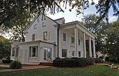
Date listed[4] |
Location |
City or town |
Description |
|---|
| 1 |
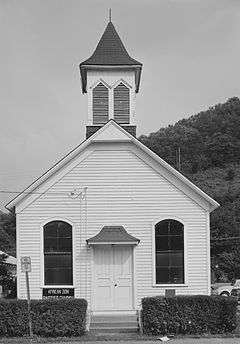
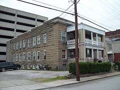
African Zion Baptist Church |
|
000000001974-12-27-0000December 27, 1974
(#74002010) |
4104 Malden Dr.
38°17′58″N 81°33′26″W / 38.299444°N 81.557222°W / 38.299444; -81.557222 (African Zion Baptist Church) |
Malden |
|
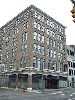
| 2 |
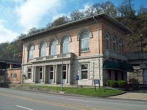
Bank of St. Albans Building |
Upload image |
000000001988-02-01-0000February 1, 1988
(#87002518) |
80 Olde Main Plaza
38°23′11″N 81°50′21″W / 38.386389°N 81.839167°W / 38.386389; -81.839167 (Bank of St. Albans Building) |
St. Albans |
|
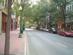
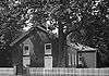
| 3 |
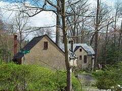
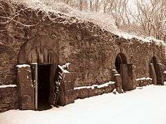
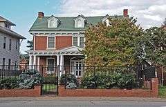
Barnes-Wellford House |
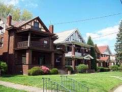
|
000000001984-10-26-0000October 26, 1984
(#84000390) |
66 Abney Circle
38°20′18″N 81°38′28″W / 38.338333°N 81.641111°W / 38.338333; -81.641111 (Barnes-Wellford House) |
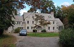
Charleston |
|
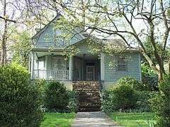
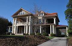
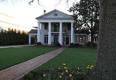
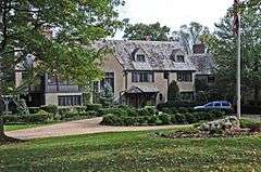
| 4 |
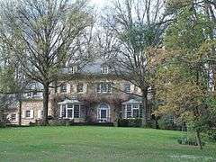
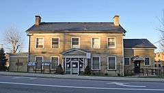
The Beeches |
Upload image |
000000001979-04-20-0000April 20, 1979
(#79002586) |
805 Kanawha Ter.
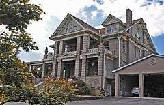
38°22′55″N 81°49′49″W / 38.381944°N 81.830278°W / 38.381944; -81.830278 (The Beeches) |
St. Albans |
|
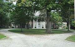
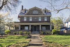
| 5 |
Bird Haven |
|
000000001984-10-26-0000October 26, 1984
(#84000393) |
733 Myrtle Rd.
38°20′12″N 81°38′35″W / 38.336667°N 81.643056°W / 38.336667; -81.643056 (Bird Haven) |
Charleston |
|
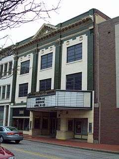
| 6 |
Daniel Boone Hotel |
|
000000001984-08-21-0000August 21, 1984
(#84003602) |
405 Capitol St.
38°21′05″N 81°37′56″W / 38.351389°N 81.632222°W / 38.351389; -81.632222 (Daniel Boone Hotel) |
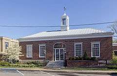
Charleston |
|
| 7 |
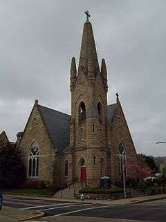
Bougemont Complex |
|
000000001984-10-26-0000October 26, 1984
(#84000395) |
Bougemont Dr.
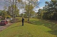
38°20′25″N 81°38′03″W / 38.340278°N 81.634167°W / 38.340278; -81.634167 (Bougemont Complex) |
Charleston |
|
| 8 |
Breezemont |
|
000000001982-04-15-0000April 15, 1982
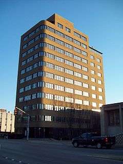
(#82004324) |
915 Breezemont Dr.
38°21′48″N 81°38′16″W / 38.363333°N 81.637778°W / 38.363333; -81.637778 (Breezemont) |
Charleston |
|
| 9 |
Briarwood |
|
000000001984-10-26-0000October 26, 1984
(#84000396) |
1240 Staunton Rd.
38°20′13″N 81°38′07″W / 38.336944°N 81.635278°W / 38.336944; -81.635278 (Briarwood) |
Charleston |
|
| 10 |
Canty House |
Upload image |
000000001988-09-23-0000September 23, 1988
(#88001587) |
WV 25
38°22′57″N 81°45′48″W / 38.3825°N 81.763333°W / 38.3825; -81.763333 (Canty House) |
Institute |
|
| 11 |
Cedar Grove |
Upload image |
000000001975-03-10-0000March 10, 1975
(#75001893) |
Southeast of the junction of U.S. Route 60 and Kanawha and James River Turnpike
38°13′17″N 81°25′41″W / 38.221389°N 81.428056°W / 38.221389; -81.428056 (Cedar Grove) |
Cedar Grove |
|
| 12 |
Charleston Baptist Temple |
|
000000002000-04-04-0000April 4, 2000
(#00000252) |
209 Morris St.
38°20′43″N 81°37′44″W / 38.345278°N 81.628889°W / 38.345278; -81.628889 (Charleston Baptist Temple) |
Charleston |
|
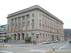
| 13 |
Charleston City Hall |
|
000000001988-06-06-0000June 6, 1988
(#88000639) |
Court and Virginia Sts.
38°21′02″N 81°38′20″W / 38.350556°N 81.638889°W / 38.350556; -81.638889 (Charleston City Hall) |
Charleston |
|
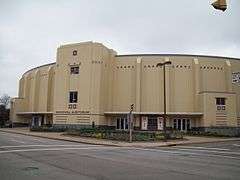
| 14 |
Charleston Municipal Auditorium |
|
000000001999-11-22-0000November 22, 1999
(#99001398) |
224-232 Virginia St. E.
38°21′10″N 81°38′24″W / 38.352778°N 81.64°W / 38.352778; -81.64 (Charleston Municipal Auditorium) |
Charleston |
|
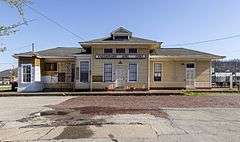
| 15 |
Chesapeake and Ohio Depot |
|
000000001984-10-26-0000October 26, 1984
(#84000782) |
305 MacCorkle Ave.
38°20′47″N 81°38′18″W / 38.346389°N 81.638333°W / 38.346389; -81.638333 (Chesapeake and Ohio Depot) |
Charleston |
|
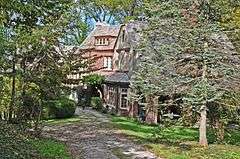
| 16 |
Chilton House |
Upload image |
000000001977-04-29-0000April 29, 1977
(#77001376) |
Off U.S. Route 60
38°23′13″N 81°50′24″W / 38.386944°N 81.84°W / 38.386944; -81.84 (Chilton House) |
St. Albans |
|
| 17 |
W.E. Chilton II House |
|
000000001984-10-26-0000October 26, 1984
(#84000397) |
1266 Louden Heights Rd.
38°19′57″N 81°38′40″W / 38.3325°N 81.644444°W / 38.3325; -81.644444 (W.E. Chilton II House) |
Charleston |
|
| 18 |
Clendenin Historic District |
|
000000001996-05-02-0000May 2, 1996
(#96000442) |
Roughly bounded by First Ave. and Kanawha Ave. between 5th St. and French St.
38°29′22″N 81°20′51″W / 38.489444°N 81.3475°W / 38.489444; -81.3475 (Clendenin Historic District) |
Clendenin |
|
| 19 |
Coal River Locks, Dams, and Log Booms Archeological District |
Upload image |
000000001997-11-24-0000November 24, 1997
(#97001417) |
Address Restricted
|
Alum Creek |
|
| 20 |
Cox-Morton House |
|
000000001984-10-26-0000October 26, 1984
(#84000399) |
640 Holley Rd.
38°20′51″N 81°38′41″W / 38.3475°N 81.644722°W / 38.3475; -81.644722 (Cox-Morton House) |
Charleston |
|
| 21 |
Cox-Parks House |
|
000000001984-10-26-0000October 26, 1984
(#84000400) |
710 Myrtle Rd.
38°20′47″N 81°38′43″W / 38.346389°N 81.645278°W / 38.346389; -81.645278 (Cox-Parks House) |
Charleston |
|
| 22 |
Craik-Patton House |
|
000000001970-08-12-0000August 12, 1970
(#75001894) |
U.S. Route 60 in Daniel Boone Roadside Park
38°19′54″N 81°35′10″W / 38.331667°N 81.586111°W / 38.331667; -81.586111 (Craik-Patton House) |
Charleston |
|
| 23 |
Crawford-Gardner House |
|
000000001984-10-26-0000October 26, 1984
(#84000401) |
743 Myrtle Rd.
38°20′43″N 81°38′34″W / 38.345278°N 81.642778°W / 38.345278; -81.642778 (Crawford-Gardner House) |
Charleston |
|
| 24 |
Dalgain |
|
000000001984-10-26-0000October 26, 1984
(#84000404) |
1223 Staunton Rd.
38°20′18″N 81°38′15″W / 38.338333°N 81.6375°W / 38.338333; -81.6375 (Dalgain) |
Charleston |
|
| 25 |
Danner-Fletcher House |
|
000000001984-10-26-0000October 26, 1984
(#84000405) |
626 Holley Rd.
38°20′52″N 81°38′46″W / 38.347778°N 81.646111°W / 38.347778; -81.646111 (Danner-Fletcher House) |
Charleston |
|
| 26 |
Downtown Charleston Historic District |
|
000000002006-03-24-0000March 24, 2006
(#06000166) |
Roughly bounded by Washington St. E, Leon Sullivan Way, Kanawha Blvd., and Summers St.
38°21′02″N 81°38′03″W / 38.350556°N 81.634167°W / 38.350556; -81.634167 (Downtown Charleston Historic District) |
Charleston |
|
| 27 |
Dutch Hollow Wine Cellars |
|
000000001970-12-18-0000December 18, 1970
(#70000654) |
Dutch Hollow Rd.
38°22′20″N 81°44′24″W / 38.372222°N 81.74°W / 38.372222; -81.74 (Dutch Hollow Wine Cellars) |
Dunbar |
|
| 28 |
East End Historic District |
|
000000001978-04-20-0000April 20, 1978
(#78002800) |
Roughly bounded by the Kanawha River, Bradford, Quarrier, and Greenbrier Sts.; also roughly bounded by Dixie, Greenbrier, and Lee Sts., and East and Shelton Alleys
38°20′16″N 81°36′53″W / 38.337778°N 81.614722°W / 38.337778; -81.614722 (East End Historic District) |
Charleston |
Second set of addresses represent a boundary increase of 000000002014-12-16-0000December 16, 2014
|
| 29 |
East Hall |
Upload image |
000000001988-09-26-0000September 26, 1988
(#88001585) |
West Quadrangle, West Virginia State University
38°22′44″N 81°46′07″W / 38.378889°N 81.768611°W / 38.378889; -81.768611 (East Hall) |
Institute |
|
| 30 |
Ebenezer Chapel |
Upload image |
000000001974-12-16-0000December 16, 1974
(#74002011) |
Ohio Ave. S. at Hillview Dr.
38°14′30″N 81°33′59″W / 38.241667°N 81.566389°W / 38.241667; -81.566389 (Ebenezer Chapel) |
Marmet |
|
| 31 |
Edgewood Historic District |
|
000000001989-11-09-0000November 9, 1989
(#89001800) |
Roughly bounded by Edgewood Dr., Highland, Beech, Chester, and Lower Chester
38°22′03″N 81°38′42″W / 38.3675°N 81.645°W / 38.3675; -81.645 (Edgewood Historic District) |
Charleston |
|
| 32 |
William H. & William S. Edwards House |
Upload image |
000000001990-05-11-0000May 11, 1990
(#90000713) |
WV 61 northeast of Cabin Creek
38°12′13″N 81°27′56″W / 38.203611°N 81.465556°W / 38.203611; -81.465556 (William H. & William S. Edwards House) |
Coalburg |
|
| 33 |
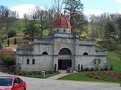
Fort Scammon |
|
000000001976-03-26-0000March 26, 1976
(#76001939) |
Atop Fort Hill[5]
38°21′07″N 81°39′18″W / 38.351944°N 81.655000°W / 38.351944; -81.655000 (Fort Scammon) |
Charleston |
|
| 34 |
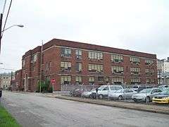
Garnet High School |
|
000000001990-07-24-0000July 24, 1990
(#90001068) |
422 Dickinson St.
38°21′04″N 81°37′48″W / 38.351111°N 81.63°W / 38.351111; -81.63 (Garnet High School) |
Charleston |
|
| 35 |
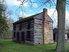
William S. Gilliland Log Cabin and Cemetery |
|
000000001984-10-26-0000October 26, 1984
(#84000407) |
Louden Heights and Bridge Rd.
38°19′47″N 81°38′48″W / 38.329722°N 81.646667°W / 38.329722; -81.646667 (William S. Gilliland Log Cabin and Cemetery) |
Charleston |
Demolished in 2016 "Deteriorated 1840s WV log cabins coming down"
|
| 36 |
Elizabeth Harden Gilmore House |
|
000000001988-09-17-0000September 17, 1988
(#88001462) |
514 Broad St. (now Leon Sullivan Way)
38°21′03″N 81°37′39″W / 38.350833°N 81.6275°W / 38.350833; -81.6275 (Elizabeth Harden Gilmore House) |
Charleston |
|
| 37 |
Good Shepherd Church |
Upload image |
000000001990-04-26-0000April 26, 1990
(#90000712) |
WV 61 southwest of East Bank
38°12′37″N 81°27′22″W / 38.210278°N 81.456111°W / 38.210278; -81.456111 (Good Shepherd Church) |
Coalburg |
|
| 38 |
Grosscup Road Historic District |
|
000000001984-01-26-0000January 26, 1984
(#84003607) |
Grosscup, Roscommon, Roller, and Bridge Rds.
38°20′35″N 81°38′15″W / 38.343056°N 81.6375°W / 38.343056; -81.6375 (Grosscup Road Historic District) |
Charleston |
|
| 39 |
Felix G. Hansford House |
Upload image |
000000001984-01-12-0000January 12, 1984
(#84003611) |
Centre and 14th Sts.
38°12′20″N 81°23′39″W / 38.205556°N 81.394167°W / 38.205556; -81.394167 (Felix G. Hansford House) |
Hansford |
|
| 40 |
John Harriman House |
Upload image |
000000001978-12-15-0000December 15, 1978
(#78002803) |
2233 3rd Ave.
38°12′59″N 81°26′27″W / 38.216389°N 81.440833°W / 38.216389; -81.440833 (John Harriman House) |
East Bank |
|
| 41 |
Holly Grove Mansion |
|
000000001974-08-28-0000August 28, 1974
(#74002007) |
1710 E. Kanawha Blvd.
38°20′10″N 81°36′54″W / 38.336111°N 81.615°W / 38.336111; -81.615 (Holly Grove Mansion) |
Charleston |
|
| 42 |
Kanawha County Courthouse |
|
000000001978-09-06-0000September 6, 1978
(#78002801) |
Virginia and Court Sts.
38°21′03″N 81°38′22″W / 38.350833°N 81.639444°W / 38.350833; -81.639444 (Kanawha County Courthouse) |
Charleston |
|
| 43 |
Kanawha State Forest Historic District |
Upload image |
000000001993-03-25-0000March 25, 1993
(#93000228) |
County Route 42/43 2.6 miles (4.2 km) south of Charleston
38°15′56″N 81°43′37″W / 38.265556°N 81.726944°W / 38.265556; -81.726944 (Kanawha State Forest Historic District) |
Loudendale |
|
| 44 |
Kearse Theater |
Upload image |
000000001980-11-28-0000November 28, 1980
(#80004026) |
161, 165, 167 Summers St.
38°21′04″N 81°38′07″W / 38.351111°N 81.635278°W / 38.351111; -81.635278 (Kearse Theater) |
Charleston |
Demolished in 1982.
|
| 45 |
Laidley-Summers-Quarrier House |
|
000000001978-12-13-0000December 13, 1978
(#78002802) |
800 Orchard St.
38°22′06″N 81°39′02″W / 38.368333°N 81.650556°W / 38.368333; -81.650556 (Laidley-Summers-Quarrier House) |
Charleston |
|
| 46 |
Mattie V. Lee Home |
|
000000001992-06-16-0000June 16, 1992
(#92000303) |
810 Donnally St.
38°21′06″N 81°37′51″W / 38.351667°N 81.630833°W / 38.351667; -81.630833 (Mattie V. Lee Home) |
Charleston |
|
| 47 |
Little Brick Church |
Upload image |
000000001974-12-16-0000December 16, 1974
(#74002006) |
0.75 miles (1.21 km) east of Kelley's Creek on U.S. Route 60
38°13′03″N 81°25′34″W / 38.2175°N 81.426111°W / 38.2175; -81.426111 (Little Brick Church) |
Cedar Grove |
|
| 48 |
Littlepage Stone Mansion |
|
000000001982-09-02-0000September 2, 1982
(#82004325) |
1809 W. Washington St.
38°22′34″N 81°39′58″W / 38.376111°N 81.666111°W / 38.376111; -81.666111 (Littlepage Stone Mansion) |
Charleston |
|
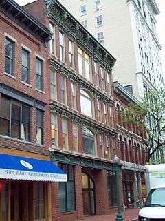
| 49 |
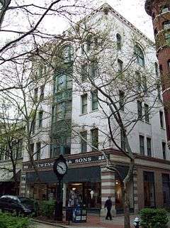
Loewenstein and Sons Hardware Building |
|
000000001985-11-01-0000November 1, 1985
(#85003475) |
223-225 Capitol St.
38°21′02″N 81°38′05″W / 38.350556°N 81.634722°W / 38.350556; -81.634722 (Loewenstein and Sons Hardware Building) |
Charleston |
|
| 50 |
Luna Park Historic District |
|
000000002012-04-03-0000April 3, 2012
(#12000181) |
Roughly bounded by Main St., Glenwood Ave., Delaware Ave., & Kanawha Blvd. W.
38°21′41″N 81°39′11″W / 38.361496°N 81.653042°W / 38.361496; -81.653042 (Luna Park Historic District) |
Charleston |
|
| 51 |
MacFarland House |
|
000000001979-12-10-0000December 10, 1979
(#79002585) |
1310 Kanawha Boulevard
38°20′35″N 81°37′49″W / 38.343056°N 81.630278°W / 38.343056; -81.630278 (MacFarland House) |
Charleston |
|
| 52 |
Malden Historic District |
|
000000001980-07-18-0000July 18, 1980
(#80004028) |
Roughly bounded by railroad tracks, the Kanawha River, Georges Dr., and U.S. Route 60
38°17′49″N 81°33′35″W / 38.296944°N 81.559722°W / 38.296944; -81.559722 (Malden Historic District) |
Malden |
|
| 53 |
Maple Terrace Court and Walton Apartments |
|
000000002002-08-22-0000August 22, 2002
(#02000885) |
Maple Terrace Court
38°20′42″N 81°37′39″W / 38.345°N 81.6275°W / 38.345; -81.6275 (Maple Terrace Court and Walton Apartments) |
Charleston |
|
| 54 |
McAndrews-Gallaher House |
|
000000001984-10-26-0000October 26, 1984
(#84000409) |
601 Briarwood Rd.
38°20′46″N 81°38′52″W / 38.346111°N 81.647778°W / 38.346111; -81.647778 (McAndrews-Gallaher House) |
Charleston |
|
| 55 |
William E. Mohler House |
Upload image |
000000001983-02-10-0000February 10, 1983
(#83003242) |
819 Pennsylvania Ave.
38°23′07″N 81°50′12″W / 38.385278°N 81.836667°W / 38.385278; -81.836667 (William E. Mohler House) |
St. Albans |
|
| 56 |
Plaza Theatre |
|
000000001985-10-30-0000October 30, 1985
(#85003408) |
123 Summers St.
38°21′00″N 81°38′08″W / 38.35°N 81.635556°W / 38.35; -81.635556 (Plaza Theatre) |
Charleston |
|
| 57 |
Pratt Historic District |
Upload image |
000000001984-01-12-0000January 12, 1984
(#84003615) |
Roughly bounded by Ferry St., the Kanawha River, and Charles and Pratt Aves., including the cemetery
38°12′32″N 81°22′52″W / 38.208889°N 81.381111°W / 38.208889; -81.381111 (Pratt Historic District) |
Pratt |
|
| 58 |
St. Albans Chesapeake and Ohio Railroad Depot |
|
000000001997-07-09-0000July 9, 1997
(#97000785) |
410 4th Ave.
38°23′16″N 81°49′57″W / 38.387778°N 81.8325°W / 38.387778; -81.8325 (St. Albans Chesapeake and Ohio Railroad Depot) |
St. Albans |
|
| 59 |
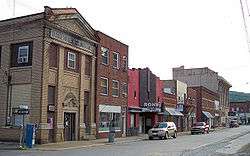
St. Albans Main Street Historic District |
Upload image |
000000002000-11-02-0000November 2, 2000
(#00001315) |
Roughly bounded by Main St. between Second St. and B St.
38°23′11″N 81°50′13″W / 38.386389°N 81.836944°W / 38.386389; -81.836944 (St. Albans Main Street Historic District) |
St. Albans |
|
| 60 |
St. Albans Post Office |
|
000000001994-11-04-0000November 4, 1994
(#94001285) |
202 Sixth Ave.
38°23′11″N 81°50′09″W / 38.386389°N 81.835833°W / 38.386389; -81.835833 (St. Albans Post Office) |
St. Albans |
|
| 61 |
St. Albans Site |
Upload image |
000000001974-05-03-0000May 3, 1974
(#74002012) |
U.S. Route 60 along the Kanawha River[6]
38°23′09″N 81°48′29″W / 38.385833°N 81.808056°W / 38.385833; -81.808056 (St. Albans Site) |
St. Albans |
|
| 62 |
St. John's Episcopal Church |
|
000000001989-11-02-0000November 2, 1989
(#89001782) |
11105 Quarrier St.
38°20′49″N 81°37′56″W / 38.346944°N 81.632222°W / 38.346944; -81.632222 (St. John's Episcopal Church) |
Charleston |
|
| 63 |
St. Mark's Episcopal Church |
Upload image |
000000001977-11-07-0000November 7, 1977
(#77001377) |
405-407 B St.
38°23′18″N 81°50′19″W / 38.388333°N 81.838611°W / 38.388333; -81.838611 (St. Mark's Episcopal Church) |
St. Albans |
|
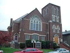
| 64 |
St. Paul Baptist Church |
Upload image |
000000001998-04-13-0000April 13, 1998
(#98000285) |
821 B St.
38°23′04″N 81°50′20″W / 38.384444°N 81.838889°W / 38.384444; -81.838889 (St. Paul Baptist Church) |
St. Albans |
|
| 65 |
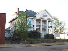
Samuel Shrewsbury, Sr. House |
Upload image |
000000001978-11-02-0000November 2, 1978
(#78002799) |
310 Stubb Dr.
38°14′15″N 81°32′39″W / 38.2375°N 81.544167°W / 38.2375; -81.544167 (Samuel Shrewsbury, Sr. House) |
Belle |
|
| 66 |
Simpson Memorial Methodist Episcopal Church |
|
000000001991-08-05-0000August 5, 1991
(#91001011) |
607 Shrewsbury St.
38°21′06″N 81°37′44″W / 38.351667°N 81.628889°W / 38.351667; -81.628889 (Simpson Memorial Methodist Episcopal Church) |
Charleston |
|
| 67 |
Smith-Giltinan House |
|
000000002002-03-20-0000March 20, 2002
(#02000253) |
1223 Virginia St., E.
38°20′39″N 81°37′51″W / 38.344167°N 81.630833°W / 38.344167; -81.630833 (Smith-Giltinan House) |
Charleston |
|
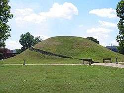
| 68 |
South Charleston Mound |
|
000000001970-10-15-0000October 15, 1970
(#70000655) |
U.S. Route 60, in city park
38°22′07″N 81°41′48″W / 38.368611°N 81.696667°W / 38.368611; -81.696667 (South Charleston Mound) |
South Charleston |
|
| 69 |
Spring Hill Cemetery Historic District |
|
000000001985-10-18-0000October 18, 1985
(#85003360) |
1554 Farnsworth Dr.
38°21′11″N 81°36′57″W / 38.353056°N 81.615833°W / 38.353056; -81.615833 (Spring Hill Cemetery Historic District) |
Charleston |
|
| 70 |
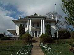
Samuel Starks House |
|
000000001988-02-01-0000February 1, 1988
(#87002526) |
413 Shrewsbury St.
38°21′02″N 81°37′50″W / 38.350556°N 81.630556°W / 38.350556; -81.630556 (Samuel Starks House) |
Charleston |
|
| 71 |
Sterrett Brothers' Dry Goods Store |
|
000000002001-11-29-0000November 29, 2001
(#01001329) |
112 Capitol St.
38°20′58″N 81°38′08″W / 38.349444°N 81.635556°W / 38.349444; -81.635556 (Sterrett Brothers' Dry Goods Store) |
Charleston |
|
| 72 |
Stoneleigh |
|
000000001984-10-26-0000October 26, 1984
(#84000411) |
909 Ridgeway Rd.
38°20′17″N 81°38′19″W / 38.338056°N 81.638611°W / 38.338056; -81.638611 (Stoneleigh) |
Charleston |
|
| 73 |
Summers House |
Upload image |
000000002015-11-24-0000November 24, 2015
(#15000841) |
805 Loudon Heights Rd.
38°20′25″N 81°38′14″W / 38.340335°N 81.637170°W / 38.340335; -81.637170 (Summers House) |
Charleston |
|
| 74 |
Sunrise |
|
000000001974-07-24-0000July 24, 1974
(#74002008) |
746 Myrtle Rd.
38°20′44″N 81°38′29″W / 38.345556°N 81.641389°W / 38.345556; -81.641389 (Sunrise) |
Charleston |
|
| 75 |
Thomas-McJunkin-Love House |
|
000000001984-10-26-0000October 26, 1984
(#84000413) |
920 Newton Rd.
38°20′26″N 81°38′23″W / 38.340556°N 81.639722°W / 38.340556; -81.639722 (Thomas-McJunkin-Love House) |
Charleston |
|
| 76 |
United Carbon Building |
|
000000001994-07-15-0000July 15, 1994
(#94000720) |
1018 Kanawha Blvd., E.
38°20′46″N 81°38′04″W / 38.346111°N 81.634444°W / 38.346111; -81.634444 (United Carbon Building) |
Charleston |
|
| 77 |
Booker T. Washington High School |
Upload image |
000000001999-12-03-0000December 3, 1999
(#99001399) |
Wyatt St. off U.S. Route 60
38°12′04″N 81°22′17″W / 38.201111°N 81.371389°W / 38.201111; -81.371389 (Booker T. Washington High School) |
London |
|
| 78 |
James Weimer House |
|
000000002004-04-14-0000April 14, 2004
(#04000309) |
411 8th Ave.
38°23′03″N 81°50′03″W / 38.384167°N 81.834167°W / 38.384167; -81.834167 (James Weimer House) |
St. Albans |
|
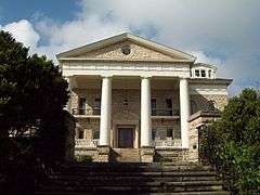
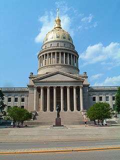
| 79 |
West Virginia Capitol Complex |
|
000000001974-12-31-0000December 31, 1974
(#74002009) |
Along Kanawha Boulevard, E.
38°20′11″N 81°36′44″W / 38.336389°N 81.612222°W / 38.336389; -81.612222 (West Virginia Capitol Complex) |
Charleston |
The West Virginia Capitol Complex consists of two primary sites, the West Virginia State Capitol and West Virginia Governor's Mansion.[7]
|
| 80 |
Col. Henry Hewitt Wood House |
Upload image |
000000001980-11-28-0000November 28, 1980
(#80004027) |
6560 Roosevelt Ave., SE.
38°18′00″N 81°33′46″W / 38.3°N 81.562778°W / 38.3; -81.562778 (Col. Henry Hewitt Wood House) |
Charleston |
|
| 81 |
Woodrums' Building |
|
000000001996-04-18-0000April 18, 1996
(#96000439) |
602 E. Virginia St.
38°21′01″N 81°38′15″W / 38.350278°N 81.6375°W / 38.350278; -81.6375 (Woodrums' Building) |
Charleston |
|
| 82 |
Young-Noyes House |
|
000000001991-04-25-0000April 25, 1991
(#91000446) |
2122 Kanawha Ave.
38°20′02″N 81°37′05″W / 38.333889°N 81.618056°W / 38.333889; -81.618056 (Young-Noyes House) |
Charleston |
|