| [3] |
Name on the Register[4] |
Image |
Date listed[5] |
Location |
City or town |
Description |
|---|
| 1 |
Ballard Farm |
|
000000001993-11-04-0000November 4, 1993
(#93001241) |
Junction of Ballard Rd. and Town Highway 6
44°42′41″N 73°07′21″W / 44.711367°N 73.122425°W / 44.711367; -73.122425 (Ballard Farm) |
Georgia |
|
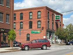
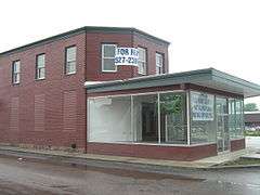
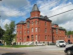
| 2 |
Billado Block |
|
000000002007-10-16-0000October 16, 2007
(#07001095) |
371 Main St.
44°54′36″N 72°48′18″W / 44.91°N 72.805°W / 44.91; -72.805 (Billado Block) |
Enosburgh |
|
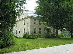
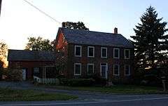
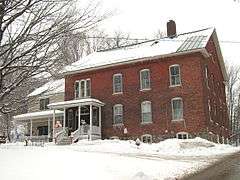
| 3 |
Sheldon Boright House |
|
000000001989-06-02-0000June 2, 1989
(#89000433) |
122 River St.
45°00′01″N 72°40′44″W / 45.000278°N 72.678889°W / 45.000278; -72.678889 (Sheldon Boright House) |
Richford |
|
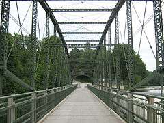
| 4 |
Bridge 9 |
|
000000002007-12-20-0000December 20, 2007
(#07001298) |
Shawville Rd.
44°54′42″N 72°58′22″W / 44.911667°N 72.972778°W / 44.911667; -72.972778 (Bridge 9) |
Sheldon |
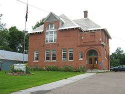
|
| 5 |
Bridge 12 |
|
000000002007-12-20-0000December 20, 2007
(#07001299) |
Boston Post Rd.
44°55′11″N 72°45′26″W / 44.919722°N 72.757222°W / 44.919722; -72.757222 (Bridge 12) |
Enosburgh |
|
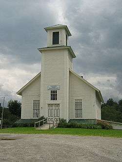
| 6 |
Brigham Academy |
|
000000001995-12-13-0000December 13, 1995
(#95001428) |
Junction of VT 108 and Academy Rd.
44°47′12″N 72°48′11″W / 44.786667°N 72.803056°W / 44.786667; -72.803056 (Brigham Academy) |
Bakersfield |
|
| 7 |
Central Vermont Railroad Headquarters |
|
000000001974-01-21-0000January 21, 1974
(#74000211) |
Bounded roughly by Federal, Catherine, Allen, Lower Welden, Houghton, and Pine Sts.
44°48′41″N 73°05′15″W / 44.811389°N 73.0875°W / 44.811389; -73.0875 (Central Vermont Railroad Headquarters) |
St. Albans |
|
| 8 |
Community Baptist Church and Parsonage |
Upload image |
000000002015-10-13-0000October 13, 2015
(#15000737) |
2 & 10 Mountain Rd.
44°52′38″N 72°36′28″W / 44.8773°N 72.6077°W / 44.8773; -72.6077 (Community Baptist Church and Parsonage) |
Montgomery |
|
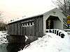
| 9 |
Comstock Covered Bridge |
|
000000001974-11-19-0000November 19, 1974
(#74000212) |
Off VT 118 spanning the Trout River
44°53′59″N 72°38′39″W / 44.899722°N 72.644167°W / 44.899722; -72.644167 (Comstock Covered Bridge) |
Montgomery |
|
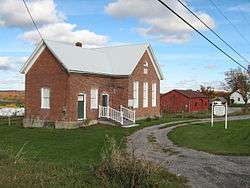
| 10 |
District No. 2 School |
|
000000002000-02-04-0000February 4, 2000
(#00000063) |
2442 Polly Hubbard Rd.
44°45′22″N 73°09′24″W / 44.756111°N 73.156667°W / 44.756111; -73.156667 (District No. 2 School) |
Georgia |
|
| 11 |
District No. 8 School |
|
000000001998-10-30-0000October 30, 1998
(#98001319) |
U.S. Route 7
44°43′51″N 73°07′04″W / 44.730833°N 73.117778°W / 44.730833; -73.117778 (District No. 8 School) |
Georgia |
|
| 12 |
Douglas & Jarvis Patent Parabolic Truss Iron Bridge |
|
000000001974-03-21-0000March 21, 1974
(#74000213) |
U.S. Route 2 over the Missisquoi River in Highgate Falls
44°56′03″N 73°02′53″W / 44.934167°N 73.048056°W / 44.934167; -73.048056 (Douglas & Jarvis Patent Parabolic Truss Iron Bridge) |
Highgate |
|
| 13 |
Downtown Richford Historic District |
|
000000001980-08-22-0000August 22, 1980
(#80000333) |
Main and River Sts.
44°59′47″N 72°40′19″W / 44.996389°N 72.671944°W / 44.996389; -72.671944 (Downtown Richford Historic District) |
Richford |
|
| 14 |
East Fairfield Covered Bridge |
|
000000001974-11-19-0000November 19, 1974
(#74000214) |
Bridge Street, over Black Creek, near East Fairfield
44°47′08″N 72°51′49″W / 44.785556°N 72.863611°W / 44.785556; -72.863611 (East Fairfield Covered Bridge) |
Fairfield |
|
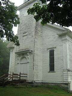
| 15 |
Enosburg Congregational Memorial Church |
|
000000002001-03-02-0000March 2, 2001
(#01000222) |
Town Highway 2
44°52′58″N 72°45′15″W / 44.882778°N 72.754167°W / 44.882778; -72.754167 (Enosburg Congregational Memorial Church) |
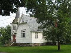
Enosburgh |
|
| 16 |
Enosburg Opera House |
|
000000001978-09-20-0000September 20, 1978
(#78000235) |
123 Depot St.
44°54′31″N 72°48′08″W / 44.908611°N 72.802222°W / 44.908611; -72.802222 (Enosburg Opera House) |
Enosburg Falls |
|
| 17 |
Evarts-McWilliams House |
|
000000001982-10-21-0000October 21, 1982
(#82001765) |
Georgia Shore Rd.
44°46′56″N 73°08′34″W / 44.782222°N 73.142778°W / 44.782222; -73.142778 (Evarts-McWilliams House) |
Georgia |
Now a bed & breakfast inn
|
| 18 |
Fairfax Covered Bridge |
|
000000001974-11-05-0000November 5, 1974
(#74000215) |
Off VT 104 over Mill Brook
44°39′49″N 73°00′39″W / 44.663611°N 73.010833°W / 44.663611; -73.010833 (Fairfax Covered Bridge) |
Fairfax |
Maple Street Covered Bridge
|
| 19 |
Fairfield Street School |
|
000000001996-11-07-0000November 7, 1996
(#96001326) |
78 Fairfield St.
44°48′31″N 73°04′45″W / 44.808611°N 73.079167°W / 44.808611; -73.079167 (Fairfield Street School) |
St. Albans |
|
| 20 |
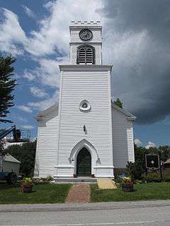
First Congregational Church of Swanton |
|
000000002001-03-02-0000March 2, 2001
(#01000220) |
42 Academy St.
44°55′02″N 73°07′21″W / 44.917222°N 73.1225°W / 44.917222; -73.1225 (First Congregational Church of Swanton) |
Swanton |
|
| 21 |
Fletcher Union Church |
|
000000001982-05-17-0000May 17, 1982
(#82001702) |
Town Highway 1 (Cambridge Rd.)
44°40′57″N 72°54′42″W / 44.6825°N 72.911667°W / 44.6825; -72.911667 (Fletcher Union Church) |
Fletcher |
|
| 22 |
Fuller Covered Bridge |
|
000000001974-12-23-0000December 23, 1974
(#74000216) |
Fuller Bridge Rd. over Black Falls Brook at Montgomery Village
44°54′12″N 72°38′23″W / 44.903262°N 72.639706°W / 44.903262; -72.639706 (Fuller Covered Bridge) |
Montgomery |
|
| 23 |
Georgia Plain Baptist Church |
|
000000002001-03-02-0000March 2, 2001
(#01000213) |
1493 Stonebridge Rd., at Plains Rd.
44°43′15″N 73°09′57″W / 44.720822°N 73.165706°W / 44.720822; -73.165706 (Georgia Plain Baptist Church) |
Georgia |
|
| 24 |
Giroux Furniture Company Building |
|
000000002006-11-08-0000November 8, 2006
(#06001010) |
10-18 Catherine St.
44°48′39″N 73°05′10″W / 44.810712°N 73.086045°W / 44.810712; -73.086045 (Giroux Furniture Company Building) |
St. Albans |
|
| 25 |
Solomon Goodrich Homestead |
|
000000002004-07-28-0000July 28, 2004
(#04000770) |
4787 Ethan Allen Highway
44°44′25″N 73°06′55″W / 44.740231°N 73.115209°W / 44.740231; -73.115209 (Solomon Goodrich Homestead) |
Georgia |
|
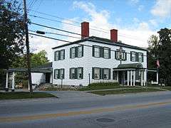
| 26 |
Hathaway's Tavern |
|
000000001983-07-14-0000July 14, 1983
(#83003209) |
255 N. Main St.
44°49′21″N 73°04′52″W / 44.8225°N 73.081111°W / 44.8225; -73.081111 (Hathaway's Tavern) |
St. Albans |
Franklin County was organized in 1795, but did not have a courthouse until 1803, during which time terms of the court were held at Silas Hathaway's tavern, the oldest house in the city.[6]
|
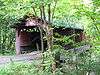
| 27 |
Hectorville Covered Bridge |
|
000000001974-11-20-0000November 20, 1974
(#74000217) |
1.8 mi (2.9 km) south of Montgomery Center over the South Branch of the Trout River
44°51′13″N 72°36′50″W / 44.853611°N 72.613889°W / 44.853611; -72.613889 (Hectorville Covered Bridge) |
Montgomery |
Bridge has been dismantled and is awaiting repairs[7]
|
| 28 |
Hopkins Covered Bridge |
|
000000001974-11-20-0000November 20, 1974
(#74000218) |
Town road over the Trout River
44°55′15″N 72°40′23″W / 44.920833°N 72.673056°W / 44.920833; -72.673056 (Hopkins Covered Bridge) |
Enosburgh |
|
| 29 |
Houghton House |
|
000000001972-09-04-0000September 4, 1972
(#72000092) |
86 S. Main St.
44°48′27″N 73°05′05″W / 44.8075°N 73.084722°W / 44.8075; -73.084722 (Houghton House) |
St. Albans |
|
| 30 |
Hutchins Covered Bridge |
|
000000001974-12-30-0000December 30, 1974
(#74000219) |
South of Montgomery Center over the South Branch of the Trout River
44°51′30″N 72°36′45″W / 44.858333°N 72.6125°W / 44.858333; -72.6125 (Hutchins Covered Bridge) |
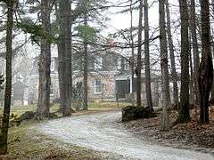
Montgomery |
|
| 31 |
Kemp-Shepard House |
Upload image |
000000001997-11-13-0000November 13, 1997
(#97001442) |
VT 104A, 1 mi (1.6 km) southeast of U.S. Route 7
44°40′56″N 73°05′24″W / 44.682222°N 73.09°W / 44.682222; -73.09 (Kemp-Shepard House) |
Georgia |
|
| 32 |
Dr. B. J. Kendall Company |
|
000000001993-08-02-0000August 2, 1993
(#93000721) |
228 N. Main St.
44°54′40″N 72°48′12″W / 44.911111°N 72.803333°W / 44.911111; -72.803333 (Dr. B. J. Kendall Company) |
Enosburgh |
|
| 33 |
L'Ecole Saintes-Anges |
|
000000001980-11-28-0000November 28, 1980
(#80000334) |
247 Lake St.
44°48′42″N 73°05′40″W / 44.811667°N 73.094444°W / 44.811667; -73.094444 (L'Ecole Saintes-Anges) |
St. Albans |
|
| 34 |
Longley Covered Bridge |
|
000000001974-12-30-0000December 30, 1974
(#74000220) |
Northwest of Montgomery over the Trout River
44°54′25″N 72°39′21″W / 44.906944°N 72.655833°W / 44.906944; -72.655833 (Longley Covered Bridge) |
Montgomery |
|
| 35 |
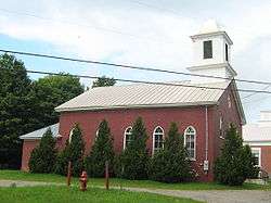
Methodist Episcopal Church |
|
000000002001-03-02-0000March 2, 2001
(#01000219) |
25 Grand Ave.
44°55′07″N 73°07′30″W / 44.918611°N 73.125°W / 44.918611; -73.125 (Methodist Episcopal Church) |
Swanton |
|
| 36 |
Missisquoi River Bridge |
|
000000001990-10-11-0000October 11, 1990
(#90001494) |
VT 105-A over the Missisquoi River
45°00′49″N 72°35′16″W / 45.013611°N 72.587778°W / 45.013611; -72.587778 (Missisquoi River Bridge) |
Richford |
|
| 37 |
Montgomery House |
|
000000001992-08-20-0000August 20, 1992
(#92000997) |
VT 118
44°54′05″N 72°38′27″W / 44.901389°N 72.640833°W / 44.901389; -72.640833 (Montgomery House) |
Montgomery |
|
| 38 |
Parish of the Holy Trinity |
|
000000002001-03-02-0000March 2, 2001
(#01000221) |
38 Grand Ave.
44°55′02″N 73°07′25″W / 44.917266°N 73.123731°W / 44.917266; -73.123731 (Parish of the Holy Trinity) |
Swanton |
|
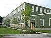
| 39 |
Richford Primary School |
|
000000002004-05-12-0000May 12, 2004
(#04000443) |
140 Intervale Ave.
44°59′47″N 72°40′31″W / 44.996389°N 72.675278°W / 44.996389; -72.675278 (Richford Primary School) |
Richford |
|
| 40 |
Richwood Estate |
|
000000001988-11-03-0000November 3, 1988
(#88002175) |
North of St. Albans off U.S. Route 7
44°51′48″N 73°05′48″W / 44.863333°N 73.096667°W / 44.863333; -73.096667 (Richwood Estate) |
Swanton |
Listed as being in the St. Albans vicinity.
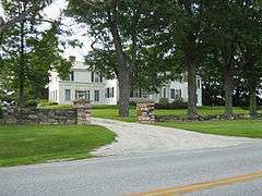
|
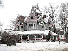
| 41 |
Rockledge |
|
000000001994-05-19-0000May 19, 1994
(#94000474) |
Highgate Rd. (Vermont Route 207)
44°52′25″N 73°04′27″W / 44.873608°N 73.074190°W / 44.873608; -73.074190 (Rockledge) |
Swanton |
|
| 42 |
St. Albans Historic District |
|
000000001980-05-01-0000May 1, 1980
(#80000335) |
U.S. Route 7 and VT 36
44°48′43″N 73°05′00″W / 44.811944°N 73.083333°W / 44.811944; -73.083333 (St. Albans Historic District) |
St. Albans |
|
| 43 |
St. Albans Town Hall |
|
000000001996-03-14-0000March 14, 1996
(#96000257) |
VT 36 (Lake Rd.)
44°48′30″N 73°08′20″W / 44.808333°N 73.138889°W / 44.808333; -73.138889 (St. Albans Town Hall) |
St. Albans |
|
| 44 |
St. Ann's Episcopal Church |
|
000000002001-03-12-0000March 12, 2001
(#01000259) |
Junction of Church and Town Sts.
44°59′52″N 72°40′20″W / 44.997778°N 72.672222°W / 44.997778; -72.672222 (St. Ann's Episcopal Church) |
Richford |
|
| 45 |
St. Bartholomew's Episcopal Church |
|
000000001988-09-01-0000September 1, 1988
(#88001467) |
VT 118
44°54′06″N 72°38′26″W / 44.901761°N 72.640470°W / 44.901761; -72.640470 (St. Bartholomew's Episcopal Church) |
Montgomery |
Now known as Pratt Hall.
|
| 46 |
St. George's Catholic Church |
|
000000002001-03-02-0000March 2, 2001
(#01000218) |
VT 25
44°46′53″N 72°48′02″W / 44.781389°N 72.800556°W / 44.781389; -72.800556 (St. George's Catholic Church) |
Bakersfield |
|
| 47 |
St. John's Episcopal Church |
|
000000001976-09-03-0000September 3, 1976
(#76000139) |
Highgate Falls village green
44°55′48″N 73°02′56″W / 44.93°N 73.048889°W / 44.93; -73.048889 (St. John's Episcopal Church) |
Highgate |
|
| 48 |
Swanton Covered Railroad Bridge |
Upload image |
000000001973-06-18-0000June 18, 1973
(#73000195) |
South of Swanton over the Missisquoi River
44°54′58″N 73°07′40″W / 44.916111°N 73.127778°W / 44.916111; -73.127778 (Swanton Covered Railroad Bridge) |
Swanton |
Destroyed in 1987[8]
|
| 49 |
Swanton School |
|
000000002002-03-01-0000March 1, 2002
(#02000118) |
53 Church St.
44°54′58″N 73°07′26″W / 44.916111°N 73.123889°W / 44.916111; -73.123889 (Swanton School) |
Swanton |
|
| 50 |
Sweat-Comings Company House |
|
000000002004-05-12-0000May 12, 2004
(#04000444) |
10-12 Powell St.
44°59′46″N 72°40′27″W / 44.996111°N 72.674167°W / 44.996111; -72.674167 (Sweat-Comings Company House) |
Richford |
|
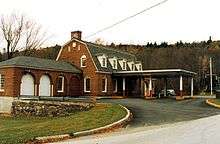
| 51 |
U.S. Inspection Station-East Richford, Vermont |
|
000000002014-09-10-0000September 10, 2014
(#14000604) |
357 Glen Sutton Rd.
45°00′40″N 72°35′16″W / 45.0111°N 72.5877°W / 45.0111; -72.5877 (U.S. Inspection Station-East Richford, Vermont) |
Richford |
Listed on the register as "U.S. Inspection Station-East Rockford, Vermont".
|
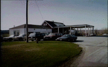
| 52 |
U.S. Inspection Station-Richford, Vermont |
|
000000002014-09-10-0000September 10, 2014
(#14000605) |
VT 139
45°00′49″N 72°39′46″W / 45.0137°N 72.6627°W / 45.0137; -72.6627 (U.S. Inspection Station-Richford, Vermont) |
Richford |
|
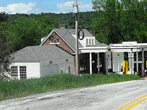
| 53 |
U.S. Inspection Station-West Berkshire, Vermont |
|
000000002014-09-10-0000September 10, 2014
(#14000606) |
VT 108
45°00′55″N 72°49′33″W / 45.0153°N 72.8257°W / 45.0153; -72.8257 (U.S. Inspection Station-West Berkshire, Vermont) |
Berkshire |
|
| 54 |
Warner Home |
|
000000001988-10-20-0000October 20, 1988
(#88002034) |
133 High St.
44°49′05″N 73°04′36″W / 44.818105°N 73.076552°W / 44.818105; -73.076552 (Warner Home) |
St. Albans |
|
| 55 |
West Berkshire School |
|
000000001993-11-04-0000November 4, 1993
(#93001174) |
Junction of Town Highways 3 and 26
44°59′10″N 72°48′36″W / 44.986111°N 72.81°W / 44.986111; -72.81 (West Berkshire School) |
Berkshire |
|
| 56 |
West Hill Covered Bridge |
|
000000001974-12-31-0000December 31, 1974
(#74000221) |
3.2 miles (5.1 km) south of Montgomery over West Hill Brook
44°52′03″N 72°38′53″W / 44.8675°N 72.648056°W / 44.8675; -72.648056 (West Hill Covered Bridge) |
Montgomery |
Restored in 2009[9]
|
| 57 |
F.W. Wheeler House |
|
000000002004-05-12-0000May 12, 2004
(#04000445) |
31 Intervale Ave.
44°59′37″N 72°40′31″W / 44.993611°N 72.675278°W / 44.993611; -72.675278 (F.W. Wheeler House) |
Richford |
|
| 58 |
Willard Manufacturing Company Building |
|
000000002006-12-06-0000December 6, 2006
(#06001116) |
25 Stowell St.
44°48′38″N 73°05′11″W / 44.810556°N 73.086389°W / 44.810556; -73.086389 (Willard Manufacturing Company Building) |
St. Albans |
|