| [3] |
Name on the Register[4] |
Image |
Date listed[5] |
Location |
City or town |
Description |
|---|
| 1 |
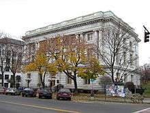
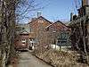
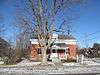
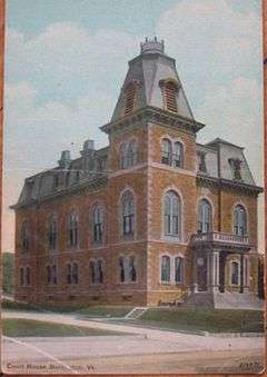
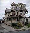
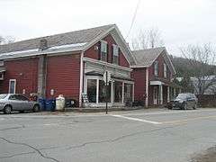
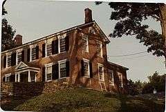
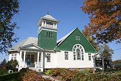
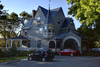
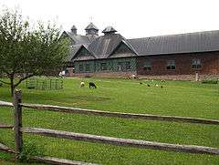
Ethan Allen Homestead |
|
000000001986-07-24-0000July 24, 1986
(#86002265) |
Off Van Patten Parkway
44°30′29″N 73°13′48″W / 44.508031°N 73.229961°W / 44.508031; -73.229961 (Ethan Allen Homestead) |
Burlington |
|
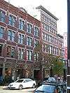
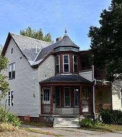
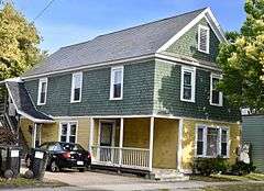
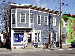
| 2 |
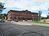
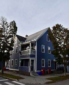
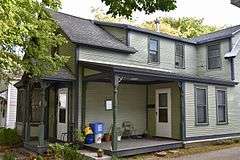
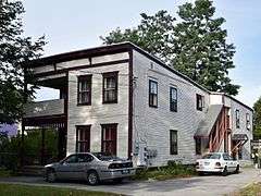
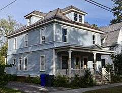
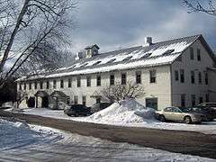
Apartment Building at 27 and 31 Peru Street and 29 Johnson Street |
|
000000002014-01-22-0000January 22, 2014
(#13001119) |
27 and 31 Peru Street and 29 Johnson Street
44°28′57″N 73°12′59″W / 44.482391°N 73.216334°W / 44.482391; -73.216334 (Apartment Building at 27 and 31 Peru Street and 29 Johnson Street) |
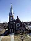
Burlington |
|
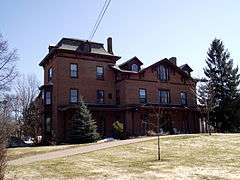
| 3 |
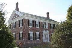
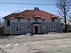
Martin M. Bates Farmstead |
Upload image |
000000001991-11-21-0000November 21, 1991
(#91001676) |
Huntington Rd. north of Huntington
44°21′57″N 72°59′48″W / 44.365833°N 72.996667°W / 44.365833; -72.996667 (Martin M. Bates Farmstead) |
Richmond |
|
| 4 |
Battery Street Historic District |
|
000000001977-11-02-0000November 2, 1977
(#77000098) |
Roughly bounded by Lake Champlain and Main, Maple, and St. Pauls Sts. (both sides); also roughly bounded by Brown's Court and King, Adams, and Union Sts.; also 214-240 Pine St., excluding 235
44°28′29″N 73°13′05″W / 44.474722°N 73.218056°W / 44.474722; -73.218056 (Battery Street Historic District) |
Burlington |
Second and third sets of boundaries represents boundary increases of 000000001984-06-28-0000June 28, 1984 and 000000002014-07-24-0000July 24, 2014 respectively
|
| 5 |
Wilson Alwyn "Snowflake" Bentley House |
Upload image |
000000001980-07-03-0000July 3, 1980
(#80004501) |
Southeast of Jericho on Nashville Rd.
44°27′01″N 72°55′57″W / 44.450278°N 72.9325°W / 44.450278; -72.9325 (Wilson Alwyn "Snowflake" Bentley House) |
Jericho |
|
| 6 |
Buell Street-Bradley Street Historic District |
|
000000001995-11-13-0000November 13, 1995
(#95001260) |
2-71 Bradley St., 24-125 Buell St., 16-75 Orchard Terr., 9-96 S. Union St., 11-87 Hungerford Terr.
44°28′45″N 73°12′31″W / 44.479167°N 73.208611°W / 44.479167; -73.208611 (Buell Street-Bradley Street Historic District) |
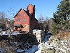
Burlington |
|
| 7 |
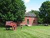
Burlington Bay Horse Ferry |
Upload image |
000000001993-12-15-0000December 15, 1993
(#93001384) |
In Burlington Bay, between Lone Rock Point and the Burlington breakwater[6]
44°29′07″N 73°14′35″W / 44.485333°N 73.243°W / 44.485333; -73.243 (Burlington Bay Horse Ferry) |
Burlington |
Shipwreck of a horse-powered ferry
|
| 8 |
Burlington Breakwater |
|
000000002003-06-06-0000June 6, 2003
(#02000711) |
Burlington Harbor
44°28′32″N 73°13′33″W / 44.475556°N 73.225833°W / 44.475556; -73.225833 (Burlington Breakwater) |
Burlington |
Built to calm the waters of Lake Champlain against Burlington harbor.
|
| 9 |
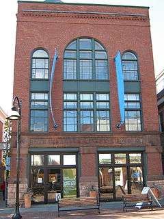
Burlington Montgomery Ward Building |
|
000000001991-05-30-0000May 30, 1991
(#91000673) |
52-54 Church St.
44°28′44″N 73°12′46″W / 44.478889°N 73.212778°W / 44.478889; -73.212778 (Burlington Montgomery Ward Building) |
Burlington |
|
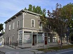
| 10 |
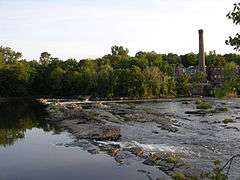
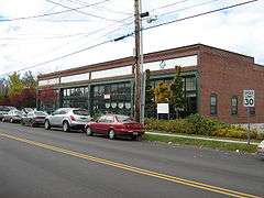
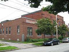
Burlington Traction Company |
|
000000002004-10-07-0000October 7, 2004
(#04001133) |
662 Riverside Ave. and 321-343 N. Winooski Ave.
44°29′29″N 73°12′22″W / 44.491389°N 73.206111°W / 44.491389; -73.206111 (Burlington Traction Company) |
Burlington |
First housing streetcars, then buses, now several small businesses.
|
| 11 |
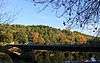
Roswell Butler House |
Upload image |
000000002001-11-08-0000November 8, 2001
(#01001226) |
6 Carmichael St.
44°30′34″N 73°05′05″W / 44.509444°N 73.084722°W / 44.509444; -73.084722 (Roswell Butler House) |
Essex |
|
| 12 |
Carnegie Building of the Fletcher Free Library |
|
000000001976-08-18-0000August 18, 1976
(#76000138) |
College St. and S. Winooski Ave.
44°28′37″N 73°12′39″W / 44.476944°N 73.210833°W / 44.476944; -73.210833 (Carnegie Building of the Fletcher Free Library) |
Burlington |
|
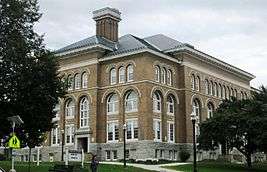
| 13 |
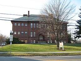
Champlain School |
|
000000001982-12-10-0000December 10, 1982
(#82001761) |
809 Pine St.
44°27′25″N 73°12′55″W / 44.456944°N 73.215278°W / 44.456944; -73.215278 (Champlain School) |
Burlington |
Former elementary school, now apartments (with addition in rear)
|
| 14 |
Charlotte Center Historic District |
|
000000001984-07-19-0000July 19, 1984
(#84003460) |
Church Hill and Hinesburg Rds.
44°18′52″N 73°14′23″W / 44.314444°N 73.239722°W / 44.314444; -73.239722 (Charlotte Center Historic District) |
Charlotte |
|
| 15 |
Giles Chittenden Farmstead |
Upload image |
000000001993-10-29-0000October 29, 1993
(#93001160) |
Governor Chittenden Rd., northeast of Williston village center
44°26′59″N 73°02′43″W / 44.449722°N 73.045278°W / 44.449722; -73.045278 (Giles Chittenden Farmstead) |
Williston |
|
| 16 |
Martin Chittenden House |
|
000000001978-01-09-0000January 9, 1978
(#78000230) |
West of Jericho on Vermont Route 117
44°27′28″N 73°01′13″W / 44.457778°N 73.020278°W / 44.457778; -73.020278 (Martin Chittenden House) |
Jericho |
|
| 17 |
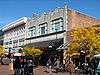
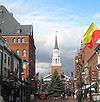
Church Street Historic District |
|
000000002010-07-29-0000July 29, 2010
(#09000915) |
Generally the Church St. corridor, along with flanking blocks of Bank, Cherry, College, and Main Streets
44°28′40″N 73°12′45″W / 44.477778°N 73.2125°W / 44.477778; -73.2125 (Church Street Historic District) |
Burlington |
|
| 18 |
City Hall Park Historic District |
|
000000001983-06-09-0000June 9, 1983
(#83003206) |
Church, College, Main, and St. Paul Sts.
44°28′35″N 73°12′49″W / 44.476389°N 73.213611°W / 44.476389; -73.213611 (City Hall Park Historic District) |
Burlington |
|
| 19 |
Downtown Essex Junction Commercial Historic District |
|
000000002004-11-01-0000November 1, 2004
(#04001216) |
3-17 and 8-12 Main St., 2-28 Railroad Ave., and 2 Railroad St.
44°29′36″N 73°06′35″W / 44.493333°N 73.109722°W / 44.493333; -73.109722 (Downtown Essex Junction Commercial Historic District) |
Essex Junction |
|
| 20 |
Dumas Tenements |
Upload image |
000000002012-09-18-0000September 18, 2012
(#11000928) |
114 W. Allen & 114 W. Canal Sts.
44°29′28″N 73°11′29″W / 44.491232°N 73.191402°W / 44.491232; -73.191402 (Dumas Tenements) |
Winooski |
|
| 21 |
Duplex at 22-26 Johnson Street |
Upload image |
000000002012-05-01-0000May 1, 2012
(#12000292) |
22-26 Johnson St.
44°28′56″N 73°12′58″W / 44.482139°N 73.216025°W / 44.482139; -73.216025 (Duplex at 22-26 Johnson Street) |
Burlington |
|
| 22 |
Duplex at 73-75 Sherman Street |
Upload image |
000000002013-12-31-0000December 31, 2013
(#13001029) |
73-75 Sherman St.
44°28′55″N 73°13′07″W / 44.481810°N 73.218543°W / 44.481810; -73.218543 (Duplex at 73-75 Sherman Street) |
Burlington |
|
| 23 |
Ethan Allen Engine Company No. 4 |
|
000000001971-04-16-0000April 16, 1971
(#71000056) |
135 Church St.
44°28′36″N 73°12′46″W / 44.47661°N 73.2128°W / 44.47661; -73.2128 (Ethan Allen Engine Company No. 4) |
Burlington |
|
| 24 |
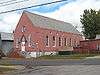
First Baptist Church |
|
000000002001-03-02-0000March 2, 2001
(#01000217) |
81 St. Paul St.
44°28′40″N 73°12′52″W / 44.477732°N 73.214510°W / 44.477732; -73.214510 (First Baptist Church) |
Burlington |
|
| 25 |
First Methodist Church of Burlington |
|
000000001978-10-05-0000October 5, 1978
(#78000231) |
S. Winooski Ave.
44°28′43″N 73°12′38″W / 44.478665°N 73.210632°W / 44.478665; -73.210632 (First Methodist Church of Burlington) |
Burlington |
|
| 26 |
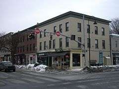
William Fitzgerald Block |
|
000000002012-05-01-0000May 1, 2012
(#12000293) |
57-63 N. Champlain St.
44°28′56″N 73°13′04″W / 44.482216°N 73.217785°W / 44.482216; -73.217785 (William Fitzgerald Block) |
Burlington |
|
| 27 |
Follett House |
|
000000001972-10-30-0000October 30, 1972
(#72000091) |
63 College St.
44°28′36″N 73°13′04″W / 44.476667°N 73.217778°W / 44.476667; -73.217778 (Follett House) |
Burlington |
|
| 28 |
Fort Ethan Allen Historic District |
|
000000001995-09-14-0000September 14, 1995
(#95001102) |
Junction of Vermont Route 15 and Barnes Rd.
44°30′19″N 73°08′56″W / 44.505278°N 73.148889°W / 44.505278; -73.148889 (Fort Ethan Allen Historic District) |
Colchester and Essex |
|
| 29 |
Galusha House |
|
000000001978-10-10-0000October 10, 1978
(#78000232) |
South of Jericho
44°30′09″N 72°59′38″W / 44.5025°N 72.993889°W / 44.5025; -72.993889 (Galusha House) |
Jericho |
Home of Truman Galusha, son of Jonas Galusha.
|
| 30 |
GENERAL BUTLER (shipwreck) |
Upload image |
000000001998-10-22-0000October 22, 1998
(#98001269) |
Burlington Bay
44°28′19″N 73°13′42″W / 44.471944°N 73.228333°W / 44.471944; -73.228333 (GENERAL BUTLER (shipwreck)) |
Burlington |
|
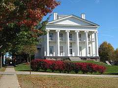
| 31 |
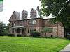
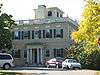
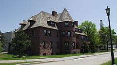
Grasse Mount |
|
000000001973-04-11-0000April 11, 1973
(#73000193) |
411 Main St.
44°28′36″N 73°12′13″W / 44.476667°N 73.203611°W / 44.476667; -73.203611 (Grasse Mount) |
Burlington |
|
| 32 |
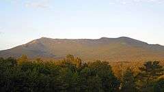
Gray Rocks |
Upload image |
000000001996-12-27-0000December 27, 1996
(#96001534) |
U.S. Route 2, near its junction with Interstate 89
44°24′05″N 72°58′29″W / 44.401389°N 72.974722°W / 44.401389; -72.974722 (Gray Rocks) |
Richmond |
|
| 33 |
Head of Church Street Historic District |
|
000000001974-07-15-0000July 15, 1974
(#74000207) |
Pearl and Church Sts.
44°28′51″N 73°12′48″W / 44.480833°N 73.213333°W / 44.480833; -73.213333 (Head of Church Street Historic District) |
Burlington |
|
| 34 |
Hinesburg Town Forest |
Upload image |
000000002016-06-07-0000June 7, 2016
(#15001037) |
Hayden Hill Rd.
44°19′47″N 73°02′42″W / 44.329688°N 73.044960°W / 44.329688; -73.044960 (Hinesburg Town Forest) |
Hinesburg |
|
| 35 |
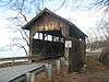
Holmes Creek Covered Bridge |
|
000000001974-09-06-0000September 6, 1974
(#74000326) |
Northwest of Charlotte over Holmes Creek
44°20′00″N 73°16′55″W / 44.333384°N 73.282082°W / 44.333384; -73.282082 (Holmes Creek Covered Bridge) |
Charlotte |
|
| 36 |
Honey Hollow Camp |
Upload image |
000000001994-12-29-0000December 29, 1994
(#94001512) |
Honey Hollow Rd.
44°21′02″N 72°55′06″W / 44.350556°N 72.918333°W / 44.350556; -72.918333 (Honey Hollow Camp) |
Bolton |
|
| 37 |
House at 44 Front Street |
|
000000002008-10-16-0000October 16, 2008
(#08000997) |
42-44 Front St.
44°29′00″N 73°13′13″W / 44.483203°N 73.220358°W / 44.483203; -73.220358 (House at 44 Front Street) |
Burlington |
|
| 38 |
Howard Mortuary Chapel |
|
000000001999-10-21-0000October 21, 1999
(#99001272) |
455 North Ave.
44°29′36″N 73°13′49″W / 44.493333°N 73.230278°W / 44.493333; -73.230278 (Howard Mortuary Chapel) |
Burlington |
|
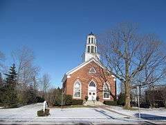
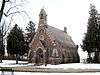
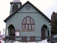
| 39 |
Huntington Lower Village Church |
|
000000001984-08-23-0000August 23, 1984
(#84003463) |
2156 Main Rd.
44°19′35″N 72°59′21″W / 44.326389°N 72.989167°W / 44.326389; -72.989167 (Huntington Lower Village Church) |
Huntington |
Now houses the local library.
|
| 40 |
Jericho Center Historic District |
|
000000001983-05-26-0000May 26, 1983
(#83003207) |
Brown's Trace, Bolger Hill and Varney Rds.
44°28′13″N 72°58′20″W / 44.470278°N 72.972222°W / 44.470278; -72.972222 (Jericho Center Historic District) |
Jericho |
|
| 41 |
Jericho Village Historic District |
|
000000001992-11-05-0000November 5, 1992
(#92001533) |
Vermont Route 15, Plains Rd., Mill St., and Old Pump Rd.
44°30′19″N 72°59′45″W / 44.505278°N 72.995833°W / 44.505278; -72.995833 (Jericho Village Historic District) |
Jericho |
|
| 42 |
Dan Johnson Farmstead |
Upload image |
000000001993-11-04-0000November 4, 1993
(#93001178) |
Junction of U.S. Route 2 and Johnson Ln.
44°25′50″N 73°03′22″W / 44.430556°N 73.056111°W / 44.430556; -73.056111 (Dan Johnson Farmstead) |
Williston |
|
| 43 |
Jonesville Academy |
|
000000001982-11-02-0000November 2, 1982
(#82001762) |
South of Jonesville at Cochran and Waterbury Rds.
44°22′53″N 72°56′18″W / 44.381389°N 72.93834°W / 44.381389; -72.93834 (Jonesville Academy) |
Jonesville |
|
| 44 |
Martin L. Kelsey House |
|
000000001983-02-24-0000February 24, 1983
(#83003208) |
43 Elmwood Ave
44°28′54″N 73°12′50″W / 44.481703°N 73.213850°W / 44.481703; -73.213850 (Martin L. Kelsey House) |
Burlington |
|
| 45 |
Lakeside Development |
|
000000001982-04-12-0000April 12, 1982
(#82001699) |
Lakeside, Central, Conger, Wright, and Harrison Aves.
44°27′35″N 73°13′15″W / 44.459722°N 73.220833°W / 44.459722; -73.220833 (Lakeside Development) |
Burlington |
|
| 46 |
LeClair Avenue Historic District |
Upload image |
000000002012-04-02-0000April 2, 2012
(#11000831) |
6, 7, 8, 11, 14 LeClair Ave., 11-13, 12, 20 North St.
44°29′39″N 73°11′23″W / 44.494064°N 73.189836°W / 44.494064; -73.189836 (LeClair Avenue Historic District) |
Winooski |
|
| 47 |
LeFerriere House |
|
000000002008-08-08-0000August 8, 2008
(#07000499) |
171-173 Intervale Ave.
44°29′21″N 73°12′37″W / 44.489133°N 73.210265°W / 44.489133; -73.210265 (LeFerriere House) |
Burlington |
Misspelled "LeFarriere" in the register listing.
|
| 48 |
Mad River Glen Ski Area Historic District |
|
000000002012-07-05-0000July 5, 2012
(#12000409) |
VT 17 (McCullough Turnpike)
44°12′07″N 72°55′02″W / 44.202082°N 72.91734°W / 44.202082; -72.91734 (Mad River Glen Ski Area Historic District) |
Buels Gore |
Mostly in Fayston in Washington County
|
| 49 |
Main Street-College Street Historic District |
|
000000001988-10-13-0000October 13, 1988
(#88001850) |
Roughly bounded by College, S. Williams and Main Sts., and S. Winooski Ave.
44°28′44″N 73°12′22″W / 44.478889°N 73.206111°W / 44.478889; -73.206111 (Main Street-College Street Historic District) |
Burlington |
|
| 50 |
McNeil Homestead |
Upload image |
000000001982-06-17-0000June 17, 1982
(#82001700) |
Lake Champlain off Vermont Route F-5
44°18′12″N 73°18′05″W / 44.303333°N 73.301389°W / 44.303333; -73.301389 (McNeil Homestead) |
Charlotte |
|
| 51 |
Methodist Episcopal Church of Winooski |
|
000000002001-03-02-0000March 2, 2001
(#01000216) |
24 W Allen St.
44°29′28″N 73°11′16″W / 44.491111°N 73.187778°W / 44.491111; -73.187778 (Methodist Episcopal Church of Winooski) |
Winooski |
|
| 52 |
Mintzer House |
|
000000002008-08-08-0000August 8, 2008
(#07000498) |
175-177 Intervale Ave.
44°29′26″N 73°12′37″W / 44.490475°N 73.21023°W / 44.490475; -73.21023 (Mintzer House) |
Burlington |
|
| 53 |
Moquin's Bakery |
|
000000001997-06-27-0000June 27, 1997
(#97000645) |
78 Rose St.
44°29′13″N 73°13′00″W / 44.486944°N 73.216667°W / 44.486944; -73.216667 (Moquin's Bakery) |
Burlington |
|
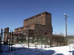
| 54 |
Moran Municipal Generation Station |
|
000000002010-12-17-0000December 17, 2010
(#10001041) |
475 Lake St.
44°28′53″N 73°13′24″W / 44.481389°N 73.223333°W / 44.481389; -73.223333 (Moran Municipal Generation Station) |
Burlington |
|
| 55 |
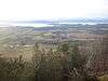
Mount Philo State Park |
|
000000002001-11-29-0000November 29, 2001
(#01001286) |
5425 Mount Philo Rd.
44°16′40″N 73°12′40″W / 44.277778°N 73.211111°W / 44.277778; -73.211111 (Mount Philo State Park) |
Charlotte |
|
| 56 |
Murray-Isham Farm |
Upload image |
000000001992-12-07-0000December 7, 1992
(#92001668) |
3515 Oak Hill Rd. (Town Highway 1)
44°23′34″N 73°05′47″W / 44.392778°N 73.096389°W / 44.392778; -73.096389 (Murray-Isham Farm) |
Williston |
|
| 57 |
Normand House |
|
000000002008-08-08-0000August 8, 2008
(#07000497) |
163-165, 165 rear Intervale Ave.
44°29′25″N 73°12′38″W / 44.490199°N 73.210466°W / 44.490199; -73.210466 (Normand House) |
Burlington |
|
| 58 |
North Street Historic District |
|
000000002001-12-21-0000December 21, 2001
(#01001364) |
Roughly along North St., from North Ave. to N. Winooski Ave.
44°29′03″N 73°13′01″W / 44.484167°N 73.216944°W / 44.484167; -73.216944 (North Street Historic District) |
Burlington |
|
| 59 |
O.J. WALKER (shipwreck) |
Upload image |
000000001998-10-22-0000October 22, 1998
(#98001270) |
Burlington Bay
44°28′44″N 73°14′27″W / 44.478889°N 73.240833°W / 44.478889; -73.240833 (O.J. WALKER (shipwreck)) |
Burlington |
|
| 60 |
Old Ohavi Zedek Synagogue |
|
000000001978-01-31-0000January 31, 1978
(#78000233) |
Archibald and Hyde Sts.
44°29′18″N 73°12′26″W / 44.488333°N 73.207222°W / 44.488333; -73.207222 (Old Ohavi Zedek Synagogue) |
Burlington |
|
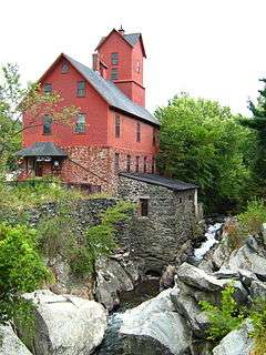
| 61 |
Old Red Mill and Mill House |
|
000000001972-07-31-0000July 31, 1972
(#72000113) |
Vermont Route 15
44°30′17″N 73°00′00″W / 44.504722°N 73.0°W / 44.504722; -73.0 (Old Red Mill and Mill House) |
Jericho |
|
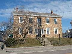
| 62 |
Old Stone House |
|
000000001973-05-08-0000May 8, 1973
(#73000271) |
73 E. Allen St.
44°29′29″N 73°11′00″W / 44.49142°N 73.18338°W / 44.49142; -73.18338 (Old Stone House) |
Winooski |
|
| 63 |
Charles R. Palmer House |
|
000000002005-08-30-0000August 30, 2005
(#05000947) |
201 and 203 N. Willard St.
44°29′12″N 73°12′22″W / 44.486570°N 73.206032°W / 44.486570; -73.206032 (Charles R. Palmer House) |
Burlington |
|
| 64 |
Pearl Street Historic District |
|
000000001984-11-01-0000November 1, 1984
(#84000416) |
Roughly 184 to 415 Pearl St., Orchard Terr., and Winooski Ave.
44°28′50″N 73°12′29″W / 44.480556°N 73.208056°W / 44.480556; -73.208056 (Pearl Street Historic District) |
Burlington |
|
| 65 |
Cicero Goddard Peck House |
|
000000002010-11-10-0000November 10, 2010
(#10000890) |
18 Mechanicsville Rd.
44°19′55″N 73°06′36″W / 44.331944°N 73.11°W / 44.331944; -73.11 (Cicero Goddard Peck House) |
Hinesburg |
|
| 66 |
PHOENIX (Shipwreck) |
Upload image |
000000001998-11-05-0000November 5, 1998
(#98001268) |
Colchester Shoal, Colchester Reef
44°33′11″N 73°19′52″W / 44.553056°N 73.331111°W / 44.553056; -73.331111 (PHOENIX (Shipwreck)) |
Colchester |
|
| 67 |
Porter Screen Company |
|
000000001979-11-15-0000November 15, 1979
(#79000219) |
110 E. Spring St.
44°29′37″N 73°10′54″W / 44.493477°N 73.181673°W / 44.493477; -73.181673 (Porter Screen Company) |
Winooski |
|
| 68 |
Preston-Lafreniere Farm |
Upload image |
000000001999-02-05-0000February 5, 1999
(#99000138) |
Junction of Duxbury Rd. and Honey Hollow Rd.
44°22′29″N 72°54′33″W / 44.374722°N 72.909167°W / 44.374722; -72.909167 (Preston-Lafreniere Farm) |
Bolton |
|
| 69 |
Proctor Maple Research Farm |
Upload image |
000000001999-09-13-0000September 13, 1999
(#99001050) |
UVM Rd.
44°31′37″N 72°51′57″W / 44.526944°N 72.865833°W / 44.526944; -72.865833 (Proctor Maple Research Farm) |
Underhill |
|
| 70 |
Quinlan's Covered Bridge |
|
000000001974-09-10-0000September 10, 1974
(#74000208) |
South of East Charlotte over Lewis Creek
44°16′35″N 73°11′04″W / 44.276389°N 73.184444°W / 44.276389; -73.184444 (Quinlan's Covered Bridge) |
East Charlotte |
|
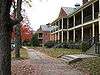
| 71 |
Redstone Historic District |
|
000000001991-11-14-0000November 14, 1991
(#91001614) |
S. Prospect St.
44°28′12″N 73°11′54″W / 44.47°N 73.198333°W / 44.47; -73.198333 (Redstone Historic District) |
Burlington |
|
| 72 |
Remington-Williamson Farm |
Upload image |
000000002001-11-19-0000November 19, 2001
(#01001239) |
4282 Main Rd.
44°18′00″N 72°58′14″W / 44.3°N 72.970556°W / 44.3; -72.970556 (Remington-Williamson Farm) |
Huntington |
|
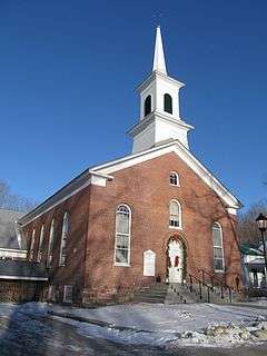
| 73 |
Richmond Congregational Church |
|
000000002001-03-29-0000March 29, 2001
(#01000326) |
Junction of Bridge and Church St.
44°24′14″N 72°59′46″W / 44.403889°N 72.996111°W / 44.403889; -72.996111 (Richmond Congregational Church) |
Richmond |
|
| 74 |
Richmond Underwear Company Building |
|
000000001992-05-07-0000May 7, 1992
(#92000465) |
Millet St.
44°24′24″N 72°59′38″W / 44.406556°N 72.993778°W / 44.406556; -72.993778 (Richmond Underwear Company Building) |
Richmond |
|
| 75 |
John B. Robarge Duplex |
|
000000002005-08-06-0000August 6, 2005
(#05000805) |
58-60 N. Champlain St.
44°29′03″N 73°13′02″W / 44.484167°N 73.217222°W / 44.484167; -73.217222 (John B. Robarge Duplex) |
Burlington |
|
| 76 |
Roberge-Desautels Apartment House |
|
000000002014-01-22-0000January 22, 2014
(#13001120) |
54 N. Champlain St.
44°28′55″N 73°13′02″W / 44.482042°N 73.217329°W / 44.482042; -73.217329 (Roberge-Desautels Apartment House) |
Burlington |
|
| 77 |
Daniel Webster Robinson House |
|
000000001982-04-22-0000April 22, 1982
(#82001701) |
384 and 388 Main St.
44°28′35″N 73°12′13″W / 44.476518°N 73.203737°W / 44.476518; -73.203737 (Daniel Webster Robinson House) |
Burlington |
Shingle Style transitional with elements of Georgian, Queen Anne, and Colonial (revival) styles; now a fraternity house.
|
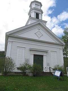
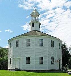
| 78 |
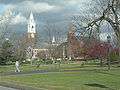
Round Church |
|
000000001974-06-20-0000June 20, 1974
(#74000355) |
Bridge St. and Cochran Rd.
44°23′56″N 72°59′58″W / 44.398889°N 72.999444°W / 44.398889; -72.999444 (Round Church) |
Richmond |
Built in 1812–1813, a rare, well-preserved example of a sixteen-sided meetinghouse
|
| 79 |
Lucy Ruggles House |
|
000000002005-12-16-0000December 16, 2005
(#05001421) |
262 S. Prospect St.
44°28′23″N 73°12′00″W / 44.473048°N 73.200058°W / 44.473048; -73.200058 (Lucy Ruggles House) |
Burlington |
|
| 80 |
Saltus Grocery Store |
|
000000002001-11-19-0000November 19, 2001
(#01001238) |
299-301 N. Winooski Ave.
44°29′18″N 73°12′28″W / 44.488333°N 73.207778°W / 44.488333; -73.207778 (Saltus Grocery Store) |
Burlington |
|
| 81 |
Sand Bar State Park |
|
000000002002-02-14-0000February 14, 2002
(#02000028) |
1215 U.S. Route 2
44°37′37″N 73°14′27″W / 44.626944°N 73.240833°W / 44.626944; -73.240833 (Sand Bar State Park) |
Milton |
|
| 82 |
Seguin Covered Bridge |
|
000000001974-09-06-0000September 6, 1974
(#74000209) |
Roscoe Road over Lewis Creek
44°17′20″N 73°09′03″W / 44.288889°N 73.150833°W / 44.288889; -73.150833 (Seguin Covered Bridge) |
East Charlotte |
Misspelled "Sequin" in the National Register.
|
| 83 |
Shelburne Farms |
|
000000001980-08-11-0000August 11, 1980
(#80000330) |
Off U.S. Route 7
44°23′37″N 73°14′53″W / 44.393611°N 73.248056°W / 44.393611; -73.248056 (Shelburne Farms) |
Shelburne |
Created in 1886 by Dr. William Seward Webb and Eliza Osgood Vanderbilt Webb as a model agricultural estate.
|
| 84 |
Shelburne Village Historic District |
|
000000001990-07-27-0000July 27, 1990
(#90001055) |
Area north and south of the junction of U.S. Route 7, Harbor Rd. and Falls Rd., including the area south and east of the LaPlatte River and U.S. Route 7
44°22′51″N 73°13′36″W / 44.380833°N 73.226667°W / 44.380833; -73.226667 (Shelburne Village Historic District) |
Shelburne |
|
| 85 |
South Union Street Historic District |
|
000000001988-10-31-0000October 31, 1988
(#88001946) |
S. Union St. between Howard and Main
44°28′16″N 73°12′30″W / 44.471111°N 73.208333°W / 44.471111; -73.208333 (South Union Street Historic District) |
Burlington |
|
| 86 |
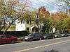
South Willard Street Historic District |
Upload image |
000000001988-11-03-0000November 3, 1988
(#88002226) |
S. Willard St.
44°28′21″N 73°12′23″W / 44.4725°N 73.206389°W / 44.4725; -73.206389 (South Willard Street Historic District) |
Burlington |
|
| 87 |
Sutton Farm |
Upload image |
000000002004-10-07-0000October 7, 2004
(#04001132) |
1592 Dorset St.
44°20′20″N 73°10′14″W / 44.338829°N 73.170662°W / 44.338829; -73.170662 (Sutton Farm) |
Shelburne |
|
| 88 |
Tavern on Mutton Hill |
|
000000001982-12-10-0000December 10, 1982
(#82001763) |
Church Hill Rd.
44°19′30″N 73°14′15″W / 44.325°N 73.2375°W / 44.325; -73.2375 (Tavern on Mutton Hill) |
Charlotte |
|
| 89 |
TICONDEROGA |
|
000000001966-10-15-0000October 15, 1966
(#66000797) |
Shelburne Museum
44°22′37″N 73°13′53″W / 44.376944°N 73.231389°W / 44.376944; -73.231389 (TICONDEROGA) |
Shelburne |
220-foot (67 m) steamboat built in Shelburne, Vermont in 1906.
|
| 90 |
Lee Tracy House |
|
000000001983-12-22-0000December 22, 1983
(#83004226) |
U.S. Route 7
44°22′54″N 73°13′42″W / 44.381667°N 73.228333°W / 44.381667; -73.228333 (Lee Tracy House) |
Shelburne |
|
| 91 |
U.S. Post Office and Custom House |
|
000000001972-11-21-0000November 21, 1972
(#72000114) |
Southeastern corner of Main and Church Sts.
44°28′33″N 73°12′44″W / 44.475833°N 73.212222°W / 44.475833; -73.212222 (U.S. Post Office and Custom House) |
Burlington |
|
| 92 |
Underhill State Park |
|
000000002002-06-21-0000June 21, 2002
(#02000665) |
352 Mountain Rd.
44°31′34″N 72°49′58″W / 44.526111°N 72.832778°W / 44.526111; -72.832778 (Underhill State Park) |
Underhill |
|
| 93 |
University Green Historic District |
|
000000001975-04-14-0000April 14, 1975
(#75000139) |
University of Vermont campus
44°28′39″N 73°12′02″W / 44.4775°N 73.200556°W / 44.4775; -73.200556 (University Green Historic District) |
Burlington |
|
| 94 |
Edward Wells House |
|
000000001979-10-03-0000October 3, 1979
(#79000220) |
61 Summit St.
44°28′28″N 73°12′11″W / 44.474444°N 73.203056°W / 44.474444; -73.203056 (Edward Wells House) |
Burlington |
|
| 95 |
Wells-Jackson Carriage House Complex |
|
000000001982-12-10-0000December 10, 1982
(#82001764) |
192-194 Jackson Court and 370 Maple St.
44°28′30″N 73°12′17″W / 44.475°N 73.204722°W / 44.475; -73.204722 (Wells-Jackson Carriage House Complex) |
Burlington |
|
| 96 |
Wells-Richardson Complex |
|
000000001979-03-05-0000March 5, 1979
(#79000221) |
Main, Pine, College, and St. Paul Sts.
44°28′35″N 73°12′54″W / 44.476389°N 73.215°W / 44.476389; -73.215 (Wells-Richardson Complex) |
Burlington |
|
| 97 |
West Milton Bridge |
|
000000001992-09-08-0000September 8, 1992
(#92001173) |
Town Highway 40 over the Lamoille River
44°37′56″N 73°10′18″W / 44.632222°N 73.171667°W / 44.632222; -73.171667 (West Milton Bridge) |
Milton |
|
| 98 |
M. S. Whitcomb Farm |
Upload image |
000000001993-09-30-0000September 30, 1993
(#93001010) |
U.S. Route 2
44°23′29″N 72°56′24″W / 44.391389°N 72.94°W / 44.391389; -72.94 (M. S. Whitcomb Farm) |
Richmond |
|
| 99 |
Williston Congregational Church |
|
000000001973-05-17-0000May 17, 1973
(#73000194) |
Center of Williston Village on Vermont Route 2
44°26′20″N 73°04′23″W / 44.438889°N 73.073056°W / 44.438889; -73.073056 (Williston Congregational Church) |
Williston |
|
| 100 |
Williston Village Historic District |
|
000000001979-12-19-0000December 19, 1979
(#79000222) |
U.S. Route 2, specifically over Allen Brook
44°26′16″N 73°04′14″W / 44.437778°N 73.070556°W / 44.437778; -73.070556 (Williston Village Historic District) |
Williston |
Allen Brook location represents a boundary increase of 000000001992-09-04-0000September 4, 1992
|
| 101 |
Winooski Archeological Site |
Upload image |
000000001978-01-05-0000January 5, 1978
(#78000234) |
Address Restricted
|
Winooski |
|
| 102 |
Winooski Block |
|
000000001974-11-20-0000November 20, 1974
(#74000210) |
E. Allen and Main Sts.
44°29′30″N 73°11′11″W / 44.491667°N 73.186389°W / 44.491667; -73.186389 (Winooski Block) |
Winooski |
|
| 103 |
Winooski Falls Mill District |
|
000000001979-02-09-0000February 9, 1979
(#79000223) |
Northern bank of the Winooski River to Center and Canal Sts., southern bank to Barrett St.; also 485-497 Colchester Ave., 5-21 Mill St., and 8-32 Barrett St., Burlington; also 110 W. Canal St.
44°29′20″N 73°11′15″W / 44.488889°N 73.1875°W / 44.488889; -73.1875 (Winooski Falls Mill District) |
Winooski |
Second and third sets of boundaries represent boundary increases of 000000001993-09-30-0000September 30, 1993 and 000000002009-11-12-0000November 12, 2009 respectively
|
| 104 |
Winooski River Bridge |
|
000000001990-05-30-0000May 30, 1990
(#90000775) |
US Route 2 over the Winooski River
44°25′24″N 73°01′01″W / 44.423333°N 73.016944°W / 44.423333; -73.016944 (Winooski River Bridge) |
Richmond |
|
| 105 |
Winterbotham Estate |
|
000000001975-05-12-0000May 12, 1975
(#75000140) |
163 S. Willard St.
44°28′33″N 73°12′22″W / 44.475833°N 73.206111°W / 44.475833; -73.206111 (Winterbotham Estate) |
Burlington |
|


.jpg)