National Register of Historic Places listings in Emmet County, Michigan

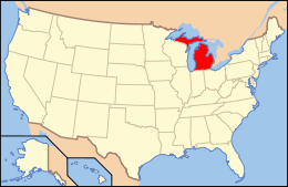
Location of Emmet County in Michigan
This is a list of the National Register of Historic Places listings in Emmet County, Michigan.
This is intended to be a complete list of the properties and districts on the National Register of Historic Places in Emmet County, Michigan, United States. Latitude and longitude coordinates are provided for many National Register properties and districts; these locations may be seen together in a map.[1]
There are 52 properties and districts listed on the National Register in the county, including 3 National Historic Landmarks.
- This National Park Service list is complete through NPS recent listings posted December 2, 2016.[2]
Current listings
| [3] | Name on the Register[4] | Image | Date listed[5] | Location | City or town | Description |
|---|---|---|---|---|---|---|
| 1 | J. B. Allen House |  |
(#86001973) |
822 Grove St. 45°22′14″N 84°56′51″W / 45.370629°N 84.947466°W |
Petoskey | |
| 2 | Isaac Bartram House | 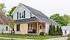 |
(#86001975) |
508 Wachtel Ave. 45°22′23″N 84°57′46″W / 45.373056°N 84.962778°W |
Petoskey | |
| 3 | Bay View | 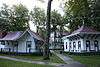 |
(#72000613) |
Northeast of Petoskey on US 31 45°22′57″N 84°55′56″W / 45.3825°N 84.932222°W |
Petoskey | Established in 1876 as a Methodist camp meeting, this romantically-planned campground was converted to an independent chautauqua in 1885, a role it served until 1915. These two uniquely American community forms are exemplified in this extensive and well-preserved complex. |
| 4 | Chief Andrew J. Blackbird House | 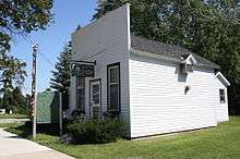 |
(#72000611) |
368 E. Main St. 45°25′49″N 84°59′05″W / 45.430278°N 84.984722°W |
Harbor Springs | |
| 5 | W. S. Carmichael House | 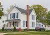 |
(#86001977) |
301 Jackson St. 45°22′16″N 84°57′50″W / 45.371111°N 84.963889°W |
Petoskey | |
| 6 | Chesapeake & Ohio Railway Station | |
(#70000270) |
Pioneer Park, W. Lake St. 45°22′31″N 84°57′33″W / 45.375278°N 84.959167°W |
Petoskey | Also known as the Chicago & West Michigan Railway Station; now used as the Little Traverse History Museum |
| 7 | I. N. Debenham House |  |
(#86001979) |
1101 Emmet St. 45°22′00″N 84°57′31″W / 45.366667°N 84.958611°W |
Petoskey | |
| 8 | James and Jean Douglas House | Upload image | (#16000232) |
3490 S. Lake Shore Dr. 45°30′04″N 85°05′51″W / 45.501127°N 85.097439°W |
Friendship Township | |
| 9 | East Mitchell Street Historic District |  |
(#86001983) |
Roughly bounded by Rose, Kalamazoo, State, Howard, Michigan, and Division 45°22′24″N 84°56′59″W / 45.373333°N 84.949722°W |
Petoskey | |
| 10 | Gerhard Fochtman House |  |
(#86001998) |
1004 Waukazoo Ave. 45°22′07″N 84°57′12″W / 45.368611°N 84.953333°W |
Petoskey | |
| 11 | Fort Michilimackinac | 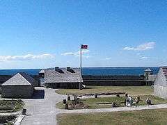 |
(#66000395) |
Near Mackinac Bridge at the southern end of the Mackinac Bridge 45°47′12″N 84°43′58″W / 45.786667°N 84.732778°W |
Mackinaw City | |
| 12 | Fourth Ward Polling Place | Upload image | (#86002001) |
209 Washington St. 45°22′06″N 84°57′29″W / 45.368333°N 84.958056°W |
Petoskey | |
| 13 | Meyer Fryman House |  |
(#86002002) |
211 Michigan St. 45°22′23″N 84°57′29″W / 45.373056°N 84.958056°W |
Petoskey | |
| 14 | Grace Methodist Episcopal Church |  |
(#86002012) |
625 Connable St. 45°22′15″N 84°58′08″W / 45.370833°N 84.968889°W |
Petoskey | |
| 15 | Grand Rapids and Indiana Railroad Harbor Springs Depot | 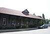 |
(#00001487) |
111 W. Bay St. 45°25′43″N 84°59′22″W / 45.428611°N 84.989444°W |
Harbor Springs | |
| 16 | Grays Reef Light Station | 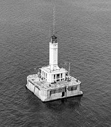 |
(#05001210) |
In northeastern Lake Michigan, 3.8 mi (6.1 km) west of Waugashance Island 45°46′00″N 85°09′12″W / 45.766667°N 85.153333°W |
Bliss Township | |
| 17 | Ernest Hemingway Cottage | 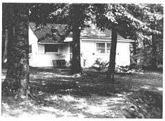 |
(#68000026) |
Between the northern shore of Walloon Lake and Lake Grove Rd. 45°16′48″N 84°59′57″W / 45.28°N 84.999167°W |
Walloon Lake | Boyhood summer home of author Ernest Hemingway. His father built the house in 1900 when Hemingway was a year old and it was here the future writer learned to hunt and fish and appreciate the outdoor life he came to celebrate in his writings. |
| 18 | Bert and John Hobbins House |  |
(#86002013) |
1024 Emmet St. 45°22′03″N 84°57′33″W / 45.367466°N 84.959061°W |
Petoskey | |
| 19 | Hosman and Wheeler Meat Market |  |
(#86002015) |
621 Ingalls Ave. 45°22′14″N 84°57′56″W / 45.370556°N 84.965556°W |
Petoskey | |
| 20 | John Kabler House |  |
(#86002017) |
415 Jackson St. 45°22′17″N 84°58′01″W / 45.371389°N 84.966944°W |
Petoskey | |
| 21 | Frank Lesher House |  |
(#86002018) |
122 Sheridan St. 45°21′54″N 84°57′36″W / 45.365°N 84.96°W |
Petoskey | |
| 22 | A. Malin House |  |
(#86002020) |
54 Bridge St. 45°22′07″N 84°57′46″W / 45.368611°N 84.962778°W |
Petoskey | |
| 23 | George and Eugene Markle House |  |
(#86002023) |
701 Kalamazoo St. 45°22′14″N 84°56′43″W / 45.370556°N 84.945278°W |
Petoskey | |
| 24 | George McManus House |  |
(#86002026) |
121 State St. 45°22′19″N 84°57′33″W / 45.371944°N 84.959167°W |
Petoskey | |
| 25 | Elias Meyers House |  |
(#86002030) |
912 Baxter St. 45°22′08″N 84°57′39″W / 45.368889°N 84.960833°W |
Petoskey | |
| 26 | Jacob Miller House | Upload image | (#86002031) |
307 Jackson St. 45°22′16″N 84°57′51″W / 45.371111°N 84.964167°W |
Petoskey | |
| 27 | Mineral Well Park | 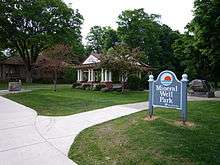 |
(#86002036) |
W. Lake St. 45°22′31″N 84°57′37″W / 45.375278°N 84.960278°W |
Petoskey | |
| 28 | John Nyman House |  |
(#86002039) |
915 Emmet St. 45°22′07″N 84°57′31″W / 45.368611°N 84.958611°W |
Petoskey | |
| 29 | G. W. Olin House |  |
(#86002042) |
610 Kalamazoo St. 45°22′17″N 84°56′44″W / 45.371389°N 84.945556°W |
Petoskey | |
| 30 | Sarah Pennington House |  |
(#86002045) |
719 Maple St. 45°22′09″N 84°58′07″W / 45.369167°N 84.968611°W |
Petoskey | |
| 31 | Petoskey Downtown Historic District |  |
(#86002048) |
Roughly bounded by Rose, Division, Michigan, and Petoskey 45°22′30″N 84°57′19″W / 45.375°N 84.955278°W |
Petoskey | |
| 32 | Petoskey Grocery Company Building |  |
(#86002051) |
616 Petoskey St. 45°22′16″N 84°57′27″W / 45.371045°N 84.957470°W |
Petoskey | |
| 33 | Petoskey Public Works Utility Building |  |
(#86002056) |
106 W. Lake St. 45°22′31″N 84°57′39″W / 45.375266°N 84.960940°W |
Petoskey | |
| 34 | Ponshewaing Point Site | Upload image | (#72001473) |
Address Restricted |
Ponshewaing | |
| 35 | Phillip Rehkopf House |  |
(#86002069) |
918 Howard St. 45°22′06″N 84°57′21″W / 45.368333°N 84.955833°W |
Petoskey | |
| 36 | Saint Ignatius Church and Cemetery | 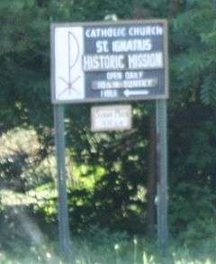 |
(#06001328) |
101 N. Lamkin Rd. 45°33′06″N 85°06′56″W / 45.551667°N 85.115556°W |
Readmond Township | |
| 37 | George Schantz House and Store | |
(#86002072) |
534 Wachtel Ave. 45°22′19″N 84°57′47″W / 45.371944°N 84.963056°W |
Petoskey | |
| 38 | Frank Schapler House | 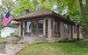 |
(#86002074) |
106 E. Lake St. 45°22′30″N 84°57′39″W / 45.375°N 84.960833°W |
Petoskey | |
| 39 | Seventh Day Adventist Church | 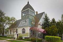 |
(#86002077) |
224 Michigan St. 45°22′21″N 84°57′26″W / 45.3725°N 84.957222°W |
Petoskey | |
| 40 | Shafer's Grocery and Residence | 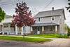 |
(#86002079) |
1018 Emmet St. 45°22′04″N 84°57′33″W / 45.367778°N 84.959167°W |
Petoskey | |
| 41 | Shay Complex | 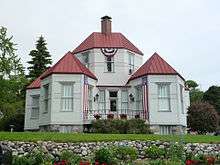 |
(#72000612) |
Main and Judd Sts. 45°25′49″N 84°59′02″W / 45.430278°N 84.983889°W |
Harbor Springs | |
| 42 | Skillagalee Light Station | 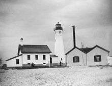 |
(#84001389) |
Southwest of Waugoshance Island 45°40′35″N 85°10′18″W / 45.676389°N 85.171667°W |
Cross Village | |
| 43 | St. Francis Solanus Mission | 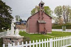 |
(#72000614) |
475 W. Lake St. 45°22′32″N 84°58′03″W / 45.375556°N 84.9675°W |
Petoskey | |
| 44 | Stout House | 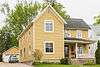 |
(#86002080) |
606 Grove St. 45°22′14″N 84°57′05″W / 45.370556°N 84.951389°W |
Petoskey | |
| 45 | Trinity Evangelical Church | 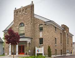 |
(#86002082) |
219 State St. 45°22′14″N 84°57′21″W / 45.370556°N 84.955833°W |
Petoskey | |
| 46 | Jacob VanZolenburg House |  |
(#86002083) |
203 State St. 45°22′20″N 84°57′32″W / 45.372222°N 84.958889°W |
Petoskey | |
| 47 | Waugoshance Light Station | 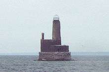 |
(#83000841) |
Northwest of Waugoshance Island 45°46′30″N 85°05′19″W / 45.775°N 85.088611°W |
Waugoshance Island | |
| 48 | J. M. Wells House |  |
(#86002084) |
203 W. Lake St. 45°22′29″N 84°57′45″W / 45.374722°N 84.9625°W |
Petoskey | |
| 49 | West Mitchell Street Bridge | 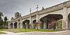 |
(#86002085) |
W. Mitchell St. at Bear River 45°22′26″N 84°57′39″W / 45.373889°N 84.960833°W |
Petoskey | |
| 50 | White Shoal Light Station | 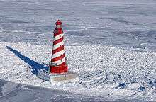 |
(#84001391) |
Northwest of Waugashance Island 45°50′32″N 85°08′07″W / 45.842222°N 85.135278°W |
Mackinaw City | |
| 51 | Wycamp Creek Site | Upload image | (#71001022) |
Address Restricted 45°39′08″N 85°00′10″W / 45.652225°N 85.002861°W |
Levering | |
| 52 | Zion Evangelical Lutheran Church |  |
(#86002086) |
812 Petoskey St. 45°22′11″N 84°57′27″W / 45.369722°N 84.9575°W |
Petoskey |
See also
| Wikimedia Commons has media related to National Register of Historic Places in Emmet County, Michigan. |
- List of National Historic Landmarks in Michigan
- National Register of Historic Places listings in Michigan
- List of Michigan State Historic Sites in Emmet County, Michigan
References
- ↑ The latitude and longitude information provided in this table was derived originally from the National Register Information System, which has been found to be fairly accurate for about 99% of listings. For about 1% of NRIS original coordinates, experience has shown that one or both coordinates are typos or otherwise extremely far off; some corrections may have been made. A more subtle problem causes many locations to be off by up to 150 yards, depending on location in the country: most NRIS coordinates were derived from tracing out latitude and longitudes off of USGS topographical quadrant maps created under the North American Datum of 1927, which differs from the current, highly accurate WGS84 GPS system used by most on-line maps. Chicago is about right, but NRIS longitudes in Washington are higher by about 4.5 seconds, and are lower by about 2.0 seconds in Maine. Latitudes differ by about 1.0 second in Florida. Some locations in this table may have been corrected to current GPS standards.
- ↑ "National Register of Historic Places: Weekly List Actions". National Park Service, United States Department of the Interior. Retrieved on December 2, 2016.
- ↑ Numbers represent an ordering by significant words. Various colorings, defined here, differentiate National Historic Landmarks and historic districts from other NRHP buildings, structures, sites or objects.
- ↑ National Park Service (2009-03-13). "National Register Information System". National Register of Historic Places. National Park Service.
- ↑ The eight-digit number below each date is the number assigned to each location in the National Register Information System database, which can be viewed by clicking the number.
| Lists by county |
|   |
|---|---|---|
| Other lists |
| |
Municipalities and communities of Emmet County, Michigan, United States | ||
|---|---|---|
| Cities | | |
| Villages | ||
| Townships | ||
| CDPs | ||
| Other unincorporated communities | ||
| Footnotes | ‡This populated place also has portions in an adjacent county or counties | |
This article is issued from Wikipedia - version of the 11/5/2016. The text is available under the Creative Commons Attribution/Share Alike but additional terms may apply for the media files.