Montgomery Heights, West Virginia
| Montgomery Heights, West Virginia | |
|---|---|
| Unincorporated community | |
 Montgomery Heights  Montgomery Heights | |
| Coordinates: 38°07′47″N 81°16′21″W / 38.12972°N 81.27250°WCoordinates: 38°07′47″N 81°16′21″W / 38.12972°N 81.27250°W | |
| Country | United States |
| State | West Virginia |
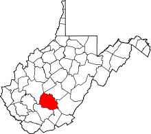
| County | Fayette |
| Elevation | 659 ft (201 m) |
| Time zone | Eastern (EST) (UTC-5) |
| • Summer (DST) | EDT (UTC-4) |
| Area code(s) | 304 & 681 |
| GNIS feature ID | 1555155[1] |
Montgomery Heights is an unincorporated community in Fayette County, West Virginia, United States. Montgomery Heights is located on the south bank of the Kanawha River 4.5 miles (7.2 km) southeast of Montgomery.
References
This article is issued from Wikipedia - version of the 10/25/2016. The text is available under the Creative Commons Attribution/Share Alike but additional terms may apply for the media files.