Mitchell River National Park (Western Australia)
| Mitchell River National Park Western Australia | |
|---|---|
|
IUCN category II (national park) | |
 | |
 Mitchell River National Park | |
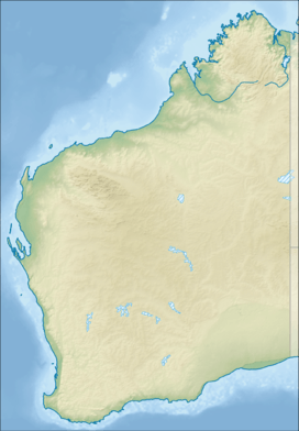
| Nearest town or city | Wyndham |
| Coordinates | 14°48′24″S 125°42′29″E / 14.80667°S 125.70806°ECoordinates: 14°48′24″S 125°42′29″E / 14.80667°S 125.70806°E |
| Established | 2000 |
| Area | 1,153.25 km2 (445.3 sq mi)[1] |
| Managing authorities | Department of Parks and Wildlife |
| Website | Mitchell River National Park |
| See also |
List of protected areas of Western Australia |
Mitchell River National Park is a national park in the Kimberley region of Western Australia, 2,140 kilometres (1,330 mi) northeast of Perth. The park adjoins the northern boundary of the Prince Regent National Park. The nearest towns are Derby which is 350 kilometres (217 mi) to the southwest and Wyndham which is 270 km (168 mi) to the southeast. Access to the park is achieved by 4WD only along the Mitchell Plateau Track from the Kalumburu Road. The two main features of the park are Mitchell Falls and Surveyors Pool.
Environment
The park is biologically significant and contains over 50 species of mammal, 220 birds and 86 amphibians and reptiles, including the Saltwater Crocodile, King Brown snake and Taipan. The park is part of the Prince Regent and Mitchell River Important Bird Area, identified as such by BirdLife International because of its importance for a range of bird species, especially those retricted to tropical savanna habitats.[2]
History and management
The park is located within the Ngauwudu Management Area. The park was formed in 2000 without the consent of the traditional owners or following proper procedure under the Native Title Act.[3] It seems that Native Title has not been determined yet over this area, which falls into the Wanjina Wunggurr Uungguu but on adjacent country.[4] The Department of Parks and Wildlife is in a cooperative management arrangement with the Kandijwal Community. Three groups of Aboriginal people have traditional lands within the National Park; Worrora, Wunambal-Gaambera and Ngarinyin.[5]
See also
References
- ↑ "Department of Environment and Conservation 2009–2010 Annual Report". Department of Environment and Conservation. 2010: 48. ISSN 1835-114X.
- ↑ "IBA: Prince Regent and Mitchell River". Birdata. Birds Australia. Retrieved 22 September 2011.
- ↑ "Horstman, M. and Wightman, G. (2001) Karparti ecology: Recognition of Aboriginal ecological knowledge and its application to management in north-western Australia. Ecological Management & Restoration. 2(2):99-109". doi:10.1046/j.1442-8903.2001.00073.x.
- ↑ "Kimberley Land Council- Native title-Wanjina Wunggurr Uungguu". Retrieved 19 February 2011.
- ↑ "Department of Environment and Conservation - Park Finder - Ngauwudu Management Area (Mitchell Plateau)". 2008. Retrieved 12 October 2010.