Mount Frankland National Park
| Mount Frankland National Park Western Australia | |
|---|---|
|
IUCN category II (national park) | |
 Mount Frankland National Park | |
 Mount Frankland National Park | |
| Nearest town or city | Walpole |
| Coordinates | 34°45′59″S 116°44′34″E / 34.76639°S 116.74278°ECoordinates: 34°45′59″S 116°44′34″E / 34.76639°S 116.74278°E |
| Established | 1988 |
| Area | 373.59 km2 (144.2 sq mi)[1] |
| Managing authorities | Department of Environment and Conservation |
| Website | Mount Frankland National Park |
| See also |
List of protected areas of Western Australia |
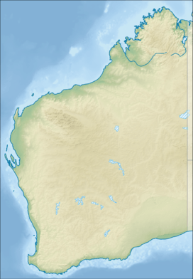
Mount Frankland National Park is a national park in the South West region of Western Australia, 327 km south of Perth.
Geography
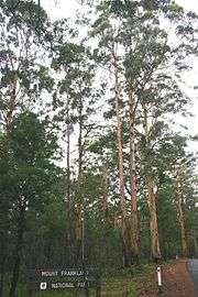
It covers the low granite hills to the north of the town of Walpole and is covered largely by forests of karri (Eucalyptus diversicolor) and red tingle (Eucalyptus jacksonii), two of the world's largest trees. The three tingle species are unique to the area between the park and the coast and the only eucalypts to be buttressed, a feature which reflects the moist conditions prevailing within the park. On exposed areas where continuous rain washes away soil, a low heathland is the dominant vegetation.
Annual rainfall at Walpole is around 1,200 mm (47 in). On the 422-metre high peak of Mount Frankland, though no rain gauge has ever been installed, annual rainfall is probably around 1,500 mm (59 in). Most rain falls between May and August, but unlike drier parts of southwestern Australia, showers are not infrequent even during the summer.
See also
References
- ↑ "Department of Environment and Conservation 2009–2010 Annual Report". Department of Environment and Conservation. 2010: 48. ISSN 1835-114X.