Cape Arid National Park
| Cape Arid National Park Western Australia | |
|---|---|
|
IUCN category II (national park) | |
 Yokinup Bay, Cape Arid | |
 Cape Arid National Park | |
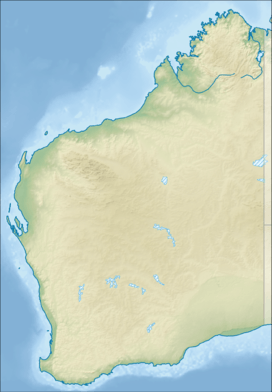
| Coordinates | 33°42′14″S 123°22′10″E / 33.70389°S 123.36944°ECoordinates: 33°42′14″S 123°22′10″E / 33.70389°S 123.36944°E |
| Established | 1969 |
| Area | 2,794.46 km2 (1,078.9 sq mi)[1] |
| Managing authorities | Department of Environment and Conservation |
| See also |
List of protected areas of Western Australia |


Cape Arid National Park is a national park in Western Australia, 731 kilometres (454 mi) south-east of Perth. The park is situated 120 kilometres (75 mi) east of Esperance[2] and lies on shore from the eastern end of the Recherche Archipelago. The bay at its western end is Duke of Orleans Bay, and the bay at the eastern side is Israelite Bay.
Its coastline is defined by Cape Arid, a bay called Sandy Bight and further east Cape Pasley.[3]
History
The first European to discover the area was the French Admiral Bruni D'Entrecasteaux in 1792 and he named it Cap Arride; Matthew Flinders anglicized the name in 1892 and the park took its name from this feature.
Pioneer graziers arrived in the area in the 1870s and the ruins of homesteads, dams and buildings as well as gravesites can be found near Pine Hill and Thomas Fishery.
Environment
Geography
The area is composed of sandy beaches and rocky headlands to the south with low granite hills extending to the north to join the jagged Russell Range that is primarily composed of pre-cambrian quartzite. The highest point of the park is Tower Peak, located within the Range, which reaches a height of 594 metres (1,949 ft). The eastern boundary of the park joins the western side of Nuytsland Nature Reserve.[4] Sand-plains that are rich in flora surround the hill areas.
Fauna
A wide variety of habitat exists within the park which supports a wide variety of flora and fauna. The park is an important site for the bird life in Western Australia. It is home to over 160 species of birds including some that are endangered and restricted. Some of the birds found in the park include: the western ground parrot, the Australasian bittern, Carnaby's cockatoo and Cape Barren geese.[5]
Fauna that can be found include the western brush wallaby, quenda, the southern bush rat, many small marsupial predators and a variety of reptiles and amphibians.
A rare and primitive species of ant of the genus Nothomyrmecia is thought to inhabit the area.[6]
Flora
Vegetation found within the park is mostly on young dune systems that have large communities of coastal heath with smaller systems of yate, banksia, paperbark and mallee. Species of orchid and ferns exist near Mount Ragged including a small population of the sticky-tail flower (Anthocersis viscosa).
Trails
Many walk trails can be found in the park, including the Len Otte Nature Trail, Tagon Coastal Trail, Boolenup Walk Trail and walks up both Mount Ragged and Mount Arid. The most accessible campsite is at Thomas River with conventional drive access, barbecues, toilets and water tanks. Other campsites at Mount Ragged, Poison Creek and Deal Creek are only accessible by four-wheel drive vehicles.
See also
References
- ↑ "Department of Environment and Conservation 2009–2010 Annual Report". Department of Environment and Conservation. 2010: 48. ISSN 1835-114X. Archived from the original on 11 January 2011.
- ↑ "Australian Adventure Directory - A guide to Cape Arid National Park at Esperance, Western Australia". 2009. Archived from the original on 8 January 2009. Retrieved 29 March 2009.
- ↑ "Place Names Search: Cape Pesley". Commonwealth of Australia 2010. Archived from the original on 4 June 2011. Retrieved 4 October 2010.
- ↑ "Department of Environment and Conservation - Cape Arid and Eucla National Parks". 2007. Archived from the original on 28 January 2011. Retrieved 15 May 2010.
- ↑ "Department of Environment and Conservation - Parkfinder - Cape Arid National Park". 2009. Retrieved 26 September 2010.
- ↑ "Cape Arid National Park (Place ID 9814)". Australian Heritage Database. Department of the Environment. 2010. Retrieved 21 November 2010.