Leeuwin-Naturaliste National Park
| Leeuwin-Naturaliste National Park Western Australia | |
|---|---|
|
IUCN category II (national park) | |
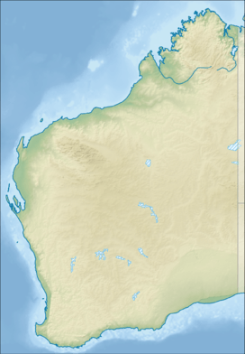
 A location in the Leeuwin-Naturaliste National Park | |
 Leeuwin-Naturaliste National Park | |
| Nearest town or city | Bunbury |
| Coordinates | 34°14′19″S 115°02′50″E / 34.23861°S 115.04722°ECoordinates: 34°14′19″S 115°02′50″E / 34.23861°S 115.04722°E |
| Established | 1957 |
| Area | 190.92 km2 (73.7 sq mi)[1] |
| Managing authorities | Department of Environment and Conservation (Western Australia) |
| Website | Leeuwin-Naturaliste National Park |
| See also |
List of protected areas of Western Australia |
Leeuwin-Naturaliste National Park is a national park in the South West region of Western Australia (Australia), 267 km south of Perth. It is named after the two locations at either end of the park which have lighthouses, Cape Leeuwin and Cape Naturaliste. It is located in the Augusta-Margaret River and Busselton council areas, and is claimed to have the highest visiting numbers of any national park in Western Australia.
It has significant stands of karri and jarrah forest, as well as an extensive network of caves – some of which are accessible by the public.
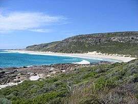
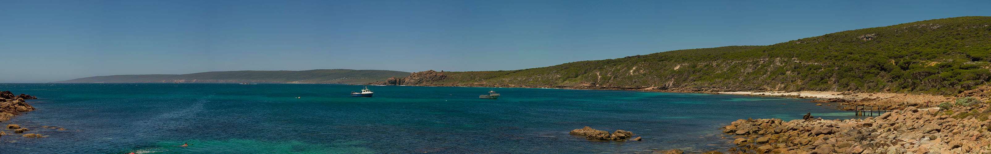
The rugged coastline stretches 120 km from the northern end at Bunker Bay to Augusta at the southern end and has many features of interest including the granite formations, sugarloaf rock and canal rocks. The coastal area also contains many beaches with well-known surf breaks, such as Supertubes, Yallingup beach and Smiths Beach.[2]
The vegetation found in the park varies from the coastal scrub-heath along the coastline that opens up into large areas of peppermint trees, banksia and karri forest.
A large variety of bird species inhabit the park including many sea birds, red-eared firetail, white-breasted robin, rock parrot and emu. Native mammals that can be found within the park include southern brown bandicoots, western grey kangaroos, western ringtail possums and brush wallabies.
Leeuwin – Naturaliste ridge
The national park was created from crown lands along the Leeuwin – Naturaliste ridge at a time after the main primary industries in the region had been dairying and forestry, and when increased land use conflict was arising from the spread of wineries, increased population on hobby farms and other agricultural activities.
Since then many competing land uses have created a complex land management scenario for state and local government authorities trying to mediate quite conflicting issues. The national park is located on some of the most vulnerable land in the region.
The ridge's geology and the variations in vegetation are confined to a number of very narrow bands that follow the north–south orientation of the ridge.
The ridge has a whole series of caves [3] that run the length of the ridge. It also has the cave known as Devil's Lair which has important archaeological significance.
Cape to Cape Track

In 2001, the Department of Environment and Conservation (DEC) opened the Cape to Cape Track, a 135 kilometre walking track along the Leeuwin-Naturaliste ridge.
See also
References
Notes
- ↑ "Department of Environment and Conservation 2009–2010 Annual Report". Department of Environment and Conservation. 2010: 48. ISSN 1835-114X.
- ↑ Blair, Larry and Cheyne Horan Wavefinder Australia 3rd edition.A Hedonist publication ISBN 0-9581726-6-8 Supertubes (Smiths) p.253, Yallingup beach p.252, Smiths Beach p.253. also in (2001) Western Australia's Yallingup Margaret River Region, www.estategraphics.com.au/surfmaps – number 10, Supertubes; number 9, Yallingup; number 11, Smiths
- ↑ List of caves in Western Australia – see the locations for Augusta, Cowaramup, Margaret River, Witchcliffe, Yallingup
Sources
- Bastian, L. V. Minerals and their relationships in the Leeuwin block Leeuwin-Naturaliste National Park Perth : Government Chemical Laboratories, [1977?]
- Cape to Cape Walk Track – Hamelin Bay to Cape Leeuwin 29 km" Department of Conservation and Environment, Busselton. n.d. pamphlet
- – Shaping the Capes: Rocks and landforms of the Leeuwin-Naturaliste Ridge an explanation of the Leeuwin Naturaliste Ridge.
- Orr, Kate. and Frewer, Paul (1988) Leeuwin-Naturaliste National Park Management plan : summary of public submissions, November 1988 Como, W.A : Dept. of Conservation and Land Management.
- Taylor, Neil., Scott, Jane., Thomson-Dans, Carolyn and Banks, Roger.(n.d.) Feast for the Soul pp. 15–20 of The Best of the South West – Landscope special edition, Kensington, W.A.: Dept. of Conservation and Land Management ISBN 0-7307-5552-5
- Western Australian Planning Commission. Statement of planning policy. No. 7, Leeuwin-Naturaliste Ridge Policy. Perth, W.A. : Govt. Printer – in – Western Australian government gazette, Perth, Friday 18 September 1998, No. 189. Special. 5191–5215 p. .
- Western Australian Planning Commission. Leeuwin-Naturaliste Ridge planning review : issues, opportunities and directions : discussion paper for public comment / Western Australian Planning Commission, Shires of Augusta–Margaret River and Busselton. [Perth, W.A.] : The Commission, 1995.