Meifod
Coordinates: 52°43′N 3°15′W / 52.71°N 3.25°W
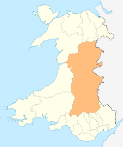
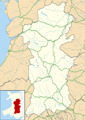
Meifod, formerly also written Meivod (![]() Welsh pronunciation ), is a small village and electoral ward 7 miles north-west of Welshpool in Powys, mid Wales, on the A495 road and located in the valley of the River Vyrnwy. The River Banwy has a confluence with the Vyrnwy approximately two miles to the west of the village.
Welsh pronunciation ), is a small village and electoral ward 7 miles north-west of Welshpool in Powys, mid Wales, on the A495 road and located in the valley of the River Vyrnwy. The River Banwy has a confluence with the Vyrnwy approximately two miles to the west of the village.
History
Although the Mediolanum of the Antonine Itinerary has since been identified as Whitchurch in Shropshire, Meifod is sometimes identified as the Mediolanum among the Ordovices described in Ptolemy's Geography,[2][3] although others argue for Llanfyllin[2] or Caersws.[4]
Meifod is about a mile north-east of the royal residence of the Princes of Wales at Mathrafal, and it was an early Christian centre known at Caer Meguaidd or Meguaid;[5] It is associated with St Gwydafarch in the 6th century and St Tysilio in the 7th.[6] Tysilio's father was Brochwel Ysgithrog, a prince of Powys, who made Meifod his summer residence. The first Christian foundation was probably a clas and a monastery in the early medieval period.[7] A church built by Madog ap Maredudd, the last prince of the entire Kingdom of Powys, and dedicated to St Fair, was consecrated in 1156.[6] The same churchyard once contained three separate churches; Eglwys Gwydafarch, Eglwys Fair and Eglwys Tysilio.[8]
The churchyard is said to contain the royal tombs of Madog ap Maredudd (d. 1160) and his son Gruffydd Maelor (d. 1191), Prince of Powys Fadog.[6] There is also a stone slab in the church dated late-9th or early-10th century, although very weathered the decorations on it are still clear and include a large cross and a smaller cross in a circle, it is assumed that it once covered a tomb.[9][10]
Religion
At the village centre is the parish church of St Tysilio and St Mary, which occupies a very large site, the building includes material with a wide range of ages some dated to the 12th century.[6][11] In addition, in common with many Welsh villages, there are a number of Nonconformist chapels with the village and its catchment area.
Buildings
The village has one pub, the King's Head and a convenience store (with a post office). In 2006, local rugby union team C.O.B.R.A built a new rugby clubhouse and two pitches. The club house has two bars and a balcony. The village football team plays in the amateur division. The village also has a primary school, Ysgol Meifod (formerly Meifod County Primary (or CP) School) and a modern village hall located next door which provides facilities for a wide variety of clubs and societies.
Dyffryn Hall, a Georgian period manor house, is situated to the west of the village and was home to Clement Davies, the Montgomeryshire MP and leader of the post-war Liberal Party between 1945 and 1956.
Demographics
57% of the population of Meifod were born in England. However, this is not in itself evidence of any large-scale immigration from England; it may simply reflect the preference of local parents for using larger hospitals more conveniently situated in nearby Shropshire for giving birth. The United Kingdom Census 2001 revealed that some 38% of the population over 3 years old had some knowledge of the Welsh language with almost 20% able to speak, read and write in Welsh.[12] The Meifod valley hosted the National Eisteddfod in 2003 and 2015.
References
- ↑ "Ward/Community population 2011". Retrieved 14 November 2015.
- 1 2 Williams, Robert. "A History of the Parish of Llanfyllin" in Collections Historical & Archaeological Relating to Montgomeryshire, Vol. III, p. 59. J. Russell Smith (London), 1870.
- ↑ Newman, John Henry & al. Lives of the English Saints: St. German, Bishop of Auxerre, Ch. X: "Britain in 429, A. D.", p. 92. James Toovey (London), 1844.
- ↑ Roman Britain Organisation. "Mediomanum?" at Roman Britain. 2010.
- ↑ Nennius; Mark the Anchorite; Gunn, Bill (1819). Historia Brittonum. J. and A. Arch. p. 105.
- 1 2 3 4 "Parish Church of St Tysilio and St Mary, Meifod". British Listed Buildings.
- ↑ "Early Medieval Ecclesiastic and Burial Sites in Mid and North-East Wales: An Interim Report". CPAT. Retrieved 25 April 2015.
PDF document, see page 5
- ↑ "Early Medieval Ecclesiastic and Burial Sites in Mid and North-East Wales: An Interim Report". CPAT. Retrieved 25 April 2015.
PDF document, see page 11
- ↑ "Meifod Church (St Tysilio and St Mary), cross slab". CPAT. CPAT. Retrieved 25 April 2015.
- ↑ "Meifod - Ancient Cross in Wales in Powys". The Megalith Portal. Retrieved 25 April 2015.
- ↑ "ST TYSILIO AND ST MARY'S CHURCH, MEIFOD". Coflein. Retrieved 25 April 2015.
- ↑ 2001 Census Neighbourhood Statistics: Meifod
External links
- Ysgol Meifod
- Photograph of headteacher and boys Meifod School 1890s
- Photograph of teachers and girls Meifod School 1890s
- BBC: Meifod
- 2001 Census Neighbourhood Statistics for Meifod
- Useful Information on Meifod
- www.geograph.co.uk : photos of Meifod and surrounding area
- Francis Frith photographs of Meifod
- Genuki information on Meifod
- Images of St Tysilio and St Mary Church and the early Christian carved stone slab