Bettws Cedewain
| Bettws Cedewain | |
| Welsh: Betws Cedewain | |
 Bettws Cedewain |
|
| Population | 425 (2001) |
|---|---|
| OS grid reference | SO122967 |
| Community | Bettws |
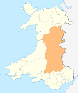
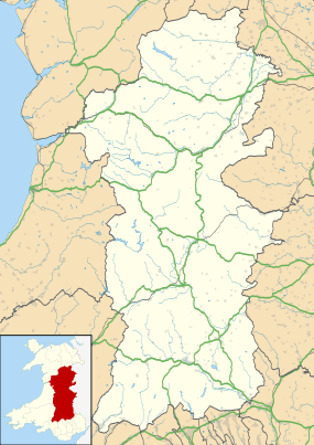
| Principal area | Powys |
| Ceremonial county | Powys |
| Country | Wales |
| Sovereign state | United Kingdom |
| Post town | NEWTOWN |
| Postcode district | SY16 3 |
| Police | Dyfed-Powys |
| Fire | Mid and West Wales |
| Ambulance | Welsh |
| EU Parliament | Wales |
Coordinates: 52°33′40″N 3°17′42″W / 52.561°N 03.295°W
See also:St Beuno's church, Bettws Cedewain
Bettws Cedewain (Welsh: Betws Cedewain), also known as Bettws Cedewen, is a small village and community in Powys, Wales. It lies in a sheltered valley on the banks of the Nant Bechan, some 3 miles (5 km) north of Newtown, on the B4389 road.
A wooden motte-and-bailey castle appears to have existed there at one time. The site was also possibly previously used by Roman soldiers, and an ancient church was founded there by Saint Beuno in the 6th century.
.jpg)
Bettws Cedewain's Grade II* listed St Beuno's church, which was the location of the village's first schoolroom, contains possibly the only pre-Reformation memorial brass in the county, dedicated to the Reverend John ap Meredyth for his work in planning and building the tower.
Until 1914, most properties in the village belonged to the Gregynog estate.
Bettws Hall is a local venue for game bird shoots.
The first element in the name of the village is from the Middle English word bedhus, meaning "prayer house", which became betws in Welsh.[1] Cedewain is the name of the medieval land division, or cantref, in which the village is situated.
National Cycle Route 81 (Lôn Cambria) passes through the village.
References
External links
- Bettws Hall Game shooting
- Church information
- Other historical information
- Photos of Bettws Cedewain and surrounding area on geograph.org.uk