List of mines in Japan

This list is incomplete; you can help by expanding it.

This list of mines in Japan is subsidiary to the list of mines article and lists working, defunct and future mines in the country. For practical purposes stone, marble and other quarries may be included in this list. This list is inherently incomplete and shows only a selection of the most notable mines.

Horonai
Akenobe
Ashio
Kōryū
Akagane
Akan
KamiSunagawa
Minamishiraoi
Inaushi
Yūbari
Ikushunbetsu
Miike
Hashima
Iriomote
Utara
Nittō
Naganobori
Shimokawa
Yaguki
Obira
Horobetsu
Kunitomi
Suttsu
Nishizawa
Chitose
Hokuryu
Konomai
Sanru
Kitanoo
Teine
Shizukari
Ponshikaribetsu
Todoroki
Toi gold
Toyoha
Kamaishi
Shojingawa
Kutchan
Yoichi
Jokoku
Inakuraishi
Itomuka
Komaki
Ōkawame
Kamikawa
Ikuno
Horobetsu sulphur
Kobui
Shiretoko
Otani
Taguchi
Tsugu
Nakauri
Yamanoyoshida
Fujii
Wakasa
Nakatatsu
Nojiri
Hatasa
Kamioka
Amou
Tono
Fukuoka
Hirase
Mumaya
Togi
HattoriKawai
Ogoya
Searashi
Suwa
Hamayokogawa
Ohinata
Tenryū
Kusakura
Otani
Asahibudo
Nanetsu
Sado
Akatani
Mochikoshi
Yugashima
Kune
Kawazu
Seikoshi
Sennotani
Takara
Yanahara
Obie
ShinMikawa
Fuka
Sasaune
Yoshioka
Wanibuchi
Tsumo
Iwami
Sasagatani
Daito
Seikyu
Hirose
NingyoToge
Fujigatani
Kuga
Kamogawa
GunmaTetsuzan
Nebazawa
Shōwa
Takatori
Hitachi
Chichibu
Ōkura
Kaso
Kidogasawa
Tochigi
Shiromaru
Asahi
Hiraki
Tada
Takeno
Ōmidani
Nakase
Takanokura
Yaso
Yokota
Chiyogahara
Mizusawa
Sennin
Tsunatori
NodaTamagawa
Matsuo
Hanawa
Taro
Akaishi
Unekura
Iwate
Tanohata
Hanawa 2
OarasawaAkutozawa
Matsuiwa
Hosokura
Oya
Kabasawa
Akayama
IsobeKoyama
Ohori
Mogami
Nissho
Ōizumi
Itaya
Yatani
Yoshino
Yoshiwara
Nagatare
Sannotake
Fuke
Hishikari
Yamagano
Kushikino
Kasuga
Akeshi
Onoyama
Iwato
Sarayama
Suzuyama
Makimine
Mitate
Taishu
Moe-Tatsugo
Otanibira
Matsubara-douzan
Yakushima
Kimu
Hoei
Obira
Bajo
Kiura
Taio
Ōku
Takaura
Hirota
Yuryo
Besshi
Ikadazu
Sazare
Ōkuki
Ichinokawa
Kurase
Motoyasu
Shingu
Kunimiyama
Ananai
Shirataki
Tosakubo
Minawa
Nonowaki
Amakusa
Hanaoka
Kosaka
Shakanai
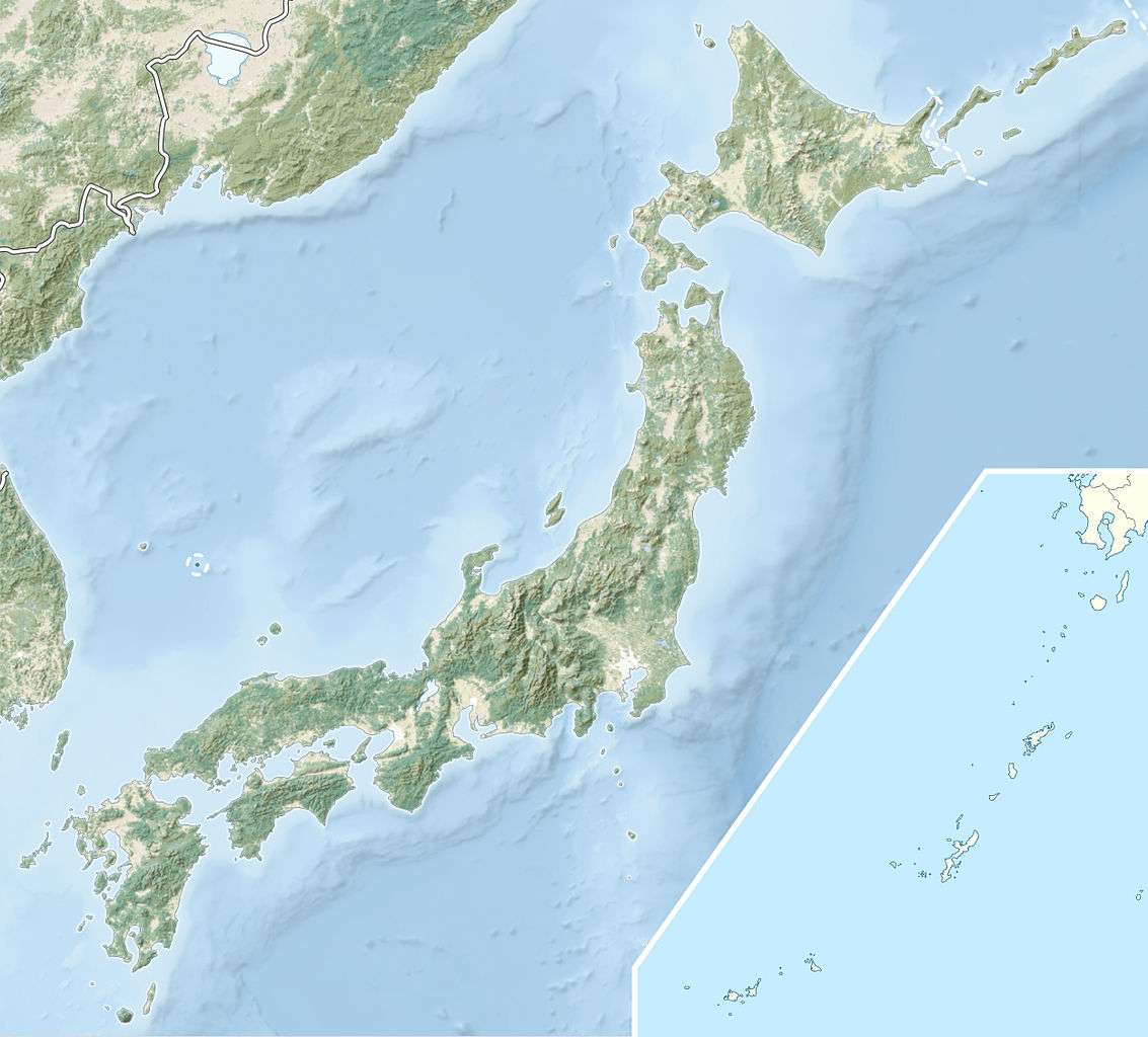
The mines of Japan[1]

Copper Iron (triangle mark) Gold/Silver Alkali/bases Lanthanide/Actinide other metals Coal, oil or oil slate Chalcogen/Halogen other non-metal stone, crystals and complex compounds

List of Mines in Japan

MineProduce!CoordinatesAssociated townOwnerOpenedClosedComments
Ichinokawa Mine[2][3] Antimony 33°53′20″N 133°13′08″E / 33.889°N 133.219°E / 33.889; 133.219 Saijō, Ehime 1659 1957
Kimu mine[4] Antimony 26°29′56″N 127°54′11″E / 26.499°N 127.903°E / 26.499; 127.903 Okinawa Island ? ?
Tsugu mine[5][6] Antimony 35°10′41″N 137°37′44″E / 35.178°N 137.629°E / 35.178; 137.629 Shitara, Aichi 15## 1956
Obira mine[7] Arsenic 32°50′31″N 131°34′41″E / 32.842°N 131.578°E / 32.842; 131.578 Bungo-ōno, Oita ? ? also contains boron and fluorine minerals
Matsuiwa mine[8] Arsenic 38°58′01″N 141°31′08″E / 38.967°N 141.519°E / 38.967; 141.519 Kesennuma, Miyagi 1949 1974 also contains some uranium, silver and gold
Sasagatani mine[9] Arsenic 34°32′56″N 131°42′11″E / 34.549°N 131.703°E / 34.549; 131.703 Tsuwano, Shimane ? ? closed
Akenobe mine[10] Arsenic 35°16′59″N 134°40′01″E / 35.283°N 134.667°E / 35.283; 134.667 Yabu, Hyōgo 1908 1987
Gunma-tetsuzan[11] Barium 36°39′11″N 138°35′49″E / 36.653°N 138.597°E / 36.653; 138.597 Nakanojō, Gunma 1943 1975
Minamishiraoi baryte mine[12] Barium 42°39′40″N 141°13′34″E / 42.661°N 141.226°E / 42.661; 141.226 Shiraoi, Hokkaido 1950 1988
Fukuoka mine[13] Beryllium 35°35′10″N 137°28′05″E / 35.586°N 137.468°E / 35.586; 137.468 Nakatsugawa, Gifu Furukawa ? ? Closed
Sannotake mine[14][15] Bismuth 33°42′N 130°51′E / 33.7°N 130.85°E / 33.7; 130.85 Tagawa, Fukuoka ? ? includes Yokozuru mine
Fukuoka mine[16] Bismuth 35°35′10″N 137°28′05″E / 35.586°N 137.468°E / 35.586; 137.468 Nakatsugawa, Gifu Furukawa ? ? Closed
Inaushi mine[17] Bismuth 43°14′31″N 143°43′19″E / 43.242°N 143.722°E / 43.242; 143.722 Kitami, Hokkaido 1934 1964
Hosokura mine[18][19] Cadmium 38°48′29″N 140°54′00″E / 38.808°N 140.9°E / 38.808; 140.9 Kurihara, Miyagi 1898 1977 now become an amusement park
Fuka mine[20] Calcite 34°46′01″N 133°25′59″E / 34.767°N 133.433°E / 34.767; 133.433 Takahashi, Okayama ? open high purity, used for toothpaste
Hirose mine[21] Chromium 35°04′01″N 133°12′00″E / 35.067°N 133.2°E / 35.067; 133.2 Hino, Tottori ? ? closed
Nittō mine[22] Chromium 42°34′19″N 142°17′13″E / 42.572°N 142.287°E / 42.572; 142.287 Saru, Hokkaido 1917 1959
Amakusa coalfield[23] coal 32°15′N 130°04′E / 32.25°N 130.06°E / 32.25; 130.06 Amakusa 186# 1963 closed but not depleted
Mogami coal field[24][25][26] coal 38°36′47″N 140°19′52″E / 38.613°N 140.331°E / 38.613; 140.331 Ōishida, Yamagata ? open lignite rich in germanium
Iwate mine[27] coal 39°53′06″N 141°37′52″E / 39.885°N 141.631°E / 39.885; 141.631 Iwaizumi, Iwate ? ?
Hokutan Horonai coal mine coal 43°13′16″N 141°54′32″E / 43.221°N 141.909°E / 43.221; 141.909 Mikasa, Hokkaido Hokutan 1879 1989 Went Bankrupt
Kami-sunagawa coal mine coal 43°28′34″N 141°59′31″E / 43.476°N 141.992°E / 43.476; 141.992 Kamisunagawa Mitsui 1915 1986 Japan Microgravity Centre
Hokutan Yūbari mine coal 43°03′50″N 141°59′06″E / 43.064°N 141.985°E / 43.064; 141.985 Yūbari Hokutan 1890 197# Went Bankrupt
Hokutan Ikushunbetsu coal mine coal 43°15′40″N 141°58′05″E / 43.261°N 141.968°E / 43.261; 141.968 Ikushunbetsu Hokutan 1885 1957
Miike coal mine coal 33°00′50″N 130°27′22″E / 33.014°N 130.456°E / 33.014; 130.456 Ōmuta Tachibana clan 1872 1997
Mitsubishi Hashima coal mine coal 32°37′41″N 129°44′17″E / 32.628°N 129.738°E / 32.628; 129.738 Hashima Mitsubishi 1869 1974 Closed
Iriomote Coal Mine coal 24°19′59″N 123°48′00″E / 24.333°N 123.8°E / 24.333; 123.8 Iriomote Mitsui 1886 1960 Closed
Utara Coal Mine coal 24°18′07″N 123°42′25″E / 24.302°N 123.707°E / 24.302; 123.707 Iriomote Marusan Mining Company 1936 1943 Closed
Shirataki mine[28][29][30] Cobalt 33°49′41″N 133°28′19″E / 33.828°N 133.472°E / 33.828; 133.472 Ōkawa, Kōchi Nippon Mining Co ? ?
Besshi copper mine[31][32] Cobalt 33°51′11″N 133°18′50″E / 33.853°N 133.314°E / 33.853; 133.314 Niihama, Ehime Sumitomo 1691 1973
Chiyogahara mine[33] Cobalt 38°52′01″N 141°21′00″E / 38.867°N 141.35°E / 38.867; 141.35 Fujisawa, Iwate ? ?
Hitachi mine[34][35] Cobalt 36°37′44″N 140°36′22″E / 36.629°N 140.606°E / 36.629; 140.606 Hitachi, Ibaraki 1905 1974
Kune mine[36] Cobalt 35°05′06″N 137°49′59″E / 35.085°N 137.833°E / 35.085; 137.833 Hamamatsu, Shizuoka 1897 open
Tenryū mine[37][38] Cobalt 35°16′59″N 137°51′00″E / 35.283°N 137.85°E / 35.283; 137.85 Tenryū, Nagano ? open
Naganobori mine[39] Cobalt 34°14′42″N 131°20′10″E / 34.245°N 131.336°E / 34.245; 131.336 Mine, Yamaguchi 1941 1945
Shimokawa mine[40] Cobalt 44°12′54″N 142°42′04″E / 44.215°N 142.701°E / 44.215; 142.701 Shimokawa, Hokkaido 1941 1979
Kosaka mine[41] Copper 40°20′13″N 140°45′14″E / 40.337°N 140.754°E / 40.337; 140.754 Kosaka, Akita Dowa Holdings 18## ?
Hanaoka mine[42] Copper 40°18′32″N 140°33′07″E / 40.309°N 140.552°E / 40.309; 140.552 Ōdate, Akita Kajima, Dowa mining 1885 ? the site of Hanaoka Incident during WWII
Nonowaki mine[43][44] Copper 33°54′00″N 134°14′49″E / 33.9°N 134.247°E / 33.9; 134.247 Naka, Tokushima ? 196#
Minawa mine[45] Copper 33°59′31″N 133°47′10″E / 33.992°N 133.786°E / 33.992; 133.786 Miyoshi, Tokushima 1956 1970
Shirataki mine[46][47][48] Copper 33°49′41″N 133°28′19″E / 33.828°N 133.472°E / 33.828; 133.472 Ōkawa, Kōchi Nippon Mining Co ? ?
Shingu mine[49][50] Copper 33°55′59″N 133°37′59″E / 33.933°N 133.633°E / 33.933; 133.633 Shikokuchūō, Ehime 1911 1975 also diamond-bearing Lherzolite
Motoyasu mine[51] Copper 33°47′46″N 133°15′11″E / 33.796°N 133.253°E / 33.796; 133.253 Saijō, Ehime 1877 1972
Ōkuki mine[52][53] Copper 33°30′50″N 132°39′22″E / 33.514°N 132.656°E / 33.514; 132.656 Uchiko, Ehime ? ?
Sazare mine[54][55][56] Copper 33°54′14″N 133°32′31″E / 33.904°N 133.542°E / 33.904; 133.542 Niihama, Ehime ? 1979
Ikadazu mine[57] Copper 33°49′55″N 133°22′59″E / 33.832°N 133.383°E / 33.832; 133.383 Niihama, Ehime ? 1973
Besshi copper mine[58][59] Copper 33°51′11″N 133°18′50″E / 33.853°N 133.314°E / 33.853; 133.314 Niihama, Ehime Sumitomo 1691 1973
Yuryo mine[60][61] Copper 33°42′25″N 132°48′11″E / 33.707°N 132.803°E / 33.707; 132.803 Iyo, Ehime 1938 1954
Hirota mine[62][63] Copper 33°39′N 132°48′E / 33.65°N 132.8°E / 33.65; 132.8 Iyo, Ehime 1917 1930
Takaura mine[64][65] Copper 33°22′34″N 132°07′19″E / 33.376°N 132.122°E / 33.376; 132.122 Ikata, Ehime 1914 1965
Ōku mine[66] Copper 33°24′43″N 132°10′52″E / 33.412°N 132.181°E / 33.412; 132.181 Ikata, Ehime ? closed
Obira mine[67] Copper 32°50′31″N 131°34′41″E / 32.842°N 131.578°E / 32.842; 131.578 Bungo-ōno, Oita ? ? also contains boron and fluorine minerals
Matsubara-douzan mine[68] Copper 27°51′40″N 128°55′01″E / 27.861°N 128.917°E / 27.861; 128.917 Tokunoshima 1903 1928
Moe-Tatsugo mine[69] Copper 28°27′32″N 129°36′36″E / 28.459°N 129.61°E / 28.459; 129.61 Amami Ōshima ? closed
Mitate mine[70][71] Copper 32°46′30″N 131°28′19″E / 32.775°N 131.472°E / 32.775; 131.472 Hinokage, Miyazaki Rasa Industries 1915 1970 on slopes of Mount Sobo
Makimine mine[72][73][74] Copper 32°37′48″N 131°27′29″E / 32.63°N 131.458°E / 32.63; 131.458 Hinokage, Miyazaki Mitsubishi 194x ?
Iwato mine[75][76] Copper 31°16′37″N 130°19′34″E / 31.277°N 130.326°E / 31.277; 130.326 Makurazaki, Kagoshima ? ?
Sannotake mine[77][78] Copper 33°42′N 130°51′E / 33.7°N 130.85°E / 33.7; 130.85 Tagawa, Fukuoka ? ? includes Yokozuru mine
Yoshiwara mine[79][80] Copper 33°45′N 130°51′E / 33.75°N 130.85°E / 33.75; 130.85 Kitakyushu, Fukuoka 1910 1971
Ōizumi mine[81][82][83] Copper 38°24′47″N 139°43′41″E / 38.413°N 139.728°E / 38.413; 139.728 Tsuruoka, Yamagata 1882 1950
Ohori mine[84][85] Copper 38°44′46″N 140°27′50″E / 38.746°N 140.464°E / 38.746; 140.464 Mogami, Yamagata ? ?
Isobe-Koyama mine[86][87] Copper 38°27′00″N 140°13′01″E / 38.45°N 140.217°E / 38.45; 140.217 Sagae, Yamagata 1932 1977
Akayama mine[88][89] Copper 38°04′26″N 140°18′11″E / 38.074°N 140.303°E / 38.074; 140.303 Naragejuku, Yamagata 16xx 1972 also contains some zinc, silver and gold
Matsuiwa mine[90] Copper 38°58′01″N 141°31′08″E / 38.967°N 141.519°E / 38.967; 141.519 Kesennuma, Miyagi 1949 1974 also contains some uranium, silver and gold
Oarasawa-Akutozawa mine[91] Copper 39°16′26″N 140°53′38″E / 39.274°N 140.894°E / 39.274; 140.894 Waga, Iwate 1907 1920 116 kt Cu produced
Hanawa 2 mine[92] Copper 40°10′34″N 140°52′01″E / 40.176°N 140.867°E / 40.176; 140.867 Hachimantai, Iwate ? ? not to be confused with Hanawa manganese mine in Miyako, Iwate
Unekura mine[93][94] Copper 39°13′59″N 140°51′00″E / 39.233°N 140.85°E / 39.233; 140.85 Yuda, Iwate Dowa Kogyo K. K. ? open
Akaishi mine[95] Copper 39°21′36″N 140°47′31″E / 39.36°N 140.792°E / 39.36; 140.792 Yuda, Iwate 1914 1973
Tsunatori mine[96] Copper 39°18′14″N 140°56′31″E / 39.304°N 140.942°E / 39.304; 140.942 Waga District, Iwate 1908 1962
Sennin mine[97] Copper 39°18′40″N 140°53′20″E / 39.311°N 140.889°E / 39.311; 140.889 Waga District, Iwate 1911 1974 also called Wagasennin mine
Mizusawa mine[98] Copper 39°26′13″N 140°46′34″E / 39.437°N 140.776°E / 39.437; 140.776 Waga District, Iwate 1717 ?
Yokota mine[99][100][101] Copper 37°23′17″N 139°26′31″E / 37.388°N 139.442°E / 37.388; 139.442 Kaneyama, Fukushima ? ?
Yaso mine[102] Copper 37°03′29″N 139°39′29″E / 37.058°N 139.658°E / 37.058; 139.658 Minamiaizu, Fukushima 1952 1970
Takanokura mine[103] Copper 37°37′34″N 140°49′19″E / 37.626°N 140.822°E / 37.626; 140.822 Sōma, Fukushima ? ?
Tada mine[104] Copper 34°53′35″N 135°21′29″E / 34.893°N 135.358°E / 34.893; 135.358 Inagawa, Hyōgo Nihon Kogyo 1211 1973
Tochigi mine[105] Copper 36°47′38″N 139°48′50″E / 36.794°N 139.814°E / 36.794; 139.814 Shioya, Tochigi 1946 1965
Kidogasawa mine[106] Copper 36°47′49″N 139°42′00″E / 36.797°N 139.7°E / 36.797; 139.7 Nikkō, Tochigi 1940 1974
Chichibu mine[107] Copper 36°01′19″N 138°49′01″E / 36.022°N 138.817°E / 36.022; 138.817 Ōtaki, Saitama 708 ? first ever copper mine of Japan
Fujigatani mine[108] Copper 34°08′38″N 132°01′01″E / 34.144°N 132.017°E / 34.144; 132.017 Iwakuni, Yamaguchi 1955 1977 closed
Sasagatani mine[109] Copper 34°32′56″N 131°42′11″E / 34.549°N 131.703°E / 34.549; 131.703 Tsuwano, Shimane ? ? closed
Iwami Ginzan Silver Mine[110][111] Copper 35°09′50″N 132°26′31″E / 35.164°N 132.442°E / 35.164; 132.442 Ōda, Shimane 130# 1923 world leading medieval silver producer
Tsumo mine[112][113] Copper 34°39′00″N 131°59′10″E / 34.65°N 131.986°E / 34.65; 131.986 Masuda, Shimane 195x ?
Yoshioka mine[114] Copper 34°51′29″N 133°27′29″E / 34.858°N 133.458°E / 34.858; 133.458 Takahashi, Okayama 1905 1972
Sasaune mine[115][116] Copper 34°51′11″N 133°28′19″E / 34.853°N 133.472°E / 34.853; 133.472 Takahashi, Okayama ? 196# also produced iron pigment
Shin-mikawa mine[117] Copper 34°37′59″N 133°34′59″E / 34.633°N 133.583°E / 34.633; 133.583 Yakage, Okayama 1916 1957
Obie mine[118] Copper 34°36′40″N 133°47′49″E / 34.611°N 133.797°E / 34.611; 133.797 Kurashiki, Okayama 1906 1947
Yanahara mine[119][120] Copper 34°57′29″N 134°04′08″E / 34.958°N 134.069°E / 34.958; 134.069 Misaki, Okayama 195# 1970 also produced iron oxide for audio tapes
Takara mine[121][122] Copper 35°34′30″N 138°51′00″E / 35.575°N 138.85°E / 35.575; 138.85 Tsuru, Yamanashi 1942 1962 also produced pyrite
Kune mine[123] Copper 35°05′06″N 137°49′59″E / 35.085°N 137.833°E / 35.085; 137.833 Hamamatsu, Shizuoka 1897 open
Kusakura mine[124] Copper 37°40′59″N 139°28′59″E / 37.683°N 139.483°E / 37.683; 139.483 Kanose, Niigata Furukawa 1738 ?
Ogoya mine[125] Copper 36°17′35″N 136°35′31″E / 36.293°N 136.592°E / 36.293; 136.592 Komatsu, Ishikawa 1884 1971
Hatasa mine[126] Copper 35°51′07″N 137°03′47″E / 35.852°N 137.063°E / 35.852; 137.063 Gujō, Gifu 1674 1916
Nojiri mine[127] Copper 35°52′34″N 136°43′01″E / 35.876°N 136.717°E / 35.876; 136.717 Ōno, Fukui ? 1968 Underwater after construction of Kuzuryu Dam
Nakatatsu mine[128] Copper 35°52′23″N 136°34′41″E / 35.873°N 136.578°E / 35.873; 136.578 Ōno, Fukui ? ? Closed
Nakauri mine[129] Copper 34°50′56″N 137°33′07″E / 34.849°N 137.552°E / 34.849; 137.552 Kamaishi, Iwate 1953 1953 worked for 3 months
Kamaishi mine[130] Copper 39°18′00″N 141°40′59″E / 39.3°N 141.683°E / 39.3; 141.683 Kamaishi, Iwate 1727 1993 Dominant iron producer of Japan pre-war
Ashio copper mine[131] Copper 36°37′59″N 139°26′38″E / 36.633°N 139.444°E / 36.633; 139.444 Nikkō, Tochigi Furukawa 1600 1973 Largest copper output during late 19th century, place of 1907 Ashio riot
Yaguki mine[132] Copper 37°10′16″N 140°54′54″E / 37.171°N 140.915°E / 37.171; 140.915 Iwaki, Fukushima 1945 1974
Obira mine[133] Copper 32°50′31″N 131°34′41″E / 32.842°N 131.578°E / 32.842; 131.578 mount Sobo in Nishiusuki, Miyazaki 1617 1954
Horobetsu mine[134] Copper 42°28′30″N 141°03′00″E / 42.475°N 141.05°E / 42.475; 141.05 Noboribetsu, Hokkaido 1898 1973
Shimokawa mine[135] Copper 44°12′54″N 142°42′04″E / 44.215°N 142.701°E / 44.215; 142.701 Shimokawa, Hokkaido 1941 1979
Kunitomi Mine[136] Copper 43°00′29″N 140°39′29″E / 43.008°N 140.658°E / 43.008; 140.658 Shiribeshi, Hokkaido 1909 1945
Suttsu mine[137] Copper 42°46′19″N 140°17′35″E / 42.772°N 140.293°E / 42.772; 140.293 Suttsu District, Hokkaido ? 1962
Akenobe mine[138] Copper 35°16′59″N 134°40′01″E / 35.283°N 134.667°E / 35.283; 134.667 Yabu, Hyōgo 1908 1987
Mogami coal field[139][140][141] Germanium 38°36′47″N 140°19′52″E / 38.613°N 140.331°E / 38.613; 140.331 Ōishida, Yamagata ? open lignite rich in germanium
Ōkuki mine[142][143] Gold 33°30′50″N 132°39′22″E / 33.514°N 132.656°E / 33.514; 132.656 Uchiko, Ehime ? ?
Takaura mine[144][145] Gold 33°22′34″N 132°07′19″E / 33.376°N 132.122°E / 33.376; 132.122 Ikata, Ehime 1914 1965
Taio mine[146][147] Gold 33°08′20″N 130°53′38″E / 33.139°N 130.894°E / 33.139; 130.894 Hita, Ōita 1896 1972 now museum
Bajo mine[148] Gold 33°28′52″N 131°31′01″E / 33.481°N 131.517°E / 33.481; 131.517 Bungotakada, Ōita ? ?
Yakushima mine[149] Gold 30°21′32″N 130°31′44″E / 30.359°N 130.529°E / 30.359; 130.529 Yakushima ? 1958 leading tungsten producer
Iwato mine[150][151] Gold 31°16′37″N 130°19′34″E / 31.277°N 130.326°E / 31.277; 130.326 Makurazaki, Kagoshima ? ?
Onoyama mine[152] Gold 31°56′17″N 130°43′52″E / 31.938°N 130.731°E / 31.938; 130.731 Yūsui, Kagoshima ? ?
Akeshi mine[153][154] Gold 31°18′36″N 130°22′44″E / 31.31°N 130.379°E / 31.31; 130.379 Minamikyūshū, Kagoshima ? 198x closed
Kasuga mine[155] Gold 31°15′58″N 130°16′30″E / 31.266°N 130.275°E / 31.266; 130.275 Makurazaki, Kagoshima ? open silica with gold as by-product
Kushikino mine[156][157] Gold 31°45′14″N 130°18′00″E / 31.754°N 130.3°E / 31.754; 130.3 Kushikino, Kagoshima Mitsui mining 195# closed
Yamagano mine[158][159] Gold 31°55′08″N 130°37′01″E / 31.919°N 130.617°E / 31.919; 130.617 Kirishima, Kagoshima 1642 1965
Hishikari mine[160][161][162] Gold 31°59′31″N 130°42′29″E / 31.992°N 130.708°E / 31.992; 130.708 Yūsui, Kagoshima Sumitomo Metal Mining 1985 open the only open gold mine of Japan as in 2014
Fuke mine[163][164][165] Gold 32°09′00″N 130°37′01″E / 32.15°N 130.617°E / 32.15; 130.617 Isa, Kagoshima Toa mining 1937 1976 also nearby Okuchi mine
Sannotake mine[166][167] Gold 33°42′N 130°51′E / 33.7°N 130.85°E / 33.7; 130.85 Tagawa, Fukuoka ? ? includes Yokozuru mine
Yoshino mine[168][169][170][171] Gold 38°09′11″N 140°11′49″E / 38.153°N 140.197°E / 38.153; 140.197 Nan'yō, Yamagata ? 1975
Isobe-Koyama mine[172][173] Gold 38°27′00″N 140°13′01″E / 38.45°N 140.217°E / 38.45; 140.217 Sagae, Yamagata 1932 1977
Oya mine[174] Gold 38°52′01″N 141°31′19″E / 38.867°N 141.522°E / 38.867; 141.522 Motoyoshi, Miyagi 1915 1971
Tsunatori mine[175] Gold 39°18′14″N 140°56′31″E / 39.304°N 140.942°E / 39.304; 140.942 Waga District, Iwate 1908 1962
Nakase mine[176] Gold 35°21′29″N 134°37′30″E / 35.358°N 134.625°E / 35.358; 134.625 Yabu, Hyōgo ? ?
Ōmidani mine[177] Gold 35°14′46″N 134°38′49″E / 35.246°N 134.647°E / 35.246; 134.647 Shisō, Hyōgo 1961 1983
Takeno mine[178] Gold 35°36′40″N 134°44′10″E / 35.611°N 134.736°E / 35.611; 134.736 Kinosaki, Hyōgo ? ?
Asahi mine[179] Gold 34°54′07″N 134°18′50″E / 34.902°N 134.314°E / 34.902; 134.314 Asago, Hyōgo 1921 1985
Nebazawa mine[180][181] Gold 36°52′16″N 139°19′19″E / 36.871°N 139.322°E / 36.871; 139.322 Katashina, Gunma 1961 1982
Iwami Ginzan Silver Mine[182][183] Gold 35°09′50″N 132°26′31″E / 35.164°N 132.442°E / 35.164; 132.442 Ōda, Shimane 130# 1923 world leading medieval silver producer
Tsumo mine[184][185] Gold 34°39′00″N 131°59′10″E / 34.65°N 131.986°E / 34.65; 131.986 Masuda, Shimane 1950x ?
Seikoshi mine[186][187] Gold 34°54′00″N 138°49′37″E / 34.9°N 138.827°E / 34.9; 138.827 Toi, Shizuoka 1935 1983
Kawazu mine[188] Gold 34°41′56″N 138°55′19″E / 34.699°N 138.922°E / 34.699; 138.922 Shimoda, Shizuoka 1915 1959
Yugashima mine[189] Gold 34°52′52″N 138°54′50″E / 34.881°N 138.914°E / 34.881; 138.914 Amagiyugashima, Shizuoka 1939 1958
Mochikoshi mine[190] Gold 34°52′34″N 138°51′50″E / 34.876°N 138.864°E / 34.876; 138.864 Amagiyugashima, Shizuoka 1929 1952
Sado mine[191] Gold 38°02′17″N 138°15′40″E / 38.038°N 138.261°E / 38.038; 138.261 Sado, Niigata 1601 1974
Togi mine[192][193] Gold 37°08′38″N 136°46′59″E / 37.144°N 136.783°E / 37.144; 136.783 Shika, Ishikawa Mitsubishi Metal Mining 1906 1942
Mumaya mine[194] Gold 36°04′01″N 137°01′26″E / 36.067°N 137.024°E / 36.067; 137.024 Shōkawa, Gifu 159# ?
Tsugu mine[195][196] Gold 35°10′41″N 137°37′44″E / 35.178°N 137.629°E / 35.178; 137.629 Shitara, Aichi 15## 1956
Kamaishi mine[197] Gold 39°18′00″N 141°40′59″E / 39.3°N 141.683°E / 39.3; 141.683 Kamaishi, Iwate 1727 1993 Dominant iron producer of Japan pre-war
Nishizawa mine[198] Gold 36°52′08″N 139°29′53″E / 36.869°N 139.498°E / 36.869; 139.498 Nikkō, Tochigi 1928 ?
Chitose mine[199] Gold 42°43′30″N 141°13′01″E / 42.725°N 141.217°E / 42.725; 141.217 Chitose, Hokkaido 1936 1974
Hokuryu mine[200] Gold 44°32′31″N 142°49′01″E / 44.542°N 142.817°E / 44.542; 142.817 Monbetsu, Hokkaido ? 1943
Konomai gold mine[201] Gold 44°08′06″N 143°20′56″E / 44.135°N 143.349°E / 44.135; 143.349 Monbetsu, Hokkaido 1917 1973
Horobetsu mine[202] Gold 42°28′30″N 141°03′00″E / 42.475°N 141.05°E / 42.475; 141.05 Noboribetsu, Hokkaido 1898 1973
Sanru mine[203] Gold 44°22′59″N 142°38′31″E / 44.383°N 142.642°E / 44.383; 142.642 Shimokawa, Hokkaido 1926 1983
Kitanoo mine[204] Gold 43°55′30″N 143°34′08″E / 43.925°N 143.569°E / 43.925; 143.569 Kitami, Hokkaido 1924 1943
Teine mine[205] Gold 43°05′31″N 141°12′11″E / 43.092°N 141.203°E / 43.092; 141.203 Sapporo, Hokkaido 1941 1971
Shizukari Mine[206] Gold 42°36′00″N 140°27′29″E / 42.6°N 140.458°E / 42.6; 140.458 Shiribeshi, Hokkaido 1918 1962
Ponshikaribetsu mine[207] Gold 43°11′02″N 140°47′10″E / 43.184°N 140.786°E / 43.184; 140.786 Shiribeshi, Hokkaido 1891 open
Todoroki mine[208] Gold 43°00′29″N 140°55′30″E / 43.008°N 140.925°E / 43.008; 140.925 Shiribeshi, Hokkaido 1903 1974
Toi gold mine Gold 34°54′29″N 138°47′35″E / 34.908°N 138.793°E / 34.908; 138.793 Toi Sumitomo Group 1370 1965
Kōryū Mine[209] Gold 42°47′35″N 141°17′10″E / 42.793°N 141.286°E / 42.793; 141.286 Eniwa, Hokkaido 1935 1943
Amou mine[210] Gold 36°14′02″N 136°57′14″E / 36.234°N 136.954°E / 36.234; 136.954 Shirakawa, Gifu (village) ? closed large gold deposit
Sennotani mine[211] Graphite 36°42′36″N 137°10′01″E / 36.71°N 137.167°E / 36.71; 137.167 Toyama, Toyama ? 1967 85% of graphite producer of Japan in 1951
Amou mine[212] Graphite 36°14′02″N 136°57′14″E / 36.234°N 136.954°E / 36.234; 136.954 Shirakawa, Gifu (village) ? closed Leading graphite producer of Japan
Toyoha mine[213] Indium 42°58′48″N 141°02′28″E / 42.98°N 141.041°E / 42.98; 141.041 Sapporo, Hokkaido ? 2006 World leading indium producer until exhausted
Kunimiyama mine[214][215] Iron 33°37′52″N 133°25′08″E / 33.631°N 133.419°E / 33.631; 133.419 Kōchi, Kōchi ? closed
Sannotake mine[216][217] Iron 33°42′N 130°51′E / 33.7°N 130.85°E / 33.7; 130.85 Tagawa, Fukuoka ? ? includes Yokozuru mine
Kabasawa mine[218][219] Iron 38°19′34″N 140°43′41″E / 38.326°N 140.728°E / 38.326; 140.728 Aoba-ku, Sendai ? ?
Matsuo mine[220][221] Iron 39°55′59″N 140°55′59″E / 39.933°N 140.933°E / 39.933; 140.933 Matsuo, Iwate 1914 1971 important iron and sulphur producer
Sennin mine[222] Iron 39°18′40″N 140°53′20″E / 39.311°N 140.889°E / 39.311; 140.889 Waga District, Iwate 1911 1974 also called Wagasennin mine
Gunma-tetsuzan[223] Iron 36°39′11″N 138°35′49″E / 36.653°N 138.597°E / 36.653; 138.597 Nakanojō, Gunma 1943 1975
Akatani mine Iron 37°48′29″N 139°29′31″E / 37.808°N 139.492°E / 37.808; 139.492 Shibata, Niigata 1925 1975
Suwa mine[224] Iron 36°02′38″N 138°16′30″E / 36.044°N 138.275°E / 36.044; 138.275 Chino, Nagano ? 195#
Akagane mine[225] Iron 39°10′01″N 141°19′59″E / 39.167°N 141.333°E / 39.167; 141.333 Esashi, Iwate 1912 1974
Kamaishi mine[226] Iron 39°18′00″N 141°40′59″E / 39.3°N 141.683°E / 39.3; 141.683 Kamaishi, Iwate 1727 1993 Dominant iron producer of Japan pre-war
Shojingawa mine[227] Iron 41°53′42″N 140°41′56″E / 41.895°N 140.699°E / 41.895; 140.699 Nanae, Hokkaido 1897 1960
Kutchan mine[228] Iron 42°54′36″N 140°46′41″E / 42.91°N 140.778°E / 42.91; 140.778 Shiribeshi, Hokkaido ? ? Dominant iron producer of Japan during Pacific War
Taishu mine[229][230] Kaolinite 34°13′16″N 129°13′08″E / 34.221°N 129.219°E / 34.221; 129.219 Tsushima Island 699 open initially mined for silver, later switched for kaolinite
Sarayama mine[231] Kaolinite 32°21′29″N 130°01′59″E / 32.358°N 130.033°E / 32.358; 130.033 Amakusa ? open
Itaya mine[232][233] Kaolinite 37°46′19″N 140°15′00″E / 37.772°N 140.25°E / 37.772; 140.25 Yonezawa, Yamagata ? ? paper-clay
Hiraki mine[234][235] Kaolinite 34°57′29″N 135°06′00″E / 34.958°N 135.1°E / 34.958; 135.1 Sanda, Hyōgo ? open High purity, used for fiber optics
Hattori-Kawai mine[236] Kaolinite 36°23′35″N 136°35′49″E / 36.393°N 136.597°E / 36.393; 136.597 Nomi, Ishikawa and
Hakusan, Ishikawa
1930 open Hattori mine in Nomi closed in 2001
Shakanai mine[237] Lead 40°18′29″N 140°34′41″E / 40.308°N 140.578°E / 40.308; 140.578 Ōdate, Akita Dowa Holdings ? ? also contains Germanium, Indium and Gold
Kosaka mine[238] Lead 40°20′13″N 140°45′14″E / 40.337°N 140.754°E / 40.337; 140.754 Kosaka, Akita Dowa Holdings 18## ?
Hanaoka mine[239] Lead 40°18′32″N 140°33′07″E / 40.309°N 140.552°E / 40.309; 140.552 Ōdate, Akita Kajima, Dowa mining 1885 ? the site of Hanaoka Incident during WWII
Mitate mine[240][241] Lead 32°46′30″N 131°28′19″E / 32.775°N 131.472°E / 32.775; 131.472 Hinokage, Miyazaki Rasa Industries 1915 1970 on slopes of Mount Sobo
Ohori mine[242][243] Lead 38°44′46″N 140°27′50″E / 38.746°N 140.464°E / 38.746; 140.464 Mogami, Yamagata ? ?
Yatani mine[244][245] Lead 37°46′30″N 140°01′01″E / 37.775°N 140.017°E / 37.775; 140.017 Yonezawa, Yamagata ? ? also some gold and silver[246]
Ōizumi mine[247][248][249] Lead 38°24′47″N 139°43′41″E / 38.413°N 139.728°E / 38.413; 139.728 Tsuruoka, Yamagata 1882 1950
Nissho mine[250][251] Lead 38°59′31″N 140°14′31″E / 38.992°N 140.242°E / 38.992; 140.242 Mamurogawa, Yamagata 1937 1963
Hosokura mine[252][253] Lead 38°48′29″N 140°54′00″E / 38.808°N 140.9°E / 38.808; 140.9 Kurihara, Miyagi 1898 1977 now become an amusement park
Hanawa 2 mine[254] Lead 40°10′34″N 140°52′01″E / 40.176°N 140.867°E / 40.176; 140.867 Hachimantai, Iwate ? ? not to be confused with Hanawa manganese mine in Miyako, Iwate
Taro mine[255][256][257] Lead 39°45′29″N 141°55′59″E / 39.758°N 141.933°E / 39.758; 141.933 Miyako, Iwate 1936 1979 reused for Cosmic-ray observatory of Meisei University
Tsumo mine[258][259] Lead 34°39′00″N 131°59′10″E / 34.65°N 131.986°E / 34.65; 131.986 Masuda, Shimane 195x ?
Wanibuchi mine[260][261] Lead 35°25′01″N 132°45′00″E / 35.417°N 132.75°E / 35.417; 132.75 Izumo, Shimane ? ? also important gypsum producer
Nanetsu mine[262] Lead 37°05′38″N 139°02′31″E / 37.094°N 139.042°E / 37.094; 139.042 Muika, Niigata 1963 1971
Asahi-budo mine[263] Lead 38°24′00″N 139°33′40″E / 38.4°N 139.561°E / 38.4; 139.561 Murakami, Niigata 1941 1957
Otani mine[264] Lead 37°45′00″N 139°24′47″E / 37.75°N 139.413°E / 37.75; 139.413 Mikawa, Niigata 1632 1961
Hatasa mine[265] Lead 35°51′07″N 137°03′47″E / 35.852°N 137.063°E / 35.852; 137.063 Gujō, Gifu 1674 1916
Ohinata mine[266] Lead 36°10′01″N 138°28′59″E / 36.167°N 138.483°E / 36.167; 138.483 Sakuho, Nagano ? ? Closed
Nakatatsu mine[267] Lead 35°52′23″N 136°34′41″E / 35.873°N 136.578°E / 35.873; 136.578 Ōno, Fukui ? ? Closed
Toyoha mine[268] Lead 42°58′48″N 141°02′28″E / 42.98°N 141.041°E / 42.98; 141.041 Sapporo, Hokkaido ? 2006 World leading indium producer until exhausted
Obira mine[269] Lead 32°50′31″N 131°34′41″E / 32.842°N 131.578°E / 32.842; 131.578 mount Sobo in Nishiusuki, Miyazaki 1617 1954
Inaushi mine[270] Lead 43°14′31″N 143°43′19″E / 43.242°N 143.722°E / 43.242; 143.722 Kitami, Hokkaido 1934 1964
Yoichi Mine[271] Lead 43°13′01″N 140°42′00″E / 43.217°N 140.7°E / 43.217; 140.7 Shakotan Peninsula, Hokkaido ? 1963
Suttsu mine[272] Lead 42°46′19″N 140°17′35″E / 42.772°N 140.293°E / 42.772; 140.293 Suttsu District, Hokkaido ? 1962
Nagatare mine[273][274] Lithium 33°34′59″N 130°16′59″E / 33.583°N 130.283°E / 33.583; 130.283 Fukuoka, Fukuoka ? ?
Ananai mine[275] Manganese 33°41′31″N 133°38′49″E / 33.692°N 133.647°E / 33.692; 133.647 Nankoku, Kōchi ? closed
Kunimiyama mine[276][277] Manganese 33°37′52″N 133°25′08″E / 33.631°N 133.419°E / 33.631; 133.419 Kōchi, Kōchi ? closed
Kurase mine[278] Manganese 33°48′00″N 133°01′59″E / 33.8°N 133.033°E / 33.8; 133.033 Saijō, Ehime ? ?
Ōizumi mine[279][280][281] Manganese 38°24′47″N 139°43′41″E / 38.413°N 139.728°E / 38.413; 139.728 Tsuruoka, Yamagata 1882 1950
Tanohata mine[282] Manganese 39°55′01″N 141°54′00″E / 39.917°N 141.9°E / 39.917; 141.9 Tanohata, Iwate ? ? a type location for a number of rare minerals
Hanawa mine[283] Manganese 39°38′28″N 141°57′25″E / 39.641°N 141.957°E / 39.641; 141.957 Miyako, Iwate ? ? closed
Noda-Tamagawa mine[284][285] Manganese 40°04′23″N 141°48′29″E / 40.073°N 141.808°E / 40.073; 141.808 Noda, Iwate 1950 ?
Shiromaru mine[286] Manganese 35°48′29″N 139°07′30″E / 35.808°N 139.125°E / 35.808; 139.125 Okutama, Tokyo ? ? now submerged, also called Hakumaru mine
Kaso mine[287][288] Manganese 36°36′14″N 139°37′59″E / 36.604°N 139.633°E / 36.604; 139.633 Kanuma, Tochigi 1947 ?
Ōkura mine[289] Manganese 36°51′22″N 139°19′41″E / 36.856°N 139.328°E / 36.856; 139.328 Hannō, Saitama 1941 1945
Shōwa mine[290] Manganese 36°33′04″N 139°18′29″E / 36.551°N 139.308°E / 36.551; 139.308 Kiryū, Gunma ? ? closed
Hamayokogawa mine[291] Manganese 35°58′23″N 137°54′00″E / 35.973°N 137.9°E / 35.973; 137.9 Kamiina District, Nagano 1925 1966 large deposits
Searashi mine[292] Manganese 37°06′58″N 136°52′48″E / 37.116°N 136.88°E / 37.116; 136.88 Nanao, Ishikawa ? ?
Fujii mine[293] Manganese 35°31′59″N 135°51′00″E / 35.533°N 135.85°E / 35.533; 135.85 Wakasa, Fukui ? ?
Taguchi mine[294] Manganese 35°07′08″N 137°32′46″E / 35.119°N 137.546°E / 35.119; 137.546 Shitara, Aichi ? ? also Pyroxmangite gems
Obira mine[295] Manganese 32°50′31″N 131°34′41″E / 32.842°N 131.578°E / 32.842; 131.578 mount Sobo in Nishiusuki, Miyazaki 1617 1954
Jokoku mine[296] Manganese 41°40′01″N 140°03′11″E / 41.667°N 140.053°E / 41.667; 140.053 Kaminokuni, Hokkaido ? ? Dominant manganese producer of Japan
Inakuraishi mine[297] Manganese 43°09′00″N 140°37′59″E / 43.15°N 140.633°E / 43.15; 140.633 Furubira, Hokkaido 1946 open Largest manganese deposit in Japan
Tosakubo mine[298] Mercury 33°48′N 133°57′E / 33.8°N 133.95°E / 33.8; 133.95 Monobe, Kōchi ? ?
Ikadazu mine[299] Mercury 33°49′55″N 133°22′59″E / 33.832°N 133.383°E / 33.832; 133.383 Niihama, Ehime ? 1973
Itomuka mine[300] Mercury 43°40′59″N 143°10′01″E / 43.683°N 143.167°E / 43.683; 143.167 Tokoro, Hokkaido 1941 1974 dominant mercury producer of Japan
Seikyu Mine[301] Molybdenum 35°17′17″N 132°59′20″E / 35.288°N 132.989°E / 35.288; 132.989 Daitō, Shimane 1954 1966
Daito Mine[302] Molybdenum 35°17′46″N 132°58′41″E / 35.296°N 132.978°E / 35.296; 132.978 Daitō, Shimane 1950 1966
Hirase Mine[303] Molybdenum 36°10′16″N 136°55′01″E / 36.171°N 136.917°E / 36.171; 136.917 Shirakawa, Gifu 1931 1979
Komaki Mine[304] Molybdenum 35°05′10″N 132°59′49″E / 35.086°N 132.997°E / 35.086; 132.997 Okuizumo, Shimane 1943 1984
Ōkawame mine[305] Molybdenum 40°11′24″N 141°46′34″E / 40.19°N 141.776°E / 40.19; 141.776 Kuji, Iwate 1943 1965
Chiyogahara mine[306] Nickel 38°52′01″N 141°21′00″E / 38.867°N 141.35°E / 38.867; 141.35 Fujisawa, Iwate ? ?
Kamogawa mine[307][308] Nickel 35°07′01″N 139°49′59″E / 35.117°N 139.833°E / 35.117; 139.833 Awa District, Chiba 1935 ? also called Kameoka mine
Tenryū mine[309][310] Nickel 35°16′59″N 137°51′00″E / 35.283°N 137.85°E / 35.283; 137.85 Tenryū, Nagano ? open
Wakasa mine[311] Nickel 35°28′59″N 135°37′01″E / 35.483°N 135.617°E / 35.483; 135.617 Ōi, Fukui Mori Kogyo ? Open also silica mining
Yamanoyoshida mine[312] Nickel 34°49′59″N 137°30′00″E / 34.833°N 137.5°E / 34.833; 137.5 Shinshiro, Aichi ? ?
Kamikawa mine[313] Nickel 43°50′53″N 142°46′12″E / 43.848°N 142.77°E / 43.848; 142.77 Kamikawa, Hokkaido 1941 1945
Otanibira quarry[314][315] Silica 30°47′28″N 130°18′18″E / 30.791°N 130.305°E / 30.791; 130.305 Iōjima (Kagoshima) ? 1997 initially mined for sulphur
Motoyasu mine[316] Silver 33°47′46″N 133°15′11″E / 33.796°N 133.253°E / 33.796; 133.253 Saijō, Ehime 1877 1972
Taio mine[317][318] Silver 33°08′20″N 130°53′38″E / 33.139°N 130.894°E / 33.139; 130.894 Hita, Ōita 1896 1972 now museum
Bajo mine[319] Silver 33°28′52″N 131°31′01″E / 33.481°N 131.517°E / 33.481; 131.517 Bungotakada, Ōita ? ?
Taishu mine[320][321] Silver 34°13′16″N 129°13′08″E / 34.221°N 129.219°E / 34.221; 129.219 Tsushima Island 699 open initially mined for silver, later switched for kaolinite
Iwato mine[322][323] Silver 31°16′37″N 130°19′34″E / 31.277°N 130.326°E / 31.277; 130.326 Makurazaki, Kagoshima ? ?
Kushikino mine[324][325] Silver 31°45′14″N 130°18′00″E / 31.754°N 130.3°E / 31.754; 130.3 Kushikino, Kagoshima Mitsui mining 195# closed
Yamagano mine[326][327] Silver 31°55′08″N 130°37′01″E / 31.919°N 130.617°E / 31.919; 130.617 Kirishima, Kagoshima 1642 1965
Fuke mine[328][329][330] Silver 32°09′00″N 130°37′01″E / 32.15°N 130.617°E / 32.15; 130.617 Isa, Kagoshima Toa mining 1937 1976 also nearby Okuchi mine
Yoshino mine[331][332][333][334] Silver 38°09′11″N 140°11′49″E / 38.153°N 140.197°E / 38.153; 140.197 Nan'yō, Yamagata ? 1975
Oya mine[335] Silver 38°52′01″N 141°31′19″E / 38.867°N 141.522°E / 38.867; 141.522 Motoyoshi, Miyagi 1915 1971
Hosokura mine[336][337] Silver 38°48′29″N 140°54′00″E / 38.808°N 140.9°E / 38.808; 140.9 Kurihara, Miyagi 1898 1977 now become an amusement park
Nebazawa mine[338][339] Silver 36°52′16″N 139°19′19″E / 36.871°N 139.322°E / 36.871; 139.322 Katashina, Gunma 1961 1982
Tsunatori mine[340] Silver 39°18′14″N 140°56′31″E / 39.304°N 140.942°E / 39.304; 140.942 Waga District, Iwate 1908 1962
Ōmidani mine[341] Silver 35°14′46″N 134°38′49″E / 35.246°N 134.647°E / 35.246; 134.647 Shisō, Hyōgo 1961 1983
Takeno mine[342] Silver 35°36′40″N 134°44′10″E / 35.611°N 134.736°E / 35.611; 134.736 Kinosaki, Hyōgo ? ?
Tada mine[343] Silver 34°53′35″N 135°21′29″E / 34.893°N 135.358°E / 34.893; 135.358 Inagawa, Hyōgo Nihon Kogyo 1211 1973
Asahi mine[344] Silver 34°54′07″N 134°18′50″E / 34.902°N 134.314°E / 34.902; 134.314 Asago, Hyōgo 1921 1985
Tochigi mine[345] Silver 36°47′38″N 139°48′50″E / 36.794°N 139.814°E / 36.794; 139.814 Shioya, Tochigi 1946 1965
Iwami Ginzan Silver Mine[346][347] Silver 35°09′50″N 132°26′31″E / 35.164°N 132.442°E / 35.164; 132.442 Ōda, Shimane 130# 1923 world leading medieval silver producer
Seikoshi mine[348][349] Silver 34°54′00″N 138°49′37″E / 34.9°N 138.827°E / 34.9; 138.827 Toi, Shizuoka 1935 1983
Yugashima mine[350] Silver 34°52′52″N 138°54′50″E / 34.881°N 138.914°E / 34.881; 138.914 Amagiyugashima, Shizuoka 1939 1958
Mochikoshi mine[351] Silver 34°52′34″N 138°51′50″E / 34.876°N 138.864°E / 34.876; 138.864 Amagiyugashima, Shizuoka 1929 1952
Sado mine[352] Silver 38°02′17″N 138°15′40″E / 38.038°N 138.261°E / 38.038; 138.261 Sado, Niigata 1601 1974
Togi mine[353][354] Silver 37°08′38″N 136°46′59″E / 37.144°N 136.783°E / 37.144; 136.783 Shika, Ishikawa Mitsubishi Metal Mining 1906 1942
Hatasa mine[355] Silver 35°51′07″N 137°03′47″E / 35.852°N 137.063°E / 35.852; 137.063 Gujō, Gifu 1674 1916
Kamaishi mine[356] Silver 39°18′00″N 141°40′59″E / 39.3°N 141.683°E / 39.3; 141.683 Kamaishi, Iwate 1727 1993 Dominant iron producer of Japan pre-war
Toyoha mine[357] Silver 42°58′48″N 141°02′28″E / 42.98°N 141.041°E / 42.98; 141.041 Sapporo, Hokkaido ? 2006 World leading indium producer until exhausted
Nishizawa mine[358] Silver 36°52′08″N 139°29′53″E / 36.869°N 139.498°E / 36.869; 139.498 Nikkō, Tochigi 1928 ?
Ikuno mine[359] Silver 35°10′01″N 134°49′30″E / 35.167°N 134.825°E / 35.167; 134.825 Asago, Hyōgo 807 1973
Chitose mine[360] Silver 42°43′30″N 141°13′01″E / 42.725°N 141.217°E / 42.725; 141.217 Chitose, Hokkaido 1936 1974
Hokuryu mine[361] Silver 44°32′31″N 142°49′01″E / 44.542°N 142.817°E / 44.542; 142.817 Monbetsu, Hokkaido ? 1943
Konomai mines[362] Silver 44°08′06″N 143°20′56″E / 44.135°N 143.349°E / 44.135; 143.349 Monbetsu, Hokkaido 1917 1973 important silver producer of Japan
Horobetsu mine[363] Silver 42°28′30″N 141°03′00″E / 42.475°N 141.05°E / 42.475; 141.05 Noboribetsu, Hokkaido 1898 1973
Sanru mine[364] Silver 44°22′59″N 142°38′31″E / 44.383°N 142.642°E / 44.383; 142.642 Shimokawa, Hokkaido 1926 1983
Kitanoo mine[365] Silver 43°55′30″N 143°34′08″E / 43.925°N 143.569°E / 43.925; 143.569 Kitami, Hokkaido 1924 1943
Shizukari Mine[366] Silver 42°36′00″N 140°27′29″E / 42.6°N 140.458°E / 42.6; 140.458 Shiribeshi, Hokkaido 1918 1962
Suttsu mine[367] Silver 42°46′19″N 140°17′35″E / 42.772°N 140.293°E / 42.772; 140.293 Suttsu District, Hokkaido ? 1962
Kōryū Mine[368] Silver 42°47′35″N 141°17′10″E / 42.793°N 141.286°E / 42.793; 141.286 Eniwa, Hokkaido 1935 1943
Nonowaki mine[369][370] Sulphur 33°54′00″N 134°14′49″E / 33.9°N 134.247°E / 33.9; 134.247 Naka, Tokushima ? 196#
Shirataki mine[371][372][373] Sulphur 33°49′41″N 133°28′19″E / 33.828°N 133.472°E / 33.828; 133.472 Ōkawa, Kōchi Nippon Mining Co ? ?
Shingu mine[374][375] Sulphur 33°55′59″N 133°37′59″E / 33.933°N 133.633°E / 33.933; 133.633 Shikokuchūō, Ehime 1911 1975 also diamond-bearing Lherzolite
Ōkuki mine[376][377] Sulphur 33°30′50″N 132°39′22″E / 33.514°N 132.656°E / 33.514; 132.656 Uchiko, Ehime ? ?
Suzuyama mine[378][379] Sulphur 31°29′N 130°27′E / 31.49°N 130.45°E / 31.49; 130.45 Kagoshima, Kagoshima 184x closed water treatment plant still active
Taro mine[380][381][382] Sulphur 39°45′29″N 141°55′59″E / 39.758°N 141.933°E / 39.758; 141.933 Miyako, Iwate 1936 1979 reused for Cosmic-ray observatory of Meisei University
Matsuo mine[383][384] Sulphur 39°55′59″N 140°55′59″E / 39.933°N 140.933°E / 39.933; 140.933 Matsuo, Iwate 1914 1971 important iron and sulphur producer
Yanahara mine[385][386] Sulphur 34°57′29″N 134°04′08″E / 34.958°N 134.069°E / 34.958; 134.069 Misaki, Okayama 195# 1970 also produced iron oxide for audio tapes
Horobetsu sulphur mine[387] Sulphur 42°33′54″N 140°58′34″E / 42.565°N 140.976°E / 42.565; 140.976 Sōbetsu, Hokkaido 1940 1959
Kobui mine[388] Sulphur 41°46′01″N 140°43′59″E / 41.767°N 140.733°E / 41.767; 140.733 Hakodate, Hokkaido 1904 1952
Shojingawa mine[389] Sulphur 41°53′42″N 140°41′56″E / 41.895°N 140.699°E / 41.895; 140.699 Nanae, Hokkaido 1938 1960
Shiretoko mine[390] Sulphur 44°07′59″N 145°09′40″E / 44.133°N 145.161°E / 44.133; 145.161 Shiretoko Peninsula, Hokkaido 1937 ? deposit created in volcanic eruption of 1936
Akan mine[391] Sulphur 43°27′07″N 144°05′56″E / 43.452°N 144.099°E / 43.452; 144.099 Ashoro, Hokkaido 1951 open
Kiura mine[392] Tin 32°48′N 131°33′E / 32.8°N 131.55°E / 32.8; 131.55 Saiki, Ōita 16## ? also mined for emery
Obira mine[393] Tin 32°50′31″N 131°34′41″E / 32.842°N 131.578°E / 32.842; 131.578 Bungo-ōno, Oita ? ? also contains boron and fluorine minerals
Hoei mine[394][395] Tin 32°51′32″N 131°27′11″E / 32.859°N 131.453°E / 32.859; 131.453 Bungo-ōno, Oita ? closed
Yakushima mine[396] Tin 30°21′32″N 130°31′44″E / 30.359°N 130.529°E / 30.359; 130.529 Yakushima ? 1958 leading tungsten producer
Mitate mine[397][398] Tin 32°46′30″N 131°28′19″E / 32.775°N 131.472°E / 32.775; 131.472 Hinokage, Miyazaki Rasa Industries 1915 1970 on slopes of Mount Sobo
Suzuyama mine[399][400] Tin 31°29′N 130°27′E / 31.49°N 130.45°E / 31.49; 130.45 Kagoshima, Kagoshima 184x closed water tratment plant still active
Tada mine[401] Tin 34°53′35″N 135°21′29″E / 34.893°N 135.358°E / 34.893; 135.358 Inagawa, Hyōgo Nihon Kogyo 1211 1973
Akenobe mine[402] Tin 35°16′59″N 134°40′01″E / 35.283°N 134.667°E / 35.283; 134.667 Yabu, Hyōgo 1908 1987 dominant tin producer of Japan
Obira mine[403] Tin 32°50′31″N 131°34′41″E / 32.842°N 131.578°E / 32.842; 131.578 mount Sobo in Nishiusuki, Miyazaki 1617 1954
Kabasawa mine[404][405] Titanium 38°19′34″N 140°43′41″E / 38.326°N 140.728°E / 38.326; 140.728 Aoba-ku, Sendai ? ?
Yakushima mine[406] Tungsten 30°21′32″N 130°31′44″E / 30.359°N 130.529°E / 30.359; 130.529 Yakushima ? 1958 leading tungsten producer
Takatori mine[407] Tungsten 36°30′00″N 140°17′38″E / 36.5°N 140.294°E / 36.5; 140.294 Shirosato, Ibaraki ? ? also Rhodochrosite gems
Kuga mine[408] Tungsten 34°13′01″N 132°01′30″E / 34.217°N 132.025°E / 34.217; 132.025 Iwakuni, Yamaguchi ? ?
Fujigatani mine[409] Tungsten 34°08′38″N 132°01′01″E / 34.144°N 132.017°E / 34.144; 132.017 Iwakuni, Yamaguchi 1955 1977 closed
Tsumo mine[410][411] Tungsten 34°39′00″N 131°59′10″E / 34.65°N 131.986°E / 34.65; 131.986 Masuda, Shimane 195x ?
Fukuoka mine[412] Tungsten 35°35′10″N 137°28′05″E / 35.586°N 137.468°E / 35.586; 137.468 Nakatsugawa, Gifu Furukawa ? ? Closed
Komaki Mine[413] Tungsten 35°05′10″N 132°59′49″E / 35.086°N 132.997°E / 35.086; 132.997 Okuizumo, Shimane 1911 1984
Akenobe mine[414] Tungsten 35°16′59″N 134°40′01″E / 35.283°N 134.667°E / 35.283; 134.667 Yabu, Hyōgo 1908 1987
Otani mine[415] Tungsten 35°01′59″N 135°31′01″E / 35.033°N 135.517°E / 35.033; 135.517 Kameoka, Kyoto 1912 1983
Yaguki mine[416] Tungsten 37°10′16″N 140°54′54″E / 37.171°N 140.915°E / 37.171; 140.915 Iwaki, Fukushima 1945 1974
Ningyo-toge mine[417][418] Uranium 35°18′29″N 133°55′59″E / 35.308°N 133.933°E / 35.308; 133.933 Kagamino, Okayama 1969 1982 dominant uranium producer of Japan
Tono mine[419] Uranium 35°24′29″N 137°13′59″E / 35.408°N 137.233°E / 35.408; 137.233 Mizunami, Gifu 2001 open
Kabasawa mine[420][421] Vanadium 38°19′34″N 140°43′41″E / 38.326°N 140.728°E / 38.326; 140.728 Aoba-ku, Sendai ? ?
Kosaka mine[422] Zinc 40°20′13″N 140°45′14″E / 40.337°N 140.754°E / 40.337; 140.754 Kosaka, Akita Dowa Holdings 18## ?
Shakanai mine[423] Zinc 40°18′29″N 140°34′41″E / 40.308°N 140.578°E / 40.308; 140.578 Ōdate, Akita Dowa Holdings ? ? also contains Germanium, Indium and Gold
Hanaoka mine[424] Zinc 40°18′32″N 140°33′07″E / 40.309°N 140.552°E / 40.309; 140.552 Ōdate, Akita Kajima, Dowa mining 1885 ? the site of Hanaoka Incident during WWII
Obira mine[425] Zinc 32°50′31″N 131°34′41″E / 32.842°N 131.578°E / 32.842; 131.578 Bungo-ōno, Oita ? ? also contains boron and fluorine minerals
Mitate mine[426][427] Zinc 32°46′30″N 131°28′19″E / 32.775°N 131.472°E / 32.775; 131.472 Hinokage, Miyazaki Rasa Industries 1915 1970 on slopes of Mount Sobo
Ohori mine[428][429] Zinc 38°44′46″N 140°27′50″E / 38.746°N 140.464°E / 38.746; 140.464 Mogami, Yamagata ? ?
Yatani mine[430][431] Zinc 37°46′30″N 140°01′01″E / 37.775°N 140.017°E / 37.775; 140.017 Yonezawa, Yamagata ? ? also some gold and silver[432]
Yoshino mine[433][434][435][436] Zinc 38°09′11″N 140°11′49″E / 38.153°N 140.197°E / 38.153; 140.197 Nan'yō, Yamagata ? 1975
Ōizumi mine[437][438][439] Zinc 38°24′47″N 139°43′41″E / 38.413°N 139.728°E / 38.413; 139.728 Tsuruoka, Yamagata 1882 1950
Nissho mine[440][441] Zinc 38°59′31″N 140°14′31″E / 38.992°N 140.242°E / 38.992; 140.242 Mamurogawa, Yamagata 1937 1963
Yaso mine[442] Zinc 37°03′29″N 139°39′29″E / 37.058°N 139.658°E / 37.058; 139.658 Minamiaizu, Fukushima 1952 1970
Hosokura mine[443][444] Zinc 38°48′29″N 140°54′00″E / 38.808°N 140.9°E / 38.808; 140.9 Kurihara, Miyagi 1898 1977 now become an amusement park
Hanawa 2 mine[445] Zinc 40°10′34″N 140°52′01″E / 40.176°N 140.867°E / 40.176; 140.867 Hachimantai, Iwate ? ? not to be confused with Hanawa manganese mine in Miyako, Iwate
Taro mine[446][447][448] Zinc 39°45′29″N 141°55′59″E / 39.758°N 141.933°E / 39.758; 141.933 Miyako, Iwate 1936 1979 reused for Cosmic-ray observatory of Meisei University
Kidogasawa mine[449] Zinc 36°47′49″N 139°42′00″E / 36.797°N 139.7°E / 36.797; 139.7 Nikkō, Tochigi 1940 1974
Tsumo mine[450][451] Zinc 34°39′00″N 131°59′10″E / 34.65°N 131.986°E / 34.65; 131.986 Masuda, Shimane 195x ?
Wanibuchi mine[452][453] Zinc 35°25′01″N 132°45′00″E / 35.417°N 132.75°E / 35.417; 132.75 Izumo, Shimane ? ? also important gypsum producer
Takara mine[454][455] Zinc 35°34′30″N 138°51′00″E / 35.575°N 138.85°E / 35.575; 138.85 Tsuru, Yamanashi 1942 1962 also produced pyrite
Nanetsu mine[456] Zinc 37°05′38″N 139°02′31″E / 37.094°N 139.042°E / 37.094; 139.042 Muika, Niigata 1963 1971
Asahi-budo mine[457] Zinc 38°24′00″N 139°33′40″E / 38.4°N 139.561°E / 38.4; 139.561 Murakami, Niigata 1941 1957
Otani mine[458] Zinc 37°45′00″N 139°24′47″E / 37.75°N 139.413°E / 37.75; 139.413 Mikawa, Niigata 1632 1961
Ohinata mine[459] Zinc 36°10′01″N 138°28′59″E / 36.167°N 138.483°E / 36.167; 138.483 Sakuho, Nagano ? ? Closed
Kamioka mine[460] Zinc 36°20′N 137°20′E / 36.34°N 137.33°E / 36.34; 137.33 Hida, Gifu ? 2002 Used to be leading Asian zinc mine until re-used for Super-Kamiokande neutrino observatory.
Hatasa mine[461] Zinc 35°51′07″N 137°03′47″E / 35.852°N 137.063°E / 35.852; 137.063 Gujō, Gifu 1674 1916
Nakatatsu mine[462] Zinc 35°52′23″N 136°34′41″E / 35.873°N 136.578°E / 35.873; 136.578 Ōno, Fukui ? ? Closed
Toyoha mine[463] Zinc 42°58′48″N 141°02′28″E / 42.98°N 141.041°E / 42.98; 141.041 Sapporo, Hokkaido ? 2006 World leading indium producer until exhausted
Inaushi mine[464] Zinc 43°14′31″N 143°43′19″E / 43.242°N 143.722°E / 43.242; 143.722 Kitami, Hokkaido 1934 1964
Yoichi Mine[465] Zinc 43°13′01″N 140°42′00″E / 43.217°N 140.7°E / 43.217; 140.7 Shakotan Peninsula, Hokkaido ? 1963
Suttsu mine[466] Zinc 42°46′19″N 140°17′35″E / 42.772°N 140.293°E / 42.772; 140.293 Suttsu District, Hokkaido ? 1962
Akenobe mine[467] Zinc 35°16′59″N 134°40′01″E / 35.283°N 134.667°E / 35.283; 134.667 Yabu, Hyōgo 1908 1987

References

  1. Hokkaidō Shinbun Sorachi 'Yama' Shuzaihan (北海道新聞空知「炭鉱」取材班), Sorachi Tankōisan Sanpō (空知炭鉱遺産散歩), pp.34-199.; Hokkaido Government Sorachi Subprefectural Office (空知支庁), Sorachi Tankōisan to Kankō (空知炭鉱遺産と観光).
  2. http://www.mindat.org/loc-5520.html
  3. Giant Stibnite Crystals from the Ichinokawa Mine, Japan
  4. http://www.mindat.org/loc-216966.html
  5. http://www.mindat.org/loc-60448.html
  6. Y. Katayama , A. Misawa, N. Yamada, S. Yachi, H. Muto, T. Aoki, Y. Kawabata, M. Nagai, "Analysis of antimony around the abandoned Tsugu mine in Aichi Prefecture by neutron activation analysis", Journal of Radioanalytical and Nuclear Chemistry, November 2008, Volume 278, Issue 2, pp 283-286
  7. http://www.mindat.org/loc-13782.html
  8. http://www.mindat.org/loc-66901.html
  9. http://www.mindat.org/loc-54105.html
  10. http://www.mindat.org/loc-8387.html
  11. http://www.mindat.org/loc-191831.html
  12. http://www.mindat.org/loc-30010.html
  13. http://www.mindat.org/loc-248435.html
  14. http://www.mindat.org/loc-40457.html
  15. "Melonite and volynskite from the Yokozuru mine, Sannotake, North Kyushu, Japan", Nobutaka SHIMADA, Michitoshi MIYAHISA, Fumitoshi HIROWATARI)
  16. http://www.mindat.org/loc-248435.html
  17. http://www.mindat.org/loc-224839.html
  18. http://www.mindat.org/loc-11888.html
  19. Hosokura mine park map
  20. http://www.mindat.org/loc-2202.html
  21. http://www.mindat.org/loc-69210.html
  22. http://www.mindat.org/loc-21767.html
  23. Preliminary Report of Reconnaissance Survey in Ushibuka District, Amakusa Coal-field
  24. http://www.mindat.org/loc-58538.html
  25. Larry Thomas, "Coal Geology", p. 74
  26. "Geology of Kameida-Matsuhashi District in Mogami Coalfield, Yamagata Prefecture" by Shigemoto Tokunaga, Hideyuki Kawauchi & Michiya Kono
  27. http://www.mindat.org/loc-209239.html
  28. http://www.mindat.org/loc-28723.html
  29. Shirataki Mine, Nippon Mining Co., Ltd
  30. "Geology and Ore Deposits of the Shirataki Mine, Kochi Prefecture (II) Mode of occurrence of ore deposits and characteristics of ores" by Hideo TAKEDA
  31. http://www.mindat.org/loc-8667.html
  32. The History of Sumitomo Metal Mining - 1590 onward : Early copper smelting to mining at Besshi
  33. http://www.mindat.org/loc-28727.html
  34. http://www.mindat.org/loc-28724.html
  35. Katsuo KASE* and Masahiro YAMAMOTO, "Geochemical Study of Conformable Massive Sulfide Deposits of the Hitachi Mine, Ibaraki Prefecture, Japan", MINING GEOLOGY, 35(1), pp. 17-29, 1985
  36. http://www.mindat.org/loc-28731.html
  37. http://www.mindat.org/loc-28731.html
  38. http://www.readcube.com/articles/10.5575%2Fgeosoc.47.437
  39. http://www.mindat.org/loc-28725.html
  40. http://www.mindat.org/loc-146259.html
  41. "On the Uchinotai "Kuroko" Deposits, Kosaka Mine, Akita Prefecture" by Hisashi KAMONO, Yohei ISHIKAWA
  42. Hanaoka Mine (Copper, Lead, Zinc) - Dowa Mining Co., Akita
  43. http://www.mindat.org/loc-217347.html
  44. "Geology and Ore-deposit of Nonowaki Cupriferous Pyrite Mine, Tokushima Prefecture" by Masatsugu SAITO
  45. http://www.mindat.org/loc-224848.html
  46. http://www.mindat.org/loc-28723.html
  47. Shirataki Mine, Nippon Mining Co., Ltd
  48. "Geology and Ore Deposits of the Shirataki Mine, Kochi Prefecture (II) Mode of occurrence of ore deposits and characteristics of ores" by Hideo TAKEDA
  49. http://www.mindat.org/loc-56379.html
  50. "On the Geology and Ore-deposit of the Shingu Mining District" by Chiharu MITSUNO
  51. http://www.mindat.org/loc-224829.html
  52. http://www.mindat.org/loc-17373.html
  53. Geology of the Ōzu District" by Yasuyuki BANNO, Kiyohide MIZUNO and Kazuhiro MIYAZAKI
  54. http://www.mindat.org/loc-21603.html
  55. "Geology and Ore Deposits of the Sazare Mine" by Masatami DOI
  56. "The Lineation and the Ore Bodies of the Sazare Mine" by Ei HORIKOSHI
  57. http://www.mindat.org/loc-11948.html
  58. http://www.mindat.org/loc-8667.html
  59. The History of Sumitomo Metal Mining - 1590 onward : Early copper smelting to mining at Besshi
  60. http://www.mindat.org/loc-185448.html
  61. "Report on the Ore Deposits of Yuryo Mine, Ehime Prefecture", by Zensuke YOSHIDA and Sakiyuki MONONOBE
  62. http://www.mindat.org/loc-224830.html
  63. "Geology and Ore Deposits of the Hirota Mine" by Hirosuke AGUI, Shoichiro KOJIMA and Setsuo KANDA
  64. http://www.mindat.org/loc-224853.html
  65. EXPLANATORY TEXT OF THE GEOLOGICAL MAP OF JAPAN Scale 1 : 50,000 IYOMISAKI Kōchi, No. 67 By TADASHI KIMURA & KŌJIRŌ KOMURA (Written in 1957)
  66. http://www.mindat.org/loc-259428.html
  67. http://www.mindat.org/loc-13782.html
  68. http://www.mindat.org/loc-64315.html
  69. http://www.mindat.org/loc-224867.html
  70. http://www.mindat.org/loc-108152.html
  71. "The Pyrrhotite Tin Vein of the Mitate Mine, Prov., Hyuga, Japan.", by Takeo Kato
  72. http://www.mindat.org/loc-159553.html
  73. Makimine Mine (Copper) - Mitsubishi Mining Co., Ltd., Miyazaki
  74. Geological Survey Professional Paper, issues 554-558, p. 45
  75. http://www.mindat.org/loc-143452.html
  76. Age of mineralization of the Nansatsu type gold deposits, Kagoshima, Japan-K-Ar dating of alunite from Kasuga, Iwato and Akeshi
  77. http://www.mindat.org/loc-40457.html
  78. "Melonite and volynskite from the Yokozuru mine, Sannotake, North Kyushu, Japan", Nobutaka SHIMADA, Michitoshi MIYAHISA, Fumitoshi HIROWATARI)
  79. http://www.mindat.org/loc-186714.html
  80. "Pyrometasomatic Copper-Iron Sulphide Ore Deposits of the Yoshiwara Mine, with special Reference to the Structural Control of Ore Localization",by Michitoshi MIYAHISA and Motomi MORI
  81. http://www.mindat.org/loc-146011.html
  82. "Report of Copper, Lead and Zinc Deposits of Oizumi Mine, Yamagata Prefecture", by Tomio Hattori
  83. Oizumi abandoned mine
  84. http://www.mindat.org/loc-45608.html
  85. "Ore Deposits of the Ohori Mine, Yamagata Prefecture, Japan" by T. TAKEUCHI, A. SUGAKI, T. SUZUKI. and H. ABE
  86. http://www.mindat.org/loc-217133.html
  87. The Gold and Copper Ore Deposits of the Isobe Koyma Mine, Yamagata Prefecture
  88. http://www.mindat.org/loc-159561.html
  89. The remains of Akayama Mine
  90. http://www.mindat.org/loc-66901.html
  91. http://www.mindat.org/loc-224857.html
  92. http://www.mindat.org/loc-159524.html
  93. http://www.mindat.org/loc-171332.html
  94. http://iss.ndl.go.jp/books/R100000002-I000006834812-00
  95. http://www.mindat.org/loc-159504.html
  96. http://www.mindat.org/loc-108091.html
  97. http://www.mindat.org/loc-108090.html
  98. http://www.mindat.org/loc-108053.html
  99. http://www.mindat.org/loc-205615.html
  100. Internal Structure of Black-Ore Deposit of the Yokota Mine by Taken HIRABAYASHI
  101. Indium and other trace elements in volcanogenic massive sulfide ores from the Kuroko, Besshi and other types in Japan, by Shunso Ishihara and Yuji Endo
  102. http://www.mindat.org/loc-224802.html
  103. http://www.mindat.org/loc-132463.html
  104. http://www.mindat.org/loc-132661.html
  105. http://www.mindat.org/loc-224844.html
  106. http://www.mindat.org/loc-224803.html
  107. http://www.mindat.org/loc-2177.html
  108. http://www.mindat.org/loc-11275.html
  109. http://www.mindat.org/loc-54105.html
  110. http://www.mindat.org/loc-108163.html
  111. Iwami Ginzan Silver Mine and its Cultural Landscape
  112. http://www.mindat.org/loc-19893.html
  113. Geology and Ore Deposits of the Tsumo Mine by Masami AKATSUKA
  114. http://www.mindat.org/loc-108058.html
  115. http://www.mindat.org/loc-146148.html
  116. http://buraneta.com/en/neta.php?id=163
  117. http://www.mindat.org/loc-264125.html
  118. http://www.mindat.org/loc-108171.html
  119. http://www.mindat.org/loc-69573.html
  120. http://www.town.misaki.okayama.jp/manabi/sisetsu/kouzan.htm
  121. http://www.mindat.org/loc-205616.html
  122. http://www.portergeo.com.au/database/mineinfo.asp?mineid=mn856
  123. http://www.mindat.org/loc-28731.html
  124. http://www.mindat.org/loc-64332.html
  125. http://www.mindat.org/loc-38562.html
  126. http://www.mindat.org/loc-265932.html
  127. http://www.mindat.org/loc-186011.html
  128. http://www.mindat.org/loc-135454.html
  129. http://www.mindat.org/loc-2191.html
  130. http://www.mindat.org/loc-12391.html
  131. http://www.mindat.org/loc-6800.html
  132. http://www.mindat.org/loc-53764.html
  133. http://www.mindat.org/loc-13782.html
  134. http://www.mindat.org/loc-73136.html
  135. http://www.mindat.org/loc-146259.html
  136. http://www.mindat.org/loc-217330.html
  137. http://www.mindat.org/loc-105896.html
  138. http://www.mindat.org/loc-8387.html
  139. http://www.mindat.org/loc-58538.html
  140. Larry Thomas, "Coal Geology", p. 74
  141. "Geology of Kameida-Matsuhashi District in Mogami Coalfield, Yamagata Prefecture" by Shigemoto Tokunaga, Hideyuki Kawauchi & Michiya Kono
  142. http://www.mindat.org/loc-17373.html
  143. Geology of the Ōzu District" by Yasuyuki BANNO, Kiyohide MIZUNO and Kazuhiro MIYAZAKI
  144. http://www.mindat.org/loc-224853.html
  145. EXPLANATORY TEXT OF THE GEOLOGICAL MAP OF JAPAN Scale 1 : 50,000 IYOMISAKI Kōchi, No. 67 By TADASHI KIMURA & KŌJIRŌ KOMURA (Written in 1957)
  146. http://www.mindat.org/loc-23643.html
  147. Taio Gold Mine Underground Museum
  148. http://www.mindat.org/loc-108077.html
  149. http://www.mindat.org/loc-69724.html
  150. http://www.mindat.org/loc-143452.html
  151. Age of mineralization of the Nansatsu type gold deposits, Kagoshima, Japan-K-Ar dating of alunite from Kasuga, Iwato and Akeshi
  152. http://www.mindat.org/loc-73118.html
  153. http://www.mindat.org/loc-143456.html
  154. "Geology and Ore Deposits of the Kasuga Mine and Akeshi Mine, in the Makurazaki District, Kagoshima Prefecture", by Masayuki TOKUNAGA
  155. http://www.mindat.org/loc-54252.html
  156. http://www.mindat.org/loc-53663.html
  157. "Recent Exploration of the Arakawa Veins, Kushikino Mine, Kagoshima Prefecture", by Minoru SUKESHITA, Kazuto UEMURA
  158. http://www.mindat.org/loc-108008.html
  159. The Yamagano Gold Mine Revisited
  160. http://www.mindat.org/loc-133415.html
  161. Core Facilities : Hishikari Mine
  162. "Geology and development of the Hishikari mine", by Ichiro ABE, Hideo SUZUKI, Atsuo ISOGAMI, Toshiyuki GOTO
  163. http://www.mindat.org/loc-216967.html
  164. Fuke Mine (Gold Silver) - Toa Mining Co., Ltd., Kagoshima
  165. "Geology and Ore Deposits of the FUKE Gold Mine,KAGOSHIMA Prefecture", by Yamamoto Takashi
  166. http://www.mindat.org/loc-40457.html
  167. "Melonite and volynskite from the Yokozuru mine, Sannotake, North Kyushu, Japan", Nobutaka SHIMADA, Michitoshi MIYAHISA, Fumitoshi HIROWATARI)
  168. http://www.mindat.org/loc-53669.html
  169. "Ore Deposits and Prospecting of the Yoshino Mine", by Shozaburo NISHIZAWA, Shunji NAKAJIMA, Hiroto MOMOSE and Masayuki ABE
  170. "On the genesis of Yoshino mine, Yamagata Prefecture", by Tomojiro Yamawaki
  171. I. L. Elliott and W. K. Fletcher, "Geochemical exploration 1974", Proceedings Of The Fifth International Geochemical Exploration Symposium, vol. 1, special publication No. 2, p. 73
  172. http://www.mindat.org/loc-217133.html
  173. The Gold and Copper Ore Deposits of the Isobe Koyma Mine, Yamagata Prefecture
  174. http://www.mindat.org/loc-19823.html
  175. http://www.mindat.org/loc-108091.html
  176. http://www.mindat.org/loc-20727.html
  177. http://www.mindat.org/loc-53672.html
  178. http://www.mindat.org/loc-108169.html
  179. http://www.mindat.org/loc-217127.html
  180. http://www.mindat.org/loc-121153.html
  181. On the geology, ore deposits and exploration of the Nebazawa gold-silver mine, Gunma Prefecture, Japan. By Keiji NAKANO, Noritaka SATO and Tohru YAMADA
  182. http://www.mindat.org/loc-108163.html
  183. Iwami Ginzan Silver Mine and its Cultural Landscape
  184. http://www.mindat.org/loc-19893.html
  185. Geology and Ore Deposits of the Tsumo Mine by Masami AKATSUKA
  186. http://www.mindat.org/loc-2204.html
  187. http://www.mikesblender.com/haikyo_seikoshi.php
  188. http://www.mindat.org/loc-10178.html
  189. http://www.mindat.org/loc-185929.html
  190. http://www.mindat.org/loc-185928.html
  191. http://www.mindat.org/loc-53677.html
  192. http://www.mindat.org/loc-217126.html
  193. http://www.shikagen.net/meisan/kinzan/kinzan.htm
  194. http://www.mindat.org/loc-267199.html
  195. http://www.mindat.org/loc-60448.html
  196. Y. Katayama , A. Misawa, N. Yamada, S. Yachi, H. Muto, T. Aoki, Y. Kawabata, M. Nagai, "Analysis of antimony around the abandoned Tsugu mine in Aichi Prefecture by neutron activation analysis", Journal of Radioanalytical and Nuclear Chemistry, November 2008, Volume 278, Issue 2, pp 283-286
  197. http://www.mindat.org/loc-12391.html
  198. http://www.mindat.org/loc-16990.html
  199. http://www.mindat.org/loc-185317.html
  200. http://www.mindat.org/loc-216943.html
  201. http://www.mindat.org/loc-13950.html
  202. http://www.mindat.org/loc-73136.html
  203. http://www.mindat.org/loc-108112.html
  204. http://www.mindat.org/loc-216944.html
  205. http://www.mindat.org/loc-13236.html
  206. http://www.mindat.org/loc-216945.html
  207. http://www.mindat.org/loc-259042.html
  208. http://www.mindat.org/loc-64854.html
  209. http://www.mindat.org/loc-19214.html
  210. http://www.mindat.org/loc-69572.html
  211. http://www.mindat.org/loc-218523.html
  212. http://www.mindat.org/loc-69572.html
  213. http://www.mindat.org/loc-13237.html
  214. http://www.mindat.org/loc-56377.html
  215. "Iron-Manganese Deposits of Kunimiyama Mine, Kochi Prefecture" by Takeo SAWAMURA, Mayumi YOSHINAGA
  216. http://www.mindat.org/loc-40457.html
  217. "Melonite and volynskite from the Yokozuru mine, Sannotake, North Kyushu, Japan", Nobutaka SHIMADA, Michitoshi MIYAHISA, Fumitoshi HIROWATARI)
  218. http://www.mindat.org/loc-171322.html
  219. Report on Iron Sand Deposits near Kabasawa Mine, Miyagi Prefecture
  220. http://www.mindat.org/loc-53766.html
  221. THE MIST-WREATHED RUIN OF MATSUO MINE
  222. http://www.mindat.org/loc-108090.html
  223. http://www.mindat.org/loc-191831.html
  224. http://www.mindat.org/loc-64584.html
  225. http://www.mindat.org/loc-2193.html
  226. http://www.mindat.org/loc-12391.html
  227. http://www.mindat.org/loc-226749.html
  228. http://www.mindat.org/loc-64333.html
  229. http://www.mindat.org/loc-59047.html
  230. "Structural Localization of Ore Shoot at the Taishu Mine, Nagasaki Prefecture, Japan", by Yukio UEHARA and Shuro MATSUHASHI
  231. http://www.mindat.org/loc-224874.html
  232. http://www.mindat.org/loc-146260.html
  233. T. Sudo, S. Shimoda, "Clays and Clay Minerals of Japan", p. 191
  234. http://www.mindat.org/loc-159549.html
  235. Ko Ko Myint and Makoto Watanabe, "Hydrothermal kaolin deposit at the Hiraki mine, Hyogo Prefecture, Japan : Geology and geochemical mass-transfer", J. Min. Petr. Econ. Geol., vol. 90, pp. 310-326, 1995
  236. http://www.mindat.org/loc-224873.html
  237. http://www.mindat.org/loc-105855.html
  238. "On the Uchinotai "Kuroko" Deposits, Kosaka Mine, Akita Prefecture" by Hisashi KAMONO, Yohei ISHIKAWA
  239. Hanaoka Mine (Copper, Lead, Zinc) - Dowa Mining Co., Akita
  240. http://www.mindat.org/loc-108152.html
  241. "The Pyrrhotite Tin Vein of the Mitate Mine, Prov., Hyuga, Japan.", by Takeo Kato
  242. http://www.mindat.org/loc-45608.html
  243. "Ore Deposits of the Ohori Mine, Yamagata Prefecture, Japan" by T. TAKEUCHI, A. SUGAKI, T. SUZUKI. and H. ABE
  244. http://www.mindat.org/loc-26672.html
  245. "Geology and ore deposits of the Yatani Mine, Yamagata Prefecture, Japan, with special reference to some suggestions on exploration", By Noritaka SATO, Isao TAKATORI and Shoji YANAGISAWA
  246. Geology and Ore Deposits of the Yatani Mine, with Special Reference to the Gold and Silver Veins, by Hirohumi TANIGUCHI
  247. http://www.mindat.org/loc-146011.html
  248. "Report of Copper, Lead and Zinc Deposits of Oizumi Mine, Yamagata Prefecture", by Tomio Hattori
  249. Oizumi abandoned mine
  250. http://www.mindat.org/loc-224834.html
  251. "Geology of the Nissho Mine, Yamagata Prefecture, with Special Reference to the Tertiary Granitic Rocks", by Sachio ORIMOTO
  252. http://www.mindat.org/loc-11888.html
  253. Hosokura mine park map
  254. http://www.mindat.org/loc-159524.html
  255. http://www.mindat.org/loc-205617.html
  256. Haikyo: Urban exploration in Japan, Taro mine
  257. Abandoned Taro mine
  258. http://www.mindat.org/loc-19893.html
  259. Geology and Ore Deposits of the Tsumo Mine by Masami AKATSUKA
  260. http://www.mindat.org/loc-217342.html
  261. https://www.jstage.jst.go.jp/article/mukimate1953/1959/43/1959_43_498/_pdf
  262. http://www.mindat.org/loc-185377.html
  263. http://www.mindat.org/loc-218455.html
  264. http://www.mindat.org/loc-108177.html
  265. http://www.mindat.org/loc-265932.html
  266. http://www.mindat.org/loc-108185.html
  267. http://www.mindat.org/loc-135454.html
  268. http://www.mindat.org/loc-13237.html
  269. http://www.mindat.org/loc-13782.html
  270. http://www.mindat.org/loc-224839.html
  271. http://www.mindat.org/loc-53564.html
  272. http://www.mindat.org/loc-105896.html
  273. http://www.mindat.org/loc-53666.html
  274. "Li tourmaline from Nagatare, Fukuoka Prefecture, Japan", Journal of Mineralogical and Petrological Sciences 108(4):238-243 · August 2013
  275. http://www.mindat.org/loc-23325.html
  276. http://www.mindat.org/loc-56377.html
  277. "Iron-Manganese Deposits of Kunimiyama Mine, Kochi Prefecture" by Takeo SAWAMURA, Mayumi YOSHINAGA
  278. http://www.mindat.org/loc-68810.html
  279. http://www.mindat.org/loc-146011.html
  280. "Report of Copper, Lead and Zinc Deposits of Oizumi Mine, Yamagata Prefecture", by Tomio Hattori
  281. Oizumi abandoned mine
  282. http://www.mindat.org/loc-2196.html
  283. http://www.mindat.org/loc-64999.html
  284. http://www.mindat.org/loc-16999.html
  285. THE MINERALS OF THE NODA-TAMAGAWA MINE, IWATÉ PREFECTURE, JAPAN:II. Pyrochroite Ore (Kimiman-kô) and Its Origin
  286. http://www.mindat.org/loc-7034.html
  287. http://www.mindat.org/loc-2198.html
  288. http://iss.ndl.go.jp/books/R100000002-I000006834228-00?ar=4e1f
  289. http://www.mindat.org/loc-126784.html
  290. http://www.mindat.org/loc-166554.html
  291. http://www.mindat.org/loc-25074.html
  292. http://www.mindat.org/loc-264260.html
  293. http://www.mindat.org/loc-135292.html
  294. http://www.mindat.org/loc-5463.html
  295. http://www.mindat.org/loc-13782.html
  296. http://www.mindat.org/loc-12117.html
  297. http://www.mindat.org/loc-25076.html
  298. http://www.mindat.org/loc-215106.html
  299. http://www.mindat.org/loc-11948.html
  300. http://www.mindat.org/loc-54164.html
  301. http://www.mindat.org/loc-218528.html
  302. http://www.mindat.org/loc-185473.html
  303. http://www.mindat.org/loc-180810.html
  304. http://www.mindat.org/loc-108204.html
  305. http://www.mindat.org/loc-106920.html
  306. http://www.mindat.org/loc-28727.html
  307. http://www.mindat.org/loc-28753.html
  308. http://iss.ndl.go.jp/books/R100000002-I000006834384-00
  309. http://www.mindat.org/loc-28731.html
  310. http://www.readcube.com/articles/10.5575%2Fgeosoc.47.437
  311. http://www.mindat.org/loc-28736.html
  312. http://www.mindat.org/loc-28743.html
  313. http://www.mindat.org/loc-28752.html
  314. http://www.mindat.org/loc-246206.html
  315. Introduction to Satsuma-iojima
  316. http://www.mindat.org/loc-224829.html
  317. http://www.mindat.org/loc-23643.html
  318. Taio Gold Mine Underground Museum
  319. http://www.mindat.org/loc-108077.html
  320. http://www.mindat.org/loc-59047.html
  321. "Structural Localization of Ore Shoot at the Taishu Mine, Nagasaki Prefecture, Japan", by Yukio UEHARA and Shuro MATSUHASHI
  322. http://www.mindat.org/loc-143452.html
  323. Age of mineralization of the Nansatsu type gold deposits, Kagoshima, Japan-K-Ar dating of alunite from Kasuga, Iwato and Akeshi
  324. http://www.mindat.org/loc-53663.html
  325. "Recent Exploration of the Arakawa Veins, Kushikino Mine, Kagoshima Prefecture", by Minoru SUKESHITA, Kazuto UEMURA
  326. http://www.mindat.org/loc-108008.html
  327. The Yamagano Gold Mine Revisited
  328. http://www.mindat.org/loc-216967.html
  329. Fuke Mine (Gold Silver) - Toa Mining Co., Ltd., Kagoshima
  330. "Geology and Ore Deposits of the FUKE Gold Mine,KAGOSHIMA Prefecture ", by Yamamoto Takashi
  331. http://www.mindat.org/loc-53669.html
  332. "Ore Deposits and Prospecting of the Yoshino Mine", by Shozaburo NISHIZAWA, Shunji NAKAJIMA, Hiroto MOMOSE and Masayuki ABE
  333. "On the genesis of Yoshino mine, Yamagata Prefecture", by Tomojiro Yamawaki
  334. I. L. Elliott and W. K. Fletcher, "Geochemical exploration 1974", Proceedings Of The Fifth International Geochemical Exploration Symposium, vol. 1, special publication No. 2, p. 73
  335. http://www.mindat.org/loc-19823.html
  336. http://www.mindat.org/loc-11888.html
  337. Hosokura mine park map
  338. http://www.mindat.org/loc-121153.html
  339. On the geology, ore deposits and exploration of the Nebazawa gold-silver mine, Gunma Prefecture, Japan. By Keiji NAKANO, Noritaka SATO and Tohru YAMADA
  340. http://www.mindat.org/loc-108091.html
  341. http://www.mindat.org/loc-53672.html
  342. http://www.mindat.org/loc-108169.html
  343. http://www.mindat.org/loc-132661.html
  344. http://www.mindat.org/loc-217127.html
  345. http://www.mindat.org/loc-224844.html
  346. http://www.mindat.org/loc-108163.html
  347. Iwami Ginzan Silver Mine and its Cultural Landscape
  348. http://www.mindat.org/loc-2204.html
  349. http://www.mikesblender.com/haikyo_seikoshi.php
  350. http://www.mindat.org/loc-185929.html
  351. http://www.mindat.org/loc-185928.html
  352. http://www.mindat.org/loc-53677.html
  353. http://www.mindat.org/loc-217126.html
  354. http://www.shikagen.net/meisan/kinzan/kinzan.htm
  355. http://www.mindat.org/loc-265932.html
  356. http://www.mindat.org/loc-12391.html
  357. http://www.mindat.org/loc-13237.html
  358. http://www.mindat.org/loc-16990.html
  359. http://www.mindat.org/loc-11621.html
  360. http://www.mindat.org/loc-185317.html
  361. http://www.mindat.org/loc-216943.html
  362. http://www.mindat.org/loc-13950.html
  363. http://www.mindat.org/loc-73136.html
  364. http://www.mindat.org/loc-108112.html
  365. http://www.mindat.org/loc-216944.html
  366. http://www.mindat.org/loc-216945.html
  367. http://www.mindat.org/loc-105896.html
  368. http://www.mindat.org/loc-19214.html
  369. http://www.mindat.org/loc-217347.html
  370. "Geology and Ore-deposit of Nonowaki Cupriferous Pyrite Mine, Tokushima Prefecture" by Masatsugu SAITO
  371. http://www.mindat.org/loc-28723.html
  372. Shirataki Mine, Nippon Mining Co., Ltd
  373. "Geology and Ore Deposits of the Shirataki Mine, Kochi Prefecture (II) Mode of occurrence of ore deposits and characteristics of ores" by Hideo TAKEDA
  374. http://www.mindat.org/loc-56379.html
  375. "On the Geology and Ore-deposit of the Shingu Mining District" by Chiharu MITSUNO
  376. http://www.mindat.org/loc-17373.html
  377. Geology of the Ōzu District" by Yasuyuki BANNO, Kiyohide MIZUNO and Kazuhiro MIYAZAKI
  378. http://www.mindat.org/loc-31927.html
  379. David M. Sutphin, Andrew E. Sabin, Bruce L. Reed, "International Strategic Minerals Inventory Summary Report: Tin", p. 44
  380. http://www.mindat.org/loc-205617.html
  381. Haikyo: Urban exploration in Japan, Taro mine
  382. Abandoned Taro mine
  383. http://www.mindat.org/loc-53766.html
  384. THE MIST-WREATHED RUIN OF MATSUO MINE
  385. http://www.mindat.org/loc-69573.html
  386. http://www.town.misaki.okayama.jp/manabi/sisetsu/kouzan.htm
  387. http://www.mindat.org/loc-262353.html
  388. http://www.mindat.org/loc-132971.html
  389. http://www.mindat.org/loc-226749.html
  390. http://www.mindat.org/loc-64335.html
  391. http://www.mindat.org/loc-123086.html
  392. http://www.mindat.org/loc-19825.html
  393. http://www.mindat.org/loc-13782.html
  394. http://www.mindat.org/loc-9901.html
  395. "Potosiite and incaite from the Hoei mine, Japan", by M. Shimizu, G. H. Moh, A. Kato
  396. http://www.mindat.org/loc-69724.html
  397. http://www.mindat.org/loc-108152.html
  398. "The Pyrrhotite Tin Vein of the Mitate Mine, Prov., Hyuga, Japan.", by Takeo Kato
  399. http://www.mindat.org/loc-31927.html
  400. David M. Sutphin, Andrew E. Sabin, Bruce L. Reed, "International Strategic Minerals Inventory Summary Report: Tin", p. 44
  401. http://www.mindat.org/loc-132661.html
  402. http://www.mindat.org/loc-8387.html
  403. http://www.mindat.org/loc-13782.html
  404. http://www.mindat.org/loc-171322.html
  405. Report on Iron Sand Deposits near Kabasawa Mine, Miyagi Prefecture
  406. http://www.mindat.org/loc-69724.html
  407. http://www.mindat.org/loc-108131.html
  408. http://www.mindat.org/loc-108206.html
  409. http://www.mindat.org/loc-11275.html
  410. http://www.mindat.org/loc-19893.html
  411. Geology and Ore Deposits of the Tsumo Mine by Masami AKATSUKA
  412. http://www.mindat.org/loc-248435.html
  413. http://www.mindat.org/loc-108204.html
  414. http://www.mindat.org/loc-8387.html
  415. http://www.mindat.org/loc-53775.html
  416. http://www.mindat.org/loc-53764.html
  417. http://www.mindat.org/loc-13944.html
  418. http://www.globalsecurity.org/wmd/world/japan/ningyotoge.htm
  419. http://www.mindat.org/loc-14761.html
  420. http://www.mindat.org/loc-171322.html
  421. Report on Iron Sand Deposits near Kabasawa Mine, Miyagi Prefecture
  422. "On the Uchinotai "Kuroko" Deposits, Kosaka Mine, Akita Prefecture" by Hisashi KAMONO, Yohei ISHIKAWA
  423. http://www.mindat.org/loc-105855.html
  424. Hanaoka Mine (Copper, Lead, Zinc) - Dowa Mining Co., Akita
  425. http://www.mindat.org/loc-13782.html
  426. http://www.mindat.org/loc-108152.html
  427. "The Pyrrhotite Tin Vein of the Mitate Mine, Prov., Hyuga, Japan.", by Takeo Kato
  428. http://www.mindat.org/loc-45608.html
  429. "Ore Deposits of the Ohori Mine, Yamagata Prefecture, Japan" by T. TAKEUCHI, A. SUGAKI, T. SUZUKI. and H. ABE
  430. http://www.mindat.org/loc-26672.html
  431. "Geology and ore deposits of the Yatani Mine, Yamagata Prefecture, Japan, with special reference to some suggestions on exploration", By Noritaka SATO, Isao TAKATORI and Shoji YANAGISAWA
  432. Geology and Ore Deposits of the Yatani Mine, with Special Reference to the Gold and Silver Veins, by Hirohumi TANIGUCHI
  433. http://www.mindat.org/loc-53669.html
  434. "Ore Deposits and Prospecting of the Yoshino Mine", by Shozaburo NISHIZAWA, Shunji NAKAJIMA, Hiroto MOMOSE and Masayuki ABE
  435. "On the genesis of Yoshino mine, Yamagata Prefecture", by Tomojiro Yamawaki
  436. I. L. Elliott and W. K. Fletcher, "Geochemical exploration 1974", Proceedings Of The Fifth International Geochemical Exploration Symposium, vol. 1, special publication No. 2, p. 73
  437. http://www.mindat.org/loc-146011.html
  438. "Report of Copper, Lead and Zinc Deposits of Oizumi Mine, Yamagata Prefecture", by Tomio Hattori
  439. Oizumi abandoned mine
  440. http://www.mindat.org/loc-224834.html
  441. "Geology of the Nissho Mine, Yamagata Prefecture, with Special Reference to the Tertiary Granitic Rocks", by Sachio ORIMOTO
  442. http://www.mindat.org/loc-224802.html
  443. http://www.mindat.org/loc-11888.html
  444. Hosokura mine park map
  445. http://www.mindat.org/loc-159524.html
  446. http://www.mindat.org/loc-205617.html
  447. Haikyo: Urban exploration in Japan, Taro mine
  448. Abandoned Taro mine
  449. http://www.mindat.org/loc-224803.html
  450. http://www.mindat.org/loc-19893.html
  451. Geology and Ore Deposits of the Tsumo Mine by Masami AKATSUKA
  452. http://www.mindat.org/loc-217342.html
  453. https://www.jstage.jst.go.jp/article/mukimate1953/1959/43/1959_43_498/_pdf
  454. http://www.mindat.org/loc-205616.html
  455. http://www.portergeo.com.au/database/mineinfo.asp?mineid=mn856
  456. http://www.mindat.org/loc-185377.html
  457. http://www.mindat.org/loc-218455.html
  458. http://www.mindat.org/loc-108177.html
  459. http://www.mindat.org/loc-108185.html
  460. http://www.mindat.org/loc-2199.html
  461. http://www.mindat.org/loc-265932.html
  462. http://www.mindat.org/loc-135454.html
  463. http://www.mindat.org/loc-13237.html
  464. http://www.mindat.org/loc-224839.html
  465. http://www.mindat.org/loc-53564.html
  466. http://www.mindat.org/loc-105896.html
  467. http://www.mindat.org/loc-8387.html

External links

This article is issued from Wikipedia - version of the 8/7/2016. The text is available under the Creative Commons Attribution/Share Alike but additional terms may apply for the media files.