List of cultural property of national significance in Switzerland: Vaud
This list contains all cultural property of national significance (class A) in the canton of Vaud from the 2009 Swiss Inventory of Cultural Property of National and Regional Significance. It is sorted by municipality and contains 186 individual buildings, 46 collections, 32 archaeological finds and 2 other, special sites or objects.
The geographic coordinates provided are in the Swiss coordinate system as given in the Inventory.
Agiez
| KGS No.? |
Picture | Name | Street Address | CH1903 X coordinate | CH1903 Y coordinate | Location |
|---|---|---|---|---|---|---|
| Unknown | ISOS village: Agiez |
Aigle
| KGS No.? |
Picture | Name | Street Address | CH1903 X coordinate | CH1903 Y coordinate | Location |
|---|---|---|---|---|---|---|
| 5889, 8694 |  |
Aigle Castle and Museum De La Vigne | Du Vin and De L’Étiquette, Chemin | 564.381 | 129.400 | 46°18′54″N 6°58′34″E / 46.315055°N 6.976214°E |
| 5897 |  |
Swiss Reformed Church of Saint-Maurice | Avenue du Cloître | 564.208 | 129.503 | 46°18′57″N 6°58′26″E / 46.315972°N 6.97396°E |
| 5890 |  |
De la Dîme House | Chemin du Château | 564.331 | 129.386 | 46°18′54″N 6°58′32″E / 46.314926°N 6.975566°E |
| Unknown | ISOS petite City / bourg: Aigle |
Allaman
| KGS No.? |
Picture | Name | Street Address | CH1903 X coordinate | CH1903 Y coordinate | Location |
|---|---|---|---|---|---|---|
| 5898 | 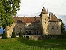 |
Allaman Castle | 520.063 | 147.196 | 46°28′17″N 6°23′52″E / 46.471317°N 6.397841°E |
Arnex-sur-Orbe
| KGS No.? |
Picture | Name | Street Address | CH1903 X coordinate | CH1903 Y coordinate | Location |
|---|---|---|---|---|---|---|
| Unknown | ISOS village: Arnex-sur-Orbe |
Arzier
| KGS No.? |
Picture | Name | Street Address | CH1903 X coordinate | CH1903 Y coordinate | Location |
|---|---|---|---|---|---|---|
| 9687 |  |
Chartreuse D’Oujon and House Basse | Monastère Médiéval | 503.480 | 146.670 | 46°27′52″N 6°10′55″E / 46.464402°N 6.182071°E |
Aubonne
| KGS No.? |
Picture | Name | Street Address | CH1903 X coordinate | CH1903 Y coordinate | Location |
|---|---|---|---|---|---|---|
| 10315 | .jpg) |
Former Federal Powder Mill | Chemin De La Vaux 48 | 520.514 | 148.916 | 46°29′13″N 6°24′12″E / 46.486842°N 6.403417°E |
| 5905 | 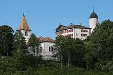 |
Aubonne Castle | 519.596 | 150.026 | 46°29′48″N 6°23′29″E / 46.496716°N 6.39127°E | |
| 5908 | 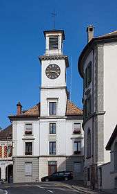 |
City Hall and grenette | Grande Rue 2 | 519.580 | 149.890 | 46°29′44″N 6°23′28″E / 46.495491°N 6.391085°E |
| 5910 | .jpg) |
D’Aspre House with Orangery | Le clos d’Aspre | 519.650 | 149.775 | 46°29′40″N 6°23′31″E / 46.494465°N 6.392016°E |
| 5911 |  |
Manoir et manège | Bougy-Saint-Martin 6 | 518.853 | 149.629 | 46°29′35″N 6°22′54″E / 46.493056°N 6.381662°E |
| Unknown | ISOS petite City / bourg: Aubonne | |||||
| Unknown | ISOS cas particulier: Poudrerie fédérale |
Avenches
| KGS No.? |
Picture | Name | Street Address | CH1903 X coordinate | CH1903 Y coordinate | Location |
|---|---|---|---|---|---|---|
| 5918, 5913 | 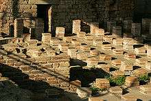 |
Aventicum , Roman City |
570.400 | 192.400 | 46°52′55″N 7°03′01″E / 46.882059°N 7.050307°E | |
| 5915 |  |
Avenches Castle | Rue du Château | 569.700 | 192.323 | 46°52′53″N 7°02′28″E / 46.881334°N 7.041129°E |
| 5920 |  |
Cure | Rue du Jura 2 | 569.636 | 192.281 | 46°52′51″N 7°02′25″E / 46.880954°N 7.040292°E |
| 5923 |  |
Swiss Reformed Church | Place de l’Eglise | 569.664 | 192.201 | 46°52′49″N 7°02′26″E / 46.880235°N 7.040665°E |
| 6051 |  |
Temple à Donatyre | Route de Villarepos | 570.990 | 191.790 | 46°52′36″N 7°03′29″E / 46.876597°N 7.058086°E |
| 10508 |  |
L’évêque Tower with Amphitheatre and Roman Museum | 569.860 | 192.300 | 46°52′52″N 7°02′36″E / 46.881135°N 7.043229°E | |
| Unknown | ISOS petite City / bourg: Avenches | |||||
| Unknown | ISOS cas particulier: Haras fédéral |
Baulmes
| KGS No.? |
Picture | Name | Street Address | CH1903 X coordinate | CH1903 Y coordinate | Location |
|---|---|---|---|---|---|---|
| 5927 | Abri De La Cure Prehistoric Shelter |
529.700 | 182.800 | 46°47′34″N 6°31′04″E / 46.792652°N 6.517865°E | ||
| 11687 |  |
Beffroi communal | Place de la Tour | 529.965 | 182.585 | 46°47′27″N 6°31′17″E / 46.790746°N 6.521369°E |
| Unknown | ISOS village: Baulmes |
Begnins
| KGS No.? |
Picture | Name | Street Address | CH1903 X coordinate | CH1903 Y coordinate | Location |
|---|---|---|---|---|---|---|
| Unknown | ISOS village: Begnins |
Bex
| KGS No.? |
Picture | Name | Street Address | CH1903 X coordinate | CH1903 Y coordinate | Location |
|---|---|---|---|---|---|---|
| 5946 |  |
Church Bell Tower | 567.125 | 122.290 | 46°15′04″N 7°00′44″E / 46.251237°N 7.012338°E | |
| 5945 |  |
Salt Mining Complex | Route de Gryon 29 | 568.457 | 123.312 | 46°15′38″N 7°01′46″E / 46.260494°N 7.029541°E |
| 5948 |  |
Fortifications de l’Arzillier | 566.720 | 119.440 | 46°13′32″N 7°00′26″E / 46.22558°N 7.00729°E | |
| 10498 |  |
Bridge over the Rhone River Shared with St-Maurice in Valais. |
Route de Saint-Maurice / Route du Chablais | 566.421 | 119.207 | 46°13′24″N 7°00′12″E / 46.223469°N 7.003431°E |
| Unknown | ISOS village: Les Posses | |||||
| Unknown | ISOS cas particulier: Le Bévieux |
Blonay
| KGS No.? |
Picture | Name | Street Address | CH1903 X coordinate | CH1903 Y coordinate | Location |
|---|---|---|---|---|---|---|
| 5956 |  |
Blonay Castle | Chemin Du Château | 557.849 | 146.616 | 46°28′10″N 6°53′23″E / 46.469542°N 6.889852°E |
Bofflens
| KGS No.? |
Picture | Name | Street Address | CH1903 X coordinate | CH1903 Y coordinate | Location |
|---|---|---|---|---|---|---|
| Unknown | ISOS village: Bofflens |
Bonvillars
| KGS No.? |
Picture | Name | Street Address | CH1903 X coordinate | CH1903 Y coordinate | Location |
|---|---|---|---|---|---|---|
| Unknown | ISOS village: Bonvillars |
Bougy-Villars
| KGS No.? |
Picture | Name | Street Address | CH1903 X coordinate | CH1903 Y coordinate | Location |
|---|---|---|---|---|---|---|
| Unknown | ISOS village: Bougy-Villars |
Bourg-en-Lavaux
| KGS No.? |
Picture | Name | Street Address | CH1903 X coordinate | CH1903 Y coordinate | Location |
|---|---|---|---|---|---|---|
| 6106 |  |
Maison Maillardoz | Rue Saint-Georges 11 | 544.618 | 149.426 | 46°29′38″N 6°43′02″E / 46.493855°N 6.717263°E |
| Unknown | UNESCO World Heritage Site: Lavaux, Vineyard Terraces | |||||
| Unknown | ISOS village: Grandvaux | |||||
| Unknown | ISOS village: Riex | |||||
| Unknown | ISOS village: Aran | |||||
| Unknown | ISOS petite City / bourg: Cully | |||||
| Unknown | ISOS village: Epesses |
Bursinel
| KGS No.? |
Picture | Name | Street Address | CH1903 X coordinate | CH1903 Y coordinate | Location |
|---|---|---|---|---|---|---|
| 5964 | Villa Choisy and Outbuildings | Choisy | 513.759 | 143.783 | 46°26′23″N 6°18′59″E / 46.439836°N 6.316408°E |
Bursins
| KGS No.? |
Picture | Name | Street Address | CH1903 X coordinate | CH1903 Y coordinate | Location |
|---|---|---|---|---|---|---|
| 5968 |  |
Swiss Reformed Church of Saint-Martin, Formerly Site of a Priory |
Rue de l’Eglise | 511.734 | 145.292 | 46°27′11″N 6°17′23″E / 46.453146°N 6.289774°E |
| 11665 | Tuilerie de Vinzel avec four Hoffmann | En Beroche | 511.275 | 144.683 | 46°26′51″N 6°17′02″E / 46.447607°N 6.283917°E | |
| Unknown | ISOS village: Bursins |
Burtigny
| KGS No.? |
Picture | Name | Street Address | CH1903 X coordinate | CH1903 Y coordinate | Location |
|---|---|---|---|---|---|---|
| Unknown | ISOS village: Burtigny |
Champagne
| KGS No.? |
Picture | Name | Street Address | CH1903 X coordinate | CH1903 Y coordinate | Location |
|---|---|---|---|---|---|---|
| Unknown | ISOS village: Champagne |
Champvent
| KGS No.? |
Picture | Name | Street Address | CH1903 X coordinate | CH1903 Y coordinate | Location |
|---|---|---|---|---|---|---|
| 5970 |  |
Champvent Castle | Chemin Du Château | 533.758 | 181.231 | 46°46′44″N 6°34′16″E / 46.778955°N 6.571238°E |
| 5971 | Manoir de Saint-Christophe | Saint-Christophe | 532.061 | 180.580 | 46°46′23″N 6°32′57″E / 46.772929°N 6.549116°E | |
| Unknown | ISOS cas particulier: Champvent | |||||
| Unknown | ISOS cas particulier: Saint-Christophe |
Chardonne
| KGS No.? |
Picture | Name | Street Address | CH1903 X coordinate | CH1903 Y coordinate | Location |
|---|---|---|---|---|---|---|
| Unknown | UNESCO World Heritage Site: Lavaux, Vineyard Terraces |
Château-d'Œx
| KGS No.? |
Picture | Name | Street Address | CH1903 X coordinate | CH1903 Y coordinate | Location |
|---|---|---|---|---|---|---|
| Unknown | Les Ciernes-Picat Mesolithic Shelter |
|||||
| Unknown | ISOS hameau: l’Etivaz |
Chavannes-le-Chêne
| KGS No.? |
Picture | Name | Street Address | CH1903 X coordinate | CH1903 Y coordinate | Location |
|---|---|---|---|---|---|---|
| 10509 | Vallon Des Vaux, Prehistoric and High Middle Ages Settlement |
548.700 | 180.650 | 46°46′30″N 6°46′01″E / 46.775047°N 6.766949°E |
Chavannes-le-Veyron
| KGS No.? |
Picture | Name | Street Address | CH1903 X coordinate | CH1903 Y coordinate | Location |
|---|---|---|---|---|---|---|
| 10319 |  |
Scierie | Veyron Les Charbonnières 49, 31 | 524.280 | 161.843 | 46°36′13″N 6°27′01″E / 46.603555°N 6.450339°E |
Chavannes-près-Renens
| KGS No.? |
Picture | Name | Street Address | CH1903 X coordinate | CH1903 Y coordinate | Location |
|---|---|---|---|---|---|---|
| 8792 |  |
Cantonal Archives of Vaud | Rue De La Mouline 32 | 533.980 | 153.071 | 46°31′32″N 6°34′41″E / 46.525679°N 6.578188°E |
Chavannes-sur-Moudon
| KGS No.? |
Picture | Name | Street Address | CH1903 X coordinate | CH1903 Y coordinate | Location |
|---|---|---|---|---|---|---|
| Unknown | ISOS village: Chavannes-sur-Moudon |
Chavornay
| KGS No.? |
Picture | Name | Street Address | CH1903 X coordinate | CH1903 Y coordinate | Location |
|---|---|---|---|---|---|---|
| 5984 |  |
Swiss Reformed Church of Saint-Maurice | En Couvalau | 533.596 | 172.628 | 46°42′06″N 6°34′13″E / 46.701556°N 6.570364°E |
Chêne-Pâquier
| KGS No.? |
Picture | Name | Street Address | CH1903 X coordinate | CH1903 Y coordinate | Location |
|---|---|---|---|---|---|---|
| 5985 |  |
Temple Et Cure | Le Pâquier | 548.460 | 180.140 | 46°46′14″N 6°45′50″E / 46.770441°N 6.763864°E |
| Unknown | ISOS cas particulier: Chêne-Pâquier |
Cheseaux-Noréaz
| KGS No.? |
Picture | Name | Street Address | CH1903 X coordinate | CH1903 Y coordinate | Location |
|---|---|---|---|---|---|---|
| 5990 |  |
Campagne De Champittet | Château De Champittet | 540.989 | 181.670 | 46°47′01″N 6°39′57″E / 46.783584°N 6.665861°E |
Chéserex
| KGS No.? |
Picture | Name | Street Address | CH1903 X coordinate | CH1903 Y coordinate | Location |
|---|---|---|---|---|---|---|
| 5993 |  |
Church of the Old Bonmont Abbey | Bonmont | 500.839 | 139.872 | 46°24′10″N 6°08′57″E / 46.402873°N 6.149149°E |
Chexbres
| KGS No.? |
Picture | Name | Street Address | CH1903 X coordinate | CH1903 Y coordinate | Location |
|---|---|---|---|---|---|---|
| Unknown | UNESCO World Heritage Site: Lavaux, Vineyard Terraces |
Concise
| KGS No.? |
Picture | Name | Street Address | CH1903 X coordinate | CH1903 Y coordinate | Location |
|---|---|---|---|---|---|---|
| 6005 | Ancienne Chartreuse De La Lance | La Lance | 546.514 | 189.998 | 46°51′32″N 6°44′14″E / 46.858961°N 6.737235°E | |
| 6006 |  |
La Raisse / En Favarges Roman Quarry |
547.100 | 190.250 | 46°51′41″N 6°44′42″E / 46.861274°N 6.74489°E | |
| 9690 |  |
Sous-Colachoz Bay and Lakeshore Neolithic and Bronze Age Settlements |
545.000 | 188.700 | 46°50′50″N 6°43′03″E / 46.847162°N 6.717538°E | |
| Unknown | ISOS village: Concise | |||||
| Unknown | ISOS cas particulier: La Lance |
Coppet
| KGS No.? |
Picture | Name | Street Address | CH1903 X coordinate | CH1903 Y coordinate | Location |
|---|---|---|---|---|---|---|
| 6010, 9174 | 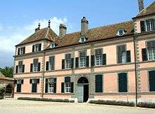 |
Coppet Castle and Institut Européen De L’Université De Genève, Centre D’Archives Européennes |
Rue de la Gare 2 | 503.985 | 130.290 | 46°19′02″N 6°11′31″E / 46.317145°N 6.192032°E |
| 6013 | .JPG) |
Temple (Former Church of the Dominicans) |
Grand’Rue | 504.064 | 130.141 | 46°18′57″N 6°11′35″E / 46.315816°N 6.193088°E |
| Unknown | ISOS petite City / bourg: Coppet |
Corcelles-près-Concise
| KGS No.? |
Picture | Name | Street Address | CH1903 X coordinate | CH1903 Y coordinate | Location |
|---|---|---|---|---|---|---|
| Unknown | ISOS village: Corcelles-près-Concise |
Corseaux
| KGS No.? |
Picture | Name | Street Address | CH1903 X coordinate | CH1903 Y coordinate | Location |
|---|---|---|---|---|---|---|
| 6020 |  |
Villa Le Lac | Route De Lavaux 21 | 553.210 | 146.525 | 46°28′06″N 6°49′46″E / 46.468415°N 6.829466°E |
| Unknown | UNESCO World Heritage Site: Lavaux, Vineyard Terraces |
Corsier-sur-Vevey
| KGS No.? |
Picture | Name | Street Address | CH1903 X coordinate | CH1903 Y coordinate | Location |
|---|---|---|---|---|---|---|
| 6021 |  |
Café De La Place | Place Du Temple 5 | 554.141 | 146.754 | 46°28′14″N 6°50′30″E / 46.47054°N 6.841564°E |
| 6022 | Manoir de Ban: House de maître with Outbuildings and Park |
Route de Fénil 2 | 554.903 | 147.293 | 46°28′32″N 6°51′05″E / 46.47544°N 6.851432°E | |
| Unknown | UNESCO World Heritage Site: Lavaux, Vineyard Terraces |
Cossonay
| KGS No.? |
Picture | Name | Street Address | CH1903 X coordinate | CH1903 Y coordinate | Location |
|---|---|---|---|---|---|---|
| 6029 |  |
Swiss Reformed Church of St-Pierre and St-Paul | Place Du Temple | 528.800 | 162.970 | 46°36′51″N 6°30′33″E / 46.614189°N 6.509155°E |
| Unknown | ISOS petite City / bourg: Cossonay | |||||
| Unknown | ISOS village: La Chaux |
Crans-près-Céligny
| KGS No.? |
Picture | Name | Street Address | CH1903 X coordinate | CH1903 Y coordinate | Location |
|---|---|---|---|---|---|---|
| 6031 |  |
Crans Castle | Château De Crans | 505.352 | 134.784 | 46°21′28″N 6°12′32″E / 46.357761°N 6.208863°E |
Cronay
| KGS No.? |
Picture | Name | Street Address | CH1903 X coordinate | CH1903 Y coordinate | Location |
|---|---|---|---|---|---|---|
| Unknown | ISOS village: Cronay |
Cuarnens
| KGS No.? |
Picture | Name | Street Address | CH1903 X coordinate | CH1903 Y coordinate | Location |
|---|---|---|---|---|---|---|
| Unknown | ISOS village: Cuarnens |
Cudrefin
| KGS No.? |
Picture | Name | Street Address | CH1903 X coordinate | CH1903 Y coordinate | Location |
|---|---|---|---|---|---|---|
| 6034 |  |
Fountain of Justice | Place De La Justice | 568.022 | 200.547 | 46°57′19″N 7°01′07″E / 46.955232°N 7.018538°E |
| Unknown | ISOS village: Montet |
Curtilles
| KGS No.? |
Picture | Name | Street Address | CH1903 X coordinate | CH1903 Y coordinate | Location |
|---|---|---|---|---|---|---|
| 6045 |  |
Curtilles Castle | Au Village | 554.844 | 172.069 | 46°41′54″N 6°50′54″E / 46.698304°N 6.848237°E |
Daillens
| KGS No.? |
Picture | Name | Street Address | CH1903 X coordinate | CH1903 Y coordinate | Location |
|---|---|---|---|---|---|---|
| 6047 |  |
Clocher Du Temple | Au Village | 531.840 | 163.640 | 46°37′14″N 6°32′55″E / 46.620532°N 6.548738°E |
Démoret
| KGS No.? |
Picture | Name | Street Address | CH1903 X coordinate | CH1903 Y coordinate | Location |
|---|---|---|---|---|---|---|
| Unknown | ISOS village: Démoret |
Donneloye
| KGS No.? |
Picture | Name | Street Address | CH1903 X coordinate | CH1903 Y coordinate | Location |
|---|---|---|---|---|---|---|
| Unknown | ISOS village: Prahins |
Duillier
| KGS No.? |
Picture | Name | Street Address | CH1903 X coordinate | CH1903 Y coordinate | Location |
|---|---|---|---|---|---|---|
| 6053 |  |
Duillier Castle | Rue Du Château | 507.389 | 140.207 | 46°24′25″N 6°14′03″E / 46.406822°N 6.234244°E |
| 6054 | .jpg) |
Grange des Dîmes | Verchère | 507.280 | 140.380 | 46°24′30″N 6°13′58″E / 46.408363°N 6.232792°E |
Dully
| KGS No.? |
Picture | Name | Street Address | CH1903 X coordinate | CH1903 Y coordinate | Location |
|---|---|---|---|---|---|---|
| 6055 | Dully Castle and Out Buildings | Rue Du Village | 512.095 | 142.652 | 46°25′46″N 6°17′42″E / 46.429447°N 6.294973°E |
Echichens
| KGS No.? |
Picture | Name | Street Address | CH1903 X coordinate | CH1903 Y coordinate | Location |
|---|---|---|---|---|---|---|
| 6492 |  |
Mestral Castle | Saint-Saphorin-sur-Morges, Le Pavé | 527.054 | 155.339 | 46°32′43″N 6°29′15″E / 46.54536°N 6.487571°E |
| Unknown | ISOS village: Saint-Saphorin-sur-Morges | |||||
| Unknown | ISOS village: Colombier |
Eclépens
| KGS No.? |
Picture | Name | Street Address | CH1903 X coordinate | CH1903 Y coordinate | Location |
|---|---|---|---|---|---|---|
| 6063 |  |
Abandoned D’Entreroches Canal | 532.260 | 168.194 | 46°39′42″N 6°33′13″E / 46.661538°N 6.55355°E | |
| 11776 |  |
Le Mormont Proto-Historic through Iron Age Site |
530.730 | 167.500 | 46°39′19″N 6°32′01″E / 46.655139°N 6.533666°E | |
| Unknown | ISOS village: Eclépens |
Écublens
| KGS No.? |
Picture | Name | Street Address | CH1903 X coordinate | CH1903 Y coordinate | Location |
|---|---|---|---|---|---|---|
| 10596 |  |
Archives of Modern Construction, EPFL, SG-Ecublens |
532.880 | 152.557 | 46°31′15″N 6°33′50″E / 46.520946°N 6.563928°E | |
| 8933, 9348 |  |
Cantonal and University Library of Lausanne and University of Lausanne, Manuscripts Department |
Allée de Dorigny | 534.078 | 152.738 | 46°31′22″N 6°34′46″E / 46.522693°N 6.579513°E |
| 9159 | .jpg) |
Jean Monnet Foundation for Europe | Route de la Sorge | 534.299 | 152.880 | 46°31′26″N 6°34′57″E / 46.523992°N 6.582373°E |
Essertines-sur-Rolle
| KGS No.? |
Picture | Name | Street Address | CH1903 X coordinate | CH1903 Y coordinate | Location |
|---|---|---|---|---|---|---|
| Unknown | ISOS hameau: Bugnaux |
Essertines-sur-Yverdon
| KGS No.? |
Picture | Name | Street Address | CH1903 X coordinate | CH1903 Y coordinate | Location |
|---|---|---|---|---|---|---|
| Unknown | ISOS village: Essertines-sur-Yverdon |
Etoy
| KGS No.? |
Picture | Name | Street Address | CH1903 X coordinate | CH1903 Y coordinate | Location |
|---|---|---|---|---|---|---|
| Unknown | ISOS village: Etoy |
Faoug
| KGS No.? |
Picture | Name | Street Address | CH1903 X coordinate | CH1903 Y coordinate | Location |
|---|---|---|---|---|---|---|
| 10322 |  |
Domaine Cornaz et ses dépendances | Route de Salavaux | 572.340 | 195.278 | 46°54′29″N 7°04′32″E / 46.90803°N 7.075583°E |
Féchy
| KGS No.? |
Picture | Name | Street Address | CH1903 X coordinate | CH1903 Y coordinate | Location |
|---|---|---|---|---|---|---|
| 6072 | La Gordanne, Main House and Out Buildings |
Route Suisse 6 | 518.485 | 146.761 | 46°28′02″N 6°22′39″E / 46.467214°N 6.377374°E | |
| Unknown | ISOS village: Féchy |
Ferreyres
| KGS No.? |
Picture | Name | Street Address | CH1903 X coordinate | CH1903 Y coordinate | Location |
|---|---|---|---|---|---|---|
| Unknown | ISOS village: Ferreyres |
Fiez
| KGS No.? |
Picture | Name | Street Address | CH1903 X coordinate | CH1903 Y coordinate | Location |
|---|---|---|---|---|---|---|
| Unknown | ISOS village: Fiez |
Fontaines-sur-Grandson
| KGS No.? |
Picture | Name | Street Address | CH1903 X coordinate | CH1903 Y coordinate | Location |
|---|---|---|---|---|---|---|
| Unknown | ISOS village: Fontaines-sur-Grandson |
Giez
| KGS No.? |
Picture | Name | Street Address | CH1903 X coordinate | CH1903 Y coordinate | Location |
|---|---|---|---|---|---|---|
| Unknown | ISOS cas particulier: Giez |
Gilly
| KGS No.? |
Picture | Name | Street Address | CH1903 X coordinate | CH1903 Y coordinate | Location |
|---|---|---|---|---|---|---|
| 6082 | Campagne De Beaulieu | Route De Genève 68 | 513.805 | 144.670 | 46°26′52″N 6°19′01″E / 46.44782°N 6.316842°E | |
| 6081 |  |
Vincy Castle | Vincy 2 | 512.611 | 146.269 | 46°27′43″N 6°18′04″E / 46.462048°N 6.301003°E |
| 10323 |  |
Farm House ECA 148 | La Rue 14 | 512.281 | 145.898 | 46°27′31″N 6°17′48″E / 46.458668°N 6.296778°E |
Gimel
| KGS No.? |
Picture | Name | Street Address | CH1903 X coordinate | CH1903 Y coordinate | Location |
|---|---|---|---|---|---|---|
| Unknown | ISOS village: Gimel |
Givrins
| KGS No.? |
Picture | Name | Street Address | CH1903 X coordinate | CH1903 Y coordinate | Location |
|---|---|---|---|---|---|---|
| Unknown | ISOS village: Givrins |
Gland
| KGS No.? |
Picture | Name | Street Address | CH1903 X coordinate | CH1903 Y coordinate | Location |
|---|---|---|---|---|---|---|
| 10325 |  |
La Rajada Villa, Out Buildings and Lands |
511.644 | 141.119 | 46°24′56″N 6°17′22″E / 46.415599°N 6.289398°E |
Grandcour
| KGS No.? |
Picture | Name | Street Address | CH1903 X coordinate | CH1903 Y coordinate | Location |
|---|---|---|---|---|---|---|
| 6093 |  |
Grandcour Castle | Au Village | 561.223 | 191.519 | 46°52′25″N 6°55′48″E / 46.873662°N 6.929989°E |
| 6092 |  |
Swiss Reformed Church of Notre-Dame de Ressudens | Ressudens | 562.580 | 191.220 | 46°52′16″N 6°56′52″E / 46.87105°N 6.947813°E |
| Unknown | ISOS village: Grandcour |
Grandson
| KGS No.? |
Picture | Name | Street Address | CH1903 X coordinate | CH1903 Y coordinate | Location |
|---|---|---|---|---|---|---|
| 6094 |  |
Grandson Castle | Place Du Château 14 | 539.582 | 184.584 | 46°48′35″N 6°38′49″E / 46.809669°N 6.647052°E |
| 6095 |  |
Swiss Reformed Church of Saint-Jean-Baptiste | Rue Haute | 539.324 | 184.447 | 46°48′30″N 6°38′37″E / 46.808413°N 6.64369°E |
| Unknown | ISOS petite City / bourg: Grandson |
Gressy
| KGS No.? |
Picture | Name | Street Address | CH1903 X coordinate | CH1903 Y coordinate | Location |
|---|---|---|---|---|---|---|
| 10991 |  |
Oppidum De Sermuz, Iron Age Settlement |
539.400 | 178.700 | 46°45′24″N 6°38′44″E / 46.756726°N 6.645447°E |
Gryon
| KGS No.? |
Picture | Name | Street Address | CH1903 X coordinate | CH1903 Y coordinate | Location |
|---|---|---|---|---|---|---|
| Unknown | ISOS village urbanisé: Gryon | |||||
| Unknown | ISOS cas particulier: Taveyanne |
Jongny
| KGS No.? |
Picture | Name | Street Address | CH1903 X coordinate | CH1903 Y coordinate | Location |
|---|---|---|---|---|---|---|
| Unknown | UNESCO World Heritage Site: Lavaux, Vineyard Terraces |
Jorat-Mézières
| KGS No.? |
Picture | Name | Street Address | CH1903 X coordinate | CH1903 Y coordinate | Location |
|---|---|---|---|---|---|---|
| 6234 |  |
Théâtre Du Jorat | Rue Du Théâtre, Mézières | 548.892 | 160.965 | 46°35′53″N 6°46′18″E / 46.597992°N 6.771653°E |
Jouxtens-Mézery
| KGS No.? |
Picture | Name | Street Address | CH1903 X coordinate | CH1903 Y coordinate | Location |
|---|---|---|---|---|---|---|
| Unknown | ISOS cas particulier: Jouxtens-Mézery |
L'Abbaye
| KGS No.? |
Picture | Name | Street Address | CH1903 X coordinate | CH1903 Y coordinate | Location |
|---|---|---|---|---|---|---|
| 5885 |  |
Manoir De Haute Roche | Le Pont | 515.338 | 169.127 | 46°40′05″N 6°19′56″E / 46.667999°N 6.332303°E |
| Unknown | ISOS village: Le Pont |
La Sarraz
| KGS No.? |
Picture | Name | Street Address | CH1903 X coordinate | CH1903 Y coordinate | Location |
|---|---|---|---|---|---|---|
| 6466 |  |
Chapelle Saint-Antoine | Dite Du Jacquemart, Grand-Rue | 529.280 | 168.014 | 46°39′35″N 6°30′53″E / 46.65961°N 6.514645°E |
| 6467 |  |
La Sarraz Castle | Rue du Château | 529.241 | 168.102 | 46°39′37″N 6°30′51″E / 46.660397°N 6.514122°E |
| Unknown | ISOS petite City / bourg: La Sarraz |
La Tour-de-Peilz
| KGS No.? |
Picture | Name | Street Address | CH1903 X coordinate | CH1903 Y coordinate | Location |
|---|---|---|---|---|---|---|
| 6502 | .jpg) |
Villa Kenwin | Chemin Du Vallon 19 | 556.936 | 144.117 | 46°26′49″N 6°52′42″E / 46.447004°N 6.878198°E |
Lausanne
| KGS No.? |
Picture | Name | Street Address | CH1903 X coordinate | CH1903 Y coordinate | Location |
|---|---|---|---|---|---|---|
| 6116 |  |
Former Hôpital | Rue Mercerie 24 | 538.375 | 152.555 | 46°31′17″N 6°38′08″E / 46.521456°N 6.635534°E |
| 6117 | .jpg) |
Former Federal Supreme Court of Switzerland (Montbenon) | Allée Ernest-Ansermet 2 | 537.707 | 152.463 | 46°31′14″N 6°37′37″E / 46.520567°N 6.626841°E |
| 6118, 8714 |  |
Former Residence of the Bishop of Lausanne and the Historical Museum of Lausanne |
Place de la Cathédrale 4 | 538.331 | 152.642 | 46°31′20″N 6°38′06″E / 46.522235°N 6.634949°E |
| 6119 |  |
Former Académie | Rue Cité-Devant 7 | 538.334 | 152.804 | 46°31′25″N 6°38′06″E / 46.523692°N 6.634966°E |
| 11779 | 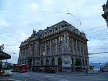 |
Archives of the Banque Vaudoise | Place Saint-François | 538.300 | 152.280 | 46°31′08″N 6°38′05″E / 46.518975°N 6.634593°E |
| 8777 |  |
Archives of the City of Lausanne | Rue du Maupas 47 | 537.528 | 152.973 | 46°31′30″N 6°37′28″E / 46.525137°N 6.62444°E |
| 11837 |  |
Archives of l’Energie Ouest Suisse (EOS) | Chemin de Mornex 10 | 537.840 | 152.260 | 46°31′08″N 6°37′43″E / 46.518753°N 6.628602°E |
| 11781 |  |
Bibliothèque des Cèdres (former Bibliothèque des pasteurs) | Chemin des Cèdres 7 | 537.730 | 153.011 | 46°31′32″N 6°37′37″E / 46.525498°N 6.627067°E |
| 6122 |  |
Casino de Montbenon | Allée Ernest-Ansermet 3 | 537.569 | 152.444 | 46°31′13″N 6°37′30″E / 46.520383°N 6.625046°E |
| 6123 |  |
Notre-Dame Cathedral | Place de la Cathédrale | 538.370 | 152.680 | 46°31′21″N 6°38′08″E / 46.52258°N 6.635452°E |
| 8977 |  |
University Hospital of Lausanne (CHUV) | Rue du Bugnon 46 | 538.922 | 152.927 | 46°31′29″N 6°38′33″E / 46.524852°N 6.642613°E |
| 6124 |  |
Château Saint-Maire | Place du château 4 | 538.375 | 152.926 | 46°31′29″N 6°38′08″E / 46.524793°N 6.635484°E |
| 6150, 8697 | 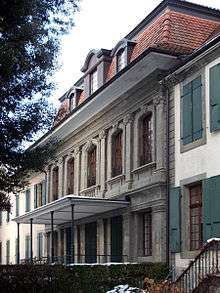 |
Beaulieu Castle and Collection de l’Art brut (Collection of Outsider art) |
Avenue des Bergières 11 | 537.570 | 153.200 | 46°31′38″N 6°37′30″E / 46.527183°N 6.624956°E |
| 10327 |  |
Bois-de-Vaux Cemetery | Route de Chavannes 2 | 535.835 | 152.222 | 46°31′06″N 6°36′09″E / 46.518222°N 6.602481°E |
| 9694 | |
Roman era/Medieval Hill Top City | 537.700 | 152.880 | 46°31′28″N 6°37′36″E / 46.524317°N 6.626694°E | |
| 6136 |  |
Swiss Reformed Church of Saint-François | Place Saint-François 18 | 538.220 | 152.360 | 46°31′11″N 6°38′01″E / 46.519688°N 6.63354°E |
| 6203 |  |
Swiss Reformed Church of Saint-Laurent | Rue Haldimand | 538.020 | 152.650 | 46°31′20″N 6°37′51″E / 46.522278°N 6.630895°E |
| 6173, 8698 |  |
Fondation de l’Hermitage, House de maître |
Route du Signal 2 | 538.513 | 153.302 | 46°31′41″N 6°38′14″E / 46.528188°N 6.637233°E |
| 8667 |  |
Fondation Toms Pauli Collection de tapisseries and d’art textile |
Rue Caroline 2 | 538.502 | 152.424 | 46°31′13″N 6°38′14″E / 46.520289°N 6.637206°E |
| 6164 |  |
Galeries Saint-François | 538.323 | 152.358 | 46°31′11″N 6°38′06″E / 46.519679°N 6.634882°E | |
| 6126 |  |
Main Train Station | Place de la Gare | 537.882 | 152.067 | 46°31′01″N 6°37′45″E / 46.517021°N 6.629175°E |
| 6190 |  |
Hôtel Beau-Rivage Palace | Chemin de Beau-Rivage | 537.950 | 151.050 | 46°30′28″N 6°37′49″E / 46.507879°N 6.630197°E |
| 6127 | .jpg) |
City Hall | Place de la Palud 2 | 538.172 | 152.588 | 46°31′18″N 6°37′58″E / 46.521734°N 6.632884°E |
| 6198 | 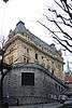 |
Hôtel des Postes | Place Saint-François 15 | 538.172 | 152.322 | 46°31′10″N 6°37′59″E / 46.519341°N 6.632919°E |
| 10510 |  |
Administration Building of André & Cie. S.A., | Chemin Messidor 5, 7 | 538.798 | 151.828 | 46°30′54″N 6°38′28″E / 46.514955°N 6.641142°E |
| 10331 |  |
Administration Building of the Vaudoise Assurances | Avenue de Cour 41 | 537.146 | 151.760 | 46°30′51″N 6°37′11″E / 46.514191°N 6.619626°E |
| 6169 |  |
Apartment and Office Building | Rue du Grand-Chêne 8 | 538.020 | 152.376 | 46°31′11″N 6°37′51″E / 46.519813°N 6.630932°E |
| 9032 | |
Les Bains de Bellerive | Avenue de Rhodanie 23 | 536.925 | 151.489 | 46°30′42″N 6°37′00″E / 46.511732°N 6.616784°E |
| 11682 |  |
l’Estérel House | Avenue d’Ouchy 16–18 | 537.953 | 151.639 | 46°30′47″N 6°37′49″E / 46.513178°N 6.630157°E |
| 6177, 8711 |  |
Musée de l'Élysée et maison de l'Élysée | Avenue de l'Élysée 18 | 538.158 | 151.275 | 46°30′36″N 6°37′58″E / 46.509922°N 6.632877°E |
| 11782 |  |
House | Chemin de Chandolin 4 | 539.197 | 152.124 | 46°31′04″N 6°38′47″E / 46.517654°N 6.646302°E |
| 6128 |  |
Mon-Repos, park, home, fountain, stables, orangery and Temple of Love |
Parc de Mon-Repos 1 | 538.927 | 152.269 | 46°31′08″N 6°38′34″E / 46.518934°N 6.642765°E |
| 8701 | %2C_vue_lat%C3%A9rale.jpg) |
Museum of Contemporary Design and Applied Arts (MUDAC) | Place de la Cathédrale 6 | 538.360 | 152.630 | 46°31′20″N 6°38′07″E / 46.522129°N 6.635328°E |
| 8712 | |
Cantonal Museum and Botanical Gardens | Avenue de Cour 14 | 537.456 | 151.607 | 46°30′46″N 6°37′25″E / 46.512843°N 6.623686°E |
| 10674, 11614 |  |
Olympic Museum and Archives of the CIO | Quai d'Ouchy 1 | 538.278 | 151.057 | 46°30′29″N 6°38′04″E / 46.507972°N 6.63447°E |
| 11616 |  |
Roman Museum | Chemin du Bois-de-Vaux 24 | 535.553 | 152.302 | 46°31′08″N 6°35′56″E / 46.518915°N 6.598795°E |
| 6131 |  |
Ouchy, Vessels of the CGN: La Suisse (1910), Savoie (1914), Simplon (1920), Rhône (1927) |
537.000 | 151.150 | 46°30′31″N 6°37′04″E / 46.50869°N 6.617807°E | |
| 6132, 8715, 8699, 8700, 8713, 8837 |  |
Palais de Rumine et Musée cantonal de géologie, Cantonal Museum of Zoology, Cantonal Museum of Fine Arts, Musée monétaire cantonal (Cabinet des médailles) et Musée d’archéologie et d’histoire |
Place de la Riponne 6 | 538.223 | 152.801 | 46°31′25″N 6°38′01″E / 46.523655°N 6.63352°E |
| 6197 |  |
Pont Chauderon | 537.475 | 152.650 | 46°31′20″N 6°37′26″E / 46.522227°N 6.623793°E | |
| 8947 |  |
Radio Suisse Romande Archives |
Avenue du Temple 40 | 539.422 | 153.852 | 46°32′00″N 6°38′56″E / 46.533218°N 6.649007°E |
| 6206 |  |
Rural et site de Vernand-Dessus | Avenue de Vernand-Dessus 2 | 536.891 | 158.334 | 46°34′24″N 6°36′55″E / 46.5733°N 6.615405°E |
| 9485 |  |
Site de l’Expo 64 avec théatre de Vidy | Avenue Emile-H.-Jaques-Dalcroze 5 | 536.491 | 151.608 | 46°30′46″N 6°36′40″E / 46.512762°N 6.611113°E |
| 6202 |  |
Synagogue | Avenue de Florimont | 538.540 | 151.975 | 46°30′59″N 6°38′16″E / 46.516254°N 6.637761°E |
| 6204 |  |
Tour Bel-Air | Place Bel-Air 1 | 537.871 | 152.639 | 46°31′20″N 6°37′44″E / 46.522165°N 6.628955°E |
| 6137, 8837 |  |
Tribunal Fédéral Suisse and Archives | Avenue du Tribunal Fédéral 29 | 539.041 | 152.341 | 46°31′11″N 6°38′39″E / 46.519592°N 6.644241°E |
| 6138 |  |
Vidy / Lousanna prehistoric settlement, Roman era Vicus |
535.700 | 152.000 | 46°30′58″N 6°36′03″E / 46.516212°N 6.600753°E | |
| Unknown | ISOS ville: Lausanne | |||||
| Unknown | ISOS cas particulier: Vernand-Dessus |
Lavigny
| KGS No.? |
Picture | Name | Street Address | CH1903 X coordinate | CH1903 Y coordinate | Location |
|---|---|---|---|---|---|---|
| Unknown | ISOS village: Lavigny |
Le Chenit
| KGS No.? |
Picture | Name | Street Address | CH1903 X coordinate | CH1903 Y coordinate | Location |
|---|---|---|---|---|---|---|
| Unknown | ISOS village urbanisé: Le Sentier | |||||
| Unknown | ISOS village: Le Solliat | |||||
| Unknown | ISOS hameau: Chez-les-Aubert |
Le Lieu
| KGS No.? |
Picture | Name | Street Address | CH1903 X coordinate | CH1903 Y coordinate | Location |
|---|---|---|---|---|---|---|
| Unknown | ISOS village: Le Lieu | |||||
| Unknown | ISOS village: Le Séchey |
Les Clées
| KGS No.? |
Picture | Name | Street Address | CH1903 X coordinate | CH1903 Y coordinate | Location |
|---|---|---|---|---|---|---|
| 5998 |  |
Les Clées Castle with Ruins and Village |
525.400 | 175.960 | 46°43′50″N 6°27′46″E / 46.730661°N 6.462665°E | |
| Unknown | ISOS hameau: La Russille | |||||
| Unknown | ISOS cas particulier: Les Clées |
Les Tavernes
| KGS No.? |
Picture | Name | Street Address | CH1903 X coordinate | CH1903 Y coordinate | Location |
|---|---|---|---|---|---|---|
| 10992 |  |
De Haut Crêt Cistercian Abbey | 12Ème Siècle | 552.350 | 156.350 | 46°33′24″N 6°49′02″E / 46.556734°N 6.817257°E |
Leysin
| KGS No.? |
Picture | Name | Street Address | CH1903 X coordinate | CH1903 Y coordinate | Location |
|---|---|---|---|---|---|---|
| Unknown | ISOS village urbanisé: Leysin | |||||
| Unknown | ISOS hameau: Veyges |
Lignerolle
| KGS No.? |
Picture | Name | Street Address | CH1903 X coordinate | CH1903 Y coordinate | Location |
|---|---|---|---|---|---|---|
| Unknown | ISOS village: Lignerolle |
L'Isle
| KGS No.? |
Picture | Name | Street Address | CH1903 X coordinate | CH1903 Y coordinate | Location |
|---|---|---|---|---|---|---|
| 6111 |  |
L'Isle Castle | Rue Du Château | 521.335 | 163.615 | 46°37′09″N 6°24′42″E / 46.619153°N 6.411603°E |
| Unknown | ISOS cas particulier: L’Isle |
Lonay
| KGS No.? |
Picture | Name | Street Address | CH1903 X coordinate | CH1903 Y coordinate | Location |
|---|---|---|---|---|---|---|
| Unknown | ISOS village: Lonay |
Lovatens
| KGS No.? |
Picture | Name | Street Address | CH1903 X coordinate | CH1903 Y coordinate | Location |
|---|---|---|---|---|---|---|
| Unknown | ISOS village: Lovatens |
Lucens
| KGS No.? |
Picture | Name | Street Address | CH1903 X coordinate | CH1903 Y coordinate | Location |
|---|---|---|---|---|---|---|
| 6220 |  |
Lucens Castle | Rue Du Château | 553.976 | 173.451 | 46°42′38″N 6°50′12″E / 46.710676°N 6.83675°E |
| Unknown | ISOS petite city / bourg: Lucens |
Luins
| KGS No.? |
Picture | Name | Street Address | CH1903 X coordinate | CH1903 Y coordinate | Location |
|---|---|---|---|---|---|---|
| 11683 | .jpg) |
Luins Castle | Au Village | 510.321 | 144.340 | 46°26′40″N 6°16′18″E / 46.444395°N 6.271569°E |
| Unknown | ISOS hameau: Luins |
Lutry
| KGS No.? |
Picture | Name | Street Address | CH1903 X coordinate | CH1903 Y coordinate | Location |
|---|---|---|---|---|---|---|
| 6226 |  |
Lutry Castle/Rôdeurs Castle | Rue Du Château 4 | 542.295 | 150.472 | 46°30′11″N 6°41′13″E / 46.503068°N 6.686876°E |
| 11783 |  |
Roman Catholic Church of Saint-Martin | Route de Taillepied | 541.523 | 150.778 | 46°30′21″N 6°40′36″E / 46.505754°N 6.676781°E |
| 6223 |  |
Swiss Reformed Church Saint-Martin | Place du Temple | 542.267 | 150.412 | 46°30′09″N 6°41′11″E / 46.502526°N 6.686519°E |
| 11784 |  |
Gothic Facade House | Rue du Bourg 8 | 542.265 | 150.465 | 46°30′11″N 6°41′11″E / 46.503003°N 6.686486°E |
| Unknown | UNESCO World Heritage Site: Lavaux, Vineyard Terraces | |||||
| Unknown | ISOS petite City / bourg: Lutry | |||||
| Unknown | ISOS hameau: Châtelard | |||||
| Unknown | ISOS hameau: Savuit |
Maracon
| KGS No.? |
Picture | Name | Street Address | CH1903 X coordinate | CH1903 Y coordinate | Location |
|---|---|---|---|---|---|---|
| 10341 | Farm House and Rural De Praz-Derrey (Eca 31) | Praz-Derrey | 556.441 | 155.391 | 46°32′54″N 6°52′14″E / 46.548386°N 6.870694°E |
Marchissy
| KGS No.? |
Picture | Name | Street Address | CH1903 X coordinate | CH1903 Y coordinate | Location |
|---|---|---|---|---|---|---|
| Unknown | ISOS village: Marchissy |
Mathod
| KGS No.? |
Picture | Name | Street Address | CH1903 X coordinate | CH1903 Y coordinate | Location |
|---|---|---|---|---|---|---|
| 6231 | |
Mathod Castle | Route De Suscevaz | 533.345 | 179.781 | 46°45′57″N 6°33′58″E / 46.765872°N 6.566042°E |
Mex
| KGS No.? |
Picture | Name | Street Address | CH1903 X coordinate | CH1903 Y coordinate | Location |
|---|---|---|---|---|---|---|
| 6233 |  |
D’En-Bas Castle | Route De Cossonay 1 | 531.982 | 158.781 | 46°34′37″N 6°33′05″E / 46.57684°N 6.551309°E |
| Unknown | ISOS village: Mex (VD) |
Mollens
| KGS No.? |
Picture | Name | Street Address | CH1903 X coordinate | CH1903 Y coordinate | Location |
|---|---|---|---|---|---|---|
| Unknown | ISOS village: Mollens |
Molondin
| KGS No.? |
Picture | Name | Street Address | CH1903 X coordinate | CH1903 Y coordinate | Location |
|---|---|---|---|---|---|---|
| 6236 | 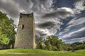 |
Saint-Martin-Du-Chêne Castle Ruins and an Abandoned Settlement |
548.100 | 180.710 | 46°46′32″N 6°45′33″E / 46.77554°N 6.759087°E | |
| Unknown | ISOS village: Molondin |
Montanaire
| KGS No.? |
Picture | Name | Street Address | CH1903 X coordinate | CH1903 Y coordinate | Location |
|---|---|---|---|---|---|---|
| Unknown | ISOS village: Denezy |
Montcherand
| KGS No.? |
Picture | Name | Street Address | CH1903 X coordinate | CH1903 Y coordinate | Location |
|---|---|---|---|---|---|---|
| 6239 |  |
Swiss Reformed Church of Sainte-Etienne | Au Village | 529.075 | 176.130 | 46°43′57″N 6°30′39″E / 46.732591°N 6.510713°E |
| Unknown | ISOS village: Montcherand |
Mont-la-Ville
| KGS No.? |
Picture | Name | Street Address | CH1903 X coordinate | CH1903 Y coordinate | Location |
|---|---|---|---|---|---|---|
| 10993 |  |
Rock Shelter at Mollendruz, Prehistoric Settlement |
518.560 | 166.520 | 46°38′42″N 6°22′30″E / 46.644951°N 6.374863°E |
Montreux
| KGS No.? |
Picture | Name | Street Address | CH1903 X coordinate | CH1903 Y coordinate | Location |
|---|---|---|---|---|---|---|
| 8716 | Audiorama, Swiss National Audiovisual Museum | Avenue de Chillon 74 | 560.478 | 141.637 | 46°25′30″N 6°55′28″E / 46.424914°N 6.924504°E | |
| 6250 | .jpg) |
Crêtes Castle | Avenue des Bosquets-de-Julie 13 | 557.906 | 143.908 | 46°26′43″N 6°53′27″E / 46.445186°N 6.89084°E |
| 6240 | 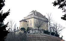 |
Châtelard Castle | Chemin Planchamp-Dessous 1 | 558.559 | 144.156 | 46°26′51″N 6°53′58″E / 46.447457°N 6.899315°E |
| 6242 |  |
Train Station | Avenue des Alpes 74 | 559.399 | 142.862 | 46°26′09″N 6°54′37″E / 46.435869°N 6.91036°E |
| 6243 |  |
Hôtel Montreux Palace | 559.150 | 143.144 | 46°26′18″N 6°54′26″E / 46.43839°N 6.907096°E | |
| 6251 |  |
Ile and Villa Salagnon | Chemin de l’Ile de Salagnon | 557.301 | 143.388 | 46°26′26″N 6°52′59″E / 46.44047°N 6.883015°E |
| 6266 | 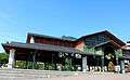 |
Marché couvert | Grand-Rue | 559.351 | 142.470 | 46°25′56″N 6°54′35″E / 46.432339°N 6.90977°E |
| 6246 |  |
Palace-Hôtel | Caux, Rue du Panorama 2 | 561.480 | 142.437 | 46°25′56″N 6°56′15″E / 46.432168°N 6.937472°E |
| 6244 | 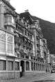 |
Territet Formerly the Grand-Hôtel, Hôtel des Alpes |
Avenue de Chillon 78 | 560.418 | 141.715 | 46°25′32″N 6°55′25″E / 46.425612°N 6.923717°E |
| 6241 | .jpg) |
Villa Karma | Rue du Lac 171 | 556.954 | 143.962 | 46°26′44″N 6°52′42″E / 46.445611°N 6.878446°E |
| Unknown | ISOS village urbanisé:Territet/Veytaux | |||||
| Unknown | ISOS cas particulier: Caux | |||||
| Unknown | ISOS cas particulier: Montreux | |||||
| Unknown | ISOS cas particulier: Villas Dubochet |
Mont-sur-Rolle
| KGS No.? |
Picture | Name | Street Address | CH1903 X coordinate | CH1903 Y coordinate | Location |
|---|---|---|---|---|---|---|
| Unknown | ISOS village: Mont-sur-Rolle |
Morges
| KGS No.? |
Picture | Name | Street Address | CH1903 X coordinate | CH1903 Y coordinate | Location |
|---|---|---|---|---|---|---|
| 6276 | Ancienne Auberge De La Croix Blanche | Grand-Rue 72 | 527.787 | 151.271 | 46°30′32″N 6°29′52″E / 46.508848°N 6.497763°E | |
| 6283 |  |
Bâtiment | Grand-Rue 54 | 527.808 | 151.324 | 46°30′34″N 6°29′53″E / 46.509327°N 6.498028°E |
| 6287 | Bâtiment | Grand-Rue 94 | 527.727 | 151.208 | 46°30′30″N 6°29′49″E / 46.508275°N 6.496991°E | |
| 6277, 8688 |  |
Morges Castle and Military Museum of Vaud | Place de la Navigation | 527.680 | 151.025 | 46°30′24″N 6°29′47″E / 46.506624°N 6.496407°E |
| 6291 |  |
City Hall | Rue Louis-de-Savoie 70 | 527.803 | 151.197 | 46°30′29″N 6°29′53″E / 46.508184°N 6.497983°E |
| 9695 |  |
Les Roseaux / La Grande Cité, Bronze Age Shore Line Settlement |
528.600 | 151.950 | 46°30′54″N 6°30′30″E / 46.515043°N 6.50825°E | |
| 6281 | .jpg) |
Temple | Place de l’Eglise | 527.989 | 151.478 | 46°30′39″N 6°30′01″E / 46.510732°N 6.500362°E |
| Unknown | ISOS petite City / bourg: Morges |
Moudon
| KGS No.? |
Picture | Name | Street Address | CH1903 X coordinate | CH1903 Y coordinate | Location |
|---|---|---|---|---|---|---|
| 10342 |  |
Former granary | Rue Du Château 21 | 550.704 | 168.887 | 46°40′10″N 6°47′40″E / 46.669388°N 6.794451°E |
| 6301 |  |
Swiss Reformed Church of Saint-Etienne | Place Saint-Etienne | 551.048 | 168.756 | 46°40′06″N 6°47′56″E / 46.668235°N 6.79896°E |
| 6313 | 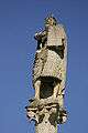 |
Fountain de Moïse (Moses Fountain) |
Rue du Château | 550.575 | 168.900 | 46°40′10″N 6°47′34″E / 46.669495°N 6.792764°E |
| 6318 |  |
City Hall | Place de l’Hôtel-de-Ville 1 | 550.922 | 168.827 | 46°40′08″N 6°47′50″E / 46.668864°N 6.797306°E |
| 9114 |  |
D’Arnay House | Rue du Château 34 | 550.719 | 168.922 | 46°40′11″N 6°47′41″E / 46.669704°N 6.794643°E |
| 9106 | 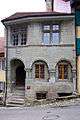 |
Etats de Vaud House | Rue du Château 15 | 550.761 | 168.885 | 46°40′10″N 6°47′43″E / 46.669374°N 6.795196°E |
| 9098 |  |
Loys de Villardin House | Rue Grenade 34 | 551.070 | 168.887 | 46°40′10″N 6°47′57″E / 46.669415°N 6.799234°E |
| 6311 |  |
De Rochefort House | Rue du Château 50 | 550.591 | 168.906 | 46°40′10″N 6°47′35″E / 46.669551°N 6.792973°E |
| 11681 |  |
Tacheron House | Grand-Rue 8 | 550.896 | 168.854 | 46°40′09″N 6°47′49″E / 46.669105°N 6.796964°E |
| 6329 | 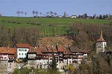 |
Moudon Castle Tower | Rue du Château | 550.798 | 168.908 | 46°40′11″N 6°47′44″E / 46.669584°N 6.795677°E |
| Unknown | ISOS petite City / bourg: Moudon |
Novalles
| KGS No.? |
Picture | Name | Street Address | CH1903 X coordinate | CH1903 Y coordinate | Location |
|---|---|---|---|---|---|---|
| Unknown | ISOS hameau: Novalles |
Noville
| KGS No.? |
Picture | Name | Street Address | CH1903 X coordinate | CH1903 Y coordinate | Location |
|---|---|---|---|---|---|---|
| Unknown | ISOS village: Noville |
Nyon
| KGS No.? |
Picture | Name | Street Address | CH1903 X coordinate | CH1903 Y coordinate | Location |
|---|---|---|---|---|---|---|
| 6332, 9385 |  |
Nyon Castle and Museum of the History of Porcelain |
Place Du Château | 507.840 | 137.446 | 46°22′55″N 6°14′26″E / 46.38205°N 6.240656°E |
| 9696 |  |
Colonia Iulia Equestris, Roman City |
507.700 | 137.500 | 46°22′57″N 6°14′20″E / 46.382517°N 6.238826°E | |
| 6350 |  |
Swiss Reformed Church of Notre-Dame | 507.620 | 137.310 | 46°22′51″N 6°14′16″E / 46.380797°N 6.237824°E | |
| 6346 |  |
Manoir | Rue Maupertuis 2, 4 | 507.826 | 137.399 | 46°22′54″N 6°14′26″E / 46.381626°N 6.240484°E |
| 11615 | Roman Museum | Rue Maupertuis | 507.760 | 137.370 | 46°22′53″N 6°14′23″E / 46.381356°N 6.239632°E | |
| 9160 | .JPG) |
Union des associations européennes de football ((UEFA)) | 507.089 | 136.224 | 46°22′15″N 6°13′52″E / 46.370955°N 6.23114°E | |
| Unknown | ISOS ville: Nyon |
Ogens
| KGS No.? |
Picture | Name | Street Address | CH1903 X coordinate | CH1903 Y coordinate | Location |
|---|---|---|---|---|---|---|
| Unknown | ISOS village: Ogens |
Ollon
| KGS No.? |
Picture | Name | Street Address | CH1903 X coordinate | CH1903 Y coordinate | Location |
|---|---|---|---|---|---|---|
| 6356 |  |
Saint-Triphon Et Charpigny, Prehistoric to Medieval Hilltop Settlement |
564.320 | 127.170 | 46°17′42″N 6°58′32″E / 46.294992°N 6.975593°E | |
| Unknown | ISOS village: Huémoz | |||||
| Unknown | ISOS village: Ollon |
Onnens
| KGS No.? |
Picture | Name | Street Address | CH1903 X coordinate | CH1903 Y coordinate | Location |
|---|---|---|---|---|---|---|
| 6364 |  |
Swiss Reformed Church of Saint-Martin | Rue De L’Eglise | 542.600 | 187.765 | 46°50′19″N 6°41′10″E / 46.838549°N 6.686191°E |
| Unknown | ISOS village: Onnens (VD) |
Orbe
| KGS No.? |
Picture | Name | Street Address | CH1903 X coordinate | CH1903 Y coordinate | Location |
|---|---|---|---|---|---|---|
| 6366 | Boscéaz, Gallo-Roman Villa |
531.100 | 177.420 | 46°44′40″N 6°32′13″E / 46.744406°N 6.53701°E | ||
| 6370 |  |
Orbe Castle with its Two Towers and Plaza |
530.750 | 175.370 | 46°43′33″N 6°31′58″E / 46.725931°N 6.53274°E | |
| 6367 |  |
Swiss Reformed Church of Notre-Dame | Rue du Château | 530.748 | 175.222 | 46°43′29″N 6°31′58″E / 46.724599°N 6.532736°E |
| 6371 |  |
City Hall | Place du Marché 2 | 530.671 | 175.181 | 46°43′27″N 6°31′54″E / 46.724222°N 6.531735°E |
| Unknown | ISOS petite City / bourg: Orbe |
Ormont-Dessous
| KGS No.? |
Picture | Name | Street Address | CH1903 X coordinate | CH1903 Y coordinate | Location |
|---|---|---|---|---|---|---|
| 6379 |  |
Pont Des Planches | 570.487 | 133.866 | 46°21′20″N 7°03′19″E / 46.355525°N 7.0552°E | |
| Unknown | ISOS village: La Forclaz |
Ormont-Dessus
| KGS No.? |
Picture | Name | Street Address | CH1903 X coordinate | CH1903 Y coordinate | Location |
|---|---|---|---|---|---|---|
| 10601 |  |
Swiss Reformed Church of Saint-Théodule | Vers-L’Eglise | 576.376 | 133.636 | 46°21′13″N 7°07′54″E / 46.353689°N 7.131722°E |
| 6386 | Scierie (Sawmill) |
576.100 | 133.780 | 46°21′18″N 7°07′41″E / 46.354974°N 7.128129°E | ||
| Unknown | ISOS village: Vers-l’Eglise | |||||
| Unknown | ISOS hamlet: La Ville |
Orny
| KGS No.? |
Picture | Name | Street Address | CH1903 X coordinate | CH1903 Y coordinate | Location |
|---|---|---|---|---|---|---|
| Unknown | ISOS village: Orny |
Oron
| KGS No.? |
Picture | Name | Street Address | CH1903 X coordinate | CH1903 Y coordinate | Location |
|---|---|---|---|---|---|---|
| 6391 |  |
Temple | 553.129 | 157.872 | 46°34′14″N 6°49′38″E / 46.57048°N 6.82726°E | |
| 6392, 9312 |  |
Oron Castle and Library | Petit Clos | 553.900 | 158.320 | 46°34′28″N 6°50′14″E / 46.574563°N 6.837272°E |
| Unknown | ISOS cas particulier: Oron-le-Châtel |
Pampigny
| KGS No.? |
Picture | Name | Street Address | CH1903 X coordinate | CH1903 Y coordinate | Location |
|---|---|---|---|---|---|---|
| Unknown | ISOS village: Pampigny |
Payerne
| KGS No.? |
Picture | Name | Street Address | CH1903 X coordinate | CH1903 Y coordinate | Location |
|---|---|---|---|---|---|---|
| 6400 |  |
Payerne Abbey Church and Former Convent Buildings | 561.755 | 185.631 | 46°49′15″N 6°56′15″E / 46.820729°N 6.937461°E | |
| 10346 | |
Ancien Tribunal | Place du Marché 3 | 561.813 | 185.614 | 46°49′14″N 6°56′18″E / 46.82058°N 6.938222°E |
| 10344 |  |
Swiss Reformed Church of Notre-Dame | Rue du Temple | 561.831 | 185.644 | 46°49′15″N 6°56′18″E / 46.820851°N 6.938456°E |
| 6401 |  |
Fountain du Banneret | Place St. Laurent | 561.811 | 185.654 | 46°49′15″N 6°56′17″E / 46.820939°N 6.938193°E |
| Unknown | ISOS petite City / bourg: Payerne |
Penthaz
| KGS No.? |
Picture | Name | Street Address | CH1903 X coordinate | CH1903 Y coordinate | Location |
|---|---|---|---|---|---|---|
| 8948 | Centre d'archivage de la Cinémathèque suisse | Chemin de la Vaux | 530.850 | 161.600 | 46°36′07″N 6°32′10″E / 46.602081°N 6.53612°E |
Perroy
| KGS No.? |
Picture | Name | Street Address | CH1903 X coordinate | CH1903 Y coordinate | Location |
|---|---|---|---|---|---|---|
| Unknown | ISOS village: Perroy |
Prangins
| KGS No.? |
Picture | Name | Street Address | CH1903 X coordinate | CH1903 Y coordinate | Location |
|---|---|---|---|---|---|---|
| 6412, 11778 |  |
Prangins Castle and Surroundings, National Museum |
508.731 | 138.779 | 46°23′39″N 6°15′07″E / 46.394162°N 6.251975°E | |
| 6414 |  |
Villa Les Bleuets | Route de Promenthoux | 509.880 | 138.518 | 46°23′31″N 6°16′01″E / 46.391969°N 6.266962°E |
| Unknown | ISOS village: Prangins |
Provence
| KGS No.? |
Picture | Name | Street Address | CH1903 X coordinate | CH1903 Y coordinate | Location |
|---|---|---|---|---|---|---|
| 10350 | Chalet D’Alpage La Redalle | 539.735 | 192.409 | 46°52′48″N 6°38′53″E / 46.880068°N 6.648024°E | ||
| Unknown | ISOS village: Provence |
Puidoux
| KGS No.? |
Picture | Name | Street Address | CH1903 X coordinate | CH1903 Y coordinate | Location |
|---|---|---|---|---|---|---|
| Unknown | UNESCO World Heritage Site: Lavaux, Vineyard Terraces | |||||
| Unknown | ISOS hameau: Treytorrens |
Pully
| KGS No.? |
Picture | Name | Street Address | CH1903 X coordinate | CH1903 Y coordinate | Location |
|---|---|---|---|---|---|---|
| 10459 |  |
Gardens of Villa Eupalinos | Chemin De La Bruyère 17 | 540.431 | 152.775 | 46°31′25″N 6°39′44″E / 46.523621°N 6.662297°E |
| 11702 |  |
Prieuré, Roman Villa |
540.380 | 151.190 | 46°30′34″N 6°39′43″E / 46.509359°N 6.661837°E | |
| Unknown | ISOS village urbanisé: Pully |
Rances
| KGS No.? |
Picture | Name | Street Address | CH1903 X coordinate | CH1903 Y coordinate | Location |
|---|---|---|---|---|---|---|
| Unknown | ISOS village: Rances |
Rivaz
| KGS No.? |
Picture | Name | Street Address | CH1903 X coordinate | CH1903 Y coordinate | Location |
|---|---|---|---|---|---|---|
| Unknown | UNESCO World Heritage Site: Lavaux, Vineyard Terraces | |||||
| Unknown | ISOS village: Rivaz |
Rolle
| KGS No.? |
Picture | Name | Street Address | CH1903 X coordinate | CH1903 Y coordinate | Location |
|---|---|---|---|---|---|---|
| 6437, 9313 | 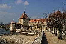 |
Rolle Castle and Library of the Community of Rolle |
Grand-Rue 1 | 515.714 | 145.850 | 46°27′31″N 6°20′29″E / 46.458677°N 6.341468°E |
| 6438 |  |
Ile de La Harpe | Grand-Rue 1 | 515.550 | 145.500 | 46°27′20″N 6°20′22″E / 46.455508°N 6.339398°E |
| Unknown | ISOS petite City / bourg: Rolle |
Romainmôtier-Envy
| KGS No.? |
Picture | Name | Street Address | CH1903 X coordinate | CH1903 Y coordinate | Location |
|---|---|---|---|---|---|---|
| 6444 | 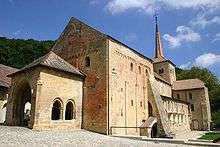 |
Former Clunic Romainmôtier Abbey | Au Village | 525.255 | 171.825 | 46°41′36″N 6°27′41″E / 46.693451°N 6.461441°E |
| 9692 | Prehistoric / Medieval Foundry | 526.550 | 169.450 | 46°40′20″N 6°28′43″E / 46.672232°N 6.47875°E | ||
| Unknown | ISOS petite City / bourg: Romainmôtier-Envy |
Rossinière
| KGS No.? |
Picture | Name | Street Address | CH1903 X coordinate | CH1903 Y coordinate | Location |
|---|---|---|---|---|---|---|
| 6456 |  |
La Maison De La Place | La Place | 572.632 | 146.243 | 46°28′01″N 7°04′56″E / 46.466953°N 7.082338°E |
| 6457 |  |
Le Grand-Chalet | Le Borjoz | 572.795 | 146.103 | 46°27′57″N 7°05′04″E / 46.4657°N 7.084468°E |
| Unknown | ISOS village: Rossinière |
Rougemont
| KGS No.? |
Picture | Name | Street Address | CH1903 X coordinate | CH1903 Y coordinate | Location |
|---|---|---|---|---|---|---|
| 6464 |  |
Swiss Reformed Church of Saint-Nicolas De Myre | 582.160 | 148.510 | 46°29′16″N 7°12′23″E / 46.487667°N 7.206293°E | |
| Unknown | ISOS village: Rougemont | |||||
| Unknown | ISOS hameau: Flendruz |
Saint-George
| KGS No.? |
Picture | Name | Street Address | CH1903 X coordinate | CH1903 Y coordinate | Location |
|---|---|---|---|---|---|---|
| 6481 |  |
Mill | Le Moulin | 509.872 | 151.542 | 46°30′33″N 6°15′52″E / 46.509114°N 6.264324°E |
Saint-Légier-La Chiésaz
| KGS No.? |
Picture | Name | Street Address | CH1903 X coordinate | CH1903 Y coordinate | Location |
|---|---|---|---|---|---|---|
| 6482 |  |
Hauteville Castle | Chemin Des Boulingrins | 556.198 | 146.341 | 46°28′01″N 6°52′06″E / 46.466962°N 6.868383°E |
| 6483 | 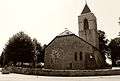 |
Swiss Reformed Church of Notre-Dame | Chemin de l’Eglise | 557.400 | 146.822 | 46°28′17″N 6°53′02″E / 46.471366°N 6.883987°E |
Saint-Livres
| KGS No.? |
Picture | Name | Street Address | CH1903 X coordinate | CH1903 Y coordinate | Location |
|---|---|---|---|---|---|---|
| Unknown | ISOS village: Saint-Livres |
Saint-Prex
| KGS No.? |
Picture | Name | Street Address | CH1903 X coordinate | CH1903 Y coordinate | Location |
|---|---|---|---|---|---|---|
| 6484 | 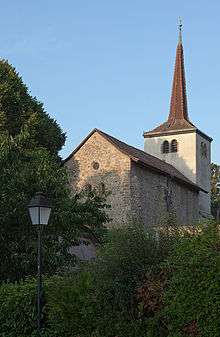 |
Swiss Reformed Church of Notre-Dame | Rue Du Motty | 524.727 | 148.265 | 46°28′53″N 6°27′30″E / 46.481473°N 6.458387°E |
| Unknown | ISOS petite City / bourg: Saint-Prex |
Saint-Saphorin (Lavaux)
| KGS No.? |
Picture | Name | Street Address | CH1903 X coordinate | CH1903 Y coordinate | Location |
|---|---|---|---|---|---|---|
| 6489 |  |
Swiss Reformed Church of Saint-Symphorien with Gallo-Roman Villa |
Chemin Neuf | 550.650 | 147.100 | 46°28′24″N 6°47′46″E / 46.473404°N 6.796077°E |
| Unknown | UNESCO World Heritage Site: Lavaux, Vineyard Terraces | |||||
| Unknown | ISOS village: Saint-Saphorin |
Saint-Sulpice
| KGS No.? |
Picture | Name | Street Address | CH1903 X coordinate | CH1903 Y coordinate | Location |
|---|---|---|---|---|---|---|
| 6493 |  |
Swiss Reformed Church of Sainte-Marie-Madeleine Et Prieuré | Chemin Du Crêt | 532.538 | 151.209 | 46°30′32″N 6°33′35″E / 46.508786°N 6.559668°E |
Sainte-Croix
| KGS No.? |
Picture | Name | Street Address | CH1903 X coordinate | CH1903 Y coordinate | Location |
|---|---|---|---|---|---|---|
| Unknown | ISOS village urbanisé: L’Auberson | |||||
| Unknown | ISOS village urbanisé: Sainte-Croix | |||||
| Unknown | ISOS hameau: La Chaux |
Sergey
| KGS No.? |
Picture | Name | Street Address | CH1903 X coordinate | CH1903 Y coordinate | Location |
|---|---|---|---|---|---|---|
| Unknown | ISOS hameau: Sergey |
Sottens
| KGS No.? |
Picture | Name | Street Address | CH1903 X coordinate | CH1903 Y coordinate | Location |
|---|---|---|---|---|---|---|
| 10354 | |
Emetteur National De Sottens | Route De Peyres-Possens | 546.171 | 167.458 | 46°39′22″N 6°44′07″E / 46.656184°N 6.735386°E |
Tartegnin
| KGS No.? |
Picture | Name | Street Address | CH1903 X coordinate | CH1903 Y coordinate | Location |
|---|---|---|---|---|---|---|
| Unknown | ISOS hameau: Tartegnin |
Tévenon
| KGS No.? |
Picture | Name | Street Address | CH1903 X coordinate | CH1903 Y coordinate | Location |
|---|---|---|---|---|---|---|
| Unknown | ISOS hameau: Vaugondry |
Trey
| KGS No.? |
Picture | Name | Street Address | CH1903 X coordinate | CH1903 Y coordinate | Location |
|---|---|---|---|---|---|---|
| Unknown | ISOS village: Trey |
Treytorrens
| KGS No.? |
Picture | Name | Street Address | CH1903 X coordinate | CH1903 Y coordinate | Location |
|---|---|---|---|---|---|---|
| 6505 |  |
Swiss Reformed Church of Saint-Jean-Baptiste | Au Village | 551.280 | 180.190 | 46°46′16″N 6°48′03″E / 46.771103°N 6.800777°E |
| Unknown | ISOS village: Treytorrens (Payerne) |
Ursins
| KGS No.? |
Picture | Name | Street Address | CH1903 X coordinate | CH1903 Y coordinate | Location |
|---|---|---|---|---|---|---|
| 6506 | Roman Sanctuary | 541.120 | 176.300 | 46°44′07″N 6°40′06″E / 46.735292°N 6.668267°E |
Valbroye
| KGS No.? |
Picture | Name | Street Address | CH1903 X coordinate | CH1903 Y coordinate | Location |
|---|---|---|---|---|---|---|
| Unknown | ISOS village: Combremont-le-Petit | |||||
| Unknown | ISOS village urbanisé: Granges-près-Marnand | |||||
| Unknown | ISOS village: Sassel |
Valeyres-sous-Rances
| KGS No.? |
Picture | Name | Street Address | CH1903 X coordinate | CH1903 Y coordinate | Location |
|---|---|---|---|---|---|---|
| 6509 |  |
Bonstetten House | Rue Du Village 5 | 530.229 | 178.355 | 46°45′10″N 6°31′32″E / 46.752726°N 6.525471°E |
| Unknown | ISOS village: Valeyres-sous-Rances |
Vallorbe
| KGS No.? |
Picture | Name | Street Address | CH1903 X coordinate | CH1903 Y coordinate | Location |
|---|---|---|---|---|---|---|
| 6513 | 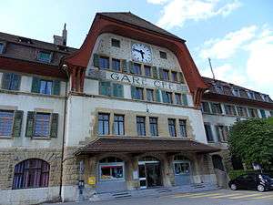 |
International Train Station | Rue De La Gare 1 | 518.337 | 174.017 | 46°42′44″N 6°22′14″E / 46.712357°N 6.370618°E |
| Unknown | ISOS village urbanisé: Vallorbe |
Vaulion
| KGS No.? |
Picture | Name | Street Address | CH1903 X coordinate | CH1903 Y coordinate | Location |
|---|---|---|---|---|---|---|
| Unknown | ISOS village urbanisé: Vaulion |
Vevey
| KGS No.? |
Picture | Name | Street Address | CH1903 X coordinate | CH1903 Y coordinate | Location |
|---|---|---|---|---|---|---|
| 8707 |  |
Alimentarium, Museum of Food |
Quai Perdonnet 25 | 554.507 | 145.398 | 46°27′30″N 6°50′47″E / 46.458367°N 6.846462°E |
| 6521, 8898 |  |
Administration Building and Historical Archives of Nestlé SA | Avenue Nestlé 55 | 553.610 | 146.331 | 46°28′00″N 6°50′05″E / 46.466698°N 6.834693°E |
| 6516 |  |
Aile Castle | Grande Place 1 | 554.086 | 145.502 | 46°27′33″N 6°50′27″E / 46.459274°N 6.840972°E |
| 6525 |  |
Cour au Chantre | Rue du Simplon 22 | 554.449 | 145.588 | 46°27′36″N 6°50′44″E / 46.460072°N 6.845688°E |
| 6517 |  |
Roman Catholic Church of Notre-Dame | Rue des Chenevières | 555.001 | 145.442 | 46°27′32″N 6°51′10″E / 46.458796°N 6.852888°E |
| 6528 | 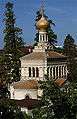 |
Orthodox Church | Rue des Communaux 12 | 554.453 | 145.789 | 46°27′43″N 6°50′45″E / 46.46188°N 6.845721°E |
| 6519 | 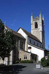 |
Swiss Reformed Church of Saint-Martin | Boulevard Saint-Martin | 554.550 | 145.820 | 46°27′44″N 6°50′49″E / 46.462166°N 6.84698°E |
| 6533 |  |
City Hall | Rue du Lac 2 | 554.560 | 145.460 | 46°27′32″N 6°50′50″E / 46.458928°N 6.847146°E |
| 6534 |  |
Hôtel des Trois-Couronnes | Rue du Château 1 | 554.657 | 145.382 | 46°27′30″N 6°50′54″E / 46.458233°N 6.848416°E |
| 6532 |  |
La Grenette and Place du Marché | Grande Place 29 | 554.222 | 145.630 | 46°27′38″N 6°50′34″E / 46.460434°N 6.842729°E |
| 8708 | Museum de la Confrérie des Vignerons | Rue du Château 2 | 554.704 | 145.363 | 46°27′29″N 6°50′57″E / 46.458065°N 6.849029°E | |
| 8717 |  |
Museum Jenisch (Musée des Beaux-Arts, Cabinet cantonal des estampes) |
Avenue de la Gare 2 | 538.495 | 152.049 | 46°31′01″N 6°38′14″E / 46.516916°N 6.637165°E |
| 8718 |  |
Museum suisse de l’appareil photographique | Grande Place | 554.120 | 145.575 | 46°27′36″N 6°50′29″E / 46.459933°N 6.841407°E |
| 11688 | 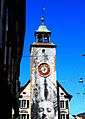 |
Saint-Jean Tower and Fountain | Rue du Lac | 554.559 | 145.461 | 46°27′32″N 6°50′50″E / 46.458937°N 6.847133°E |
| Unknown | ISOS ville: Vevey |
Veytaux
| KGS No.? |
Picture | Name | Street Address | CH1903 X coordinate | CH1903 Y coordinate | Location |
|---|---|---|---|---|---|---|
| 6544 |  |
Chillon Castle | Avenue Du Chillon 21 | 560.703 | 140.445 | 46°24′51″N 6°55′39″E / 46.414204°N 6.927532°E |
| 9513 | 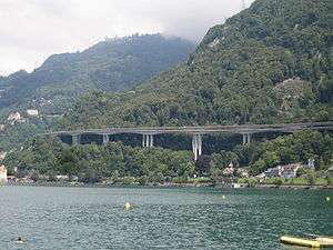 |
Viaduc autoroutier de Chillon sur la N9 | 560.920 | 140.370 | 46°24′49″N 6°55′49″E / 46.413542°N 6.93036°E | |
| Unknown | ISOS village urbanisé:Territet/Veytaux | |||||
| Unknown | ISOS cas particulier: Castle de Chillon |
Villarzel
| KGS No.? |
Picture | Name | Street Address | CH1903 X coordinate | CH1903 Y coordinate | Location |
|---|---|---|---|---|---|---|
| Unknown | ISOS village: Villarzel |
Villeneuve
| KGS No.? |
Picture | Name | Street Address | CH1903 X coordinate | CH1903 Y coordinate | Location |
|---|---|---|---|---|---|---|
| Unknown | ISOS petite City / bourg: Villeneuve |
Vinzel
| KGS No.? |
Picture | Name | Street Address | CH1903 X coordinate | CH1903 Y coordinate | Location |
|---|---|---|---|---|---|---|
| Unknown | ISOS hameau: Vinzel |
Vufflens-la-Ville
| KGS No.? |
Picture | Name | Street Address | CH1903 X coordinate | CH1903 Y coordinate | Location |
|---|---|---|---|---|---|---|
| Unknown | ISOS village: Vufflens-la-Ville |
Vufflens-le-Château
| KGS No.? |
Picture | Name | Street Address | CH1903 X coordinate | CH1903 Y coordinate | Location |
|---|---|---|---|---|---|---|
| 6561 |  |
Vufflens Castle | Chemin de la Balle 1 | 526.161 | 153.069 | 46°31′29″N 6°28′35″E / 46.524844°N 6.476292°E |
| Unknown | ISOS cas particulier: Vufflens-le-Château |
Vullierens
| KGS No.? |
Picture | Name | Street Address | CH1903 X coordinate | CH1903 Y coordinate | Location |
|---|---|---|---|---|---|---|
| 6563 |  |
Vullierens Castle and Surroundings | Rue Du Château | 526.498 | 158.197 | 46°34′16″N 6°28′48″E / 46.571007°N 6.479867°E |
| Unknown | ISOS village: Vullierens |
Vully-les-Lacs
| KGS No.? |
Picture | Name | Street Address | CH1903 X coordinate | CH1903 Y coordinate | Location |
|---|---|---|---|---|---|---|
| 6330 |  |
Guévaux Castle | 570.900 | 198.630 | 46°56′17″N 7°03′23″E / 46.93812°N 7.056468°E | |
| Unknown | ISOS hameau: Cotterd | |||||
| Unknown | ISOS hameau: Vallamand-Dessous |
Yens
| KGS No.? |
Picture | Name | Street Address | CH1903 X coordinate | CH1903 Y coordinate | Location |
|---|---|---|---|---|---|---|
| Unknown | ISOS village: Yens |
Yverdon-les-Bains
| KGS No.? |
Picture | Name | Street Address | CH1903 X coordinate | CH1903 Y coordinate | Location |
|---|---|---|---|---|---|---|
| 9314 |  |
Public Library of Yverdon-les-Bains | Place de L’Ancienne-Poste 4 | 538.957 | 181.305 | 46°46′48″N 6°38′21″E / 46.780117°N 6.639301°E |
| 6564, 8709 |  |
Castle and Museum | Place Pestalozzi | 539.108 | 181.093 | 46°46′42″N 6°38′29″E / 46.778224°N 6.641307°E |
| 9679 | .jpg) |
Clendy, Littoral Settlement and Prehistoric Megalithic Site |
540.300 | 181.400 | 46°46′52″N 6°39′25″E / 46.781094°N 6.656874°E | |
| 6585 |  |
Eburodunum, Celtic Oppidum, Roman Vicus, Medieval and Modern Village |
539.130 | 180.670 | 46°46′28″N 6°38′30″E / 46.774422°N 6.641651°E | |
| 6566 |  |
Town Hall | Place Pestalozzi 1 | 539.079 | 181.104 | 46°46′42″N 6°38′27″E / 46.778321°N 6.640926°E |
| 10355 |  |
Former Hôtel de l’Aigle | Place Pestalozzi 2 | 539.035 | 181.109 | 46°46′42″N 6°38′25″E / 46.778362°N 6.640349°E |
| 6567 |  |
Thorens House (formerly Steiner House) | Rue du Four 17 | 538.950 | 181.100 | 46°46′42″N 6°38′21″E / 46.778273°N 6.639237°E |
| 6568 |  |
Temple | Place Pestalozzi / Rue du Lac | 539.058 | 181.158 | 46°46′44″N 6°38′26″E / 46.778804°N 6.640643°E |
| 6586 |  |
Villa d’Entremont | Avenue des Bains 20 | 539.696 | 180.428 | 46°46′20″N 6°38′57″E / 46.772296°N 6.649093°E |
See also
References
- All entries, addresses and coordinates are from: "Kantonsliste A-Objekte". KGS Inventar (in German). Federal Office of Civil Protection. 2009. Retrieved 25 April 2011.
External links
- Swiss Inventory of Cultural Property of National and Regional Significance, 2009 edition:
- "Revision of the PCP Inventory (Revision des KGS-Inventars)". KGS Forum. Federal Office of Civil Protection (13/2008). 2008.
This article is issued from Wikipedia - version of the 11/6/2016. The text is available under the Creative Commons Attribution/Share Alike but additional terms may apply for the media files.