List of Sites of Special Scientific Interest in Cambridgeshire

This is a list of the Sites of Special Scientific Interest (SSSIs) in the county of Cambridgeshire, England, United Kingdom. In England the body responsible for designating SSSIs is Natural England, which chooses a site because of its fauna, flora, geological or physiographical features.[1] Natural England uses Cambridgeshire's borders to mark one of its Areas of Search. As of 2012, there are 101 sites designated in this Area of Search.[2] There are 10 sites with a purely geological interest, and 90 listed for biological interest. One site is designated for both reasons.
Natural England took over the role of designating and managing SSSIs from English Nature in October 2006 when it was formed from the amalgamation of English Nature, parts of the Countryside Agency and the Rural Development Service. Natural England, like its predecessor, uses the 1974–1996 county system[3] and as such the same approach is followed here. The data in the table is taken from Natural England in the form of citation sheets for each SSSI, and the County Background Datasheet for Cambridgeshire.[4]
Key
Interest
Public access
|
Other classifications
|
Sites
| Site name | Photograph | B | G | Area | Public access |
Location | Other classifications |
Map[lower-alpha 1] | Citation[lower-alpha 2] | Description |
|---|---|---|---|---|---|---|---|---|---|---|
| Adventurers' Land | 10.1 hectares (25 acres)[5] | March 52°35′53″N 0°00′29″E / 52.598°N 0.008°E TF361019 [5] |
GCR[6] | Map | Citation | The site is described by Natural England as important for the study of changes in Holocene sea levels. There are five peat levels dating to between 6,400 and 1,850 years BP, and the earliest level represents the oldest directly dated transgression of the sea into the Fens.[7] | ||||
| Alder Carr | 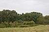 |
6.7 hectares (17 acres)[8] | NO | Hildersham 52°07′01″N 0°15′04″E / 52.117°N 0.251°E TL542489 [8] |
Map | Citation | The site is a wet valley which has alder on fen peat, a type of woodland which is now rare in East Anglia. Ground flora include angelica and meadowsweet. This habitat is very valuable to invertebrates.[9] | |||
| Aversley Wood | 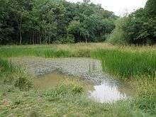 |
62.3 hectares (154 acres)[10] | YES | Sawtry 52°25′23″N 0°17′38″W / 52.423°N 0.294°W TL161819 [10] |
WT[11] | Map | Citation | This wood is ash and maple on heavy clay soils, with much of it being ancient and having diverse flora and fauna as a result. Another area, which was probaby cultivated until around 1350, has medieval ridge and furrow. It has a number of wild service trees, which are uncommon and an indicator of ancient woodland.[12] | ||
| Balsham Wood | 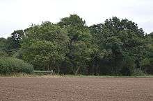 |
35.0 hectares (86 acres)[13] | NO | Balsham 52°07′19″N 0°19′05″E / 52.122°N 0.318°E TL588496 [13] |
Map | Citation | This site has one of the last surviving areas of ash and maple woodland on chalky boulder clay. It has diverse flora, including the rare oxlip and a variety of shrubs, such as dogwood. Open grassy rides provide additional habitats.[14] | |||
| Barnack Hills & Holes | 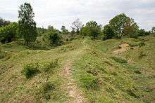 |
23.5 hectares (58 acres)[15] | YES | Barnack 52°37′44″N 0°24′43″W / 52.629°N 0.412°W TF076046 [15] |
NCR,[16] NNR,[17] SAC[18] | Map | Citation | This site on a former mineral working is grassland on Jurassic limestone, and it is managed by sheep grazing and scrub control. it has a diverse flora including some species which are nationally scarce, such as pasque flowers.[19] | ||
| Barrington Chalk Pit |  |
97.1 hectares (240 acres)[20] | FP | Barrington 52°08′31″N 0°01′59″E / 52.142°N 0.033°E TL392512[20] |
GCR[21] | Map | Citation | This large quarry is the only surviving exposure of the Cretaceous Cambridge Greensand. Fossils include brachiopods and fish teeth. It is overlain by thick sequences of chalk and Totternhoe Stone.[22] | ||
| Barrington Pit |  |
3.8 hectares (9.4 acres)[23] | NO | Barrington 52°07′23″N 0°01′08″E / 52.123°N 0.019°E TL383491 [23] |
GCR[24] | Map | Citation | This site is described by Natural England as of national importance for its mammal fossils. Species include hippopotamuses, straight-tusked elephants, lions and aurochs. They probably date to the warm Eemian period, around 130,000 to 115,000 years ago.[25] | ||
| Bassenhally Pit |  |
8.6 hectares (21 acres)[26] | NO | Whittlesey 52°34′08″N 0°06′14″W / 52.569°N 0.104°W TL286985 [26] |
Map | Citation | This former gravel quarry has diverse habitats, such as a pond, marshes, grassland, scrub and woodland. The marsh is a nationally scarce habitat, and it has plants including jointed rush, creeping bent, lesser water-plantain, early marsh-orchid and water violet.[27] | |||
| Bedford Purlieus |  |
214.3 hectares (530 acres)[28] | YES | Wansford 52°34′59″N 0°27′54″W / 52.583°N 0.465°W TL041995[28] |
NCR,[29] NNR[17] | Map | Citation | This is ancient woodland with a variety of habitats of oak and ash coppices. It also has diverse flora including ramsons, lily-of-the-valleys, columbines, herb-paris and fly orchids.[30] | ||
| Berry Fen | 15.3 hectares (38 acres) | Earith 52°21′04″N 0°01′19″E / 52.351°N 0.022°E TL378745 |
Map | Citation | ||||||
| Bonemills Hollow |  |
17.5 hectares (43 acres)[31] | NO | Wittering 52°35′56″N 0°28′23″W / 52.599°N 0.473°W TF035012 [31] |
Map | Citation | The valley has marsh and Jurassic calcareous grassland areas. The marshland is on the valley floor, and dominant species are lesser pond-sedge and the rushes Juncus articulatus and Juncus inflexus.[32] | |||
| Brackland Rough |  |
10.7 hectares (26 acres)[33] | YES | Fordham 52°18′07″N 0°23′38″E / 52.302°N 0.394°E TL633698 [33] |
WTBCN[34] | Map | Citation | This wet woodland site has semi-natural alder coppice, with ash, crack willow and silver birch. The ground flora has tall fens, together with herbs such as marsh marigold and yellow flag.[35] | ||
| Brampton Meadow |  |
1.0 hectare (2.5 acres)[36] | NO | Brampton 52°19′59″N 0°15′07″W / 52.333°N 0.252°W TL192720 [36] |
Map | Citation | The site has a rich variety of plant species on calcareous clay pasture, a declining habitat. Plants include quaking-grass, adder's tongue fern, cowslip and green-winged orchid.[37] | |||
| Brampton Racecourse |  |
21.1 hectares (52 acres)[38] | NO | Brampton 52°20′06″N 0°14′10″W / 52.335°N 0.236°W TL203722 [38] |
Map | Citation | The site is species-rich neutral grassland, a rare habitat in the county, in the flood plain of Alconbury Brook. Plants include salad burnet, pepper-saxifrage, and the largest population in of green-winged orchid in Cambridgeshire.[39] | |||
| Brampton Wood | 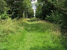 |
132.1 hectares (326 acres)[40] | YES | Brampton 52°18′58″N 0°16′12″W / 52.316°N 0.27°W TL179701[40] |
WTBCN[41] | Map | Citation | This is one of the few surviving areas of ancient woodland in the county. It is wet ash and maple on heavy clay soil, with rides which have a varied grassland flora, such as yellow pimpernel, greater bird's-foot-trefoil and devil's-bit scabious.[42] | ||
| Buff Wood | 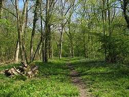 |
15.8 hectares (39 acres) | WTPR | Hatley 52°08′10″N 0°07′41″W / 52.136°N 0.128°W TL282503 |
WTBCN[43] | Map | Citation | This site is ecologically diverse boulder clay woodland, with a range of wildflowers, including oxlips and the uncommon green hellebore. There are butterlies such as brimstones, large whites, orange-tips and speckled woods.[43] | ||
| Caldecote Meadows |  |
9.1 hectares (22 acres)[44] | NO | Caldecote 52°12′04″N 0°01′44″W / 52.201°N 0.029°W TL348577[44] |
Map | Citation | The site is herb-rich calcareous grassland, which was formerly common in the county, but is now rare. It is traditionally managed by hay cutting and grazing, and plants include salad burnet and dropwort.[45] | |||
| Cam Washes |  |
166.5 hectares (411 acres)[46] | YES | Wicken 52°19′01″N 0°15′07″E / 52.317°N 0.252°E TL536712[46] |
Map | Citation | This site on the banks of the River Cam is composed of pastures which are seasonally flooded. It is described by Natural England as an important site for wintering and breeding wildfowl and waders. Breeding birds include snipe, redshank, gadwall, teal and shovelers.[47] | |||
| Carlton Wood | 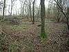 |
10.5 hectares (26 acres) | Great Bradley 52°09′00″N 0°24′58″E / 52.15°N 0.416°E TL654529 |
Map | Citation | |||||
| Castor Flood Meadows | 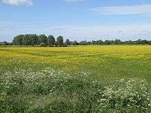 |
41.8 hectares (103 acres)[48] | YES | Peterborough 52°33′43″N 0°20′42″W / 52.562°N 0.345°W TL123972 [48] |
Map | Citation | This site on the banks of the River Nene is a remnant of formerly extensive flood meadows. Flora include slender tufted-sedges, early marsh-orchids and the nationally restricted narrow-leaved water-dropwort.[49] | |||
| Castor Hanglands | 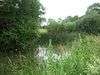 |
89.8 hectares (222 acres)[50] | YES | Peterborough 52°36′04″N 0°21′07″W / 52.601°N 0.352°W TF117016 [50] |
NCR,[51] NNR[17] | Map | Citation | This site has ancient ash and maple woodland, unimproved grassland and scrub. The site is described by Natural England as valuable for invertebrates, including some nationally uncommon species. There are also ponds and ditches which have a variety of aquatic fauna including the warty newt.[52] | ||
| Cherry Hinton Pit | 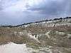 |
12.8 hectares (32 acres)[53] | YES | Cambridge 52°10′48″N 0°10′05″E / 52.18°N 0.168°E TL483557 [53] |
LNR,[54] WTBCN[55] | Map | Citation | These former chalk quarries have a variety of habitats, including grassland and woodland. The site was designated an SSSI because it has four rare plants, three of which are listed in the British Red List of Threatened Species. These are great pignut, moon carrot and grape hyacinth.[56] | ||
| Chettisham Meadow |  |
0.7 hectares (1.7 acres)[57] | YES | Chettisham 52°25′23″N 0°15′54″E / 52.423°N 0.265°E TL541830[57] |
WTBCN[58] | Map | Citation | The site is grassland on calcareous clay, and evidence survives of ridge and furrow medieval farming. Flowering plants include adder's tongue, cowslip and the uncommon green-winged orchid.[59] | ||
| Chippenham Fen and Snailwell Poor's Fen |  |
155.6 hectares (384 acres)[60] | NO | Fordham 52°17′53″N 0°24′54″E / 52.298°N 0.415°E TL648694 [60] |
NCR,[61] NNR,[17] Ramsar,[62] SAC[63] | Map | Citation | The site is described by Natural England as "of national importance for its wide range of wetland habitats and associated birds and insects". It has diverse habitats and flora, with several uncommon species in damp meadows. It also has many species of breeding birds, and rare spiders and moths.[64] | ||
| Delph Bridge Drain |  |
0.1 hectares (0.25 acres)[65] | YES | Soham 52°22′01″N 0°18′00″E / 52.367°N 0.3°E TL567768 [65] |
Map | Citation | This site has the only known British population of fen ragwort, which was previously believed to have become extinct in the UK in 1857, due to habitat destruction. It was re-discovered in 1971 when dormant seeds probably germinated following excavation of the drain.[66] | |||
| Dernford Fen |  |
10.3 hectares (25 acres)[67] | NO | Sawston 52°07′52″N 0°08′56″E / 52.131°N 0.149°E TL472503 [67] |
Map | Citation | The site is a rare surviving example of rough fen and carr. Other habitats are dry grassland and scrub, together with ditches and a chalk stream. The diverse habitats are valuable for amphibians and reptiles.[68] | |||
| Devil's Dyke | 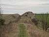 |
39.8 hectares (98 acres)[69] | YES | Newmarket 52°13′55″N 0°21′32″E / 52.232°N 0.359°E TL612619 [69] |
SAC,[70] SM[71][72] | Map | Citation | It is not known when the dyke was built but a date in the Anglo-Saxon period is thought most likely.[71] There is extensive chalk grassland with diverse species, and areas of woodland and chalk scrub. The site has unusual plants such as purple milk-vetch, bastard toadflax and pasque flowers.[73] | ||
| Dogsthorpe Star Pit | 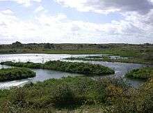 |
36.4 hectares (90 acres)[74] | YES | Peterborough 52°36′29″N 0°12′43″W / 52.608°N 0.212°W TF212026 [74] |
LNR,[75] WTBCN[76] | Map | Citation | This former brick pit has been designated an SSSI mainly for its invertebrates, especially its water beetles, with 64 species, including four on the IUCN Red List of Threatened Species, Graptodytes bilineatus, Dryops similaris, Gyrinus distinctus and Myopites inulaedyssentericae.[77] | ||
| Elsworth Wood |  |
6.9 hectares (17 acres)[78] | NO | Elsworth 52°14′20″N 0°04′48″W / 52.239°N 0.080°W TL312618 [78] |
Map | Citation | This site has three different uncommon types of woodland. The dominant tree is coppiced field maple, with a varied shrub layer and a considerable population of oxlips. There are several nationally uncommon beetles, such as the rove beetle Stichoglossa semirufa.[79] | |||
| Ely Pits and Meadows | 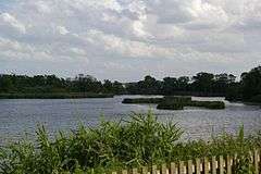 |
85.8 hectares (212 acres)[80] | PP | Ely 52°24′11″N 0°16′59″E / 52.403°N 0.283°E TL554808[80] |
GCR,[81] WTBCN[82] | Map | Citation | This site has yielded an extensive assemblage of fossils reptiles dating to the Kimmeridgian, around 155 million years ago in the late Jurassic. Its biological interest lies mainly in its breeding birds, especially nationally rare wintering and breeding bitterns.[83] | ||
| Eversden and Wimpole Woods | 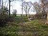 |
66.6 hectares (165 acres) | Great Eversden 52°09′36″N 0°02′06″W / 52.16°N 0.035°W TL345531 |
SAC[84] | Map | Citation | ||||
| Eye Gravel Pit | 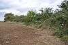 |
0.3 hectares (0.74 acres)[85] | NO | Eye Green 52°36′58″N 0°11′06″W / 52.616°N 0.185°W TF230036 [85] |
GCR[86] | Map | Citation | This former gravel quarry has marine and a few non-marine shells laid down when the area was under the North Sea, probably during the warm Eemian period, 130,000 to 115,000 years ago.[87] | ||
| Fleam Dyke | 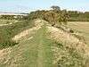 |
11.8 hectares (29 acres) | Fulbourn 52°09′36″N 0°15′58″E / 52.16°N 0.266°E TL551539 |
SM[88] | Map | Citation | ||||
| Fowlmere Watercress Beds | 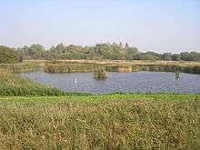 |
39.9 hectares (99 acres) | Melbourn 52°05′20″N 0°02′56″E / 52.089°N 0.049°E TL405454 |
RSPB[89] | Map | Citation | ||||
| Fulbourn Fen | 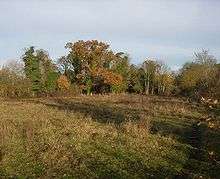 |
27.3 hectares (67 acres) | Fulbourn 52°10′52″N 0°14′10″E / 52.181°N 0.236°E TL530560 |
WTBCN[90] | Map | Citation | ||||
| Furze Hill | 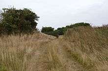 |
5.8 hectares (14 acres)[91] | NO | Hildersham 52°06′50″N 0°16′01″E / 52.114°N 0.267°E TL553486 [91] |
Map | Citation | The site has steep banks of glacial deep sandy gravel, and is one of the few examples of a sandy habitat in the county. There are several rare plants, such as hoary cinquefoils, pasque flowers and maiden pinks.[92] | |||
| Gamlingay Wood | 48.4 hectares (120 acres) | Gamlingay 52°09′54″N 0°11′10″W / 52.165°N 0.186°W TL242534 |
Map | Citation | ||||||
| Godmanchester Eastside Common |  |
29.7 hectares (73 acres)[93] | YES | Godmanchester 52°19′30″N 0°08′20″W / 52.325°N 0.139°W TL269713 [93] |
Map | Citation | There are two fields, with a disused railway line separating them. The habitats are calcareous loam and calcareous clay, both of which are unusual. The southern field has lines of medieval ridge and furrow.[94] | |||
| Gog Magog Golf Course |  |
88.1 hectares (218 acres) | Fulbourn 52°09′54″N 0°10′26″E / 52.165°N 0.174°E TL488541 |
Map | Citation | |||||
| Grafham Water |  |
806.3 hectares (1,992 acres) | Grafham 52°17′49″N 0°19′08″W / 52.297°N 0.319°W TL147679 |
WTBCN[95] | Map | Citation | ||||
| Great Stukeley Railway Cutting |  |
34.7 hectares (86 acres)[96] | NO | Huntingdon 52°21′29″N 0°11′17″W / 52.358°N 0.188°W TL235748 [96] |
Map | Citation | The site is calcareous clay grassland which has plants which were formerly common on the Huntingdonshire claylands, but are now scarce due to agricultural use. Rabbit grazing and occasional burning maintain the habitat.[97] | |||
| Great Wilbraham Common | 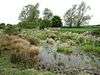 |
23.5 hectares (58 acres) | Great Wilbraham 52°11′42″N 0°14′35″E / 52.195°N 0.243°E TL534576 |
Map | Citation | |||||
| Hardwick Wood | 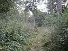 |
15.5 hectares (38 acres)[98] | YES | Caldecote 52°11′56″N 0°01′19″W / 52.199°N 0.022°W TL354576[98] |
WTBCN[99] | Map | Citation | This medieval wood is now managed by coppicing. It is mainly ash and field maple, while the oldest parts have pedunculate oak with an understorey of hazel and hawthorn, while ground flora include early-purple orchid and yellow archangel.[99][100] | ||
| Hayley Wood | 51.7 hectares (128 acres) | Great Gransden 52°09′32″N 0°06′50″W / 52.159°N 0.114°W TL291529 |
NCR, WTBCN[101] | Map | Citation | |||||
| Hemingford Grey Meadow | 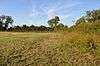 |
0.7 hectares (1.7 acres)[102] | YES | Hemingford Grey 52°18′22″N 0°06′29″W / 52.306°N 0.108°W TL291692 [102] |
WTBCN[103] | Map | Citation | The site is calcareous clay pasture with a wide variety of plant species, including the herbs oxeye daisy and yellow rattle. There are orchids such as common twayblades and common spotteds.[104] | ||
| Hildersham Wood | 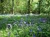 |
7.4 hectares (18 acres) | Linton 52°05′13″N 0°14′17″E / 52.087°N 0.238°E TL534456 |
Map | Citation | |||||
| Histon Road | 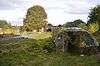 |
0.6 hectares (1.5 acres)[105] | NO | Cambridge 52°13′44″N 0°06′43″E / 52.229°N 0.112°E TL443611 [105] |
GCR[106] | Map | Citation | This is described by Natural England as a "key Pleistocene stratigraphic site". It is one only two sites in East Anglia which has an almost complete sequence of the second half of the warm Eemian interglacial, around 120,000 years ago.[107] | ||
| Holland Hall (Melbourn) Railway Cutting | _Railway_Cutting_6.jpg) |
3.3 hectares (8.2 acres)[108] | NO | Melbourn 52°04′01″N 0°00′43″W / 52.067°N 0.012°W TL364428 [108] |
Map | Citation | The site is steeply sloping chalk grassland, which has many plants which are unique in the county, and some which are nationally uncommon, such as wild candytuft. Also present is the nationally rare great pignut.[109] | |||
| Holme Fen |  |
269.4 hectares (666 acres) | Holme 52°29′10″N 0°13′26″W / 52.486°N 0.224°W TL207890 |
NCR, NNR[17] | Map | Citation | ||||
| Houghton Meadows |  |
4.7 hectares (12 acres) | Houghton 52°19′37″N 0°06′14″W / 52.327°N 0.104°W TL293716 |
WTBCN[110] | Map | Citation | ||||
| Kingston Wood and Outliers |  |
47.4 hectares (117 acres) | Kingston 52°10′12″N 0°03′50″W / 52.17°N 0.064°W TL325542 |
Map | Citation | |||||
| L-Moor, Shepreth | 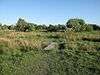 |
6.6 hectares (16 acres)[111] | YES | Shepreth 52°06′29″N 0°01′19″E / 52.108°N 0.022°E TL386474 [111] |
WTBCN[112] | Map | Citation | This is unploughed calcareous grassland which has diverse flora such as horseshoe vetch and felwort in drier areas, and devil's bit scabious and fen bedstraw in wetter ones. The site is regarded by Natural England as valuable for its invertebrates.[112][113] | ||
| Langley Wood |  |
31.6 hectares (78 acres) | Bartlow 52°03′25″N 0°20′31″E / 52.057°N 0.342°E TL607424 |
NCR | Map | Citation | ||||
| Little Catworth Meadow | 5.2 hectares (13 acres) | Catworth 52°20′28″N 0°22′55″W / 52.341°N 0.382°W TL103727 |
Map | Citation | ||||||
| Little Paxton Pits |  |
127.4 hectares (315 acres) | Little Paxton 52°15′32″N 0°14′31″W / 52.259°N 0.242°W TL201638 |
LNR[114] | Map | Citation | ||||
| Little Paxton Wood | 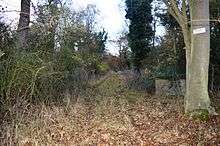 |
44.1 hectares (109 acres)[115] | NO | Little Paxton 52°15′29″N 0°17′24″W / 52.258°N 0.290°W TL168636 [115] |
Map | Citation | This ancient wood is wet ash and maple on heavy calcareous clay, with seaonally waterlogged soils, and it has an extremely diverse flora. A double bank and ditch has wood melick, sweet violet and the nationally restricted spiked star-of-Bethlehem.[116] | |||
| Madingley Wood | 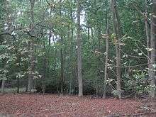 |
15.2 hectares (38 acres)[117] | NO | Cambridge 52°13′01″N 0°02′53″E / 52.217°N 0.048°E TL400596 [117] |
Map | Citation | The western part of this wood is ancient pedunculate oak, with other trees including ash and field maple, with hazel and hawthorn in the shrub layer. The newer eastern woodland is elm and ash. There is a variety of mosses. The site has been extensively used by Cambridge University for research and teaching.[118] | |||
| Monk's Wood and The Odd Quarter | 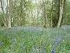 |
169.3 hectares (418 acres) | Wood Walton 52°24′18″N 0°14′24″W / 52.405°N 0.24°W TL198800 |
NCR, NNR[17] | Map | Citation | ||||
| Nene Washes | 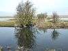 |
1,522.9 hectares (3,763 acres) | Peterborough 52°35′N 0°04′W / 52.58°N 0.07°W TF307999 |
NCR, Ramsar, RSPB, SAC, SPA | Map | Citation | ||||
| Orton Pit | 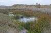 |
145.8 hectares (360 acres)[119] | PP | Peterborough 52°31′55″N 0°17′20″W / 52.532°N 0.289°W} TL162941[119] |
SAC[120] | Map | Citation | This extensive area of disused brick clay workings has the largest known population in Britain of great crested newts. There are ten species of stonewort, including chara canescens, which was previously thought to be extinct in Britain, and four other nationally rare species.[121] | ||
| Orwell Clunch Pit | 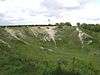 |
1.9 hectares (4.7 acres) | Orwell 52°08′13″N 0°00′36″W / 52.137°N 0.01°W TL363506 |
Map | Citation | |||||
| Ouse Washes | 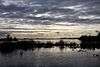 |
2,513.6 hectares (6,211 acres) | Ely 52°28′N 0°11′E / 52.46°N 0.19°E TL490879 |
NCR, Ramsar, RSPB, SAC, SPA, WTBCN,[122] WWT | Map | Citation | ||||
| Out and Plunder Woods | 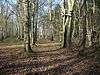 |
38.6 hectares (95 acres) | Great Bradley 52°09′58″N 0°25′23″E / 52.166°N 0.423°E TL657547 |
Map | Citation | |||||
| Overhall Grove | 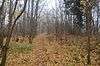 |
17.4 hectares (43 acres)[123] | YES | Knapwell 52°14′56″N 0°02′31″W / 52.249°N 0.042°W TL338630 [123] |
NCR,[124] WTBCN[125] | Map | Citation | This site is the largest elm woodland in the county. It was seriously affected by Dutch elm disease, but many trees have regenerated from their bases, and the mixture of new growth and dead wood provides a very good habitat for insects and birds.[125] | ||
| Papworth Wood | 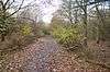 |
8.7 hectares (21 acres)[126] | YES | Papworth Everard 52°14′56″N 0°06′36″W / 52.249°N 0.11°W TL291629 [126] |
Map | Citation | This is one of the oldest secondary woods in the county. It has diverse ground flora including brambles, rough meadow grass, stinging nettles, ground ivy, bluebells and primroses.[127] | |||
| Park Wood | 8.1 hectares (20 acres) | Brinkley 52°09′54″N 0°23′46″E / 52.165°N 0.396°E TL640546 |
Map | Citation | ||||||
| Perry Woods | 67.9 hectares (168 acres) | Kimbolton 52°17′02″N 0°20′24″W / 52.284°N 0.34°W TL133664 |
Map | Citation | ||||||
| Portholme | 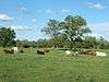 |
106.0 hectares (262 acres)[128] | YES | Huntingdon 52°19′16″N 0°11′17″W / 52.321°N 0.188°W TL236708 [128] |
NCR,[129] SAC[130] | Map | Citation | The site is an alluvial flood meadow, and one of the largest areas of grassland which is still traditionally managed as a Lammas meadow. Watercourses have some unusual invertebrates, including the nationally restricted dragonfly Libellula fulva.[129] | ||
| Roman Road | 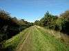 |
12.4 hectares (31 acres) | Cambridge 52°09′25″N 0°12′22″E / 52.157°N 0.206°E TL510532 |
SM | Map | Citation | ||||
| Sawston Hall Meadows | 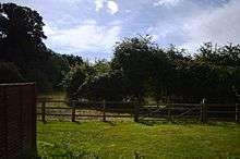 |
7.4 hectares (18 acres)[131] | NO | Sawston 52°07′08″N 0°10′34″E / 52.119°N 0.176°E TL491490 [131] |
Map | Citation | This site has spring fed peat meadows on chalk, a habitat formerly common but now rare. It has the nationally rare flower Selinum carvifolia, which is only found in Cambridgeshire. Drier grassland has a varied flora including spotted-orchid.[132] | |||
| Shippea Hill | 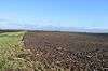 |
27.6 hectares (68 acres)[133] | NO | Littleport 52°26′17″N 0°24′25″E / 52.438°N 0.407°E TL637850 [133] |
GCR[134] | Map | Citation | The succession of sedimentary layers in the Fens in the Holocene epoch, the period since the last ice age, was determined on the basis of this site. It is particularly important for dating the "Fen Clay transgression" of the sea into the Fens in the Neolithic.[135][136] | ||
| Snailwell Meadows |  |
15.2 hectares (38 acres)[137] | NO | Snailwell 52°17′02″N 0°24′00″E / 52.284°N 0.4°E TL638678 [137] |
Map | Citation | The meadows are on peat overlying spring-fed chalk, with a variety of soil conditions. Some areas are dry calcareous pasture, and others are wet neutral and marshy acidic grassland. Flowering plants include the nationally rare umbellifer Cambridge milk-parsley.[138] | |||
| Soham Wet Horse Fen |  |
33.8 hectares (84 acres) | Soham 52°19′48″N 0°21′50″E / 52.33°N 0.364°E TL612728 |
WTBCN | Map | Citation | ||||
| Southorpe Meadow |  |
2.0 hectares (4.9 acres)[139] | YES | Southorpe 52°36′54″N 0°24′07″W / 52.615°N 0.402°W TF083031 [139] |
WTBCN[140] | Map | Citation | This is one of the few surviving areas of neutral grassland in the county, where ridge and furrow from medieval ploughing can be seen. There is a rich variety of species, such as red fescue in drier areas, and salad burnet in damper ones.[141] | ||
| Southorpe Paddock |  |
1.6 hectares (4.0 acres)[142] | YES | Southorpe 52°36′22″N 0°24′04″W / 52.606°N 0.401°W TF084021 [142] |
WTBCN[143] | Map | Citation | This site is a rare example of unimproved grassland on the Jurassic limestone of eastern England. It has typical limestone plants such as purple milk-vetch and clustered bellflower. Mature hedgerows provide additional habitats for wildlife.[144] | ||
| Southorpe Roughs | 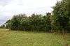 |
9.8 hectares (24 acres)[145] | NO | Southorpe 52°36′54″N 0°25′01″W / 52.615°N 0.417°W TF073031 [145] |
Map | Citation | This is a disused quarry which has grassland on Jurassic limestone. The main grasses are tor-grass and sheep's fescue, and there are the nationally rare plants spotted cat's ear and pasque flower.[146] | |||
| St Neots Common |  |
33.4 hectares (83 acres)[147] | YES | St Neots 52°14′10″N 0°16′16″W / 52.236°N 0.271°W TL182612 [147] |
Map | Citation | This site on the east bank of the River Great Ouse has grassland, willow carr, ditches and ponds, which support diverse wildlife species. The grassland is traditionally maintained by grazing, and herbs in wetter areas include marsh orchids and marsh arrow grass.[148] | |||
| Stow-Cum-Quy Fen | 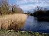 |
29.9 hectares (74 acres) | Lode 52°14′35″N 0°13′08″E / 52.243°N 0.219°E TL516628 |
Map | Citation | |||||
| Sutton Heath and Bog | 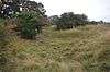 |
18.3 hectares (45 acres)[149] | FP | Wansford 52°35′13″N 0°23′38″W / 52.587°N 0.394°W TF089000 [149] |
Map | Citation | This site has calcareous grassland on Jurassic limestone and base-poor marshy neutral grassland. The base poor areas have a diverse variety of plant species, including some which are locally uncommon.[150] | |||
| Ten Wood | 17.7 hectares (44 acres) | Burrough Green 52°10′34″N 0°25′55″E / 52.176°N 0.432°E TL664559 |
Map | Citation | ||||||
| Thriplow Meadows |  |
3.5 hectares (8.6 acres)[151] | YES | Thriplow 52°06′07″N 0°05′49″E / 52.102°N 0.097°E TL437469 [151] |
Map | Citation | The site has two fields with neutral pastures which range from dry to marshy. These lowland habitats are now rare. Wetland herbs include ragged robin, fleabane and purple loosestrife.[152][153] | |||
| Thriplow Peat Holes | 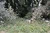 |
12.2 hectares (30 acres)[154] | NO | Thriplow 52°06′25″N 0°06′58″E / 52.107°N 0.116°E TL450475 [154] |
Map | Citation | The site has rare alder carr and fen habitats, enhanced by ditches and ponds, with a wide variety of invertebrates. The main vegetation is alder, ash, willow and guelder rose.[155] | |||
| Traveller's Rest Pit |  |
2.3 hectares (5.7 acres)[156] | NO | Cambridge 52°13′05″N 0°05′24″E / 52.218°N 0.09°E TL429598 [156] |
GCR[157] | Map | Citation | This is described by Natural England as an important site dating to the Anglian ice age around 450,000 years ago. It also has the most extensive collection of paleolithic stone tools in the county, which are thought to date to the Cromerian Stage, which preceded the Anglian.[158][159] | ||
| Upware Bridge Pit North | 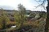 |
2.5 hectares (6.2 acres)[160] | NO | Wicken 52°19′44″N 0°15′47″E / 52.329°N 0.263°E TL543725[160] |
GCR[161] | Map | Citation | This site shows exposes rocks of Oxfordian age, around 160 million years ago. It was then a sea which was connected to the Tethys Ocean, and it has many Tethyan invertebrate fossils. It is described by Natural England as "an essential site for the study of Oxfordian palaeontology and palaeogeography in the English midlands".[162] | ||
| Upware North Pit | 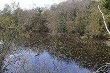 |
1.1 hectares (2.7 acres)[163] | YES | Wicken 52°19′52″N 0°15′50″E / 52.331°N 0.264°E TL544727 [163] |
Map | Citation | This site has several flooded pits with areas of willow and hawthorn. It is one of only two Brtish sites which has water germander, a plant listed in the British Red Data Books of threatened species. Other unusual aquatic plants are great water dock and greater pond sedge.[164] | |||
| Upware South Pit | 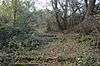 |
1.1 hectares (2.7 acres)[165] | YES | Upware 52°18′54″N 0°15′22″E / 52.315°N 0.256°E TL539709[165] |
GCR[166] | Map | Citation | This site has rocks dating to the Oxfordian stage, around 160 million years ago. It was then a coral reef, and has fossils of bivalves and ammonites, as well as corals, which show affinities with the fauna of the Tethys Ocean. It is described by Natural England as a key site in study of the Oxfordian.[167] | ||
| Upwood Meadows | 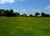 |
6.0 hectares (15 acres)[168] | Upwood 52°25′37″N 0°09′43″W / 52.427°N 0.162°W TL251826[168] |
NCR,[169] NNR,[17] WTBCN[170] | Map | Citation | The site has three fields on calcareous clay with poor drainage, a type of pasture now very rare, and was described by Derek Ratcliffe as having "an outstandingly rich and diverse flora".[169] One of the fields, which is agriculturally unimproved, has medieval ridge and furrow.[171] | |||
| Wansford Pasture | 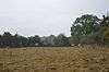 |
3.1 hectares (7.7 acres)[172] | YES | Wansford 52°34′55″N 0°25′26″W / 52.582°N 0.424°W TL069994 [172] |
WTBCN[173] | Map | Citation | This is a south-facing slope, with Jurassic limestone grassland and a flush lower down which has a wide variety of wet-loving plants, including some which are rare in the county. The ecology is maintained by avoiding the use of fertilisers and herbicides, and by grazing.[174] | ||
| Warboys and Wistow Woods | 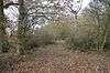 |
44.5 hectares (110 acres)[175] | PP | Warboys 52°25′08″N 0°05′24″W / 52.419°N 0.090°W TL300818 [175] |
WTBCN[176] | Map | Citation | These woods have high conservation value because they are ancient ash and maple, and this habitat has sharply declined in extent since 1945. The woods have diverse flora and fauna, particularly invertebrates.[177] | ||
| Warboys Clay Pit | 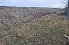 |
12.6 hectares (31 acres)[178] | NO | Warboys 52°25′08″N 0°04′48″W / 52.419°N 0.08°W TL307818 [178] |
GCR[179] | Map | Citation | According to Natural England this "unrivalled Oxfordian section shows more than 20 metres of Upper Oxford Clay". It has ammonite fossils dating to the Late Jurassic, around 160 million years ago.[180] | ||
| Waresley Wood | 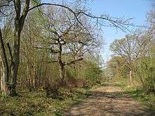 |
54.2 hectares (134 acres) | Waresley 52°10′37″N 0°09′22″W / 52.177°N 0.156°W TL262548 |
WTBCN | Map | Citation | ||||
| Weaveley and Sand Woods | 62.0 hectares (153 acres) | Gamlingay 52°10′16″N 0°12′43″W / 52.171°N 0.212°W TL224540 |
Map | Citation | ||||||
| West, Abbot's and Lound Woods | 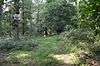 |
50.4 hectares (125 acres)[181] | NO | Wittering 52°35′46″N 0°26′17″W / 52.596°N 0.438°W TF059010 [181] |
Map | Citation | The site has a variety of woodland types, some of which are rare in Britain, including plateau alderwood. There are ancient woodland plants such as yellow archangel and toothwort.[182] | |||
| Whitewater Valley | 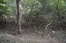 |
4.3 hectares (11 acres)[183] | NO | Wittering 52°37′12″N 0°27′40″W / 52.620°N 0.461°W TF043036 [183] |
Map | Citation | Habitats in this site include a stream together with associated marsh, tall fen and willow carr. The carr has a varied flora, and the marsh has many plants rare in the county. There are also springs, which have mosses including the uncommon cratoneuron commutatum.[184] | |||
| Whittlesford - Thriplow Hummocky Fields | 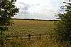 |
55.6 hectares (137 acres)[185] | NO | Whittlesford 52°06′54″N 0°06′43″E / 52.115°N 0.112°E TL447484 [185] |
Map | Citation | This site has the nationally rare grass-poly, and the nationally uncommon fairy shrimp chirocephalus diaphanus. They are found in shallow hollows in arable fields, which are the result of ice lenses melting at the end of the last ice age.[186] | |||
| Wicken Fen |  |
255.0 hectares (630 acres) | Wicken 52°18′25″N 0°16′41″E / 52.307°N 0.278°E TL554701 |
NCR, NNR,[17] NT, Ramsar, SAC | Map | Citation | ||||
| Wilbraham Fens | 62.0 hectares (153 acres) | Cambridge 52°12′32″N 0°13′08″E / 52.209°N 0.219°E TL517591 |
Map | Citation | ||||||
| Woodwalton Fen | 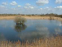 |
208.7 hectares (516 acres) | Ramsey 52°26′42″N 0°11′35″W / 52.445°N 0.193°W TL229845 |
NCR, NNR,[17] Ramsar, SAC | Map | Citation | ||||
| Woodwalton Marsh |  |
0.8 hectares (2.0 acres) | Ramsey 52°24′54″N 0°13′16″W / 52.415°N 0.221°W TL211812 |
WTBCN | Map | Citation |
See also
Notes
- A Data rounded to one decimal place.
- B Grid reference is based on the British national grid reference system, also known as OSGB36, and is the system used by the Ordnance Survey.[187]
- C Link to maps using the Nature on the Map service provided by English Nature.
References
- ↑ "Notification of SSSIs". English Nature. Retrieved 2008-03-24.
- ↑ "SSSIs in Cambridgeshire". English Nature. Retrieved 2012-09-01.
- ↑ "County search of SSSIs". English Nature. Retrieved 2006-08-05.
- ↑ Natural England County Background datasheet for Cambridgeshire SSSIs Accessed 29 August 2012
- 1 2 "Designated Sites View: Adventurers' Land". Sites of Special Scientific Interest. Natural England. Retrieved 25 November 2016.
- ↑ "Adventurers` Land (Quaternary of East Anglia)". Joint Nature Conservation Committee. Retrieved 4 December 2016.
- ↑ "Adventurers' Land citation" (PDF). Sites of Special Scientific Interest. Natural England. Retrieved 25 November 2016.
- 1 2 "Designated Sites View: Alder Carr". Sites of Special Scientific Interest. Natural England. Retrieved 4 September 2016.
- ↑ "Alder Carr citation" (PDF). Sites of Special Scientific Interest. Natural England. Retrieved 4 September 2016.
- 1 2 "Designated Sites View: Aversley Wood". Sites of Special Scientific Interest. Natural England. Retrieved 28 November 2016.
- ↑ "Aversley Wood". Woodland Trust. Retrieved 28 November 2016.
- ↑ "Aversley Wood citation" (PDF). Sites of Special Scientific Interest. Natural England. Retrieved 28 November 2016.
- 1 2 "Designated Sites View: Balsham Wood". Sites of Special Scientific Interest. Natural England. Retrieved 4 September 2016.
- ↑ "Balsham Wood citation" (PDF). Sites of Special Scientific Interest. Natural England. Retrieved 4 September 2016.
- 1 2 "Designated Sites View: Barnack Hills & Holes". Sites of Special Scientific Interest. Natural England. Retrieved 28 November 2016.
- ↑ Ratcliffe, A Nature Conservation Review, p. 138
- 1 2 3 4 5 6 7 8 9 "Cambridgeshire's National Nature Reserves". Natural England. Retrieved 28 September 2016.
- ↑ "Barnack Hills and Holes". Joint Nature Conservation Committee. Retrieved 28 November 2016.
- ↑ "Barnack Hills & Holes citation" (PDF). Sites of Special Scientific Interest. Natural England. Retrieved 28 November 2016.
- 1 2 "Designated Sites View: Barrington Chalk Pit". Sites of Special Scientific Interest. Natural England. Retrieved 29 September 2016.
- ↑ "Barrington Chalk Pit (Cenomanian, Turonian, Senonian, Maastrichtian)". Joint Nature Conservation Committee. Retrieved 29 September 2016.
- ↑ "Barrington Chalk Pit citation" (PDF). Sites of Special Scientific Interest. Natural England. Retrieved 29 September 2016.
- 1 2 "Designated Sites View: Barrington Pit". Sites of Special Scientific Interest. Natural England. Retrieved 29 September 2016.
- ↑ "Barrington Pit (Pleistocene Vertebrata)". Joint Nature Conservation Committee. Retrieved 29 September 2016.
- ↑ "Barrington Pit citation" (PDF). Sites of Special Scientific Interest. Natural England. Retrieved 29 September 2016.
- 1 2 "Designated Sites View: Bassenhally Pit". Sites of Special Scientific Interest. Natural England. Retrieved 9 October 2016.
- ↑ "Bassenhally Pit citation" (PDF). Sites of Special Scientific Interest. Natural England. Retrieved 9 October 2016.
- 1 2 "Designated Sites View: Bedford Purlieus". Sites of Special Scientific Interest. Natural England. Retrieved 28 November 2016.
- ↑ Ratcliffe, A Nature Conservation Review, p. 57
- ↑ "Bedford Purlieus citation" (PDF). Sites of Special Scientific Interest. Natural England. Retrieved 28 November 2016.
- 1 2 "Designated Sites View: Bonemills Hollow". Sites of Special Scientific Interest. Natural England. Retrieved 28 August 2016.
- ↑ "Bonemills Hollow citation" (PDF). Sites of Special Scientific Interest. Natural England. Retrieved 28 August 2016.
- 1 2 "Designated Sites View: Brackland Rough". Sites of Special Scientific Interest. Natural England. Retrieved 6 November 2016.
- ↑ "Fordham Woods". Wildlife Trust for Bedfordshire, Cambridgeshire and Northamptonshire. Retrieved 26 July 2016.
- ↑ "Brackland Rough citation" (PDF). Sites of Special Scientific Interest. Natural England. Retrieved 6 November 2016.
- 1 2 "Designated Sites View: Brampton Meadow". Sites of Special Scientific Interest. Natural England. Retrieved 13 September 2016.
- ↑ "Brampton Meadow citation" (PDF). Sites of Special Scientific Interest. Natural England. Retrieved 13 September 2016.
- 1 2 "Designated Sites View: Brampton Racecourse". Sites of Special Scientific Interest. Natural England. Retrieved 13 September 2016.
- ↑ "Brampton Racecoursecitation" (PDF). Sites of Special Scientific Interest. Natural England. Retrieved 13 September 2016.
- 1 2 "Designated Sites View: Brampton Wood". Sites of Special Scientific Interest. Natural England. Retrieved 28 November 2016.
- ↑ "Brampton Wood". Wildlife Trust for Bedfordshire, Cambridgeshire and Northamptonshire. Retrieved 28 November 2016.
- ↑ "Brampton Wood citation" (PDF). Sites of Special Scientific Interest. Natural England. Retrieved 28 November 2016.
- 1 2 "Buff Wood". Wildlife Trust for Bedfordshire, Cambridgeshire and Northamptonshire. Retrieved 29 November 2016.
- 1 2 "Designated Sites View: Caldecote Meadows". Sites of Special Scientific Interest. Natural England. Retrieved 29 September 2016.
- ↑ "Caldecote Meadows citation" (PDF). Sites of Special Scientific Interest. Natural England. Retrieved 29 September 2016.
- 1 2 "Designated Sites View: Cam Washes". Sites of Special Scientific Interest. Natural England. Retrieved 29 November 2016.
- ↑ "Cam Washes citation" (PDF). Sites of Special Scientific Interest. Natural England. Retrieved 29 November 2016.
- 1 2 "Designated Sites View: Castor Flood Meadows". Sites of Special Scientific Interest. Natural England. Retrieved 30 November 2016.
- ↑ "Castor Flood Meadows citation" (PDF). Sites of Special Scientific Interest. Natural England. Retrieved 30 November 2016.
- 1 2 "Designated Sites View: Castor Hanglands SSSI". Sites of Special Scientific Interest. Natural England. Retrieved 30 November 2016.
- ↑ , Ratcliffe, A Nature Conservation Review, pp. 57–58, 141
- ↑ "Castor Hanglands citation" (PDF). Sites of Special Scientific Interest. Natural England. Retrieved 30 November 2016.
- 1 2 "Designated Sites View: Cherry Hinton Pit". Sites of Special Scientific Interest. Natural England. Retrieved 30 November 2016.
- ↑ "East Pit". Local Nature Reserves. Natural England. 20 February 2013. Retrieved 30 November 2016.
- ↑ "Cherry Hinton Chalk Pits". Wildlife Trust for Bedfordshire, Cambridgeshire and Northamptonshire. Retrieved 30 November 2016.
- ↑ "Cherry Hinton Pit citation" (PDF). Sites of Special Scientific Interest. Natural England. Retrieved 30 November 2016.
- 1 2 "Designated Sites View: Chettisham Meadow". Sites of Special Scientific Interest. Natural England. Retrieved 14 November 2016.
- ↑ "Chettisham Meadow". Wildlife Trust for Bedfordshire, Cambridgeshire and Northamptonshire. Retrieved 14 November 2016.
- ↑ "Chettisham Meadow citation" (PDF). Sites of Special Scientific Interest. Natural England. Retrieved 14 November 2016.
- 1 2 "Designated Sites View: Chippenham Fen and Snailwell Poor's Fen". Sites of Special Scientific Interest. Natural England. Retrieved 30 November 2016.
- ↑ Ratcliffe, A Nature Conservation Review, pp.211–12
- ↑ "Information Sheet on Ramsar Wetlands: Chippenham Fen" (PDF). Joint Nature Conservation Committee. Retrieved 30 November 2016.
- ↑ "Fenland SAC". Joint Nature Conservation Committee. Retrieved 30 November 2016.
- ↑ "Chippenham Fen and Snailwell Poor's Fen". Sites of Special Scientific Interest. Natural England.
- 1 2 "Designated Sites View: Delph Bridge Drain". Sites of Special Scientific Interest. Natural England. Retrieved 6 November 2016.
- ↑ "Delph Bridge Drain citation" (PDF). Sites of Special Scientific Interest. Natural England. Retrieved 6 November 2016.
- 1 2 "Designated Sites View: Dernford Fen". Sites of Special Scientific Interest. Natural England. Retrieved 4 September 2016.
- ↑ "Dernford Fen citation" (PDF). Sites of Special Scientific Interest. Natural England. Retrieved 4 September 2016.
- 1 2 "Designated Sites View: Devil's Dyke". Sites of Special Scientific Interest. Natural England. Retrieved 30 November 2016.
- ↑ "Devil`s Dyke SAC". Joint Nature Conservation Committee. Retrieved 30 November 2016.
- 1 2 "Devil's Ditch/Dyke, Reach to Woodditton". Heritage Gateway. Retrieved 30 November 2016.
- ↑ "Devil's Ditch, Reach to Woodditton". Historic England. Retrieved 30 November 2016.
- ↑ "Devil's Dyke citation" (PDF). Sites of Special Scientific Interest. Natural England. Retrieved 30 November 2016.
- 1 2 "Designated Sites View: Dogsthorpe Star Pit". Sites of Special Scientific Interest. Natural England. Retrieved 30 November 2016.
- ↑ "Dogsthorpe Star Pit". Local Nature Reserves. Natural England. 20 February 2013. Retrieved 30 November 2016.
- ↑ "Dogsthorpe Star Pit". Wildlife Trust for Bedfordshire, Cambridgeshire and Northamptonshire. Retrieved 30 November 2016.
- ↑ "Dogsthorpe Star Pitcitation" (PDF). Sites of Special Scientific Interest. Natural England. Retrieved 30 November 2016.
- 1 2 "Designated Sites View: Elsworth Wood". Sites of Special Scientific Interest. Natural England. Retrieved 27 November 2016.
- ↑ "Elsworth Wood citation" (PDF). Sites of Special Scientific Interest. Natural England. Retrieved 27 November 2016.
- 1 2 "Designated Sites View: Ely Pits and Meadows". Sites of Special Scientific Interest. Natural England. Retrieved 1 December 2016.
- ↑ "Roswell Pits, Ely (Jurassic - Cretaceous Reptilia)". Joint Nature Conservation Committee. Retrieved 1 December 2016.
- ↑ "Roswell Pits". Wildlife Trust for Bedfordshire, Cambridgeshire and Northamptonshire. Retrieved 1 December 2016.
- ↑ "Ely Pits and Meadows citation" (PDF). Sites of Special Scientific Interest. Natural England. Retrieved 1 December 2016.
- ↑ "Eversden and Wimpole Woods SAC". Joint Nature Conservation Committee. Retrieved 2 December 2016.
- 1 2 "Designated Sites View: Eye Gravel Pit". Sites of Special Scientific Interest. Natural England. Retrieved 9 October 2016.
- ↑ "Eye Gravel Pit (Quaternary of East Anglia)". Joint Nature Conservation Committee. Retrieved 9 October 2016.
- ↑ "Eye Gravel Pit citation" (PDF). Sites of Special Scientific Interest. Natural England. Retrieved 9 October 2016.
- ↑ "Fleam Dyke". Historic England. Retrieved 2 December 2016.
- ↑ "Fowlmere". Royal Society for the Protection of Birds. Retrieved 2 December 2016.
- ↑ "Fulbourn Fen". Wildlife Trust for Bedfordshire, Cambridgeshire and Northamptonshire. Retrieved 1 December 2016.
- 1 2 "Designated Sites View: Furze Hill". Sites of Special Scientific Interest. Natural England. Retrieved 4 September 2016.
- ↑ "Furze Hill citation" (PDF). Sites of Special Scientific Interest. Natural England. Retrieved 4 September 2016.
- 1 2 "Designated Sites View: Godmanchester Eastside Common". Sites of Special Scientific Interest. Natural England. Retrieved 13 September 2016.
- ↑ "Godmanchester Eastside Common citation" (PDF). Sites of Special Scientific Interest. Natural England. Retrieved 13 September 2016.
- ↑ "Grafham Water". Wildlife Trust for Bedfordshire, Cambridgeshire and Northamptonshire. Retrieved 1 December 2016.
- 1 2 "Designated Sites View: Great Stukeley Railway Cutting". Sites of Special Scientific Interest. Natural England. Retrieved 13 September 2016.
- ↑ "Great Stukeley Railway Cutting citation" (PDF). Sites of Special Scientific Interest. Natural England. Retrieved 13 September 2016.
- 1 2 "Designated Sites View: Hardwick Wood". Sites of Special Scientific Interest. Natural England. Retrieved 1 October 2016.
- 1 2 "Hardwick Wood". Wildlife Trust for Bedfordshire, Cambridgeshire and Northamptonshire. Retrieved 29 September 2016.
- ↑ "Hardwick Wood citation" (PDF). Sites of Special Scientific Interest. Natural England. Retrieved 1 October 2016.
- ↑ "Hayley Wood". Wildlife Trust for Bedfordshire, Cambridgeshire and Northamptonshire. Retrieved 1 December 2016.
- 1 2 "Designated Sites View: Hemingford Grey Meadow". Sites of Special Scientific Interest. Natural England. Retrieved 13 September 2016.
- ↑ "Arthur's Meadow". Wildlife Trust for Bedfordshire, Cambridgeshire and Northamptonshire. Retrieved 26 July 2016.
- ↑ "Hemingford Grey Meadow citation" (PDF). Sites of Special Scientific Interest. Natural England. Retrieved 13 September 2016.
- 1 2 "Designated Sites View: Histon Road". Sites of Special Scientific Interest. Natural England. Retrieved 26 October 2016.
- ↑ "Histon Road (Quaternary of East Anglia)". Joint Nature Conservation Committee. Retrieved 26 October 2016.
- ↑ "Histon Road citation" (PDF). Sites of Special Scientific Interest. Natural England. Retrieved 26 October 2016.
- 1 2 "Designated Sites View: Holland Hall (Melbourn) Railway Cutting". Sites of Special Scientific Interest. Natural England. Retrieved 1 October 2016.
- ↑ "Holland Hall (Melbourn) Railway Cutting citation" (PDF). Sites of Special Scientific Interest. Natural England. Retrieved 1 October 2016.
- ↑ "Houghton Meadows". Wildlife Trust for Bedfordshire, Cambridgeshire and Northamptonshire. Retrieved 1 December 2016.
- 1 2 "Designated Sites View: L-Moor, Shepreth". Sites of Special Scientific Interest. Natural England. Retrieved 2 October 2016.
- 1 2 "Shepreth L Moor". Wildlife Trust for Bedfordshire, Cambridgeshire and Northamptonshire. Retrieved 27 July 2016.
- ↑ "L-Moor, Shepreth citation" (PDF). Sites of Special Scientific Interest. Natural England. Retrieved 2 October 2016.
- ↑ "Little Paxton Pits". Local Nature Reserves. Natural England. 21 fEBRUARY 2013. Retrieved 2 December 2016. Check date values in:
|date=(help) - 1 2 "Designated Sites View: Little Paxton Wood". Sites of Special Scientific Interest. Natural England. Retrieved 27 November 2016.
- ↑ "Little Paxton Wood citation" (PDF). Sites of Special Scientific Interest. Natural England. Retrieved 27 November 2016.
- 1 2 "Designated Sites View: Madingley Wood". Sites of Special Scientific Interest. Natural England. Retrieved 2 October 2016.
- ↑ "Madingley Wood citation" (PDF). Sites of Special Scientific Interest. Natural England. Retrieved 2 October 2016.
- 1 2 "Designated Sites View: Orton Pit". Sites of Special Scientific Interest. Natural England. Retrieved 31 October 2016.
- ↑ "Orton Pit". Joint Nature Conservation Committee. Retrieved 31 October 2016.
- ↑ "Orton Pit citation" (PDF). Sites of Special Scientific Interest. Natural England. Retrieved 31 October 2016.
- ↑ "Ouse Washes". Wildlife Trust for Bedfordshire, Cambridgeshire and Northamptonshire. Retrieved 1 December 2016.
- 1 2 "Designated Sites View: Overhall Grove". Sites of Special Scientific Interest. Natural England. Retrieved 27 November 2016.
- ↑ Ratcliffe, A Nature Conservation Review, p. 61
- 1 2 "Overhall Grove". Wildlife Trust for Bedfordshire, Cambridgeshire and Northamptonshire. Retrieved 27 November 2016.
- 1 2 "Designated Sites View: Papworth Wood". Sites of Special Scientific Interest. Natural England. Retrieved 27 November 2016.
- ↑ "Papworth Wood citation" (PDF). Sites of Special Scientific Interest. Natural England. Retrieved 27 November 2016.
- 1 2 "Designated Sites View: Portholme". Sites of Special Scientific Interest. Natural England. Retrieved 13 September 2016.
- 1 2 "Portholme citation" (PDF). Sites of Special Scientific Interest. Natural England. Retrieved 13 September 2016.
- ↑ "Portholme". Joint Nature Conservation Committee. Retrieved 13 September 2016.
- 1 2 "Designated Sites View: Sawston Hall Meadows". Sites of Special Scientific Interest. Natural England. Retrieved 5 September 2016.
- ↑ "Sawston Hall Meadows citation" (PDF). Sites of Special Scientific Interest. Natural England. Retrieved 5 September 2016.
- 1 2 "Designated Sites View: Shippea Hill SSSI". Sites of Special Scientific Interest. Natural England. Retrieved 14 November 2016.
- ↑ "Shippea Hill (Quaternary of East Anglia)". Joint Nature Conservation Committee. Retrieved 13 November 2016.
- ↑ "Shippea Hill citation" (PDF). Sites of Special Scientific Interest. Natural England. Retrieved 14 November 2016.
- ↑ French, Charles (2005). "The Flandrian Sequence". Geoarchaeology in Action: Studies in Soil Micromorphology and Landscape Evolution. Routledge. ISBN 9781134482337.
- 1 2 "Designated Sites View: Snailwell Meadows". Sites of Special Scientific Interest. Natural England. Retrieved 6 November 2016.
- ↑ "Snailwell Meadows citation" (PDF). Sites of Special Scientific Interest. Natural England. Retrieved 6 November 2016.
- 1 2 "Designated Sites View: Southorpe Meadow". Sites of Special Scientific Interest. Natural England. Retrieved 30 August 2016.
- ↑ "Southorpe Meadow". Wildlife Trust for Bedfordshire, Cambridgeshire and Northamptonshire. Retrieved 30 August 2016.
- ↑ "Southorpe Meadow citation" (PDF). Sites of Special Scientific Interest. Natural England. Retrieved 30 August 2016.
- 1 2 "Designated Sites View: Southorpe Paddock". Sites of Special Scientific Interest. Natural England. Retrieved 30 August 2016.
- ↑ "Southorpe Paddock". Wildlife Trust for Bedfordshire, Cambridgeshire and Northamptonshire. Retrieved 30 August 2016.
- ↑ "Southorpe Paddock citation" (PDF). Sites of Special Scientific Interest. Natural England. Retrieved 30 August 2016.
- 1 2 "Designated Sites View: Southorpe Roughs". Sites of Special Scientific Interest. Natural England. Retrieved 30 August 2016.
- ↑ "Southorpe Roughs citation" (PDF). Sites of Special Scientific Interest. Natural England. Retrieved 30 August 2016.
- 1 2 "Designated Sites View: St Neots Common". Sites of Special Scientific Interest. Natural England. Retrieved 28 November 2016.
- ↑ "St Neots Common citation" (PDF). Sites of Special Scientific Interest. Natural England. Retrieved 28 November 2016.
- 1 2 "Designated Sites View: Sutton Heath and Bog SSSI". Sites of Special Scientific Interest. Natural England. Retrieved 28 August 2016.
- ↑ "Sutton Heath and Bog citation" (PDF). Sites of Special Scientific Interest. Natural England. Retrieved 28 August 2016.
- 1 2 "Designated Sites View: Thriplow Meadows". Natural England. Retrieved 28 August 2016.
- ↑ "Thriplow Meadows citation" (PDF). Sites of Special Scientific Interest. Natural England. Retrieved 19 August 2016.
- ↑ "Map of Thriplow Meadows". Sites of Special Scientific Interest. Natural England. Retrieved 19 August 2016.
- 1 2 "Designated Sites View: Thriplow Peat Holes". Sites of Special Scientific Interest. Natural England. Retrieved 28 August 2016.
- ↑ "Thriplow Peat Holes citation" (PDF). Sites of Special Scientific Interest. Natural England. Retrieved 19 August 2016.
- 1 2 "Designated Sites View: Traveller's Rest Pit". Sites of Special Scientific Interest. Natural England. Retrieved 26 October 2016.
- ↑ "Travellers Rest Pit (Quaternary of East Anglia)". Joint Nature Conservation Committee. Retrieved 26 October 2016.
- ↑ "Traveller's Rest Pit citation" (PDF). Sites of Special Scientific Interest. Natural England. Retrieved 26 October 2016.
- ↑ "Traveller's Rest Pit baseline Report" (PDF). University of Cambridge. August 2011. p. 12. Retrieved 26 October 2016.
- 1 2 "Designated Sites View: Upware Bridge Pit North". Sites of Special Scientific Interest. Natural England. Retrieved 6 November 2016.
- ↑ "Dimmock's Cote Quarry (Upware) (Oxfordian)". Joint Nature Conservation Committee. Retrieved 6 November 2016.
- ↑ "Upware Bridge Pit North citation" (PDF). Sites of Special Scientific Interest. Natural England. Retrieved 6 November 2016.
- 1 2 "Designated Sites View: Upware North Pit". Sites of Special Scientific Interest. Natural England. Retrieved 9 November 2016.
- ↑ "Upware North Pit citation" (PDF). Sites of Special Scientific Interest. Natural England. Retrieved 9 November 2016.
- 1 2 "Designated Sites View: Upware South Pit". Sites of Special Scientific Interest. Natural England. Retrieved 9 November 2016.
- ↑ "Upware South Pit (Oxfordian)". Joint Nature Conservation Committee. Retrieved 6 November 2016.
- ↑ "Upware South Pit citation" (PDF). Sites of Special Scientific Interest. Natural England. Retrieved 9 November 2016.
- 1 2 "Designated Sites View: Upwood Meadows". Sites of Special Scientific Interest. Natural England. Retrieved 21 November 2016.
- 1 2 Ratcliffe, A Nature Conservation Review, p. 139
- ↑ "Upwood Meadows". Wildlife Trust for Bedfordshire, Cambridgeshire and Northamptonshire. Retrieved 21 November 2016.
- ↑ "Upwood Meadows citation" (PDF). Sites of Special Scientific Interest. Natural England. Retrieved 21 November 2016.
- 1 2 "Designated Sites View: Wansford Pasture". Sites of Special Scientific Interest. Natural England. Retrieved 28 August 2016.
- ↑ "Wansford Pasture & Standen's Pasture". Wildlife Trust for Bedfordshire, Cambridgeshire and Northamptonshire. Retrieved 26 August 2016.
- ↑ "Wansford Pasture citation" (PDF). Sites of Special Scientific Interest. Natural England. Retrieved 28 August 2016.
- 1 2 "Designated Sites View: Warboys and Wistow Woods". Sites of Special Scientific Interest. Natural England. Retrieved 4 December 2016.
- ↑ "Wistow Wood". Wildlife Trust for Bedfordshire, Cambridgeshire and Northamptonshire. Retrieved 3 December 2016.
- ↑ "Warboys and Wistow Woods citation" (PDF). Sites of Special Scientific Interest. Natural England. Retrieved 4 December 2016.
- 1 2 "Designated Sites View: Warboys Clay Pit". Sites of Special Scientific Interest. Natural England. Retrieved 4 December 2016.
- ↑ "Warboys Clay Pit (Oxfordian)" (PDF). Joint Nature Conservation Committee. Retrieved 4 December 2016.
- ↑ "Warboys Clay Pit citation" (PDF). Sites of Special Scientific Interest. Natural England. Retrieved 4 December 2016.
- 1 2 "Designated Sites View: West, Abbot's and Lound Woods". Sites of Special Scientific Interest. Natural England. Retrieved 28 August 2016.
- ↑ "West, Abbot's and Lound Woods citation" (PDF). Sites of Special Scientific Interest. Natural England. Retrieved 28 August 2016.
- 1 2 "Designated Sites View: Whitewater Valley". Sites of Special Scientific Interest. Natural England. Retrieved 30 August 2016.
- ↑ "Whitewater Valley citation" (PDF). Sites of Special Scientific Interest. Natural England. Retrieved 30 August 2016.
- 1 2 "Designated Sites View: Whittlesford - Thriplow Hummocky Fields". Sites of Special Scientific Interest. Natural England. Retrieved 28 August 2016.
- ↑ "Whittlesford - Thriplow Hummocky Fields citation" (PDF). Sites of Special Scientific Interest. Natural England. Retrieved 19 August 2016.
- ↑ "Guide to National Grid". Ordnance Survey. Retrieved 2006-08-07.
Coordinates: 52°20′N 0°0′W / 52.333°N -0.000°E
Sources
- Ratcliffe, Derek, ed. (1977). A Nature Conservation Review. 2. Cambridge, UK: Cambridge University Press. ISBN 0521 21403 3.