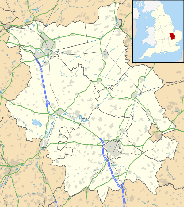
Godmanchester
| Godmanchester | |
 Post Street in Godmanchester |
|
 Godmanchester |
|
| Population | 6,711 (2011) |
|---|---|
| OS grid reference | TL245704 |
| Civil parish | Godmanchester |
| District | Huntingdonshire |
| Shire county | Cambridgeshire |
| Region | East |
| Country | England |
| Sovereign state | United Kingdom |
| Post town | HUNTINGDON |
| Postcode district | PE29 |
| Dialling code | 01480 |
| Police | Cambridgeshire |
| Fire | Cambridgeshire |
| Ambulance | East of England |
| EU Parliament | East of England |
| UK Parliament | Huntingdon |
|
|
Coordinates: 52°19′03″N 0°10′21″W / 52.3176°N 0.1725°W
Godmanchester /ˈɡɒdmənˈtʃɛstər/ is a small town and civil parish within the Huntingdonshire district of Cambridgeshire, in England. It lies on the south bank of the River Great Ouse, south of the larger town of Huntingdon, and on the A14 road.
History
The town is on the site of the Roman town of Durovigutum.[1] There is archaeological evidence of Celtic and earlier habitation prior to the establishment of a key Roman town and a Mansio (inn), so the area has probably been continuously occupied for more than 2000 years. The settlement was at a crossroads of Roman roads, with Ermine Street, the Via Devana (from Cambridge, between Colchester and Chester) and a military road from Sandy, Bedfordshire, all passing through. The Roman settlement was sacked by Anglo-Saxons in the third century. In contrast to Huntingdon, there have been vast amounts of archaeological finds in the centre of Godmanchester, which has two conservation areas[2] with a large number of timber-framed Tudor houses, the largest being Tudor Farm, dating from 1600 and restored in 1995.
The mansio is mentioned in Godmanchester's name, which comes from Anglo-Saxon Godmundceaster, meaning a "town or Roman buildings associated with a man called Godmund". The location is likely to have been originally settled due to the gravel beds providing a ford across the River Great Ouse.
In 1085 William the Conqueror ordered that a survey should be carried out across his kingdom to discover who owned which parts and what it was worth. The survey took place in 1086 and the results were recorded in what, since the 12th century, has become known as the Domesday Book. Starting with the king himself, for each landholder within a county there is a list of their estates or manors; and, for each manor, there is a summary of the resources of the manor, the amount of annual rent that was collected by the lord of the manor both in 1066 and in 1086, together with the taxable value.[3]
Godmanchester was listed in the Domesday Book in the Hundred of Leightonstone in Huntingdonshire; the name of the settlement was written as Godmundcestre in the Domesday Book.[4] In 1086 there was just one manor at Godmanchester; the annual rent paid to the lord of the manor in 1066 had been £40 and the rent was the same in 1086.[5]
The Domesday Book does not explicitly detail the population of a place but it records that there were 97 households at Godmanchester.[5] There is no consensus about the average size of a household at that time; estimates range from 3.5 to 5.0 people per household.[6] Using these figures then an estimate of the population of Godmanchester in 1086 is that it was within the range of 339 and 485 people.
The Domesday Book uses a number of units of measure for areas of land that are now unfamiliar terms, such as hides and ploughlands. In different parts of the country, these were terms for the area of land that a team of eight oxen could plough in a single season and are equivalent to 120 acres (49 hectares); this was the amount of land that was considered to be sufficient to support a single family. By 1086, the hide had become a unit of tax assessment rather than an actual land area; a hide was the amount of land that could be assessed as £1 for tax purposes. The survey records that there were 26 ploughlands at Godmanchester in 1086 and that there was the capacity for a further 31 ploughlands.[5] In addition to the arable land, there was 160 acres (65 hectares) of meadows, 50 acres (20 hectares) of woodland and three water mills at Godmanchester.[5]
The tax assessment in the Domesday Book was known as geld or danegeld and was a type of land-tax based on the hide or ploughland. It was originally a way of collecting a tribute to pay off the Danes when they attacked England, and was only levied when necessary. Following the Norman Conquest, the geld was used to raise money for the King and to pay for continental wars; by 1130, the geld was being collected annually. Having determined the value of a manor's land and other assets, a tax of so many shillings and pence per pound of value would be levied on the land holder. While this was typically two shillings in the pound the amount did vary; for example, in 1084 it was as high as six shillings in the pound. For the manor at Godmanchester the total tax assessed was 14 geld.[5]
By 1086 there was already a church and a priest at Godmanchester.
It was first chartered by King John in 1212, though it had been a market town and royal manor for some years.
In 2003 it had a population of about 5500 in 3500 homes, with the largest[7] increase in population occurring between 1981 and 1991 (81%) and more modest growth since.
A former pronunciation, a contraction of Godmundceaster, is Gunecestre.[8] It is also pronounced as Gumster.[9]
Government
Godmanchester is a town and has a town council. The town council is elected by the residents of the town who have registered on the electoral roll; the town council is the lowest tier of government in England. A town council is responsible for providing and maintaining a variety of local services including allotments and a cemetery; grass cutting and tree planting within public open spaces such as a village green or playing fields. Godmanchester town council reviews all planning applications that might affect the town and makes recommendations to Huntingdonshire District Council, which is the local planning authority for the town. The town council also represents the views of the town on issues such as local transport, policing and the environment. The town council raises its own tax to pay for these services, known as the parish precept, which is collected as part of the Council Tax. The town council in Godmanchester has sixteen councillors including a mayor and a deputy-mayor.[10]
Godmanchester was in the historic and administrative county of Huntingdonshire until 1965. From 1965, the village was part of the new administrative county of Huntingdon and Peterborough. Then in 1974, following the Local Government Act 1972, Godmanchester became a part of the county of Cambridgeshire.
The second tier of local government is Huntingdonshire District Council which is a non-metropolitan district of Cambridgeshire and has its headquarters in Huntingdon. Huntingdonshire District Council has 52 councillors representing 29 district wards.[11] Huntingdonshire District Council collects the council tax, and provides services such as building regulations, local planning, environmental health, leisure and tourism.[12] Godmanchester is a district ward and is represented on the district council by two councillors.[13][11] District councillors serve for four year terms following elections to Huntingdonshire District Council.
For Godmanchester the highest tier of local government is Cambridgeshire County Council which has administration buildings in Cambridge. The county council provides county-wide services such as major road infrastructure, fire and rescue, education, social services, libraries and heritage services.[14] Cambridgeshire County Council consists of 69 councillors representing 60 electoral divisions.[15] Godmanchester is part of the electoral division of Godmanchester and Huntingdon East[13] and is represented on the county council by two councillors.[15]
At Westminster Godmanchester is in the parliamentary constituency of Huntingdon,[13] and elects one Member of Parliament (MP) by the first past the post system of election. Godmanchester is represented in the House of Commons by Jonathan Djanogly (Conservative). Jonathan Djanogly has represented the constituency since 2001. The previous member of parliament was John Major (Conservative) who represented the constituency between 1983 and 2001 and was Prime Minister between 1990 and 1997. For the European Parliament Godmanchester is part of the East of England constituency which elects seven MEPs using the d'Hondt method of party-list proportional representation.
Demography
Population
In the period 1801 to 1901 the population of Godmanchester was recorded every ten years by the UK census. During this time the population was in the range of 1573 (the lowest was in 1801) and 2438 (the highest was in 1861).[16]
From 1901, a census was taken every ten years with the exception of 1941 (due to the Second World War).
| Parish |
1911 |
1921 |
1931 |
1951 |
1961 |
1971 |
1981 |
1991 |
2001 |
2011 |
|---|---|---|---|---|---|---|---|---|---|---|
| Godmanchester | 2130 | 2035 | 1993 | 2502 | 2955 | 5255 | 5996 | 6711 | ||
All population census figures from report Historic Census figures Cambridgeshire to 2011 by Cambridgeshire Insight.[16]
In 2011, the parish covered an area of 4,900 acres (1,983 hectares)[16] and so the population density for Godmanchester in 2011 was 876.5 persons per square mile (338.4 per square kilometre).
Culture and community
There are several bridges across the Great Ouse to Huntingdon, but until 1975 Old Bridge, Huntingdon, a medieval bridge, was the only one. It is now used only for light traffic, and a parallel footbridge has been built for pedestrians. Construction of the A14 bypass means that heavy traffic now flows over a modern bridge.
Between Godmanchester, Huntingdon and Brampton lies England's largest meadow, Portholme,[17] which remains an important flood plain but which has served as an equestrian racecourse and centre for early aviation.
About a mile south of the town centre, on the A1198 road at grid reference TL260683 is the headquarters of the Wood Green Animal Shelters - a charity dedicated to re-homing unwanted pets.
Original historical documents relating to Godmanchester, including the original church parish registers, local government records, maps, photographs and the surviving borough charters, are held by Cambridgeshire Archives and Local Studies at the County Record Office Huntingdon.
In October 2003 BBC1's Songs Of Praise was hosted by the parish church of St Mary the Virgin and featured the new hymn tune Godmanchester written by the vicar, Peter Moger.[18]
Landmarks
Chinese Bridge

One of the town's best-known features is its Chinese Bridge which connects the town with a water meadow. Local legend has it that the bridge was built without the use of nails or any other fixings. An architect later applied to the council for permission to deconstruct the bridge to discover how exactly this had been accomplished. This being done, however, reconstruction proved impossible, as the bridge would no longer support its own weight. Today the Chinese Bridge is held together by nails. The claims are of course all false. Indeed, a bridge in Queens' College, Cambridge has the same urban myth. More likely the original nails corroded away, giving the appearance that no nails existed. With maintenance work carried out in the latter part of the 20th century, nails would have been applied to strengthen the structure.
The bridge was removed by crane on 9 February 2010. A new replica was built off-site in two parts and was installed on 15–16 February 2010.[19]
Sport and leisure
Godmanchester has a non-League football club Godmanchester Rovers F.C. who play at Bearscroft Lane.
References
- ↑ Rivet, A.L.F.; Smith, Colin (1979). The Place-Names of Roman Britain. London. p. 354.
- ↑ "Conservation Areas in Godmanchester (c) Stuart Bond 2002". godmanchester.net.
- ↑ Dr Ann Williams, Professor G.H. Martin, eds. (1992). Domesday Book: A Complete Translation. London: Penguin Books. pp. 551–561. ISBN 0-141-00523-8.
- ↑ Dr Ann Williams, Professor G.H. Martin, eds. (1992). Domesday Book: A Complete Translation. London: Penguin Books. p. 1349. ISBN 0-141-00523-8.
- 1 2 3 4 5 Professor J.J.N. Palmer, University of Hull. "Open Domesday: Place - Godmanchester". www.opendomesday.org. Anna Powell-Smith. Retrieved 25 February 2016.
- ↑ Goose, Nigel; Hinde, Andrew. "Estimating Local Population Sizes" (PDF). Retrieved 23 February 2016.
- ↑ "Population in Godmanchester - Web Site (c) Stuart Bond All rights reserved 1998-2006 - - The authoritative site about Godmanchester and its residents, more than 330 pages about the town, forums and events".
- ↑ "5th entry, seen at the end of the first line, the home of Robert Bocher, accused of taking animals from the plaintiff". Plea Rolls of the Court of Common Pleas. National Archives; CP 40/555.
- ↑ https://web.archive.org/web/20160917142328/http://www.cambridge-news.co.uk/guide-wrongly-corrects-the-pronunciation-of-godmanchester-to-gumster/story-29722906-detail/story.html
- ↑ "Godmanchester Town Council: Councillors". www.gmccouncil.com. Godmanchester Town Council. Retrieved 6 February 2016.
- 1 2 "Huntingdonshire District Council: Councillors". www.huntingdonshire.gov.uk. Huntingdonshire District Council. Retrieved 23 February 2016.
- ↑ "Huntingdonshire District Council". www.huntingdonshire.gov.uk. Huntingdonshire District Council. Retrieved 23 February 2016.
- 1 2 3 "Ordnance Survey Election Maps". www.ordnancesurvey.co.uk. Ordnance Survey. Retrieved 23 February 2016.
- ↑ "Cambridgeshire County Council". www.cambridgeshire.gov.uk. Cambridgeshire County Council. Retrieved 23 February 2016.
- 1 2 "Cambridgeshire County Council: Councillors". www.cambridgeshire.gov.uk. Cambridgeshire County Council. Retrieved 15 February 2016.
- 1 2 3 "Historic Census figures Cambridgeshire to 2011" (xlsx - download). www.cambridgeshireinsight.org.uk. Cambridgeshire Insight. Retrieved 12 February 2016.
- ↑ "Portholme Godmanchester (c) Stuart Bond 2002". godmanchester.net.
- ↑ "St Mary the Virgin, Godmanchester - Archived Event".
- ↑ Godmanchester Community Association The Bridge magazine, 2010
External links
- The Parish Church of Saint Mary the Virgin, Godmanchester
- Godmanchester Town Council
- Godmanchester Porch Museum
- Godmanchester Baptist Church
- Huntingdonshire District Council website for the town
- Godmanchester Community Association Web site featuring photo records in the 'scrapbook'
- The Roman Mansio in Godmanchester