Knapwell
| Knapwell | |
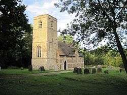 Knapwell, All Saints |
|
 Knapwell |
|
| Population | 110 (2001 estimate) |
|---|---|
| OS grid reference | TL331631 |
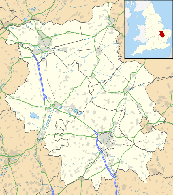
| Shire county | Cambridgeshire |
| Region | East |
| Country | England |
| Sovereign state | United Kingdom |
| Post town | Newmarket |
| Postcode district | CB3 |
| Dialling code | 01954 |
| EU Parliament | East of England |
|
|
Coordinates: 52°15′N 0°03′W / 52.25°N 0.05°W
Knapwell is a hamlet in Cambridgeshire situated about 10 miles (16 km) west of Cambridge. It is within the diocese of Ely. Its population was estimated at 110 in 2001. At the 2011 census the population had fallen to less than 100 and was included in the town of Newmarket.
Nearby villages include Boxworth, Conington, Elsworth and the fast expanding new settlement of Cambourne.
History
The settlement was mentioned as a vill at the start of the 11th century and is listed as Chenewelle in the Domesday Book, when it was held by the Abbot of Ramsey.[1]
A mound to the north-east of the church is believed to be the motte of a Norman motte-and-bailey castle. It would have been a small fortification, probably with a timber superstructure.
The name Knapwell is of unclear origin though it seems clear that it is named after the chalybeate Red Well in the wood just to the east of the village.[2] The well is probably ancient and was the only source of water to both the village and neighbouring Boxworth. Its waters were known for their medicinal properties.[1]
The village's manor house was established in Norman times, between the church and the motte, and traces of a building and moat remain in the wood (Overhall Grove) to the east of the church.[2]
Church
The village has had a church since at least 1180. The present church, dedicated to All Saints, was probably built in the early 14th century. The medieval church had a long, low chancel and a three-bay aisled nave all under a single roof, and a west tower. In 1864 the medieval church was demolished, except for the tower, and rebuilt in a plain Gothic style. The original 14th-century tower is built of field stones dressed with limestone and is unbuttressed.[3]
The Knapwell elm trees
Knapwell was once celebrated for its many ancient pollarded Field Elms, which marked the old boundaries, closes and lanes of the larger medieval village and which were locally called "the Dodds".[4][5] The trees grew both in the fields immediately bordering the main street and amongst the houses of the modern village. The name may have derived from "dodderel", a dialect word for a pollard.[4] The trees succumbed to Dutch Elm Disease in the 1980s.
Village life
The village has no shops or pubs, though was home to the Three Horseshoes pub until its closure in 1880.[2]
It is adjacent to the wood known as Overhall Grove (not to be confused with Knapwell Wood), which has a notably large number of surviving elm trees.
The local primary school is Elsworth CE(A) Primary School[6] in Elsworth.
References
- 1 2 "Knapwell - The Red Well". Megalithic Portal.
- 1 2 3 "Knapwell". Victoria County History.
- ↑ "Knapwell Church". Victoria County History.
- 1 2 Mabey, R. The Flowering of Britain, Hutchinson, 1980,p.97
- ↑ Rackham, O. Trees and Woodland in the British Landscape,Dent, 1976, p.1171
- ↑ "Elsworth Primary School".
External links
| Wikimedia Commons has media related to Knapwell. |