Larecaja Province
| Larecaja Province | |
|---|---|
| Province | |
|
| |
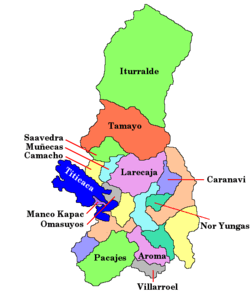
 Location of Larecaja Province within Bolivia | |
 | |
| Coordinates: 15°50′0″S 68°10′0″W / 15.83333°S 68.16667°W | |
| Country |
|
| Department | La Paz Department |
| Municipalities | 8 |
| Capital | Sorata |
| Area | |
| • Total | 8,110 km2 (3,130 sq mi) |
| Population (2012 census) | |
| • Total | 86,481 |
| • Density | 11/km2 (28/sq mi) |
| • Ethnicities | Aymara, Quechua |
| Website | Official website |

Larecaja is a province in the Bolivian La Paz Department. It was founded by Antonio José de Sucre on October 18, 1826. Its capital is Sorata.
Geography
The Cordillera Real traverses the province. Some of the highest peaks of the province are Illampu and Janq'u Uma. Other mountains are listed below:[1]
- Achachi Qala
- Allqamarini
- Aqhuya Aqhuyani
- Chachakumani
- Chunta Qullu
- Ch'iyar Juqhu
- Ch'iyar Qullu
- Ch'uch'u
- Ch'uch'u Apachita
- Ch'uxña Quta
- Ch'uxñani
- Imasiña
- Jach'a Apachita
- Jach'a Pata
- Jach'a Pukara
- Jach'a Waylla Punta
- Janq'u K'ark'a (Larecaja-Murillo)
- Janq'u K'ark'a (Larecaja-Omasuyos)
- Jichu Quta
- Jukumarini
- Kuntur Jipiña
- Llawi Imaña
- Ñuñuni Qalani
- Pallqa K'ark'a
- Patapatani
- Phallata
- P'iq'iñ Qullu
- Qala Phusa
- Qillwani
- Quña Quñani
- Quriwani
- Q'asiri
- Saywani
- Saywani (Sorata)
- Tawqani
- Turini
- Uma Jalanta
- Uma Manqha
- Wankar Quta Qullu
- Warachani
- Wari Qalluni Pata
- Wila Lluxita
- Wila Quta
- Wila Umani
- Wila Wila
- Wila Wilani
- Wiluyu Janq'u Uma
- Yapuchañani
Parts of the Apolobamba Integrated Management Natural Area and the Pilón Lajas Biosphere Reserve and Communal Lands lie in the Larecaja Province.
Subdivision
Larecaja Province is divided into eight municipalities which are partly further subdivided into cantons.
| Section | Municipality | Seat |
|---|---|---|
| 1st | Sorata Municipality | Sorata |
| 2nd | Guanay Municipality | Guanay |
| 3rd | Tacacoma Municipality | Tacacoma |
| 4th | Quiabaya Municipality | Quiabaya |
| 5th | Combaya Municipality | Combaya |
| 6th | Tipuani Municipality | Tipuani |
| 7th | Mapiri Municipality | Mapiri |
| 8th | Teoponte Municipality | Teoponte |
Languages
The languages spoken in the Larecaja Province are mainly Aymara, Spanish and Quechua. The following table shows the number of those belonging to the recognised group of speakers.[2]
| Language | Sorata Municipality | Guanay Municipality | Tacacoma Municipality | Quiabaya Municipality | Combaya Municipality | Tipuani Municipality | Mapiri Municipality | Teoponte Municipality |
|---|---|---|---|---|---|---|---|---|
| Quechua | 363 | 1.653 | 1.058 | 33 | 20 | 1.587 | 3.649 | 756 |
| Aymara | 16.029 | 3.405 | 4.389 | 2.269 | 2.522 | 2.534 | 1.767 | 2.837 |
| Guaraní | 7 | 5 | 1 | 0 | 0 | 20 | 6 | 6 |
| Another native | 8 | 94 | 17 | 2 | 1 | 18 | 7 | 22 |
| Spanish | 11.223 | 10.064 | 4.321 | 1.391 | 1.214 | 8.594 | 8.567 | 6.211 |
| Foreign | 70 | 86 | 6 | 6 | 1 | 61 | 17 | 33 |
| Only native | 6.680 | 737 | 1.599 | 1.023 | 1.363 | 190 | 363 | 472 |
| Native and Spanish | 9.540 | 4.123 | 3.389 | 1.256 | 1.162 | 3.499 | 4.653 | 2.925 |
| Only Spanish | 1.690 | 5.942 | 933 | 135 | 52 | 5.097 | 3.915 | 3.290 |
See also
- Ch'alla Quta
- Ch'uch'u Jawira
- Ch'usiq Uta
- Janq'u Quta
- Warus Quta
- Laguna Glaciar, 17th highest lake in the world.[3]
References
- ↑ Bolivian IGM maps 1:50,000 Milluni 5945-II , Peñas 5945-III and Sorata 5846-I
- ↑ obd.descentralizacion.gov.bo (Spanish)
- ↑ "The Highest Lake in the World". www.highestlake.com. Retrieved 2009-04-12.
Coordinates: 15°50′S 68°10′W / 15.833°S 68.167°W