Ingavi Province
| Ingavi Province | |
|---|---|
| Province | |
|
| |
 Location of Ingavi Province within Bolivia | |
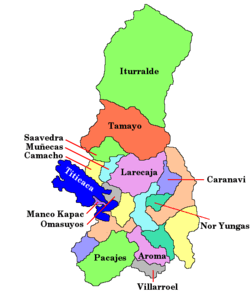
 Map of municipalities of Ingavi | |
| Coordinates: 16°43′0″S 68°50′0″W / 16.71667°S 68.83333°W | |
| Country |
|
| Department | La Paz Department |
| Municipalities | 7 |
| Capital | Viacha |
| Area | |
| • Total | 5,410 km2 (2,090 sq mi) |
| Population (2012 census) | |
| • Total | 134,535 |
| • Density | 25/km2 (64/sq mi) |
| • Ethnicities | Aymara |
| Website | Official website |


Ingavi is a province in the La Paz Department in Bolivia. This is where the Battle of Ingavi occurred on November 18, 1841 and where the World Heritage Site of Tiwanaku is situated.
During the presidency of Eliodoro Villazón the province was founded on December 16, 1909 with Viacha as its capital.
Geography
Ingavi lies on the southern shore of Lake Titicaca. The Chilla-Kimsa Chata mountain range traverses the province. Some of the highest mountains of the province are listed below:[1][2][3]
- Achachi Qala
- Apachita
- Asir Kunka
- Chuqi Ch'iwani
- Chuqi Q'awa
- Chuqi Q'awa (Chuñuni Jawira)
- Chhuxlla Willk'i
- Ch'alla Qullu
- Ch'utu Wankarani
- Imill Wawani
- Jach'a Uma Chuwani
- Jani Lawani
- Janq'u Jaqhi
- Jilarata
- Jisk'a Sallalla
- Laqaya
- Nasa Puqi
- Pukara (Guaqui)
- Pukara (J. de Machaca)
- Phujtir Pata Punta
- Qala Waxrani
- Quta Willk'i
- Q'awiri Qullu
- Q'ilani
- Q'ullq'uni
- Turini
- T'aqachiri
- Utani Apu
- Wayllani
- Wanq'uni
- Wila Qullu
- Wisk'achani
Subdivision
Ingavi Province is divided into seven municipalities which are partly further subdivided into cantons.
| Section | Municipality | Inhabitants (2001) [4] | Inhabitants (2005, est.) | Seat |
|---|---|---|---|---|
| 1st | Viacha Municipality | 46,596 | 51,540 | Viacha |
| 2nd | Guaqui Municipality | 7,552 | 8,608 | Guaqui |
| 3rd | Tiwanaku Municipality | 11,309 | 12,936 | Tiwanaku (village) |
| 4th | Desaguadero Municipality | 4,981 | 5,395 | Desaguadero |
| 5th | San Andrés de Machaca Municipality | 6,299 | 6,967 | San Andrés de Machaca |
| 6th | Jesús de Machaca Municipality | 13,247 | 14,653 | Jesús de Machaca |
| 7th | Taraco Municipality | 5,922 | 6,774 | Taraco |
Population
The people are predominantly indigenous citizens of Aymara descent.[5]
| Ethnic group | Viacha Municipality (%) | Guaqui Municipality (%) | Tiwanaku Municipality (%) | Desaguadero Municipality (%) | San Andrés de Machaca Municipality (%) | Jesús de Machaca Municipality (%) | Taraco Municipality (%) |
|---|---|---|---|---|---|---|---|
| Quechua | 2.9 | 1.3 | 0.4 | 1.3 | 0.3 | 0.3 | 0.2 |
| Aymara | 84.4 | 91.1 | 96.1 | 92.9 | 96.0 | 94.4 | 96.4 |
| Guaraní, Chiquitos, Moxos | 0.2 | 0.3 | 0.1 | 0.2 | 0.1 | 0.1 | 0.0 |
| Not indigenous | 12.2 | 7.1 | 3.3 | 5.6 | 3.3 | 4.3 | 3.3 |
| Other indigenous groups | 0.2 | 0.1 | 0.0 | 0.1 | 0.4 | 0.9 | 0.1 |
Tourist attractions
Some of the tourist attractions of the municipalities are:[6]
- In Viacha Municipality:
- The town of Viacha
- Viriloco lagoon, a small man made lake in Viacha Canton
- Qalachaka bridge in Viacha Canton
- "Virgen de Letanías" Sanctuary in Viacha Canton
- "Pan de Azúcar" mountain in Viacha Canton
- Fields of the Battle of Ingavi in Viacha Canton
- In Guaqui Municipality:
- Guaqui festivity from July 23 to July 25 celebrated in honour of Apostle James
- Apostle James church of Guaqui built between 1625 and 1784
- Guaqui port
- In Tiwanaku Municipality:
- archaeological site of Tiwanaku in Tiwanaku Canton
- Saint Peter church in Tiwanaku
- Willkakuti, the Andean-Amazonic New Year, celebrated on June 21 of every year in the viewpoint of Kimsa Chata mountain in Tiwanaku Canton
- Tiwanaku festivity (Señor de la Exaltación) celebrated in Tiwanaku Canton in September
- In Desaguadero Municipality:
- In San Andrés de Machaca Municipality:
- Afiani lagoon in San Andrés de Machaca Canton
- The chullpa of Kañoma in San Andrés de Machaca Canton
- The church of San Andrés de Machaca, built between 1806 and 1836
- In Jesús de Machaca Municipality:
- The archaeological site of Qhunqhu Wankani in Jesús de Machaca Canton
- Jesús de Machaca, an indigenous community
- Yakayuni saltflats in Jesús de Machaca Canton where salt exploitation is possible
- Uru Iruwit'u community in Jesús de Machaca Canton and the Uru Iruwit'u museum in Jesús de Machaca
- In Taraco Municipality:
- Taraco Peninsula in Taraco Canton with its archaeological sites:
- Chiripa and its museum
- Qala Uyuni, Pumani and Achacachi Coacollo in Coacollo
- Iwawi (Kolata Quenacache, Ojje Puku, Awichu and Ch'uxña Qala) in Higuagui Grande, Taraco Canton
- Sikuya Island in Taraco Canton
- The church of Taraco dating from 1767
- Taraco museum in Taraco Canton
- Taraco Peninsula in Taraco Canton with its archaeological sites:
See also
References
- ↑ IGM map 1:50,000 5844-III Guaqui
- ↑ IGM map 1:50,000 5843-I Sacacani
- ↑ IGM map 1:50,000 Tiahuanacu 5844-II
- ↑ Instituto Nacional de Estadistica de Bolivia (INE) (Spanish)
- ↑ obd.descentralizacion.gov.bo/municipal/fichas/ (inactive)
- ↑ www.gobernacionlapaz.gob.bo Tourist guide by the government of the department
Coordinates: 16°43′S 68°50′W / 16.717°S 68.833°W