L'Ascension, Quebec
| L'Ascension | |
|---|---|
| Municipality | |
 | |
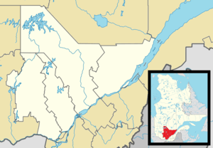
 Location within Antoine-Labelle RCM. | |
 L'Ascension Location in central Quebec. | |
| Coordinates: 46°33′N 74°50′W / 46.550°N 74.833°WCoordinates: 46°33′N 74°50′W / 46.550°N 74.833°W[1] | |
| Country |
|
| Province |
|
| Region | Laurentides |
| RCM | Antoine-Labelle |
| Constituted | September 23, 1905 |
| Government[2] | |
| • Mayor | Yves Meilleur |
| • Federal riding | Laurentides—Labelle |
| • Prov. riding | Labelle |
| Area[2][3] | |
| • Total | 351.60 km2 (135.75 sq mi) |
| • Land | 341.90 km2 (132.01 sq mi) |
| Population (2011)[3] | |
| • Total | 844 |
| • Density | 2.5/km2 (6/sq mi) |
| • Pop 2006-2011 |
|
| • Dwellings | 853 |
| Time zone | EST (UTC−5) |
| • Summer (DST) | EDT (UTC−4) |
| Postal code(s) | J0T 1W0 |
| Area code(s) | 819 |
| Highways |
|
| Website |
www lascension |
L'Ascension is a municipality in the Laurentides region of Quebec, Canada, part of the Antoine-Labelle Regional County Municipality. The area is known as La Vallée de la Rouge (English: The Valley of the Rouge (river)).
Demographics
Population trend:[4]
- Population in 2011: 844 (2006 to 2011 population change: -2.0 %)
- Population in 2006: 861
- Population in 2001: 783
- Population in 1996: 755
- Population in 1991: 662
Private dwellings occupied by usual residents: 410 (total dwellings: 853)
Mother tongue:
- English as first language: 0%
- French as first language: 96.5%
- English and French as first language: 0%
- Other as first language: 3.5%
See also
References
- ↑ Reference number 324625 of the Commission de toponymie du Québec (French)
- 1 2 Geographic code 79050 in the official Répertoire des municipalités (French)
- 1 2 Statistics Canada 2011 Census - L'Ascension census profile
- ↑ Statistics Canada: 1996, 2001, 2006, 2011 census
 |
Lac-Douaire | Baie-des-Chaloupes | | |
| Rivière-Rouge | |
Baie-des-Chaloupes | ||
| ||||
| | ||||
| La Macaza |
| Cities/towns | |
|---|---|
| Municipalities | |
| Villages | |
| Unorganized territories | |
| |
This article is issued from Wikipedia - version of the 10/21/2015. The text is available under the Creative Commons Attribution/Share Alike but additional terms may apply for the media files.