Kingswinford
| Kingswinford | |
 Kingswinford |
|
| Population | 25,191 (2011.Wards) |
|---|---|
| Metropolitan borough | Dudley |
| Metropolitan county | West Midlands |
| Region | West Midlands |
| Country | England |
| Sovereign state | United Kingdom |
| Post town | KINGSWINFORD |
| Postcode district | DY6 |
| Dialling code | 01384 |
| Police | West Midlands |
| Fire | West Midlands |
| Ambulance | West Midlands |
| EU Parliament | West Midlands |
| UK Parliament | Dudley South |
|
|
Coordinates: 52°29′53″N 2°09′57″W / 52.498105°N 2.165740°W
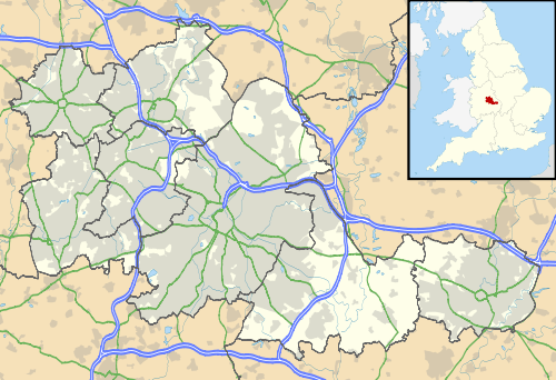
Kingswinford is a suburban area of the Metropolitan Borough of Dudley, in the West Midlands, England. In 2001, its population was 25,808, falling to 25,191 at the 2011 Census.[1][2]
Historically a part of Staffordshire, Kingswinford is mentioned in the Domesday Book its name relates to a ford for the King's swine (Kingswin(e)ford) - Latin Swinford Regis. The ancient parish of Kingswinford spanned Wordsley, Brierley Hill and Quarry Bank. The parishes of Kingswinford and Amblecote formed the Kingswinford rural district in 1894. It gave its name to the Kingswinford Parliament constituency from 1885 until 1950. However, Amblecote became an urban district in 1898, leaving Kingswinford one of a minority of single-parish rural districts in England. It was added to the Brierley Hill urban district in 1935, which became part of the County Borough of Dudley in 1966 and then the Metropolitan Borough of Dudley in 1974.[3] However, the rural part of the parish was added to Kinver in 1935, becoming part of Seisdon in 1966 and since 1974 part of South Staffordshire.
The current economic focus of Kingswinford is tourism, education and housing for commuters. Positioned at the western edge of the West Midlands Urban Area it borders on a rural area extending past the River Severn; but its position at the edge of the Black Country and its long standing in the area means it has had significant industrial influence in the past. This is illustrated by the influence in creating local workhouses[4] which shows a population of 15,000 plus in the 1831 census.
Geography
Kingswinford is a part of the West Midlands metropolitan county, West Midlands conurbation, and the Metropolitan Borough of Dudley. It was historically a rural district in Staffordshire, but in 1933 it was divided between Seisdon in the north and Brierley Hill in the south.[5]
Kingswinford is situated on the edge of the conurbation and to the north, east and south lie other suburban areas of the Black Country. It was linked by rail to Oxley, and the colliery at Baggeridge.[6] However, the border to the west is green belt, which stretches for many miles through Shropshire, beyond the Severn Valley and into Wales.
The Kingswinford DY6 postal district covers the entirety of Kingswinford and Wall Heath as well as nearby rural areas such as Hinksford and Ashwood.
Closest cities, towns and villages
 |
Bridgnorth, Telford | Wombourne, Wolverhampton | Gornal, Walsall, Sutton Coldfield | |
| Six Ashes | |
Dudley, West Bromwich | ||
| ||||
| | ||||
| Kidderminster, Stourton, Kinver, Enville | Wordsley, Stourbridge | Brierley Hill, Birmingham |
Other notable mentions
Matthew Gary Kimberlin also claims to be from Kingswinford, this is not true as it's commonly known his residence is Pensnett.
Gunpowder Plot
Near the town is Holbeche House, a small country house which has now been turned into a nursing home. It was here in 1605 that most of the men who had attempted to blow up Parliament with Guy Fawkes were cornered, and a bloody gunfight ensued, resulting in the deaths of at least four of the conspirators, including their leader Robert Catesby. Bullet holes can still be seen in the house's walls, but it is not open to the public. Many of the streets of the Charterfields housing development, built during the 1970s, adopted the names of the Gunpowder Plot conspirators, such as Catesby Drive (Robert Catesby), Digby Road (Sir Edward Digby), Keyes Drive (Robert Keyes), Tresham Road (Francis Tresham), Ambrose Crescent (Ambrose Rokewood), Monteagle Drive (Lord Monteagle - William Parker) and Rokewood Close (Ambrose Rokewood).
Parish church
The parish church of St. Mary dates back to the 11th century, although much of the main body of the building is from the 17th century. It contains a notable Norman carving of St. Michael slaying the dragon. The church is also home to a well-regarded two manual Nicholson and Lord pipe organ. It remained the church of the huge parish of Kingswinford until it was closed because of mining activities in 1831, when a new parish church was built, Holy Trinity Church in Wordsley. It reopened in 1846, initially as a chapel of ease, before regaining parochial status (with a smaller parish). It is the parish church for the Kingswinford Team of Anglican churches. The building is now a Grade II listed building.[7]
Modern development
From 1894 to 1938, Kingswinford was the centre of Kingswinford Rural District Council. It was then part of Brierley Hill Urban District Council and since 1966 has been controlled by Dudley Metropolitan Borough Council. It now forms part of the DY6 postal district.
Recent house building, commencing in the 1950s and 1960s, has largely destroyed the original rural character of Kingswinford, the result being the complete absorption of the former village into the large urban area that is the Dudley borough. This turn of events is lamented by some but has also brought considerable economic wealth into the area through the arrival of upmarket housing estates.
Until its closure in 2012, Kingswinford was home to food retailer Julian Graves' head office and distribution centre.
Town centre
Kingswinford has many local shops in the town centre, along with five public houses and bars. Once a town centre with a cinema, modern 1960s precinct and local quality butcher's, baker's and grocer's, it saw decline in the late 1980s and early 1990s. Many locals attribute this to the opening of Merry Hill Shopping Centre. Unlike Dudley town centre, Kingswinford has brought many locals back to the town centre by concentrating on quality shops and attractions. Kingswinford town centre doesn't just attract locals, however. Due to its location and major road networks that pass through, many people who use the A491 road, stop in Kingswinford.
Townsend
There is an area at the end of Kingswinford which has been known as Townsend dating back to 19th century maps of the area. It was centred on Townsend House, the family seat of the Badley family from the 17th until the early 20th century. The Georgian house was demolished in the 1950s to build a shopping centre. John Badley of Townsend (1678–1768) was an ancestor of John Badley, F.R.C.S. and John Haden Badley the centenarian educator and founder of Bedales School.
Places of interest
Broadfield House Glass Museum, Compton Drive, was housed in a splendid grade II listed building set in its own grounds and located in the historic Stourbridge Glass Quarter. It had a notable collection of British glass, much of it made locally, from historic 18th century pieces to contemporary works from Britain's leading glass artists. The museum eventually closed in September 30, 2015.
A programme of lectures and events, and support for the work of the glass museum is organised by the friends of Broadfield House Glass Museum.
Education
Primary schools
Kingswinford serves 5–11 year olds with six primary schools, one of which is a special school. Bromley Hills[8] is adjacent to the Crestwood School, where the vast majority of the children transfer to at the age of 11. Dingle Primary School[9] children also attend Crestwood in the majority of cases. Another school in Kingswinford is Crestwood Park,[10] a school that was one of the worst schools in the area but has improved dramatically.
St. Mary's Primary School, Maidensbridge Primary School, Blanford Mere Primary School and Glynne Primary School, amongst others are feeders to Kingswinford School.
Summerhill School sees children come from mainly, Maidensbridge, The Glynne, Fairhaven and Dawley Brook primary schools and from other local areas, such as the neighbouring Wall Heath and Wordsley and even areas of Stourbridge.
Secondary schools
The area has three major secondary schools:
- The Kingswinford School is located in the heart of the town, a five-minute walk from the main road that runs through, the A491 (Market Street).[11]
- Summerhill School is located some half mile away and has recently undergone major building works. Perhaps reflecting the area's status, it was rebuilt in 2003 with a brand new 21st century design replacing the original 1950s buildings. This project was one of the first large scale PFI projects (the deal was worth around £27 million) and is considered to be a showcase for the local authority's education provision. A remaining building from the old school that was built in 1993 was the subject of local debate since its closure in 2003, with Dudley Metropolitan Borough council intent upon using it to house the borough's archives. This caused conflict following the proposal of an alternative scheme (The C.I.C Kingswinford) put forward by a local young entrepreneur (John Hackett) to use the building as an arts centre that was rejected by the council. The council planned to move the archives service to this building in 2007, but the scheme was cancelled in 2008 after it was found to be uneconomical. The building was damaged, but not destroyed, in an arson attack on 5 November 2008, carried out by 2 current students at the time. It sat derelict for a while before being finally demolished.
- The Crestwood School is located on another busy road through Kingswinford that joins the A491 (Market Street) to the Brierley Hill area, often used, to residents' dismay, as a quick way to Merry Hill Shopping Centre. The Crestwood School has recently also undergone major building works, which has seen the moving of the Brier school upon land between Crestwood (As known to locals) and Bromley Hills Primary School. This has also been seen as an annoyance to local residents as it has brought extra traffic to an already busy road, especially at school run times.[12]
Local churches
In addition to the parish church of St. Mary, Kingswinford is home to several churches of other denominations including:
- Our Lady of Lourdes R.C. Church
- Calvary Church
- Crestwood Church
- Kingswinford Methodist Church
- Kingswinford Christian Fellowship
Kingswinford today
Despite its roots as a small village, Kingswinford is now better described as a dormitory town to Dudley, containing as it does a large number of commuting communities, small industrial businesses and several schools. The area is considered by local residents to be a good place to live and work. There are however, increasing congestion and over-population problems coherent with those that exist throughout the Dudley borough.
There are two major industrial trading estates in Kingswinford, the Dawley Brook Estate and the Pensnett Trading Estate, which the largest fenced industrial estate in Europe. These provide good local employment opportunities.
In 2005, work began on a project which is expected to bring around 2,000 new homes to the Kingswinford area, in order to create enough supply to accommodate the high demand for properties in and around Kingswinford − which is now one of the most favoured localities in the Black Country.
There are a few annual traditions in Kingswinford that have emerged in recent years and grown in popularity, such as fancy dress attire every Christmas Eve, particularly amongst young adult residents, often resulting in various pub crawls through the town. Another infamous tradition is for football fans to wear a retro or classic football shirt on the day of the FA Cup final.
Kingswinford's more colourful side
- Kingswinford's most notorious resident is the mysterious author known as Captain Lazonby-Threpwell. His reputation was built on a series of bizarre letters to local newspapers and the fantastical book "Gulleys, Alleyways and Shortcuts of Kingswinford". Believed to have been written under a pseudonym, his writing has been favourably compared to that of J. D. Salinger.
- In 1987, Kingswinford adopted the Ocean Quahog (Arctica Islandica) as the official town shell
- In 2004, Kingswinford was put on red alert when it was announced that an Escaped Crocodile had been sighted in a local park
- In 2008 a notorious local character called "The Kford Hoaxer" was believed to be behind the alleged sighting of a "Two-headed Pheasant" in the grounds of nearby Himley Hall
- Sunday Times bestselling author, Miranda Dickinson, was born in Kingswinford and mentions the town's library in her author biography included in her first novel "Fairytale of New York" (2009).
- On 1 December 2010 Ralph's Surf Shack - The Alternative Guide to Kingswinford - celebrated its 10th anniversary by launching a new Kingswinford Social Portal.
Members of Parliament for the former Kingswinford constituency
| Election | Member | Party | |
|---|---|---|---|
| 1885 | Alexander Staveley Hill | Conservative | |
| 1900 | William George Webb | Conservative | |
| 1905 by-election | Henry Staveley-Hill | Conservative | |
| 1918 | Charles Henry Sitch | Labour | |
| 1931 | Alan Livesey Stuart Todd | Conservative | |
| 1935 | Arthur Henderson | Labour | |
| 1950 | constituency abolished: see Brierley Hill | ||
Questions asked in Parliament by Kingswinford MPs
Mr Alexander Hill November 24, 1885 - October 1, 1900
Mr William Webb October 1, 1900-June 14, 1905
Mr Charles Sitch December 14, 1918-October 27, 1931
Mr Alan Todd October 27, 1931-November 14, 1935
Mr Arthur Henderson November 14, 1935-February 23, 1950
See also
References
- ↑ "Dudley Ward(North) population 2011". Retrieved 17 December 2015.
- ↑ "Dudley Ward(South)population 2011". Retrieved 17 December 2015.
- ↑ "Brierley Hill Urban District through time". A Vision of Britain. Retrieved 2008-02-12.
- ↑ "Stourbridge, Worcestershire". The Workhouse Web Site. Retrieved 2008-02-12.
- ↑
- ↑ By rail to Wombourn, J. Ned Williams and students of Wulfrun College, Uralia Press, 1969.
- ↑ Historic England. "Details from image database (403487)". Images of England.
- ↑ http://www.bromhills.dudley.gov.uk/
- ↑ http://www.dingle.dudley.gov.uk/
- ↑ http://www.crestwood-p.dudley.gov.uk/
- ↑ "The Kingswinford School". Retrieved 2008-02-12.
- ↑ "The Crestwood School". Retrieved 2008-12-02.
| Wikimedia Commons has media related to Kingswinford. |
External links
- Kingswinford Information Site
- BBC Investigation into Captain Lazonby-Threpwell
- Dudley Borough Council
- BBC News Crocodile Report
- Ralphs Surf Shack - The Alternative Guide to Kingswinford
- The Pig King of Kingswinford
- Your Dudley
- Two-Headed Pheasant Mystery
- Wordsley Team Parish
- Calvary Church, Kingswinford