Brierley Hill
| Brierley Hill | |
 Brierley Hill flats |
|
 Brierley Hill |
|
| Population | 13,935 (2011.Ward)[1] |
|---|---|
| OS grid reference | SO915868 |
| Metropolitan borough | Dudley |
| Metropolitan county | West Midlands |
| Region | West Midlands |
| Country | England |
| Sovereign state | United Kingdom |
| Post town | Brierley Hill |
| Postcode district | DY5 |
| Dialling code | 01384 |
| Police | West Midlands |
| Fire | West Midlands |
| Ambulance | West Midlands |
| EU Parliament | West Midlands |
| UK Parliament | Dudley South |
|
|
Coordinates: 52°28′46″N 2°07′28″W / 52.4795°N 2.1245°W
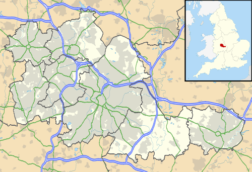
Brierley Hill is a small town and electoral ward of the Dudley Metropolitan Borough, in the West Midlands of England, and is situated approximately 2.5 miles south of central Dudley and 2 miles north of Stourbridge. Part of the Black Country, and in a heavily industrialised area of the Dudley Borough, it has a population of 13,935 at the 2011 census,[1] and is best known for glass and steel manufacturing, although the industry has declined considerably since the 1970s. One of the largest factories in the area was the Round Oak Steelworks, which was closed down and redeveloped in the 1980s to become the Merry Hill Shopping Centre. Brierley Hill was originally in Staffordshire, but is now part of the West Midlands metropolitan county since its creation in 1974.
Since 2008, Brierley Hill, including the nearby Waterfront Business Park and Merry Hill Shopping Centre, has been designated as the Strategic Town Centre of the Dudley Borough, with the aim to create a new town centre for the borough.[2][3]
History
The name Brierley Hill derives from the Old English words 'brer', meaning the place where the Briar Rose grew; 'leah', meaning a woodland clearing; and 'hill'.[4]
Largely a product of the Industrial Revolution, Brierley Hill has a relatively recent history, with the first written records of the town dating back to the 17th century.[4] Originally established as a settlement in the woodland of Pensnett Chase, it began expanding rapidly following the chase's enclosure in 1748, and was first recorded on a map in 1785 after the mapping of the Stourbridge Canal.[4]

Brierley Hill had become heavily industrialized by the beginning of the 19th century, with a number of quarries, collieries, glass works, and iron works emerging. A National School was opened in the town in 1835, and a market area had developed along the High Street.[4]
By the start of the 20th century, the raw material deposits had become depleted, leading to the closure of many of the industries in the area.[4] The decline in manufacturing resulted in an unemployment rate of 25% in Brierley Hill by the early 1980s,[5] with the closure of the Round Oak Steelworks in December 1982 resulting in a further 1,300 redundancies. The steelworks site, along with the adjacent Merry Hill Farm, were subsequently designated as an Enterprise Zone, and were redeveloped to create the Merry Hill Shopping Centre and The Waterfront business park.[6]
In recent years, proposals have been drawn up by the local authority to regenerate Brierley Hill, with the Brierley Hill Regeneration Partnership formed to improve the town over a period of 10 years, by investing in the infrastructure and increasing the number of homes and job opportunities.[7]
Civic history
Originally part of Staffordshire, Brierley Hill became an urban district in 1894 under the Local Government Act. Previously, it had been an urban sanitary authority. The urban district expanded greatly in 1934 after taking in most of the Kingswinford and Quarry Bank districts, and made a failed bid to obtain borough status in 1952.[8] It became part of the Dudley County Borough in 1966,[9] now the Dudley Metropolitan Borough.
Governance
Brierley Hill is part of the Dudley Metropolitan Borough, in the West Midlands county in England. The Brierley Hill electoral ward is currently represented by three Labour councillors on the borough council; Rachel Harris, Zafar Islam, and Margaret Wilson.[10]
On a national level, the ward forms part of the Dudley South constituency, with the Conservative MP Mike Wood currently elected.
Places of interest

The Merry Hill Shopping Centre is located immediately east of Brierley Hill. One of the largest shopping centres in the UK, it was built between 1985 and 1989 on the grounds of Merry Hill Farm, the last working urban farm in the West Midlands.
Round Oak Steelworks was built in 1857 on land overlooking the site of what is now the Merry Hill Centre, and employed up to 3,000 people at its peak, but that figure had fallen to just over 1,200 by the time it closed in December 1982. The adjacent Waterfront office complex was built on the former steelworks site, being developed between 1989 and 1995, although since the onset of the recession in the late 2000s around half of its office units have become empty, with an application for government-funded Enterprise Zone status rejected.[11] The original TH Baker store is on the High Street, central to the town since 1888. The West Bromwich Building Society had intended to relocate to the Waterfront from its previous base in West Bromwich in 2012,[12] although the plan was later shelved.[13]
Brierley Hill Civic Hall, situated on Bank Street in the town centre, hosted several of Slade's first gigs during the early 1970s, although none of the members were actually from Brierley Hill.
Geography
Brockmoor
Situated to the immediate north of the town centre. On the border with Wordsley was the Bottle and Glass Inn, erected on the bank of the Dudley Canal in about 1800 as The Bush. It remained at this location until 1980, when it was transferred to the Black Country Living Museum as a centrepiece of the then new village.[14] It is also home to Brockmoor Primary School,[15] which has existed at its current site in Belle Isle since 1994.[16] The original school was built in the late 19th century, as an infant school for 5–7 year olds and a junior school for 7–11 year olds, become a first school for 5–8 year olds and a middle school for 8–12 year olds in September 1972. However, the two schools merged in September 1989 to form Brockmoor Primary School and a year later the age range was altered to 5–11.[17]
Pensnett
Pensnett is situated more than a mile north of the town centre and borders the townships of Sedgley, Kingswinford and Dudley. Pensnett And Kingswinford Feature McDonalds, Premier Inn, Beefeater, Co-Op Food Which Used To Be Somerfield, Booker Wholesale And Focus DIY.
Withymoor Village
Withymoor Village lies to the south of the town centre towards the border with Stourbridge, and was mostly developed in the 1970s and 1980s, following open cast coalmining.
Chapel Street Estate
Chapel Street Estate was developed during the 1960s with predominantly multi storey flats on the site of a Victorian residential area.
Quarry Bank
Quarry Bank is situated to the south-east of the town centre and leads to the border with Cradley Heath.
Hawbush Estate
Hawbush Estate stands one mile to the west of the town centre and was developed in the late 1920s and early 1930s.
On the border with Wordsley and Brockmoor was the Bottle and Glass Inn, erected on the bank of the Dudley Canal in about 1800 as The Bush. It remained at this location until 1980, when it was transferred to the Black Country Living Museum as a centrepiece of the then new village.[14]
Transport
Brierley Hill is situated along the main A461 road between Stourbridge and Dudley, with other roads providing connections to neighbouring locations. It is also served by numerous bus services, with a bus station situated at the Merry Hill Shopping Centre, and several bus stops along the main High Street. Buses from Brierley Hill and Merry Hill provide links to central Dudley, Halesowen, Stourbridge, Walsall, West Bromwich, and Wolverhampton, among others.
From 1850 to 1962, Brierley Hill was served by a railway station for passengers on the Oxford-Worcester-Wolverhampton Line between Dudley Town and Stourbridge Junction, before passenger services were withdrawn. This was before the Beeching Axe came into effect in 1964. The section of line from Stourbridge to Brierley Hill is still in use for goods trains, with a railway steel terminal opening in 1986, but the line northbound to Dudley has been closed since 1993. Currently, the nearest passenger railway station is Cradley Heath, over a mile south-east of the town.

Under current plans, a proposed extension to the Midland Metro would see the railway line north of Brierley Hill re-opened, with light rail services providing a link to the existing Metro line in Wednesbury and Dudley to the north and Stourbridge to the south. Though there is some speculation as to where in Brierley Hill the metro will route, with two suggested options. Number one being that the metro follows the disused South Staffs line. Number two being that the line diverts at Canal Street in Woodside and travels through The Waterfront and then through the Merry Hill Centre before travelling along Brierley Hill High Street, which under current plans may mean that the High Street is pedestrianised.[18]
Public services
West Midlands Police have their main Dudley area station in Brierley Hill, situated on the corner of Bank Street, next to the Civic Hall. The police station was originally built in the 1960s as the future local council offices, but the plan was scrapped when Brierley Hill became a part of the Dudley Borough.
There is also a fire station located on the Dudley Road, with fire and rescue services provided by the West Midlands Fire Service.
Education
The town currently has 10 primary schools and one secondary school. Thorns Community College is now the town's only secondary school due to the closure of Pensnett High School.
Brierley Hill runs a system of 5–7 infant, 7–11 junior and 11–16 secondary schools, in accordance with the rest of the Dudley borough and the majority of schools in other areas.
However (along with Dudley, Sedgley and Coseley) it ran a system of 5–8 first, 8–12 middle and 12–16 secondary schools from 1972 until 1990, before reverting to the traditional age ranges.
Primary schools
- Brierley Hill Primary School
- Brockmoor Primary School
- Hawbush Primary School
- Mount Pleasant Primary School
- Quarry Bank Primary School
- St Mark's Primary School
- St Mary's RC Primary School
- Bromley-Pensnett Primary School
- Thorns Primary School
- Withymoor Primary School
- Peters Hill Primary School
- Thorns Primary School is a primary school located in Brierley Hill, West Midlands, England.
The school serves the Quarry Bank area which is situated approximately one mile south of the town centre, and there are currently around 175 pupils aged 5–11 on the roll. The current head teacher is Mr David Priestley.
Secondary schools
- Thorns Community College, a dual specialist Arts College and ICT College
- Pensnett High School, closed in July 2010, stayed open until July 2012 as a learning centre for the oldest two age groups in the school, but is now closed permanently it is now branded as Pens Meadow.
Religion

The first religious building in Brierley Hill was St. Michael's Chapel, which was constructed in 1765 by public subscription. It became a parish church in 1842, covering the areas of Brockmoor, Delph, and Quarry Bank.[4] In 1872, construction commenced on St. Mary's Church. Designed by E. W. Pugin, it was completed in 1873 and upon completion, consisted of a nave, sanctuary, aisle and side chapel.[19]
There is also a Chinese Buddhist temple located in Brierley Hill, to cater for the Buddhist community of the Dudley Borough.[20]
Notable residents
- Industrialist John Corbett was born in the town.
- Don Richardson, the man who developed the Merry Hill Shopping Centre, was born in the town, just streets away from the land that he developed for mass commercialisation more than 50 years later.
- Danny Batth, professional footballer for Wolverhampton Wanderers.
See also
- Royal Brierley (glass makers)
References
- 1 2 "Brierley Hill (Ward) - Population Density". Neighbourhood Statistics. ONS. Retrieved 21 February 2013.
- ↑ "Local Development Framework - Brierley Hill AAP". Dudley Metropolitan Borough Council. Retrieved 30 June 2013.
- ↑ "Introduction". Brierley Hill Area Action Plan. Dudley Metropolitan Borough Council. Retrieved 30 June 2013.
- 1 2 3 4 5 6 Hemingway, John (2005-12-22). "A History of Brierley Hill". Dudley Metropolitan Borough Council. Retrieved 2008-08-05.
- ↑ "History of Brierley Hill". Brierley Hill Regeneration Partnership. Archived from the original on 5 April 2008. Retrieved 2008-08-05.
- ↑ "Round Oak Steel Works Ltd.". Access to Archives. The National Archives. Retrieved 17 November 2012.
- ↑ "Our vision". Brierley Hill Regeneration Partnership. Archived from the original on 6 April 2008. Retrieved 2008-08-05.
- ↑ "London Gazette online archive". The London Gazette (39477): 1119. 26 February 1952. Retrieved 23 July 2013.
- ↑ "Brierley Hill UD through time". Vision of Britain. Retrieved 16 November 2012.
- ↑ "councillors - Brierley Hill". Dudley Councillors Online. Dudley Metropolitan Borough Council. Retrieved 19 November 2012.
- ↑ "Hopes for the future as city status bid rejected". Express & Star. 14 March 2012. Retrieved 19 November 2012.
- ↑ "West Bromwich Building Society moving HQ to Dudley". Express & Star. 28 September 2012. Retrieved 19 November 2012.
- ↑ "West Bromwich Building Society HQ to stay in the town". BBC News. 30 November 2012. Retrieved 30 November 2012.
- 1 2 "Bottle and Glass Inn - Black Country Living Museum". Retrieved 18 June 2016.
- ↑ "Brockmoor Primary School, Brockmoor, Brierley Hill: Schools in Brierley Hill". Retrieved 18 June 2016.
- ↑ "Brockmoor Primary School Brockmoor Belle Isle". Retrieved 18 June 2016.
- ↑ "Brockmoor First School, Dudley: Schools in Dudley". Retrieved 18 June 2016.
- ↑ Chadwick, Edward (25 November 2010). "Plans for £1.1 bn West Midlands Metro system unveiled". Birmingham Post. Retrieved 19 November 2012.
- ↑ O'Donnell, Roderick (2002). "Gazetteer". The Pugins and the Catholic Midlands. Gracewing Publishing. p. 76. ISBN 0-85244-567-9.
- ↑ "Buddhism". Beliefs in the Region. West Midlands Faiths Forum. Retrieved 19 November 2012.