Kidderminster
| Kidderminster | |
 Kidderminster |
|
| Population | 55,530 |
|---|---|
| OS grid reference | SO831767 |
| – London | 131.1 m |
| Civil parish | Kidderminster |
| District | Wyre Forest |
| Shire county | Worcestershire |
| Region | West Midlands |
| Country | England |
| Sovereign state | United Kingdom |
| Post town | KIDDERMINSTER |
| Postcode district | DY10, DY11 |
| Dialling code | 01562 |
| Police | West Mercia |
| Fire | Hereford and Worcester |
| Ambulance | West Midlands |
| EU Parliament | West Midlands |
| UK Parliament | Wyre Forest |
|
|
Coordinates: 52°23′19″N 2°14′56″W / 52.3885°N 2.2490°W
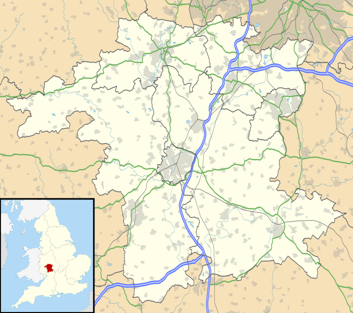
Kidderminster is a large town and civil parish in the Wyre Forest district of Worcestershire, England. It is located approximately 17 miles (27 km) south-west of Birmingham city centre and approximately 15 miles (24 km) north of Worcester city centre. The 2011 census recorded a population of 55,530 in the town. The town is twinned with Husum, Germany and it forms the majority of the Wyre Forest Conurbation, an urban area of 99,000.
History
The land around Kidderminster may have been first populated by the Husmerae, an Anglo-Saxon tribe first mentioned in the Ismere Diploma, a document in which Ethelbald of Mercia granted a "parcel of land of ten hides" to Cyneberht.[1] This became the settlement of Stour-in-Usmere, which was later the subject of a territorial dispute settled by Offa of Mercia in 781, where he restored certain rights to Bishop Heathored.[2] This allowed for the creation of a monastery or minstre in the area, and the earliest written form of the name Kidderminster (Chedeminstre) was not seen until it appeared in the Domesday Book of 1086. It was a large manor held by William I with 16 outlying settlements (Bristitune, Fastochesfeld, Franche, Habberley, Hurcott, Mitton, Oldington, Ribbesford, Sudwale, Sutton, Teulesberge, Trimpley, Wannerton and Wribbenhall). Various spellings were in use – Kedeleministre or Kideministre (in the 12th and 13th centuries), Kidereministre (13th–15th centuries) – until the name of the town was settled as Kidderminster by the 16th century.[2] Between 1156 and 1162 Henry II granted the manor to his steward, Manasser Biset, and as the settlement grew a fair (1228) and later a market (1240) were established there.[2] In a visit to the town sometime around 1540, King's Antiquary John Leland noted that Kidderminster "standeth most by clothing".[2] King Charles I granted the Borough of Kidderminster a Charter in 1636.[2] the original charter can be viewed at Kidderminster Town Hall

A parliamentary report of 1777 listed Kidderminster Borough as having a parish workhouse accommodating up to 70 inmates. Under the so-called Gilbert's Act of 1782 Kidderminster Union was established for the purpose of relieving the indigent poor.

Kidderminster has two Commissioners' churches. The first was St. George's church, on Radford Avenue. This was designed by Francis Goodwin and built in 1821–1824,[3] finally being consecrated in April 1824. It had the third largest grant by the Commission, of just over £17,000.00, of any church outside London.[4] The second church was St. John's Church, on the Bewdley Road. This church was built in 1843 and the architect was Matthew Steele, although the grant in this case was just over £4,000.[4] To the south by the River Stour, dating from the 15th century, is a single surviving tower of Caldwall (or Caldwell) Castle, a fortified manor house.[5]
Geography
The River Stour and the Staffordshire and Worcestershire Canal both flow through Kidderminster town centre.
Climate
The town is noted for its particularly high record lows. Despite an average July low of 11.7 °C,[6] the temperature has never fallen below 5 °C in that month. The coldest and warmest July nights were both recorded in 2015.[7]
| Climate data for Kidderminster | |||||||||||||
|---|---|---|---|---|---|---|---|---|---|---|---|---|---|
| Month | Jan | Feb | Mar | Apr | May | Jun | Jul | Aug | Sep | Oct | Nov | Dec | Year |
| Record high °C (°F) | 18.0 (64.4) |
19.6 (67.3) |
25.0 (77) |
26.6 (79.9) |
28.2 (82.8) |
32.0 (89.6) |
34.6 (94.3) |
32.0 (89.6) |
27.6 (81.7) |
27.0 (80.6) |
18.0 (64.4) |
19.1 (66.4) |
34.6 (94.3) |
| Average high °C (°F) | 6.8 (44.2) |
7.4 (45.3) |
10.2 (50.4) |
13.3 (55.9) |
16.8 (62.2) |
19.5 (67.1) |
21.8 (71.2) |
21.4 (70.5) |
18.3 (64.9) |
14.0 (57.2) |
9.7 (49.5) |
7.0 (44.6) |
13.85 (56.92) |
| Average low °C (°F) | 1.3 (34.3) |
0.8 (33.4) |
2.7 (36.9) |
3.9 (39) |
6.7 (44.1) |
9.7 (49.5) |
11.7 (53.1) |
11.6 (52.9) |
9.5 (49.1) |
6.7 (44.1) |
3.7 (38.7) |
1.5 (34.7) |
5.82 (42.48) |
| Record low °C (°F) | −8.0 (17.6) |
−11.9 (10.6) |
−7.0 (19.4) |
−3.0 (26.6) |
0.0 (32) |
2.0 (35.6) |
5.0 (41) |
6.0 (42.8) |
−6.0 (21.2) |
−3.0 (26.6) |
−7.0 (19.4) |
−10.1 (13.8) |
−11.9 (10.6) |
| Average rainfall mm (inches) | 65.6 (2.583) |
46.1 (1.815) |
53.1 (2.091) |
62.0 (2.441) |
56.7 (2.232) |
59.1 (2.327) |
54.8 (2.157) |
64.4 (2.535) |
62.9 (2.476) |
80.8 (3.181) |
72.4 (2.85) |
73.3 (2.886) |
751.2 (29.574) |
| Average rainy days (≥ 1.0 mm) | 12.5 | 9.6 | 11.0 | 10.5 | 10.4 | 9.7 | 9.4 | 9.8 | 9.6 | 12.0 | 12.0 | 11.8 | 128.3 |
| Mean monthly sunshine hours | 53.4 | 73.6 | 109.2 | 151.6 | 190.8 | 191.3 | 200.7 | 186.0 | 140.4 | 107.1 | 62.4 | 46.7 | 1,513.2 |
| Source #1: Met Office[6] | |||||||||||||
| Source #2: Voodoo Skies[7] | |||||||||||||
Economy
The modern carpet industry was founded in the area in 1785 by Brintons, and the carpet industry became extremely important to the local economy, so much so that the local newspaper is still named The Shuttle after the shuttles used on the carpet looms.[8] By 1951 there were over thirty carpet manufacturers in the town,[9] including, for example Quayle & Tranter (now defunct) who commissioned notable artists including George Bain for their traditional designs.[10][11] Aided by a 2004 grant from the Heritage Lottery Fund, a museum dedicated to the Kidderminster carpet industry was officially opened by Lord Cobham in 2012.[12]
The Wyre was the town's first local commercial radio station and began broadcasting on 12 September 2005 from studios in Kidderminster. Other radio stations providing local coverage are Free Radio, Sunshine Radio and BBC Hereford & Worcester. The Wyre ceased broadcasting in 2012 and Signal 107 was launched on 26 March 2012.[13]
Politics
| Kidderminster Town Council | |
|---|---|
| Type | |
| Type | |
| Leadership | |
Mayor |
Cllr Mary Rayner |
Deputy Mayor |
Cllr Nicky Gale |
| Structure | |
| Seats | 18 Councillors |
|
6 / 18 | |
|
4 / 16 | |
|
3 / 18 | |
|
2 / 18 | |
|
2 / 18 | |
|
1 / 18 | |
| Elections | |
| Multiple non transferable vote | |
Last election | 5 May 2016 |
| Meeting place | |
| Town Hall, Kidderminster | |
| Website | |
|
www | |
Kidderminster Town is a civil parish within Wyre Forest District, with Kidderminister Town Council created to take on the duties of a parish council following a referendum in May 2015.[14] Prior to this, Charter Trustees maintained the traditions of the town and elected a Mayor. As of the last election in 2014 Wyre Forest District Council currently has no party with a majority on the council. The area (initially as Kidderminster, then after 1983 as the Wyre Forest constituency) has been represented by Conservative MPs Gerald Nabarro 1950–64, Tatton Brinton 1964–74, Esmond Bulmer 1974–87, Anthony Coombs 1987–97, and Labour MP David Lock 1997–2001. In the United Kingdom general election, 2001, the town returned Dr Richard Taylor as an independent MP for the Wyre Forest parliamentary constituency. Taylor had fought the election to protest against the proposed reduction in services at Kidderminster Hospital. He held his seat at the 2005 election, the first independent MP to do so since 1949.[15] In the May 2010 General Election Taylor lost to Conservative candidate Mark Garnier.
Architecture and landmarks
In the 1968 Buildings of England volume on Worcestershire, Pevsner described the town as; "uncommonly devoid of visual pleasure and architectural interest."[16] In the 2007 revision, Alan Brooks goes toward a reassessment, writing; "the 19th century mill buildings, together with the churches, provide most of the architectural interest in a town otherwise uncommonly lacking in visual pleasures."[17]
Transport
- Rail
Two railway stations in the town share the same approach road and are located less than fifty metres apart. The main Network Rail station operated by London Midland is Kidderminster, from where trains run to Birmingham, Worcester and London. The other station, Kidderminster Town, is the terminus of the preserved Heritage Railway line, Severn Valley Railway from where trains run to Bridgnorth.
- Road
Several major routes run through the town including the A456 which runs from Birmingham to Woofferton, Shropshire, a few miles south of Woofferton, the A451 which runs from Stourbridge to Abberley, the A442 which runs from Droitwich to Hodnet, Shropshire, a few miles north of Telford, the A449 which runs from Newport in south Wales to Stafford and crosses the A456 at the Land Oak, and the A448 road which starts in the town and goes to Bromsgrove. A major change in the town centre road infrastructure was the construction of the ring road in the 1970s and 1980s, which relieved the town's growing congestion problem. Unusually, the final phase of the ring road was never completed which results in it having a ring road that does not form a complete ring.
- Waterways
The Staffordshire and Worcestershire Canal passes through the town.
- Bus
There are direct bus links with towns including Worcester, Halesowen, Bewdley, Stourport, Bridgnorth, Bromsgrove and Redditch. The majority of the services in Kidderminster are operated by Diamond Bus (previously First Midland Red), while the rest is operated by Central Buses & Coniston Coaches.
Education
As part of educational restructuring in the Wyre Forest district, Kidderminster's schools were reorganised from a three-tier system of first, middle and high schools to the two-tier system more common in the UK as a whole with primary schools and secondary schools. Several first and middle schools were closed or merged into new primaries, with the three high schools of King Charles I School, Wolverley C E Secondary School, and Baxter College (formerly Harry Cheshire High School) becoming secondary schools with sixth forms. Independent schools include Heathfield School in Wolverley. Formerly independent, Holy Trinity School became a state-funded free school in 2014. Kidderminster College is located in Market Street in the town centre, having moved from older premises in Hoo Road in 2003. Other local secondary schools include the Stourport High School & VIth Form Centre and the Bewdley School and Sixth Form Centre.
Educational provision within the town of Kidderminster and its surrounding areas has significantly improved over recent years, with GCSE results being in line and above national averages. Four out the five local secondary school's are graded good or outstanding by Ofsted.
| School | OFSTED Grade |
| The Bewdley School and Sixth Form Centre | Good with Outstanding Features |
| Baxter College | Poor/Requires Improvement |
| King Charles I School | Good |
| The Stourport High School and Sixth Form Centre | Outstanding |
| Wolverley CE Secondary School | Good 1 |
Sport
Cricket
Kidderminster Victoria CC is a local cricket club.
Football

Formed in 1886, Kidderminster Harriers F.C. is the town's professional football club. Local rivals of the Harriers were traditionally Worcester City and Bromsgrove Rovers, and in recent years also Cheltenham Town and Hereford United, although as of 2013 Cheltenham are in a division above Kidderminster. In 2005 the Harriers were relegated to the Conference Premier after five years in the Football League Two division. They had reached the Football League as Conference champions in 2000, and remain as Worcestershire's only-ever representative in the league. They had won the title in 1994 but were denied promotion then as their stadium did not meet Football League capacity requirements – this came the same year that they eliminated Birmingham City from the FA Cup.
The Kidderminster & District League has operated since 1984 and draws teams from Worcestershire and South Staffordshire.
Rugby
Kidderminster Carolians RFC is a local rugby union club, currently playing in Midlands Division 2 West Northern Section.
Field hockey
Kidderminster Hockey club was founded in 1892 and in 2010 there are five men's hockey teams, a ladies team and a junior team.
Notable residents
- Captain H.W.R. Alger, who flew the inaugural air mail flight from England to Australia for Imperial Airways' Empires Air Routes, in February 1937. He flew the Short "C" class Seaplane (named Castor) from Calshot near Southampton to Marseilles, Brindisi, Alexandria, South Africa, India and Australia.[18]
- Richard Baxter (12 November 1615 – 8 December 1691); Puritan minister. He began his ministry in Kidderminster in April 1641 and spent the next 19 years in the town. There is a statue to him outside Saint Mary's parish church, where he was based. It states his wish "for unity and comprehension in religion". Prior to him beginning his ministry in Kidderminster he previously lived in Bridgnorth from 1640, until 1641.[19]
- Mark Birch, former guitarist with Wishbone Ash was born and raised in Kidderminster.
- Robbie Blunt, solo guitarist, Robert Plant collaborator, has associations with Kidderminster.
- Edward Bradley, the English humorist of the mid-Victorian era, was born in Kidderminster in 1827. He died on 11 December 1889.
- Peter Bradley-Fulgoni, Concert Pianist
- Lant Carpenter was born in Kidderminster on 2 September 1780.
- Gilbert Claughton Chairman of the London North Western Railway
- Peter Collins, former Formula One driver was born in Kidderminster on 6 November 1931. During his career Collins drove for the HWM, Vanwall, Maserati and Ferrari teams and won 3 of his 33 Grands Prix. Tragically his promising career was cut short during the 1958 German Grand Prix, when Collins spun off the track and sustained a fatal head injury in the accident that followed.
- Sammi Davis (born 1964), film actress, was born in Kidderminster.
- Tony De Vit, Birmingham-based nightclub DJ and singer, was born in Kidderminster, died in Birmingham in 1998.
- Alun Evans, English football's first £100,000 teenager, was born in Kidderminster.
- Richard Eve, Grand Treasurer of the United Grand Lodge of England in 1889 was born in Kidderminster.
- Thomas Foley, 1st Baron Foley (1716–1777), MP for Droitwich and Herefordshire, created Baron Foley, of Kidderminster in the County of Worcester in 1776.
- Paul Frampton, theoretical physicist, was born in Kidderminster, and educated at King Charles I School.
- Ukawsaw Gronniosaw, known also as James Albert, lived with his family in the town in the 1760s and 1770. An African prince and freed slave, he worked on his autobiography in Kidderminster, with a secretary from Leominster. Published at Bath in about 1772, this was considered the first Black African autobiography published in Britain.
- Robert Hamer, film director and screenwriter, known for his 1949 comedy Kind Hearts and Coronets, starring Dennis Price and Alec Guinness, was born in Kidderminster on 31 March 1911.
- Jowe Head (born 1956), as Joe Hendon in Kidderminster, bass guitarist, singer and visual artist was a member of Swell Maps before joining the Television Personalities.
- Sir Rowland Hill, the inventor of the Penny Black and the modern postal system, was born in Blackwell Street on 3 December 1795. There is a statue, sculpted by Sir Thomas Brock,[20] to him in Vicar Street outside the Town Hall. There is a pub in the Bull Ring called The Penny Black in his honour.
- Captain Eustace Jotham, won the Victoria Cross in 1915, born in Kidderminster
- Kevin Keelan, Footballer Played for Norwich City F.C
- Roger Lavern (born Roger Jackson) 11 November 1938 died 15 June 2013) Keyboards The Tornados
- Walter W. Law was born in Kidderminster in 1837 to a carpet dealer, and worked as a carpet manufacturer. He later founded Briarcliff Manor, New York, and died in 1924.[21]
- Rustie Lee, TV personality and celebrity chef, used to live on the outskirts of the town.
- Sir Josiah Mason, an English pen-manufacturer, was born in Mill Street on 23 February 1795.
- Walter Nash, former Labour Prime Minister of New Zealand, was born in the town.
- Taylor Parkes, journalist and broadcaster, was born in West Bromwich but grew up in Kidderminster.
- Ewan Pearson, DJ and record producer, grew up in Kidderminster.
- Ernest Perry, first-class cricketer, died in Kidderminster in 1996.
- Robert Plant (born 1948), English musician who was the front man of the 1970s rock band Led Zeppelin, grew up Kidderminster and has had associations with Kidderminster College.
- Jess Roden, singer, was born in Kidderminster.
- Nick J.Townsend, singer and guitarist, was born in Kidderminster.
- Mike Sanchez (born 1964), rhythm and blues pianist and vocalist is a long-time resident of Kidderminster.
- Sir Herbert Smith, 1st Baronet (1872–1943), Kidderminster carpet manufacturer and owner of Witley Court (see Smith of Kidderminster baronets)
- Alf Tabb, Kidderminster cycle maker rider of miniature cycles
- Jon Turley (born 26 April 1971), an author who writes children's books, has lived in Kidderminster since the mid-1990s and was born some 15 miles (24 km) away in Worcester.
- Tom Watson (born 8 January 1967), is the Labour Party Member of Parliament (MP) for West Bromwich East. He was educated at King Charles I High School in Kidderminster. Deputy Leader of the Labour Party.
- Stan Webb, blues guitarist and founder of Chicken Shack, resides in the town.
- Private John Francis Young , won the Victoria Cross in 1918, born in Kidderminster
- James O'Brien, radio talk show host of LBC and journalist, was raised in Kidderminster
Closest cities, towns and villages
 |
Arley, Highley, Alveley, Bridgnorth, Telford | Wolverley, Cookley, Kinver, Enville, Wolverhampton | Blakedown, Hagley, Stourbridge, Dudley, Birmingham | |
| Bewdley, Ludlow | |
Belbroughton | ||
| ||||
| | ||||
| Tenbury Wells, Leominster | Stourport, Hartlebury, Worcester | Bromsgrove, Droitwich |
.
References
- ↑ John Blair, The Church in Anglo-Saxon Society (New York, Oxford University Press, 2005)
- 1 2 3 4 5 http://www.british-history.ac.uk/report.aspx?compid=43103
- ↑ The Buildings of England: Worcestershire, Nikolaus Pevsner, 1968 Penguin. p206
- 1 2 A History of Kidderminster, Nigel Gilbert, 2004 Phillimore. p89 and p102
- ↑ "Caldwall Castle". britishlistedbuildings.co.uk. Retrieved 8 March 2011.
- 1 2 "Kidderminster Climate Period: 1981–2010". Met Office. Retrieved 6 October 2015.
- 1 2 http://m.accuweather.com/en/gb/kidderminster/dy10-2/month/326280 "Extreme temperatures in Kidderminster" Check
|url=value (help). Voodoo Skies. Retrieved 6 October 2015. - ↑ Parker, Mike (2010). Map Addict. London: Collins. p. 17. ISBN 978-0-00-735157-2.
- ↑ "Wyre Forest carpet industry doyen retires at 80". The Shuttle. Newsquest (Midlands South) Ltd,. 24 August 2010. Retrieved 15 October 2013.
- ↑ "GEORGE BAIN FOR QUAYLE AND TRANTER". Christie's. Retrieved 15 October 2013.
- ↑ "George Bain, A Celtic pattern hunting rug". Bonhams. Retrieved 15 October 2013.
- ↑ "Carpet Museum". The Carpet Museum Trust. Retrieved 15 October 2013.
- ↑ "The Wolf, the Severn and the Wyre to merge as signal 107". BBC News. 7 February 2012.
- ↑ http://www.wyreforestdc.gov.uk/the-council/creating-kidderminster-town-council.aspx
- ↑ Blanchard, Jack (19 May 2009). "Taylor in contention to be new Speaker". Worcester News. Retrieved 26 January 2010.
- ↑ Pevsner 1968, p. 203.
- ↑ Brooks & Pevsner 2007, p. 395.
- ↑ Norris, Geoffrey (1966). The Short Empire Boats (PDF). Profile Publications. p. 10. Retrieved 26 January 2010.
- ↑ http://ubique-matt.blogspot.co.uk/2010/09/richard-baxters-house-bridgnorth.html?m=1
- ↑ Public Monument and Sculpture Association National Recording Project
- ↑ Cheever, Mary (1990). The Changing Landscape: A History of Briarcliff Manor-Scarborough. West Kennebunk, Maine: Phoenix Publishing. ISBN 0-914659-49-9. LCCN 90045613. OCLC 22274920. OL 1884671M.
Further reading
- Burton, John Richard (1890). A history of Kidderminster, with short accounts of some neighbouring parishes. London: E. Stock.
- Pevsner, Nikolaus (1968). The Buildings of England: Worcestershire. Penguin.
- Brooks, Alan; Pevsner, Nikolaus (2007). The Buildings of England: Worcestershire. Yale University Press. ISBN 978 0 300 11298 6.
External links
-
 Media related to Kidderminster at Wikimedia Commons
 - Kidderminster Workhouse
- River Stour
- S&W Canal
- Wyfopedia, on-line encyclopaedia for the Wyre Forest district