Manchester, Vermont
| Manchester, Vermont | |
|---|---|
| Town | |
|
Bennington County Courthouse in Manchester Village | |
 Manchester, Vermont | |
 Manchester, Vermont Location in the United States | |
| Coordinates: 43°8′27″N 73°4′48″W / 43.14083°N 73.08000°WCoordinates: 43°8′27″N 73°4′48″W / 43.14083°N 73.08000°W | |
| Country |
|
| State |
|
| County | Bennington |
| Area | |
| • Total | 42.2 sq mi (109.4 km2) |
| • Land | 42.1 sq mi (109.1 km2) |
| • Water | 0.1 sq mi (0.3 km2) |
| Elevation | 899 ft (281 m) |
| Population (2010) | |
| • Total | 4,391 |
| • Density | 104/sq mi (40.2/km2) |
| Time zone | Eastern (EST) (UTC-5) |
| • Summer (DST) | EDT (UTC-4) |
| ZIP code | 05254 |
| Area code(s) | 802 |
| FIPS code | 50-42850[1] |
| GNIS feature ID | 1462142[2] |
| Website |
manchester-vt |

Manchester is a town in, and one of two shire towns[3] (county seats[4]) of, Bennington County, Vermont, United States. The population was 4,391 at the 2010 census.[5]
Manchester Village, an incorporated village, and Manchester Center are settlement centers within the town.
Manchester has become a tourist destination, especially for those from New York and Connecticut, offering visitors factory outlet stores of national chain retailers such as Brooks Brothers and Ralph Lauren, as well as many locally owned businesses, including the Northshire Bookstore, one of America's leading independent bookstores.
History

The town was one of several chartered in 1761 by Benning Wentworth, colonial governor of New Hampshire. It was his custom to name new towns after prominent English aristocrats of the day, hoping they might adopt a patronly interest in their namesakes. Wentworth named Manchester for Robert Montagu, 3rd Duke of Manchester. First settled in 1764, the town was laid out in 1784. The land was better suited for grazing than tillage, so by 1839 about 6,000 sheep roamed the pastures and hillsides.
Other industries came to include iron mines, marble quarries and mills, and lumber companies. The arrival of the railroad from industrialized centers like New York City brought tourists, drawn by Manchester's historic architecture and beautiful setting among mountains. Following the Civil War, the town developed into an affluent resort area, which it remains today.
Between 1812 and 1819 Manchester was made famous by the Boorn–Colvin case, called "America's first wrongful conviction murder case",[6] the subject of several books and still studied today.[7]
In 1850 Ward Manor was built on the now Ward-Equinox Estate on the 200 Acre well known Equinox Mountain. Bought by Rutherford Ward from Poplar Bluff, Missouri he moved here as threats of a Civil War was being whispered through the south and the southern part of the mid-west. It is the only brick structure ever to be built in the town's history. It was abandoned until 1950 when Rutherford's grandson the well known Industrialist Farmer, Dewey H. Ward renovated it and called it home during the summers. When he passed in 2002 it was left to his daughter well known jeweler and founder of Marchesa Jewelry, Louise O'Kief-Trout and his great grandson Nicholas Silvestri.
Orvis is a family-owned retail and mail-order business specializing in high-end fly fishing, hunting and sporting goods. Founded in Manchester in 1856 by Charles F. Orvis to sell fishing tackle, it is the oldest mail-order retailer in the United States.[8][8][8][9]
Jake Burton Carpenter, founder of Burton Snowboards, perfected snowboard design in his garage in Manchester. The company operated out of Manchester until 1992 when it relocated to Burlington, Vermont.[8]
The town has three distinct state-recognized historic districts—the Depot district located on Highland Avenue and Elm Street, Bonnet Street, just north of Main Street, and Main Street itself.[8]
Geography
Manchester is located in north-central Bennington County, lying between the Green Mountains to the east and the Taconic Range to the west. Equinox Mountain, the highest summit in the Taconics, with an elevation of 3,850 feet (1,170 m), is in the western part of the town. Manchester is drained by the Batten Kill, Lye Brook, Munson Brook, Bromley Brook, and Bourn Brook. The Lye Brook Falls Hiking Trail which leads to one of the highest waterfalls in Vermont is a popular local attraction.
According to the United States Census Bureau, the town has a total area of 42.2 square miles (109.4 km2), of which 42.1 square miles (109.1 km2) is land and 0.1 square miles (0.3 km2), or 0.29%, is water.[5]
Demographics
| Historical population | |||
|---|---|---|---|
| Census | Pop. | %± | |
| 1790 | 1,276 | — | |
| 1800 | 1,397 | 9.5% | |
| 1810 | 1,502 | 7.5% | |
| 1820 | 1,508 | 0.4% | |
| 1830 | 1,525 | 1.1% | |
| 1840 | 1,599 | 4.9% | |
| 1850 | 1,782 | 11.4% | |
| 1860 | 1,688 | −5.3% | |
| 1870 | 1,897 | 12.4% | |
| 1880 | 1,928 | 1.6% | |
| 1890 | 1,907 | −1.1% | |
| 1900 | 1,955 | 2.5% | |
| 1910 | 2,044 | 4.6% | |
| 1920 | 2,057 | 0.6% | |
| 1930 | 2,004 | −2.6% | |
| 1940 | 2,139 | 6.7% | |
| 1950 | 2,425 | 13.4% | |
| 1960 | 2,470 | 1.9% | |
| 1970 | 2,919 | 18.2% | |
| 1980 | 3,261 | 11.7% | |
| 1990 | 3,622 | 11.1% | |
| 2000 | 4,180 | 15.4% | |
| 2010 | 4,391 | 5.0% | |
| Est. 2015 | 740 | [10] | −83.1% |
| U.S. Decennial Census[11] | |||
As of the census[1] of 2000, there were 4,180 people, 1,819 households, and 1,156 families residing in the town. The population density was 99.0 people per square mile (38.2/km2). There were 2,456 housing units at an average density of 58.2 per square mile (22.5/km2). The racial makeup of the town was 97.87% White, 0.38% Black or African American, 0.17% Native American, 0.31% Asian, 0.43% from other races, and 0.84% from two or more races. Hispanic or Latino of any race were 1.75% of the population.
There were 1,819 households out of which 28.5% had children under the age of 18 living with them, 51.5% were married couples who were living together, 9.5% had a female householder with no husband present, and 36.4% were non-families. 30.5% of all households were made up of individuals and 14.0% had someone living alone who was 65 years of age or older. The average household size was 2.26 and the average family size was 2.81.
In the town the population was spread out with 23.1% under the age of 18, 4.0% from 18 to 24, 25.0% from 25 to 44, 28.8% from 45 to 64, and 19.1% who were 65 years of age or older. The median age was 44 years. For every 100 females there were 87.9 males. For every 100 females age 18 and over, there were 84.3 males.
The median income for a household in the town was $47,196, and the median income for a family was $59,191. Males had a median income of $36,453 versus $26,017 for females. The per capita income for the town was $30,499. About 2.2% of families and 4.6% of the population were below the poverty line, including 1.9% of those under age 18 and 6.5% of those age 65 or over.
Transportation
Manchester is crossed by four highways, including one Super-2 freeway. They are:
 U.S. Route 7 (Exit 4 serves the town)
 Historic VT Route 7A
 Vermont Route 30
 Vermont Route 11
Green Mountain Community Network's Orange Line bus and MVRTD "The Bus" Manchester-Rutland Connector serve the town with public transit commuter connections to Bennington and Rutland, respectively.[12][13] The closest major airport is Albany International Airport in New York, although three daily round trip flights from Rutland to Boston are available via Cape Air from Rutland – Southern Vermont Regional Airport.[14] The closest Amtrak train station is in Rutland. Greyhound, the national intercity bus system, also serves Manchester through Premier Coach's Vermont Translines with an intercity bus connection between Burlington, Vermont and Albany, New York.[15][16]
Media
Like the rest of Bennington County, Manchester lies in the Albany–Schenectady–Troy television and radio media market.
Manchester is home to alternative rock radio station WEQX's studios. Their broadcast tower is on the summit of Equinox Mountain, from which their callsign derives, enabling their signal to reach the northern and eastern Capital Region of New York's radio market area,[17] while also being able to reach the remainder of southern Vermont, western Massachusetts and southwestern New Hampshire.
WVNK 91.1 FM, a VPR partner station, is also licensed to Manchester.
Print news is carried in the Manchester Journal and Bennington Banner.
Notable people

- Elfriede Abbe, sculptor[18]
- Charles Augustus Aiken, clergyman; president of Union College; professor at Princeton University
- Joseph Sweetman Ames, physicist; president of Johns Hopkins University
- Frank C. Archibald, Vermont Attorney General[19]
- Edmund Bennett, judge and educator
- Myra Bradwell, first American woman to become an attorney
- James M. Clarke, US congressman
- Sarah Norcliffe Cleghorn, poet, feminist, and suffragist
- Jeremiah French, soldier, judge and political figure in Upper Canada
- Jonathan Goldsmith, actor ("The Most Interesting Man in the World" from Dos Equis advertising)
- John Irving, novelist and Academy Award-winning screenwriter
- Robert Todd Lincoln, first son of Abraham Lincoln
- Ahiman Louis Miner, US congressman
- Benjamin S. Roberts, Civil War general
- The Samples, alternative rock band
- Clara Sipprell, photographer
- Richard Skinner, jurist and US congressman
- Treat Williams, movie and television actor
See also
History of Ye Olde Tavern, the oldest tavern in Vermont. Circa 1790
References
- 1 2 "American FactFinder". United States Census Bureau. Retrieved 2008-01-31.
- ↑ "US Board on Geographic Names". United States Geological Survey. 2007-10-25. Retrieved 2008-01-31.
- ↑ Title 24, Part I, Chapter 1, §3, Vermont Statutes. Accessed 2007-11-01.
- ↑ "Find a County". National Association of Counties. Retrieved 2011-06-07.
- 1 2 "Geographic Identifiers: 2010 Demographic Profile Data (G001): Manchester town, Bennington County, Vermont". U.S. Census Bureau, American Factfinder. Retrieved April 25, 2014.
- ↑ Warden, Rob (2013-10-10). "First Wrongful Conviction: Jesse Boorn and Stephen Boorn". Center on Wrongful Convictions. Northwestern University Law School. Retrieved 2015-04-15.
- ↑ Murder by Gaslight: The Dead Alive. Murderbygasslight.blogspot.com (2010-04-11). Retrieved on 2014-04-12.
- 1 2 3 4 5 Archived March 20, 2012, at the Wayback Machine.
- ↑ Orvis
- ↑ "Annual Estimates of the Resident Population for Incorporated Places: April 1, 2010 to July 1, 2015". Retrieved July 2, 2016.
- ↑ "U.S. Decennial Census". United States Census Bureau. Retrieved May 16, 2015.
- ↑ Orange Line Schedule, Green Mountain Community Network, Inc. Retrieved 2013-07-24.
- ↑ Manchester Route, Marble Valley Regional Transit District. Retrieved 2013-07-24.
- ↑ Rutland-Southern Vermont Regional Airport. Retrieved 2013-07-24.
- ↑ New Vermont Bus Service Coming Soon, My Champlain Valley. Retrieved 2014-07-23.
- ↑ Bus Service VT NH NY, Vermont Translines. Retrieved 2014-07-25.
- ↑ WEQX's Coverage Area. Retrieved 2013-07-24.
- ↑ "Elfriede Abbe". Printmaking. Frog Hollow. Retrieved 13 Jun 2011.
- ↑ Bigelow, Walter J. (1919). Vermont, Its Government 1919-1920. Montpelier, VT: Historical Publishing Company. p. 23.
External links
| Wikimedia Commons has media related to Manchester, Vermont. |
| Wikisource has the text of a 1905 New International Encyclopedia article about Manchester, Vermont. |
-
 Manchester, Vermont travel guide from Wikivoyage
 - Town website
- VT Living Magazine – Manchester, VT
- Mark Skinner Library
- Manchester Historical Society & Museum
- Manchester and the Mountains Vermont Regional Chamber of Commerce
- History of Manchester, Vermont (1839)
Municipalities and communities of Bennington County, Vermont, United States | ||
|---|---|---|
| Towns | 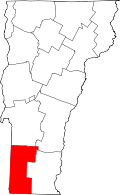 | |
| Villages | ||
| CDPs | ||
| Footnotes | ‡ Disincorporated | |