Ipswich Road, Brisbane
| Ipswich Road Queensland | |
|---|---|
 | |
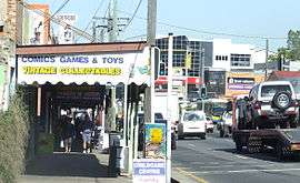
| Ipswich Road in Woolloongabba, 2010 | |
 Ipswich Road | |
| Coordinates | |
| General information | |
| Type | Road |
| Length | 9 km (5.6 mi) |
| Route number(s) |
|
| Former route number |
|
| Major junctions | |
| NE end |
|
| SW end |
|
| Location(s) | |
| Major suburbs | Annerley, Moorooka |
| |
Ipswich Road is one Brisbane's main roads connecting Brisbane to the nearby city of Ipswich, via the Ipswich Motorway. Ipswich Road used to be part of the Cunningham Highway. Logan Road, Pacific Motorway, and Beaudesert Road (Mount Lindesay Highway) are the other major roads in the south of Brisbane. The road was an important transport route in 19th century Brisbane.[1]
Woolloongabba
Ipswich Road begins at the Woolloongabba Five Ways intersection. From there Ipswich Road heads south bound for Ipswich City, Main Street heads north (to the tip of Kangaroo Point), Stanley Street goes east and west and Logan Road heads south-east towards Logan City.
The heritage-listed Norman Hotel is positioned on 102 Ipswich Road at Woolloongabba. The establishment was built in 1889, opened in 1890 and quickly became a local landmark.[1][2]
The Clem Jones Tunnel (Clem7) has an entry and exit point on Ipswich Road at Woolloongabba, the same place that the Pacific Motorway crosses over the road. Also in this vicinity the Eastern Busway crosses Ipswich Road.
Buranda
The Princess Alexandra Hospital is located on Ipswich Road at Buranda, as is the Buranda Shopping Centre (formerly the Ipswich Road tram depot).
Annerley
At Annerley, Ipswich Road intersects with Annerley Road (formerly Boggo Road) at the Annerley Junction.
There are a number of heritage-listed sites on Ipswich Road in Annerley. In the Annerley Junction area are:
- 413 Ipswich Road: Tram substation (part of the infrastructure of Brisbane's former tramways, now used as a hotel restaurant)[3]
- 413 Ipswich Road: Fig tree (the sole survivor of an avenue of fig trees planted on Ipswich Road in Annerley between 1911 and 1955)[4]
- 444 Ipswich Road: Police Station (built in 1925 and still in use as a police station)[5]
- 448 Ipswich Road: Annerley Library & Community Centre (designed in 1956 by architect James Birrell)[6]
Further along in the Chardon's Corner area (the intersection with Cracknell Road where the Chardons Hotel stands), there are more heritage-listed sites:
- 616 Ipswich Road: Mary Immaculate Catholic Church (a notable city landmark due to its prominent position its imposing interwar Gothic architecture)[7]
- 770 Ipswich Road: Shops [8]
Yeronga
In Yeronga the road passes the heritage-listed Yeronga Memorial Park and the heritage-listed Yeronga Fire Station.[9][10]
The Ipswich Road is the boundary between Annerley and Yeronga in the vicinity of the Yeronga Memorial Park (Annerley being on the east, Yeronga on the west).
Moorooka
At Moorooka the major arterial road called Beaudesert Road branches to the south east through the industrial suburbs of Salisbury, Acacia Ridge continuing on to the northern outskirts of Logan City. It is when Beaudesert Road crosses the Logan Motorway that Beaudesert Road becomes the Mount Lindesay Highway, which continues through to Logan, Jimboomba, Beaudesert and Mount Lindesay and beyond to the Queensland-New South Wales border.
South from this intersection the road is lined with numerous car sale yards and is known as the Moorooka Magic Mile of Motors.
Rocklea
At Rocklea the road becomes the upgraded Ipswich Motorway after crossing over the Beenleigh railway line.
Road traffic
At morning peak times the road can be congested anywhere from Annerley towards the city. According to the Brisbane City Council compared to 2007 rates, by 2016 the road is expected to carry an extra 12,000 cars each day. The road carried an average of 52,299 vehicles per day between July and December 2014.[11]
Trams
The last tram service in Brisbane took route S34 along Ipswich Road into Tottenham Road and the Ipswich Road Depot on 14 April 1969.[12]
See also
References
- 1 2 Tony Moore (5 June 2010). "Hotel with a past". Brisbane Times. Fairfax Media. Retrieved 10 July 2010.
- ↑ "Norman Hotel (entry 602539)". Queensland Heritage Register. Queensland Heritage Council. Retrieved 26 December 2013.
- ↑ "Tram substation (former)". Brisbane Heritage Register. Brisbane City Council. Retrieved 2 January 2014.
- ↑ "Fig tree)". Brisbane Heritage Register. Brisbane City Council. Retrieved 2 January 2014.
- ↑ "Police Station)". Brisbane Heritage Register. Brisbane City Council. Retrieved 2 January 2014.
- ↑ "Annerley Library & Community Centre". Brisbane Heritage Register. Brisbane City Council. Retrieved 2 January 2014.
- ↑ "Mary Immaculate Catholic Church". Brisbane Heritage Register. Brisbane City Council. Retrieved 2 January 2014.
- ↑ "Shops, 770 Ipswich Road". Brisbane Heritage Register. Brisbane City Council. Retrieved 2 January 2014.
- ↑ "Yeronga Memorial Park (entry 602462)". Queensland Heritage Register. Queensland Heritage Council. Retrieved 2 January 2014.
- ↑ "Yeronga Fire Station (former) (entry 602144)". Queensland Heritage Register. Queensland Heritage Council. Retrieved 2 January 2014.
- ↑ Kristian Silva (18 March 2015). "Brisbane traffic increasing, report shows". Brisbane Times. Fairfax Media. Retrieved 18 March 2015.
- ↑ Ford, Garry (2008). Carolyn Fitz-Gerald, ed. "Trams, tramways and termini". Brisbane:Water, Power and Industry Paper No. 20. Kelvin Grove, Queensland: Brisbane History Group: 64. ISBN 978-0-9751793-3-8.
External links
| Wikimedia Commons has media related to Ipswich Road, Brisbane. |