Interstate 35 in Iowa
| ||||
|---|---|---|---|---|
|
Iowa's Interstate Highways with I-35 highlighted in red. | ||||
| Route information | ||||
| Maintained by Iowa DOT | ||||
| Length: | 219.225 mi[1] (352.808 km) | |||
| Existed: | ca. September 21, 1958[2] – present | |||
| History: | Under construction 1958–1975 | |||
| Major junctions | ||||
| South end: |
| |||
| North end: |
| |||
| Location | ||||
| Counties: | ||||
| Highway system | ||||
| ||||
.svg.png)
_map.svg.png)
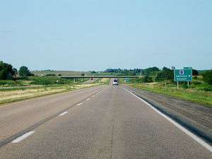
Interstate 35 (I-35) is a north–south Interstate Highway in the United States that runs from Laredo, Texas, to Duluth, Minnesota. In Iowa, the highway runs from south to north through the center of the state, roughly parallel to U.S. Highway 69 (US 69) and US 65. It enters the state near Lamoni from Missouri and continues north through the southern Iowa drift plain. In the Des Moines area, I-35 is overlapped by I-80 and the two routes bypass Des Moines to the west and north. I-235, the only auxiliary route of I-35, serves the suburbs and downtown Des Moines; it begins and ends at the two interchanges where I-35 and I-80 meet. Near Mason City and Clear Lake, US 18 and Iowa Highway 27 (Iowa 27) overlap with I-35. Shortly after, US 18 splits off to the west in Clear Lake, while Iowa 27 runs with I-35 until they reach the Minnesota state line.
Construction of I-35 in Iowa took place over 17 years. The first 10-mile-long (16 km) section of the route that stretched from Cumming to Urbandale was opened on September 21, 1958. In the next 14 years, new sections of the route opened regularly, only leaving the section between Mason City and US 20 uncompleted. On November 14, 1975, the last 50-mile-long (80 km) section of the route was completed and connected the two non-contiguous sections of I-35.
Route description
Southern Iowa
I-35 enters Iowa at the Missouri state line near Lamoni. An interchange that provides access to the adjacent US 69 is situated over the state line. The highway travels to the north-northeast for four miles (6.4 km) until it again meets US 69 on Lamoni's eastern edge. North of Lamoni is a rest area which overlooks the Grand River and provides pedestrian access to Decatur County's Slip Bluff County Park.[3] North of the Grand River, the interstate straightens to a north–south alignment. Near Decatur City, it intersects Iowa Highway 2 (Iowa 2) at a diamond interchange. Continuing north, the road slightly eases to the east. Two rural interchanges and another in Van Wert dot the 21 miles (34 km) separating Decatur City and Osceola.[1]
The Osceola area is served by three interchanges. The first is a partial cloverleaf interchange with US 34. This junction is so configured because of US 34's proximity to the BNSF Railway line which carries Amtrak's California Zephyr.[4] The next exit serves a casino and western Osceola. Northwest of Osceola is the western end of Iowa 152, which connects I-35 and US 69 at a narrow point between the two routes. Further north, the small towns of New Virginia, Truro, and St. Charles are each served by an interchange. The Iowa 92 exit just east of Bevington connects I-35 to the larger communities of Winterset and Indianola, to the west and east, respectively. The interchange for Cumming is the last before the interstate enters the Des Moines metropolitan area.[1]
Central Iowa

It continues north, enters the Des Moines metropolitan area and meets the Iowa Highway 5 freeway at West Des Moines. Further on in West Des Moines, at the West Mixmaster Interchange, I-35 meets Interstate 80 and Interstate 235. I-235 serves downtown Des Moines, while I-35 and I-80 overlap and serve the western and northern Des Moines suburbs. On the Clive/Urbandale border, I-35 and I-80 meet U.S. Highway 6. Further north in Urbandale, they meet Iowa Highway 141 and turn eastward. They also meet U.S. Highway 69 north of Des Moines. Between Des Moines and Ankeny, at the East Mixmaster interchange, I-35 and I-80 separate at an interchange where they also meet I-235.
Interstate 35 then turns north to go through Ankeny. It continues north and at Ames meets U.S. Highway 30. Ames is also served by Business Loop 35. I-35 continues north and meets Iowa Highway 175 near Ellsworth and meets the U.S. Highway 20 freeway near Williams. It continues north until the Wright County border, where it turns northeast. On this northeasterly alignment, I-35 meets Iowa Highway 3.
Northern Iowa
Shortly after meeting Iowa Highway 3, Interstate 35 turns north again and meets U.S. Highway 18 and Iowa Highway 27 near Clear Lake. I-35 overlaps U.S. 18 and Iowa Highway 27 through the Clear Lake area, which is also served with Business Loop 35. U.S. 18 separates in Clear Lake and I-35 and Iowa 27, which serves as the designation in Iowa for the Avenue of the Saints, overlap for the rest of the way to the Minnesota border, meeting Iowa Highway 9 near Hanlontown.
Services

The Iowa DOT operates 37 rest areas and one scenic overlook in 20 locations along its 780 miles (1,260 km) of interstate highway. Along I-35, there are five locations that have facilities accessible to each direction of traffic. A sixth is under construction in northern Polk County. Parking areas are divided so passenger automobiles are separated from large trucks. Common among all of the rest stops are separate men's and women's restrooms, payphones with TDD capabilities, weather reporting kiosks, vending machines, and free wireless Internet. Many stations have family restrooms and dump stations for recreational vehicles.[5]
The first rest areas along Iowa's interstates were built in the 1960s. They were modest facilities; separate buildings housed the restrooms and vending machines. A few rest stops had another building with local tourist information.[6] The newer facilities feature one large building housing as many as 28 more toilets than the older buildings, in addition to all the other common rest area amenities. They also feature artwork by local Iowa artists.[7] Each new rest area is designed around a theme.[8][9] For instance, the facility near Story City celebrates the history of transportation in the state. Story County is the home of the Iowa Department of Transportation and the location where the historic Lincoln Highway and I-35 intersect.[10]
History
The first section of I-35, a 10-mile-long (16 km) stretch from Cumming to Urbandale opened around September 21, 1958. Within five years, the interstate had grown to 55 miles (89 km), extending from U.S. Route 34 (US 34) Osceola to the eastern interchange with I-80 and I-235. The next two sections of I-35, 25 miles (40 km) from Ankeny to US 30 near Ames and 30 miles (48 km) from Ames to US 20 near Williams.[2]
By 1972, I-35 was completed at the Missouri and Minnesota state lines. In southern Iowa, the last section, from Iowa 2 near Decatur City to the state line, was completed on December 2, 1970. In northern Iowa, the section from Iowa 9 near Hanlontown to the state line opened on December 12, 1972. The last section of I-35 to open, from US 20 to Mason City, opened on November 14, 1975.[2]
Exit list
| County | Location | mi[1] | km | Exit[11] | Destinations | Notes |
|---|---|---|---|---|---|---|
| Harrison | Colfax Township | Continuation into Missouri | ||||
| Missouri–Iowa state line | 0.000 | 0.000 | 114 | Exit number follows Missouri numbering; interchange is on the state line | ||
| Decatur | Lamoni | 4.169 | 6.709 | 4 | ||
| Decatur City | 12.804 | 20.606 | 12 | |||
| Long Creek Township | 17.928 | 28.852 | 18 | |||
| Van Wert | 22.272 | 35.843 | 22 | |||
| Clarke | Knox Township | 29.348 | 47.231 | 29 | ||
| Osceola | 33.165 | 53.374 | 33 | |||
| 34.625 | 55.724 | 34 | Clay Street – Osceola | |||
| Osceola Township | 36.307 | 58.430 | 36 | Formerly Iowa 152 | ||
| Warren | Virginia Township | 43.850 | 70.570 | 43 | ||
| 47.414 | 76.305 | 47 | ||||
| Jackson Township | 51.949 | 83.604 | 52 | |||
| Bevington | 56.759 | 91.345 | 56 | |||
| Cumming | 65.045 | 104.680 | 65 | |||
| Polk | West Des Moines | 68.006 | 109.445 | 68 | ||
| 69.155 | 111.294 | 69 | Grand Avenue – West Des Moines | |||
| 70.398 | 113.295 | 70 | Mills Civic Parkway | |||
| 72.680 | 116.967 | 72A | ||||
| 72B | Southern end of I-80 overlap | |||||
| 72.734 | 117.054 | 72C | University Avenue – Clive | |||
| Clive | 74.245 | 119.486 | 125 | Exit numbers follow I-80 | ||
| Urbandale | 75.252 | 121.106 | 126 | Douglas Avenue – Urbandale | ||
| Meredith Drive | Future half diamond interchange[12] | |||||
| 76.649 | 123.355 | 127 | ||||
| 100th Street | Future diamond interchange[12] | |||||
| 78.625 | 126.535 | 129 | Northwest 86th Street – Camp Dodge | |||
| 80.633 | 129.766 | 131 | ||||
| Saylor Township | 84.424 | 135.867 | 135 | |||
| 85.672 | 137.876 | 136 | ||||
| Ankeny | 86.963 | 139.953 | 137A | |||
| 87A | Northern end of I-80 overlap | |||||
| 88.922 | 143.106 | 89 | Corporate Woods Drive | Exit numbers follow I-35 | ||
| 90.484 | 145.620 | 90 | ||||
| 92.486 | 148.842 | 92 | 1st Street | Future diverging diamond interchange[13] | ||
| 94.856 | 152.656 | 94 | NE 36th Street | Opened November 20, 2012[14] | ||
| Elkhart Township | 97.474 | 156.869 | 96 | Polk City, Elkhart | ||
| Story | Huxley | 103.437 | 166.466 | 102 | ||
| Ames | 112.401 | 180.892 | 111 | Signed as exits 111A (east) and 111B (west/north) | ||
| 114.255 | 183.876 | 113 | ||||
| Milford Township | 117.255 | 188.704 | 116 | |||
| Howard Township | 123.672 | 199.031 | 123 | |||
| Story City | 125.165 | 201.434 | 124 | Story City | ||
| Hamilton | Scott Township | 128.655 | 207.050 | 128 | ||
| Ellsworth | 133.637 | 215.068 | 133 | |||
| Rose Grove Township | 139.700 | 224.825 | 139 | |||
| 143.180 | 230.426 | 142 | Signed as exits 142A (east) and 142B (west) | |||
| Williams Township | 144.719 | 232.903 | 144 | |||
| 147.725 | 237.740 | 147 | ||||
| Wright | Vernon Township | 152.060 | 244.717 | 151 | ||
| Franklin | Morgan Township | 160.551 | 258.382 | 159 | ||
| Scott Township | 166.354 | 267.721 | 165 | |||
| Marion Township | 170.807 | 274.887 | 170 | |||
| Richland Township | 176.989 | 284.836 | 176 | |||
| Cerro Gordo | Pleasant Valley Township | 180.613 | 290.668 | 180 | ||
| 183.164 | 294.774 | 182 | ||||
| Mount Vernon Township | 189.208 | 304.501 | 188 | |||
| Lake Township | 191.436 | 308.086 | 190 | Southern end of US 18 / Iowa 27 overlap | ||
| Clear Lake | 193.885 | 312.028 | 193 | |||
| 194.755 | 313.428 | 194 | Northern end of US 18 overlap | |||
| Lincoln Township | 198.446 | 319.368 | 197 | |||
| Worth | Danville Township | 204.367 | 328.897 | 203 | ||
| Brookfield Township | 209.381 | 336.966 | 208 | |||
| Hartland Township | 215.401 | 346.654 | 214 | Former Iowa 105 | ||
| Iowa–Minnesota state line | 219.225 | 352.808 | Northern end of Iowa 27 overlap | |||
| Freeborn | Freeman Township | Continuation into Minnesota | ||||
1.000 mi = 1.609 km; 1.000 km = 0.621 mi
| ||||||
See also
References
- 1 2 3 4 "2012 Volume of Traffic on the Primary Road System of Iowa" (PDF). Iowa Department of Transportation. January 1, 2012. Retrieved October 30, 2013.
- 1 2 3 Completion Map of Interstate System (PDF) (Map). Iowa Department of Transportation. January 1, 1982. Retrieved January 11, 2011.
- ↑ "Natural Environment" (PDF). near Lamoni: Iowa Department of Transportation. November 9, 2006. Retrieved December 28, 2013.
- ↑ "Passenger Rail in Iowa". Iowa Department of Transportation. Retrieved December 28, 2013.
- ↑ Office of Maintenance. "Iowa Interstate Rest Areas". Iowa Department of Transportation. Retrieved August 10, 2012.
- ↑ Mastellar, Mark (2003). "Iowa's New Interstate Rest Areas" (PDF). Center of Transportation Research and Education. p. 2. Retrieved October 14, 2012.
- ↑ Petroski, William (July 30, 1999). "State-of-the-Art Rest Stop to Make Its Debut; New Facility Has Welcome Center, Bank of Vending Machines". The Des Moines Register. p. 8 (Metro).
- ↑ Office of Maintenance. "Iowa Interstate Rest Area Posters". Iowa Department of Transportation. Retrieved August 10, 2012.
- ↑ Buddenberg, Roger (September 5, 2009). "I-80 drivers can still rest easy". Omaha World-Herald. Archived from the original on October 23, 2012. Retrieved October 23, 2012.
- ↑ "Celebration of Transportation" (PDF). near Story City, Iowa: Iowa Department of Transportation. Retrieved December 27, 2013.
- ↑ Transportation Map (PDF) (Map). Iowa Department of Transportation. 2011. Retrieved November 16, 2011.
- 1 2 Aschbrenner, Joel (September 4, 2015). "Rider Corner changes bring opportunities, worries". The Des Moines Register. Retrieved September 5, 2015.
- ↑ Ta, Linh (December 5, 2015). "Diverging diamond interchange planned in Ankeny". The Des Moines Register. Retrieved March 14, 2016.
- ↑ VerHelst, Megan (November 15, 2012). "Ankeny's 36th Street Interchange Slated to Open Tuesday". Ankeny Patch. Ankeny, Iowa. Retrieved November 21, 2012.
External links
 Geographic data related to Interstate 35 at OpenStreetMap
| Previous state: Missouri |
Iowa | Next state: Minnesota |