Lamoni, Iowa
| Lamoni, Iowa | |
|---|---|
| City | |
|
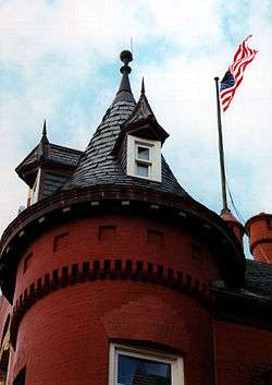
Graceland Administration Building | |
 Location of Lamoni, Iowa | |
 Lamoni, Iowa Location in the United States | |
| Coordinates: 40°37′21″N 93°56′1″W / 40.62250°N 93.93361°WCoordinates: 40°37′21″N 93°56′1″W / 40.62250°N 93.93361°W | |
| Country | United States |
| State |
|
| County | Decatur |
| Government | |
| • City Clerk | Barb Stuck |
| • Mayor | Janelle Anders |
| Area[1] | |
| • Total | 3.44 sq mi (8.91 km2) |
| • Land | 3.34 sq mi (8.65 km2) |
| • Water | 0.10 sq mi (0.26 km2) |
| Elevation | 1,125 ft (343 m) |
| Population (2010)[2] | |
| • Total | 2,324 |
| • Estimate (2012[3]) | 2,336 |
| • Density | 695.8/sq mi (268.6/km2) |
| Time zone | Central (CST) (UTC-6) |
| • Summer (DST) | CDT (UTC-5) |
| ZIP code | 50140 |
| Area code(s) | 641 |
| FIPS code | 19-42960 |
| GNIS feature ID | 0458214 |
Lamoni is a city in Decatur County, Iowa, United States. The population was 2,324 at the 2010 census. Lamoni is the home of Graceland University, affiliated with the Community of Christ, and the city was the church's headquarters from 1880 to 1920 when it moved to Independence, Missouri.
History
The Lamoni area was first settled in 1834 to 1840 by people who thought they were settling in slave-owning Missouri. It was only after the Sullivan Line separating Missouri and Iowa was formally surveyed when Iowa became a state in 1846 that they realized they were in non-slave-owning Iowa.[4]
In 1851, refugees from the Hungarian Revolution of 1848 sought to settle the area and form the community of New Buda (named for a neighborhood of Budapest). However, their efforts did not result in a significant settlement.[4]
In 1870, Joseph Smith III authorized the Order of Enoch to purchase over three thousand acres (12 km²) to form a community of the Reorganized Church of Jesus Christ of Latter Day Saints (RLDS Church). Smith lived in Liberty Hall which is now a museum.[5]
The city was named after Lamoni, a king mentioned in the Book of Mormon.
Lamoni, which is just north of the Missouri border, was chosen because of its good farmland and because of its being about 100 miles north of Temple Lot, which is an important location of church teachings. The Mormons had been evicted from Temple Lot and Missouri in the 1838 Mormon War.[6]
Members of The Church of Jesus Christ of Latter-day Saints, led by Brigham Young, had passed through the community in 1846, staying at nearby Garden Grove, Iowa, while en route from Nauvoo, Illinois, (where they had settled after being forced to leave Missouri) to the Salt Lake Valley.[4]
The town was formally platted adjacent to newly laid tracks of the Chicago, Burlington and Quincy Railroad in 1879. By 1900, its population had grown to 1,500.[6]
In 1880, Smith moved to Lamoni (as did the RLDS Church headquarters) from Plano, Illinois.[6]
In 1895,the church founded Graceland University in Lamoni.
After the Smith family moved to Independence to the area near Temple Lot in 1916, Liberty Hall served as a home for the aged, a farmhouse, CCC Headquarters, and a private residence before becoming the museum it is today.
Charles Hyde and David Vredenburg, members of the church and affiliated with the church-owned General Supply Company, which owned Lamoni mills, hardware and grocery stores, started a grocery store chain called the Supply Store in 1930, which in turn became Hy-Vee (from their two names). Lamoni remained the company's headquarters until 1945 when it moved to Chariton, Iowa.[7]
Lamoni area has a sizable Amish community, whose businesses are not open on Sundays.[8]
Geography
Lamoni is located at 40°37′21″N 93°56′1″W / 40.62250°N 93.93361°W (40.622563, -93.933739).[9] According to the United States Census Bureau, the city has a total area of 3.44 square miles (8.91 km2), of which 3.34 square miles (8.65 km2) is land and 0.10 square miles (0.26 km2) is water.[1]
Climate
Lamoni has a humid continental climate (Köppen climate classification Dfa).
| Climate data for Lamoni | |||||||||||||
|---|---|---|---|---|---|---|---|---|---|---|---|---|---|
| Month | Jan | Feb | Mar | Apr | May | Jun | Jul | Aug | Sep | Oct | Nov | Dec | Year |
| Average high °F (°C) | 31 (−1) |
37 (3) |
49 (9) |
61 (16) |
72 (22) |
82 (28) |
87 (31) |
85 (29) |
77 (25) |
64 (18) |
48 (9) |
35 (2) |
61 (16) |
| Average low °F (°C) | 12 (−11) |
17 (−8) |
28 (−2) |
38 (3) |
51 (11) |
60 (16) |
65 (18) |
63 (17) |
53 (12) |
41 (5) |
28 (−2) |
17 (−8) |
39 (4) |
| Average precipitation inches (mm) | 1.01 (25.7) |
1.42 (36.1) |
2.67 (67.8) |
3.85 (97.8) |
4.92 (125) |
4.26 (108.2) |
4.93 (125.2) |
4.52 (114.8) |
4.34 (110.2) |
3.29 (83.6) |
2.64 (67.1) |
1.52 (38.6) |
39.37 (1,000) |
| Source: Weather Channel[10] | |||||||||||||
Demographics
| Historical populations | ||
|---|---|---|
| Year | Pop. | ±% |
| 1900 | 1,540 | — |
| 1910 | 1,541 | +0.1% |
| 1920 | 1,787 | +16.0% |
| 1930 | 1,739 | −2.7% |
| 1940 | 1,567 | −9.9% |
| 1950 | 2,196 | +40.1% |
| 1960 | 2,173 | −1.0% |
| 1970 | 2,540 | +16.9% |
| 1980 | 2,705 | +6.5% |
| 1990 | 2,319 | −14.3% |
| 2000 | 2,444 | +5.4% |
| 2010 | 2,324 | −4.9% |
| 2014 | 2,404 | +3.4% |
| 2015 | 2,376 | −1.2% |
| Source:"American FactFinder". United States Census Bureau. and Iowa Data Center Source: | ||
2010 census
As of the census[12] of 2010, there were 2,324 people, 770 households, and 427 families residing in the city. The population density was 723.6 people per square mile (279.4/km²). There were 927 housing units at an average density of 288.7 per square mile (111.5/km²). The racial makeup of the city was 88.6% White, 5.7% African American, 0.6% Native American, 1.1% Asian, 0.7% Pacific Islander, 1.1% from other races, and 2.0% from two or more races. Hispanic or Latino of any race were 4.5% of the population.
There were 770 households of which 24% had children under the age of 18 living with them, 42.7% were married couples living together, 9.2% had a female householder with no husband present, and 44.5% were non-families. 32.3% of all households were made up of individuals and 13.6% had someone living alone who was 65 years of age or older. The average household size was 2.25 and the average family size was 2.84.
27.8% were under the age of 20, 25.6% from 20 to 24, 11.9% from 25 to 44, 15.8% from 45 to 64, and 15.5% were 65 years of age or older. The median age was 23.5 years. For every 100 females, there were 98.6 males. For every 100 females age 18 and over, there were 96.9 males.[13]
2000 census
As of the census[12] of 2000, there were 2,444 people, 818 households, and 428 families residing in the city. The population density was 761.1 people per square mile (294.0/km²). There were 904 housing units at an average density of 281.5 per square mile (108.7/km²). The racial makeup of the city was 91.86% White, 2.95% African American, 0.16% Native American, 1.60% Asian, 0.41% Pacific Islander, 0.82% from other races, and 2.21% from two or more races. Hispanic or Latino of any race were 2.78% of the population.
There were 818 households, out of which 21.4% had children under the age of 18 living with them, 44.7% were married couples living together, 5.9% had a female householder with no husband present, and 47.6% were non-families. 36.7% of all households were made up of individuals and 16.5% had someone living alone who was 65 years of age or older. The average household size was 2.14 and the average family size was 2.84.
15.1% were under the age of 18, 39.6% from 18 to 24, 13.9% from 25 to 44, 15.6% from 45 to 64, and 15.8% were 65 years of age or older. The median age was 23 years. For every 100 females there were 93.2 males. For every 100 females age 18 and over, there were 92.2 males.
The median income for a household in the city was $42,083, and the median income for a family was $53,363. Males had a median income of $37,700 versus $26,563 for females. The per capita income for the city was $14,279. About 6.9% of families and 15.3% of the population were below the poverty line, including 7.2% of those under age 18 and 9.2% of those age 65 or over.
Notable people
- Paul Ballantyne, actor
- William W. Blair, RLDS Church leader
- Eveline Burgess, chess champion
- Steven V. Carter, politician
- Floyd M. McDowell, RLDS Church leader
- Alexander Hale Smith, RLDS Church leader
- Heman C. Smith, RLDS Church leader
- Israel A. Smith, RLDS Church leader
- Joseph Smith III, RLDS Church leader
- W. Wallace Smith, RLDS Church leader
- Wallace B. Smith, RLDS Church leader
- Eddie Watt, Major League Baseball pitcher
References
- 1 2 "US Gazetteer files 2010". United States Census Bureau. Retrieved 2012-05-11.
- ↑ "American FactFinder". United States Census Bureau. Retrieved 2012-05-11.
- ↑ "Population Estimates". United States Census Bureau. Retrieved 2013-05-23.
- 1 2 3 "History of Lamoni | Lamoni IA". Retrieved 2013-05-18.
- ↑ "Lamoni, Iowa, Rlds Church History Tour Page". Jwha.info. 2003-05-10. Retrieved 2013-05-18.
- 1 2 3 "Chapter7rev2". Welcometobibleverses.org. Retrieved 2013-05-18.
- ↑ http://www.hy-vee.com/webres/File/Lamoni_Years.pdf
- ↑ "Amish Area Business Map", Lamoni-Iowa.com, City of Lamoni
|contribution=ignored (help) - ↑ "US Gazetteer files: 2010, 2000, and 1990". United States Census Bureau. 2011-02-12. Retrieved 2011-04-23.
- ↑ Average weather for Lamoni Weather Channel Retrieved 2008-04-08
- ↑ "Census of Population and Housing". Census.gov. Retrieved June 4, 2015.
- 1 2 "American FactFinder". United States Census Bureau. Retrieved 2008-01-31.
- ↑ "Link to data". American FactFinder. U.S. Census Bureau.
External links
| Wikimedia Commons has media related to Lamoni, Iowa. |
- Official City Website
- City-Data Comprehensive Statistical Data and more about Lamoni
Municipalities and communities of Decatur County, Iowa, United States | ||
|---|---|---|
| Cities | ||
| Townships | ||