Hensley Township, Champaign County, Illinois
| Hensley Township | |
|---|---|
| Township | |
|
Rising road and the Rising Farmers Grain Company elevator in the southwest corner of section 29. | |
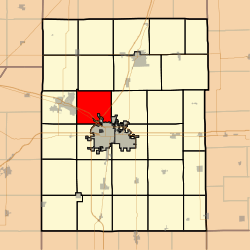 Location in Champaign County | |
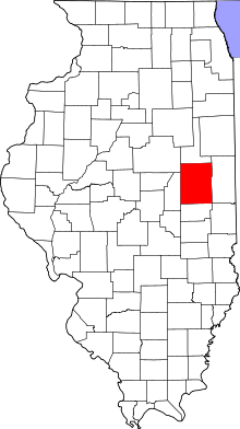 Champaign County's location in Illinois | |
| Coordinates: 40°10′42″N 88°17′12″W / 40.17833°N 88.28667°WCoordinates: 40°10′42″N 88°17′12″W / 40.17833°N 88.28667°W | |
| Country | United States |
| State | Illinois |
| County | Champaign |
| Established | September 1866 |
| Area | |
| • Total | 30.16 sq mi (78.1 km2) |
| • Land | 30.16 sq mi (78.1 km2) |
| • Water | 0 sq mi (0 km2) 0% |
| Elevation | 774 ft (236 m) |
| Population (2010) | |
| • Total | 1,278 |
| • Density | 42.4/sq mi (16.4/km2) |
| Time zone | CST (UTC-6) |
| • Summer (DST) | CDT (UTC-5) |
| GNIS feature ID | 0429129 |


Hensley Township is a township in Champaign County, Illinois, USA. As of the 2010 census, its population was 1,278 and it contained 542 housing units.[1]
History
Hensley Township formed from Champaign Township in September, 1866 as Grant Township, but the name was changed to Hensley on an unknown date.
Geography
According to the 2010 census, the township has a total area of 30.16 square miles (78.1 km2), all land.[1] The source of the Kaskaskia River is located in section 19 of this township, rising from the Kaskaskia ditch.
Cities and towns
- Mahomet (east edge)
Unincorporated towns
Cemeteries
The township contains seven cemeteries: Bethlehem, Fisher, George Peters Family, Grandview Memorial Gardens, Gregory Burial and Haines Family.
Major highways
Airports and landing strips
- Andrew RLA Airport
- Champaign Airport (historical)
- McCulley Airport
References
- "Hensley Township, Champaign County, Illinois". Geographic Names Information System. United States Geological Survey. Retrieved 2010-01-04.
- United States Census Bureau cartographic boundary files
- 1 2 "Population, Housing Units, Area, and Density: 2010 - County -- County Subdivision and Place -- 2010 Census Summary File 1". United States Census. Retrieved 2013-05-28.
External links
 |
Newcomb Township | Condit Township | | |
| Mahomet Township | |
Somer Township | ||
| ||||
| | ||||
| Scott Township | City of Champaign Champaign Township |
Municipalities and communities of Champaign County, Illinois, United States | ||
|---|---|---|
| Cities | ||
| Villages | ||
| Townships | ||
| CDPs | ||
| Other unincorporated communities | ||
| Footnotes | ‡This populated place also has portions in an adjacent county or counties | |
This article is issued from Wikipedia - version of the 11/8/2016. The text is available under the Creative Commons Attribution/Share Alike but additional terms may apply for the media files.