Rantoul Township, Champaign County, Illinois
| Rantoul Township | |
|---|---|
| Township | |
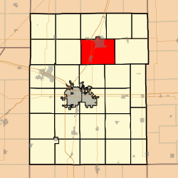 Location in Champaign County | |
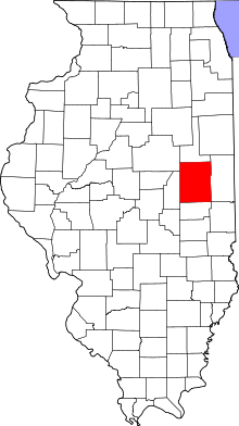 Champaign County's location in Illinois | |
| Coordinates: 40°16′22″N 88°09′56″W / 40.27278°N 88.16556°WCoordinates: 40°16′22″N 88°09′56″W / 40.27278°N 88.16556°W | |
| Country | United States |
| State | Illinois |
| County | Champaign |
| Established | November 8, 1859 |
| Area | |
| • Total | 49.64 sq mi (128.6 km2) |
| • Land | 49.54 sq mi (128.3 km2) |
| • Water | 0.11 sq mi (0.3 km2) 0.22% |
| Elevation | 728 ft (222 m) |
| Population (2010) | |
| • Total | 11,273 |
| • Density | 227.6/sq mi (87.9/km2) |
| Time zone | CST (UTC-6) |
| • Summer (DST) | CDT (UTC-5) |
| GNIS feature ID | 0429618 |
Rantoul Township is a township in Champaign County, Illinois, USA. As of the 2010 census, its population was 11,273 and it contained 4,969 housing units.[1]
Geography
According to the 2010 census, the township has a total area of 49.64 square miles (128.6 km2), of which 49.54 square miles (128.3 km2) (or 99.80%) is land and 0.11 square miles (0.28 km2) (or 0.22%) is water.[1]
Cities and towns
- Rantoul (south three-quarters)
- Thomasboro
Cemeteries
The township contains five cemeteries: Beckman, Eden, Elizabeth, Elmwood and Saint Elizabeth.
Major highways
Airports and landing strips
- Schmidt Airport
References
- "Rantoul Township, Champaign County, Illinois". Geographic Names Information System. United States Geological Survey. Retrieved 2010-01-04.
- United States Census Bureau cartographic boundary files
- 1 2 "Population, Housing Units, Area, and Density: 2010 - County -- County Subdivision and Place -- 2010 Census Summary File 1". United States Census. Retrieved 2013-05-28.
External links
 |
East Bend Township | Ludlow Township | Harwood Township | |
| Condit Township | |
Compromise Township | ||
| ||||
| | ||||
| Somer Township | Stanton Township |
Municipalities and communities of Champaign County, Illinois, United States | ||
|---|---|---|
| Cities | ||
| Villages | ||
| Townships | ||
| CDPs | ||
| Other unincorporated communities | ||
| Footnotes | ‡This populated place also has portions in an adjacent county or counties | |
This article is issued from Wikipedia - version of the 11/29/2013. The text is available under the Creative Commons Attribution/Share Alike but additional terms may apply for the media files.