South Homer Township, Champaign County, Illinois
| South Homer Township | |
|---|---|
| Township | |
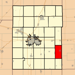 Location in Champaign County | |
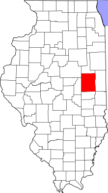 Champaign County's location in Illinois | |
| Coordinates: 40°01′24″N 87°58′19″W / 40.02333°N 87.97194°WCoordinates: 40°01′24″N 87°58′19″W / 40.02333°N 87.97194°W | |
| Country | United States |
| State | Illinois |
| County | Champaign |
| Settled | November 8, 1859 |
| Area | |
| • Total | 28.26 sq mi (73.2 km2) |
| • Land | 27.96 sq mi (72.4 km2) |
| • Water | 0.3 sq mi (0.8 km2) 1.06% |
| Elevation | 669 ft (204 m) |
| Population (2010) | |
| • Total | 1,601 |
| • Density | 57.3/sq mi (22.1/km2) |
| Time zone | CST (UTC-6) |
| • Summer (DST) | CDT (UTC-5) |
| GNIS feature ID | 0429768 |
South Homer Township is a township in Champaign County, Illinois, USA. As of the 2010 census, its population was 1,601 and it contained 681 housing units.[1]
Geography
According to the 2010 census, the township has a total area of 28.26 square miles (73.2 km2), of which 27.96 square miles (72.4 km2) (or 98.94%) is land and 0.3 square miles (0.78 km2) (or 1.06%) is water.[1] The Salt Fork of the Vermilion River winds its way through the north west section of the township. The confluence of 40°N 88°W / 40°N 88°W lies in a farm field, in section 19 of the township.
Cities and towns
Unincorporated towns
(This list is based on USGS data and may include former settlements.)
Cemeteries
The township contains two cemeteries: Homer Grand Army of the Republic and Lost Grove.
Major highways
Airports and landing strips
- Homer Airport (historical)
References
- "South Homer Township, Champaign County, Illinois". Geographic Names Information System. United States Geological Survey. Retrieved 2010-01-04.
- United States Census Bureau cartographic boundary files
- 1 2 "Population, Housing Units, Area, and Density: 2010 - County -- County Subdivision and Place -- 2010 Census Summary File 1". United States Census. Retrieved 2013-05-28.
External links
 |
St. Joseph Township | Ogden Township | | |
| Sidney Township | |
Vance Township, Vermilion County | ||
| ||||
| | ||||
| Ayers Township | Sidell Township, Vermilion County |
Municipalities and communities of Champaign County, Illinois, United States | ||
|---|---|---|
| Cities | ||
| Villages | ||
| Townships | ||
| CDPs | ||
| Other unincorporated communities | ||
| Footnotes | ‡This populated place also has portions in an adjacent county or counties | |
This article is issued from Wikipedia - version of the 12/4/2013. The text is available under the Creative Commons Attribution/Share Alike but additional terms may apply for the media files.