Haddon, Victoria
| Haddon Victoria | |||||||||||||
|---|---|---|---|---|---|---|---|---|---|---|---|---|---|
 The Bills Horse Trough in Haddon | |||||||||||||
 Haddon | |||||||||||||
| Coordinates | 37°35′18″S 143°41′58″E / 37.58833°S 143.69944°ECoordinates: 37°35′18″S 143°41′58″E / 37.58833°S 143.69944°E | ||||||||||||
| Postcode(s) | 3351 | ||||||||||||
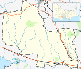
| Location | |||||||||||||
| LGA(s) | Golden Plains Shire | ||||||||||||
| State electorate(s) | Buninyong | ||||||||||||
| Federal Division(s) | Ballarat | ||||||||||||
| |||||||||||||
Haddon is a township in the Golden Plains Shire, 12 km west of Ballarat.
Haddon is home to Ballarat Kart Club, the original Haddon circuit was built in 1961, before being extended and widened to its modern configuration.
River
Haddon is set on the Woady Yaloak River, which rises in some swamp land a few kilometres to the north. The river runs though paddocks, parks and under a road. The river has two bridges in the town, a footbridge in the park and a road bridge.
External links
![]() Media related to Haddon, Victoria at Wikimedia Commons
Media related to Haddon, Victoria at Wikimedia Commons
This article is issued from Wikipedia - version of the 6/29/2016. The text is available under the Creative Commons Attribution/Share Alike but additional terms may apply for the media files.