Enfield, Victoria
| Enfield Victoria | |||||||||||||
|---|---|---|---|---|---|---|---|---|---|---|---|---|---|
 Enfield | |||||||||||||
| Coordinates | 38°02′0″S 144°03′0″E / 38.03333°S 144.05000°ECoordinates: 38°02′0″S 144°03′0″E / 38.03333°S 144.05000°E | ||||||||||||
| Population | 394 (2011 census)[1] | ||||||||||||
| Postcode(s) | 3352 | ||||||||||||
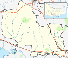
| Location | |||||||||||||
| LGA(s) | Golden Plains Shire | ||||||||||||
| State electorate(s) | Buninyong | ||||||||||||
| Federal Division(s) | Corangamite | ||||||||||||
| |||||||||||||
Enfield is a rural locality in Victoria, Australia. The locality is in the Golden Plains Shire, near the regional city of Ballarat and 149 kilometres (93 mi) west of the state capital, Melbourne. At the 2011 census, Enfield and the surrounding area had a population of 394.[1]
Enfield Post Office was renamed from Whim Holes Post office on 19 November 1874. It closed on 31 December 1971.[2]
References
| Wikimedia Commons has media related to Enfield, Victoria. |
- 1 2 Australian Bureau of Statistics (31 October 2012). "Enfield (State Suburb)". 2011 Census QuickStats. Retrieved 8 December 2014.
- ↑ Premier Postal History, Post Office List, retrieved 2010-04-21
This article is issued from Wikipedia - version of the 5/7/2016. The text is available under the Creative Commons Attribution/Share Alike but additional terms may apply for the media files.