Guysborough, Nova Scotia
| Guysborough | |||
|---|---|---|---|
| Municipal district | |||
| |||
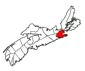 Location of Guysborough Municipal District | |||
| Coordinates: 44°26′00″N 64°35′57″W / 44.433333°N 64.599167°WCoordinates: 44°26′00″N 64°35′57″W / 44.433333°N 64.599167°W | |||
| Country |
| ||
| Province |
| ||
| County | Guysborough | ||
| Founded | 1604 | ||
| Incorporated | April 17, 1879 | ||
| Government | |||
| • Type |
Council of the Municipality of the District of Guysborough | ||
| • Municipal Seat | Guysborough | ||
| • Warden | Vernon Pitts | ||
| Area[1] | |||
| • Land | 2,111.42 km2 (815.22 sq mi) | ||
| Population (2006)[1][2] | |||
| • Total | 4,681 | ||
| • Density | 2.2/km2 (6/sq mi) | ||
| • Change 2001-06 |
| ||
| • Census Ranking | 721 of 5,008 | ||
| Electoral districts | |||
| • Federal | Cape Breton—Canso | ||
| • Provincial | Guysborough–Eastern Shore–Tracadie | ||
| Time zone | AST (UTC-4) | ||
| • Summer (DST) | ADT (UTC-3) | ||
| Area code(s) | 902 | ||
| Dwellings | 2,889 | ||
| Median Income* | $34,987 CDN | ||
| Website |
www | ||
| |||

The Municipality of the District of Guysborough is a municipal district in Guysborough County, Nova Scotia.
It is home to the Boylston and Salsman Provincial Parks. This park is an ideal place to camp while touring the Eastern Shore. Its location is between Boylston and Guysborough. The park's wooded hilltop campground offers a spectacular view of Guysborough Harbour to patrons.[3]
History
The area was originally called Chedabouctou and was the site of one of a fishing post of Nicolas Denys. In 1682, a permanent settlement was started by Clerbaud Bergier. A group cleared land and spent the winter with the first crops being planted in 1683. Louis-Alexandre des Friches de Meneval landed at Chedabouctou in 1687 when arriving to take up his position as governor of Acadia. The community is named after Sir Guy Carleton.[4]
Geography
Occupying the eastern half of Guysborough County, the district's administrative centre is the community of Guysborough. The district completely surrounds the town of Mulgrave and it borders the St. Mary's municipal district to the west, Antigonish County to the north and the Strait of Canso to the east.
Demographics
|
|
See also
References
- 1 2 3 2006 Statistics Canada Community Profile: Guysborough Municipal District, Nova Scotia
- ↑ Statistics Canada Population and dwelling counts, for Canada and census subdivisions (municipalities), 2006 and 2001 censuses - 100% data
- ↑ http://www.novascotia.com/places-to-stay/campgrounds/boylston-provincial-park/22
- ↑ https://archive.org/stream/placenamesofprov00browuoft#page/62/mode/2up
- ↑ Statistics Canada: 1996, 2001, 2006 census
- ↑ 2011 Census
External links
- Municipality of the District of Guysborough Website
- Melford International Terminal
- the Dictionary of Canadian Biography Online - Clerbaud Bergier
- Dictionary of Canadian Biography Online - Governor Meneval
 |
Antigonish County | Inverness County | | |
| St. Mary's Municipal District | |
Richmond County / Chedabucto Bay | ||
| ||||
| | ||||
| Atlantic Ocean |
| Counties | |
|---|---|
| Economic Regions | |
| Regional municipalities | |
| Municipal districts | |
| Towns | |
| Incorporated villages | |
| Lists | |
| |