Mulgrave, Nova Scotia
| Mulgrave | ||
|---|---|---|
| Town | ||
|
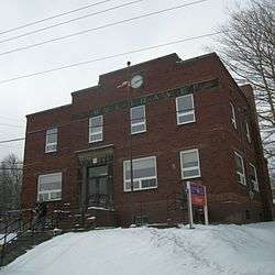
Mulgrave Post Office | ||
| ||
| Nickname(s): Deep Water Port | ||
| Motto: "Come be a part of our Family" | ||
 Mulgrave Location of Mulgrave, Nova Scotia | ||
| Coordinates: 45°36′48″N 61°23′30″W / 45.61333°N 61.39167°W | ||
| Country |
| |
| Province |
| |
| Municipality | Guysborough County | |
| Founded | 1800 | |
| Incorporated | December 1, 1923 | |
| Government | ||
| • Mayor | Lorne MacDonald [1] | |
| • Governing Body | Mulgrave Town Council | |
| • MLA | Lloyd Hines (L) | |
| • MP | Rodger Cuzner (L) | |
| Area | ||
| • Total | 17.81 km2 (6.88 sq mi) | |
| Elevation | 48 m (157 ft) | |
| Population (2011) | ||
| • Total | 794 | |
| • Density | 44.6/km2 (116/sq mi) | |
| Time zone | AST (UTC-4) | |
| Postal code | B0E 2G0 | |
| Area code(s) | 902 | |
| Telephone Exchange | 747 | |
| Median Earnings* | $40,339 | |
| NTS Map | 011F11 | |
| GNBC Code | CBAQK | |
| Website |
townofmulgrave | |
| ||

Coordinates: 45°36′48″N 61°23′30″W / 45.61333°N 61.39167°W Mulgrave (2011 population: 794) is a town on the Strait of Canso in Guysborough County, Nova Scotia, Canada. The town's current name was adopted in 1859 to honour the colonial Lieutenant Governor, the Earl of Mulgrave. The town of Mulgrave lies on the Strait of Canso opposite the town of Port Hawkesbury.
History
Mulgrave was first settled as McNair's Cove by British Loyalists fleeing from the American Revolution and soon became a part of the lumber trade with the English in the early part of the nineteenth century. In 1818, the lumber trade ended and the economy shifted to fishing, becoming by 1830 the major occupation. In 1833, a ferry service began between the Nova Scotia mainland and Cape Breton Island began. The ferry made an important contribution to the local economy. Steam power was introduced in 1863, boosting the amount of traffic that could be ferried.
The economy was badly affected however, when in 1870 trade agreements in the fishing industry were cancelled to protect the American fish market, and the local fishing industry collapsed. Gradually, people began moving away, and by 1880 more than a third of the population moved, mainly to New England in search of employment.[2]

By the early 1900s the railroad industry had now become the main industry and Mulgrave was becoming a bustling terminal, equipped with freight sheds, marshalling yards, and auxiliary services of an efficient railway centre. Adding to the economy were a new lobster factory and a new rail ferry, which further increased capacity across the Strait of Canso to Port Hawkesbury. Ferry service through Mulgrave provided a rail and road gateway for traffic from mainland Nova Scotia and the rest of Canada to Cape Breton and Newfoundland. In 1923, the community was incorporated as a town.
In 1955, Mulgrave suffered a new blow to its economy with the opening of the Canso Causeway which immediately removed both road and rail traffic through the town. Recovery has been slow.
Notable residents
- Birthplace of Lt. Col. Thomas Howard MacDonald of the HMHS Llandovery Castle
Public services
The headquarters of the Eastern Counties Regional Library is in Mulgrave.
Demography
| Historical population | ||
|---|---|---|
| Year | Pop. | ±% |
| 1956 | 1,227 | — |
| 1961 | 1,145 | −6.7% |
| 1981 | 1,099 | −4.0% |
| 1991 | 935 | −14.9% |
| 1996 | 896 | −4.2% |
| 2001 | 904 | +0.9% |
| 2006 | 879 | −2.8% |
| 2011 | 794 | −9.7% |
| [3] [4] | ||
References
See Also
External links
- Town of Mulgrave
- A picture gallery of Mulgrave
- Mulgrave Marine Industrial Park
- Archive photograph of Mulgrave railway station
| Counties | |
|---|---|
| Economic Regions | |
| Regional municipalities | |
| Municipal districts | |
| Towns | |
| Incorporated villages | |
| Lists | |
| |