Guangfu, Hualien
| Guangfu Township 光復鄉 Fata'an (馬太鞍) | |
|---|---|
 | |
| Coordinates: 23°38′6.23″N 121°25′21.94″E / 23.6350639°N 121.4227611°ECoordinates: 23°38′6.23″N 121°25′21.94″E / 23.6350639°N 121.4227611°E | |
| Country | Taiwan |
| Region | Eastern Taiwan |
| Government | |
| • Type | Township |
| Area | |
| • Total | 157.1100 km2 (60.6605 sq mi) |
| Population (December 2014) | |
| • Total | 13,395 |
| Time zone | CST (UTC+8) |
| Post code | 976 |
| Subdivision | 14 Villages |
| Website | www.guangfu.gov.tw (Chinese) |

Fataan Ecological Wetland
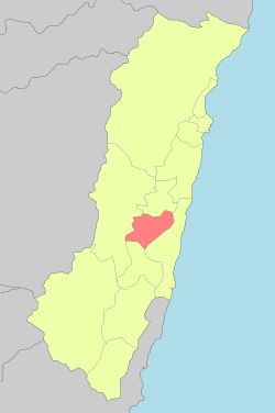
Guangfu Township (Chinese: 光復鄉; pinyin: Guāngfù Xiāng) is a rural township located in mid Huatung Valley between Central Mountain Range and coastal Range of Hualien County, Taiwan. It has 14 villages and a population of 13,395 inhabitants, which the greatest aborigines here is Ami people. The main economical activity is agriculture.
Geography
The township is located at the Huatung Valley.
Administrative divisions
Dahua Village, Daan Village, Daping Village, Dama Village, Datong Village, Tungfu Village, Xifu Village, Nanfu Village, Beifu Village, Dajin Village, Daquan Village, Daxing Village, Dafu Village and Dafeng Village.
Tourist attractions
- Bao'an Temple
- Dafong Ecological Park
- Daxing Waterfall Memorial Park
- Fataan Ecological Wetland
- Hualien Sugar Factory (Taiwan Sugar Corporation)
- Mataian Culture Street
- Mataian Humanities Studio
- Mataian Wetland Ecological Park
- Mudflow Memorial Park
- Tabalong aboriginal culture[1]
Transportation
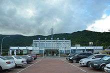
Guangfu Station
- Taiwan Railway Administration Guangfu and Dafu Station (Hualien-Taitung Line)
- Provincial Highway No.9 (Hualien-Taitung Provincial Highway)
- Provincial Highway No.11A (Guangfu-Fengbin)
- County Road No.193
See also
References
External links
| Wikimedia Commons has media related to Guangfu Township, Hualien County. |
- Guangfu Township Administration Office
 Guangfu travel guide from Wikivoyage
Cities and townships of Hualien County | ||
|---|---|---|
| Cities |  | |
| Urban townships | ||
| Rural townships | ||
| Mountain indigenous townships | ||
Taiwanese aboriginal areas | ||||||||||||||||||||||||||||||||||||||||||||||||
|---|---|---|---|---|---|---|---|---|---|---|---|---|---|---|---|---|---|---|---|---|---|---|---|---|---|---|---|---|---|---|---|---|---|---|---|---|---|---|---|---|---|---|---|---|---|---|---|---|
| Highland aboriginal Townships and Districts |
| 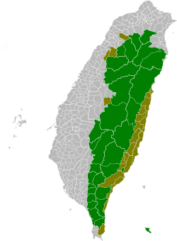 | ||||||||||||||||||||||||||||||||||||||||||||||
| Plains aboriginal Townships and County-Controlled Cities |
| |||||||||||||||||||||||||||||||||||||||||||||||
Note: On the map, "Highland aboriginal areas" are in green, and "Plains aboriginal areas" are in tan. | ||||||||||||||||||||||||||||||||||||||||||||||||
This article is issued from Wikipedia - version of the 8/29/2016. The text is available under the Creative Commons Attribution/Share Alike but additional terms may apply for the media files.