Greensburg, Louisiana
| Town of Greensburg | |
| Town | |
| Country | United States |
|---|---|
| State | Louisiana |
| Parish | St. Helena |
| Elevation | 220 ft (67.1 m) |
| Coordinates | 30°49′41″N 90°40′09″W / 30.82806°N 90.66917°WCoordinates: 30°49′41″N 90°40′09″W / 30.82806°N 90.66917°W |
| Area | 2.5 sq mi (6.5 km2) |
| - land | 2.5 sq mi (6 km2) |
| - water | 0.0 sq mi (0 km2), 0% |
| Population | 718 (2010) |
| Density | 287.3/sq mi (110.9/km2) |
| Mayor | (Interim)Amanda Ficklin-Mixon
Aldermen: |
| Timezone | CST (UTC-6) |
| - summer (DST) | CDT (UTC-5) |
| ZIP code | 70441 |
| Area code | 225 |
 Location of Greensburg in Louisiana | |
 Location of Louisiana in the United States | |
Greensburg is a town in and the parish seat of St. Helena Parish, Louisiana, United States.[1] The population was 718 at the 2010 census. It is part of the Baton Rouge Metropolitan Statistical Area.
Greensburg is one of the oldest towns in Louisiana.[2] It has two 19th-century properties listed on the National Register of Historic Places, the old land office and the old parish jail.
During the American Civil War, Union General Albert L. Lee left from Baton Rouge with a division of cavalry on October 5, 1864, and raided Greensburg, where his men destroyed a tannery containing two thousand sides of leather. He also seized a large supply of quinine.[3]
Geography
Greensburg is located at 30°49′41″N 90°40′9″W / 30.82806°N 90.66917°W (30.827953, -90.669302).[4]
According to the United States Census Bureau, the town has a total area of 2.5 square miles (6.5 km2), of which 2.5 square miles (6.5 km2) is land and 0.40% is water.
Demographics
| Historical population | |||
|---|---|---|---|
| Census | Pop. | %± | |
| 1870 | 160 | — | |
| 1880 | 297 | 85.6% | |
| 1890 | 280 | −5.7% | |
| 1900 | 315 | 12.5% | |
| 1910 | 268 | −14.9% | |
| 1920 | 286 | 6.7% | |
| 1930 | 262 | −8.4% | |
| 1940 | 389 | 48.5% | |
| 1950 | 423 | 8.7% | |
| 1960 | 512 | 21.0% | |
| 1970 | 652 | 27.3% | |
| 1980 | 662 | 1.5% | |
| 1990 | 583 | −11.9% | |
| 2000 | 631 | 8.2% | |
| 2010 | 718 | 13.8% | |
| Est. 2015 | 685 | [5] | −4.6% |
As of the census[7] of 2000, there were 631 people, 242 households, and 150 families residing in the town. The population density was 250.6 people per square mile (96.7/km²). There were 275 housing units at an average density of 109.2 per square mile (42.1/km²). The racial makeup of the town was 66.72% White, 32.96% African American, 0.16% Asian, and 0.16% from two or more races. Hispanic or Latino of any race were 0.79% of the population.
There were 242 households out of which 31.0% had children under the age of 18 living with them, 41.3% were married couples living together, 15.7% had a female householder with no husband present, and 38.0% were non-families. 35.1% of all households were made up of individuals and 16.5% had someone living alone who was 65 years of age or older. The average household size was 2.33 and the average family size was 3.06.
In the town the population was spread out with 22.3% under the age of 18, 8.1% from 18 to 24, 24.9% from 25 to 44, 22.2% from 45 to 64, and 22.5% who were 65 years of age or older. The median age was 40 years. For every 100 females there were 89.5 males. For every 100 females age 18 and over, there were 83.5 males.
The median income for a household in the town was $25,625, and the median income for a family was $35,000. Males had a median income of $30,625 versus $19,861 for females. The per capita income for the town was $15,083. About 26.0% of families and 27.1% of the population were below the poverty line, including 35.3% of those under age 18 and 16.7% of those age 65 or over.
Education
Greensburg and all of St. Helena Parish are served by the St. Helena Parish School System. Zoned campuses include St. Helena Central Elementary School (Grades PK-4), St. Helena Central Middle School (Grades 5-8), and St. Helena Central High School (Grades 9-12).
Notable people
- Robby Carter, Democratic member of the Louisiana House of Representatives, 1996-2008 and since 2016; Greensburg lawyer
- Stacy Aline Singleton Head, Democratic member of the New Orleans City Council, reared in Greensburg
- Doris Lindsey Holland Rhodes, first woman to serve in the Louisiana Legislature, born and lived in Greensburg
- Mabel Simmons, fictional character created and portrayed by Tyler Perry
Climate
The climate in this area is characterized by hot, humid summers and generally mild to cool winters. According to the Köppen Climate Classification system, Greensburg has a humid subtropical climate, abbreviated "Cfa" on climate maps.[8]
References
- ↑ "Find a County". National Association of Counties. Retrieved 2011-06-07.
- ↑ See LA 1077 <--Wrong highway, December 2015.
- ↑ John D. Winters, The Civil War in Louisiana, Baton Rouge: Louisiana State University Press, 1963, ISBN 0-8071-0834-0, p. 396
- ↑ "US Gazetteer files: 2010, 2000, and 1990". United States Census Bureau. 2011-02-12. Retrieved 2011-04-23.
- ↑ "Annual Estimates of the Resident Population for Incorporated Places: April 1, 2010 to July 1, 2015". Retrieved July 2, 2016.
- ↑ "Census of Population and Housing". Census.gov. Retrieved June 4, 2015.
- ↑ "American FactFinder". United States Census Bureau. Retrieved 2008-01-31.
- ↑ Climate Summary for Greensburg, Louisiana
Municipalities and communities of Saint Helena Parish, Louisiana, United States | ||
|---|---|---|
| Town | 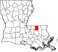 | |
| Village | ||
| Unincorporated community | ||