Convent, Louisiana
| Convent, Louisiana | |
| Census-designated place | |
| Country | United States |
|---|---|
| State | Louisiana |
| Parish | St. James |
| Elevation | 20 ft (6.1 m) |
| Coordinates | 30°01′15″N 90°49′47″W / 30.02083°N 90.82972°WCoordinates: 30°01′15″N 90°49′47″W / 30.02083°N 90.82972°W |
| Area | 5.331 sq mi (13.8 km2) |
| - land | 3.887 sq mi (10 km2) |
| - water | 1.444 sq mi (4 km2), 27.09% |
| Population | 711 (2010) |
| Density | 133.37/sq mi (51.49/km2) |
| Timezone | CST (UTC-6) |
| - summer (DST) | CDT (UTC-5) |
| Area code | 225 |
 Location of Convent in Louisiana
| |
 Location of Louisiana in the United States
| |
Convent (French: Couvent) is a census-designated place in and the parish seat of St. James Parish, Louisiana, United States.[1] As of the 2010 census, its population was 711.[2] It has been the parish seat since 1869.
History
_~_1937.jpg)
Community was originally named Baron when first settled 1722 to 1739. It was the location of the St. Michael's Convent (Order of the Sacred Heart) from 1825 to 1932 and the location of Jefferson College, 1831 to 1931.[3]
St. Michael's Church Historic District and Jefferson College (now a Jesuit retreat center called Manresa House of Retreats), along with several historic homes in Convent, are listed on the National Register of Historic Places.
The former Jefferson College operated in Convent. Among its alumni was Etienne J. Caire, who owned the E. J. Caire Store in Edgard and was the Republican gubernatorial nominee in 1928 against Huey Long.[4]Caire in 1922 had been the founded of the Manresa retreat center.[5]
The town sustained damage during Hurricane Katrina, disrupting parish government activities for several months.
On February 23, 2016, an extremely large wedge tornado hit the Sugar Hill RV park with two dead and several people injured. [6][7]
Geography
Located on the east bank of the Mississippi River, the town is only 16 feet (5 meters) above sea level. Convent has an area of 5.331 miles (8.579 km), of which 3.887 miles (6.256 km) is land and 1.444 miles (2.324 km) is water.[8]
Notable people
- Jarvis Landry is an American football wide receiver and return specialist for the Miami Dolphins of the National Football League. He also played college football at LSU.
References
- ↑ "Find a County". National Association of Counties. Archived from the original on 2011-05-31. Retrieved 2011-06-07.
- ↑ "American FactFinder". United States Census Bureau. Archived from the original on 2013-09-11. Retrieved 2011-05-14.
- ↑ Louisiana Department of Culture, Recreation and Tourism. "Convent Historical Marker".
- ↑ David Vitrano (July 31, 2010). "E. J. Caire's legacy lives on: Historic Edgard store turning 150". lobservateur.com. Retrieved January 7, 2015.
- ↑ "Caire, Etienne J.". A Dictionary of Louisiana Biography from Louisiana Historical Association. Retrieved January 28, 2015.
- ↑ (WWL TV)
- ↑ https://weather.com/storms/severe/news/tornado-severe-weather-outbreak-south-east-coast-news
- ↑ "US Gazetteer files: 2010, 2000, and 1990". United States Census Bureau. 2011-02-12. Retrieved 2011-04-23.
Municipalities and communities of St. James Parish, Louisiana, United States | ||
|---|---|---|
| Towns | 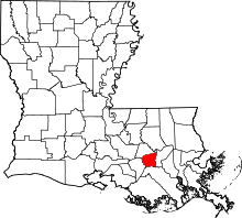 | |
| CDPs |
| |
| Unincorporated community | ||
| Footnotes | ‡This populated place also has portions in an adjacent parish or parishes | |