Grade I listed buildings in Cherwell (district)

There are over 9,000 Grade I listed buildings in England. This page is a list of these buildings in the district of Cherwell in Oxfordshire.

List of buildings

Name Location Type Completed [note 1]Date designated Grid ref.[note 2]
Geo-coordinates
Entry number [note 3]Image
Church of St Mary Adderbury East, Adderbury Church Early 13th century 8 December 1955 SP4708935378
52°00′53″N 1°18′55″W / 52.014838°N 1.315277°W / 52.014838; -1.315277 (Church of St Mary)
1200012
Church of St Mary Banbury Church c.1790 9 April 1952 SP4540840551
52°03′41″N 1°20′21″W / 52.061483°N 1.339084°W / 52.061483; -1.339084 (Church of St Mary)
1369519
Church of St Michael Barford St Michael Church c.1150 8 December 1955 SP4327032610
51°59′25″N 1°22′17″W / 51.990263°N 1.371269°W / 51.990263; -1.371269 (Church of St Michael)
1284140
Church of St Edburg Bicester Church 11th century 31 January 1952 SP5830222278
51°53′46″N 1°09′15″W / 51.896009°N 1.154128°W / 51.896009; -1.154128 (Church of St Edburg)
1199769
Church of St Mary Bloxham Church 12th century 8 December 1955 SP4301135679
52°01′04″N 1°22′29″W / 52.017874°N 1.374656°W / 52.017874; -1.374656 (Church of St Mary)
1284130
Broughton Castle and attached walls Broughton Manor house 14th century 8 December 1955 SP4180938173
52°02′25″N 1°23′31″W / 52.040387°N 1.391867°W / 52.040387; -1.391867 (Broughton Castle and attached walls)
1248742
Broughton Castle, gatehouse, bridge and curtain wall Broughton Gatehouse 14th century 8 December 1955 SP4180438242
52°02′28″N 1°23′31″W / 52.041008°N 1.391931°W / 52.041008; -1.391931 (Broughton Castle, gatehouse, bridge and curtain wall)
1248762
Broughton Castle, stable block Broughton Stable 15th century 8 December 1955 SP4184438246
52°02′28″N 1°23′29″W / 52.041041°N 1.391347°W / 52.041041; -1.391347 (Broughton Castle, stable block)
1277775
Church of St Mary the Virgin Broughton Church c.1300 8 December 1955 SP4186138321
52°02′30″N 1°23′28″W / 52.041714°N 1.39109°W / 52.041714; -1.39109 (Church of St Mary the Virgin)
1248778
Church of St Peter Bucknell Church 11th/12th century 7 December 1966 SP5608425599
51°55′34″N 1°11′09″W / 51.926092°N 1.185819°W / 51.926092; -1.185819 (Church of St Peter)
1200258
Church of St Mary the Virgin Charlton-on-Otmoor Church 13th and 14th century 7 December 1966 SP5619415815
51°50′17″N 1°11′09″W / 51.838123°N 1.185809°W / 51.838123; -1.185809 (Church of St Mary the Virgin)
1370086
Old Manor Farmhouse Cottisford Farmhouse 13th/14th century 26 November 1951 SP5892231082
51°58′30″N 1°08′37″W / 51.97509°N 1.143614°W / 51.97509; -1.143614 (Old Manor Farmhouse)
1046440
Church of St Mary the Virgin Cropredy Church 13th century 8 December 1955 SP4689946668
52°06′59″N 1°18′59″W / 52.116351°N 1.316498°W / 52.116351; -1.316498 (Church of St Mary the Virgin)
1216164
The Leadenporch House Deddington Farmhouse Early 14th century 8 December 1955 SP4668031405
51°58′45″N 1°19′18″W / 51.979155°N 1.321776°W / 51.979155; -1.321776 (The Leadenporch House)
1300760
Chapel at Water Eaton Manor House Water Eaton Domestic chapel c.1600 7 December 1966 SP5156712104
51°48′19″N 1°15′13″W / 51.805206°N 1.25351°W / 51.805206; -1.25351 (Chapel at Water Eaton Manor House)
1046563
Church of St Peter Hanwell Church 13th century 8 December 1955 SP4357243575
52°05′20″N 1°21′56″W / 52.088816°N 1.365477°W / 52.088816; -1.365477 (Church of St Peter)
1216364
Church of St Peter Hook Norton Church 12th century[1] 8 December 1955 SP3551233125
51°59′44″N 1°29′03″W / 51.995442°N 1.48419°W / 51.995442; -1.48419 (Church of St Peter)
1369840
Church of St Ethelreda Horley Church 12th century 8 December 1955 SP4168543965
52°05′33″N 1°23′35″W / 52.092467°N 1.392969°W / 52.092467; -1.392969 (Church of St Ethelreda)
1216504
Church of St John the Baptist Hornton Church 12th century 8 December 1955 SP3922245005
52°06′07″N 1°25′44″W / 52.101996°N 1.428798°W / 52.101996; -1.428798 (Church of St John the Baptist)
1227940
Church of St Nicholas Islip Church 11th century 7 December 1966 SP5265214095
51°49′23″N 1°14′15″W / 51.823005°N 1.237474°W / 51.823005; -1.237474 (Church of St Nicholas)
1046574
Church of St Mary Kidlington Church 12th century 7 December 1966 SP4972314809
51°49′47″N 1°16′48″W / 51.829691°N 1.279864°W / 51.829691; -1.279864 (Church of St Mary)
1291046
Kirtlington Park Kirtlington Country house 1742–46 26 November 1951 SP5082219833
51°52′29″N 1°15′47″W / 51.874759°N 1.263181°W / 51.874759; -1.263181 (Kirtlington Park)
1200202
Church of St Mary Launton Church Late 12th century 7 December 1966 SP6043822827
51°54′03″N 1°07′23″W / 51.900718°N 1.122995°W / 51.900718; -1.122995 (Church of St Mary)
1369735
Church of St Swithun Merton Church 13th century 7 December 1966 SP5773717816
51°51′21″N 1°09′47″W / 51.855955°N 1.163083°W / 51.855955; -1.163083 (Church of St Swithun)
1369750
Middleton Park Middleton Stoney Country house 1938 26 November 1951 SP5249223237
51°54′19″N 1°14′18″W / 51.905207°N 1.238409°W / 51.905207; -1.238409 (Middleton Park)
1232948
Church of St Michael Alkerton Church c.1200 8 December 1955 SP3772142924
52°05′00″N 1°27′03″W / 52.083392°N 1.45094°W / 52.083392; -1.45094 (Church of St Michael)
1300845
Church of St James Somerton Church 12th century 7 December 1966 SP4968828631
51°57′14″N 1°16′42″W / 51.953956°N 1.278385°W / 51.953956; -1.278385 (Church of St James)
1225707
Churchyard cross approximately 12 metres north of church of St James Somerton Cross Medieval 26 February 1988 SP4970428645
51°57′15″N 1°16′41″W / 51.954081°N 1.278151°W / 51.954081; -1.278151 (Churchyard cross approximately 12 metres north of church of St James)
1225734
Church of St Peter ad Vincula South Newington Church 12th century 8 December 1955 SP4074733338
51°59′49″N 1°24′29″W / 51.996999°N 1.407923°W / 51.996999; -1.407923 (Church of St Peter ad Vincula)
1277633
Church of St Mary and St Edburga Stratton Audley Church 14th and 15th century 7 December 1966 SP6085826036
51°55′46″N 1°06′59″W / 51.92952°N 1.116325°W / 51.92952; -1.116325 (Church of St Mary and St Edburga)
1046404
Church of St Peter and St Paul Swalcliffe Church Saxon 8 December 1955 SP3785737892
52°02′17″N 1°26′58″W / 52.038144°N 1.449512°W / 52.038144; -1.449512 (Church of St Peter and St Paul)
1199016
Manor House Swalcliffe Hall house 13th century 8 December 1955 SP3780537905
52°02′18″N 1°27′01″W / 52.038265°N 1.450268°W / 52.038265; -1.450268 (Manor House)
1046268
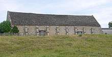
Tithe Barn Swalcliffe Tithe barn c.1400 8 December 1955 SP3774537919
52°02′18″N 1°27′04″W / 52.038395°N 1.451142°W / 52.038395; -1.451142 (Tithe Barn)
1046267
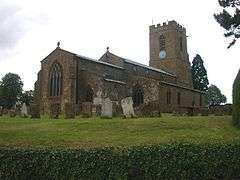
Church of St Nicholas Tadmarton Church 12th century 8 December 1955 SP3923837856
52°02′16″N 1°25′46″W / 52.037725°N 1.429384°W / 52.037725; -1.429384 (Church of St Nicholas)
1369852
Tithe Barn approximately 30 metres south of Manor Farmhouse Upper Heyford Tithe barn c.1400 26 November 1951 SP4944425812
51°55′43″N 1°16′56″W / 51.928635°N 1.28234°W / 51.928635; -1.28234 (Tithe Barn approximately 30 metres south of Manor Farmhouse)
1266058
Church of St Mary Magdalene Wardington Church 12th century 8 December 1955 SP4911246334
52°06′47″N 1°17′03″W / 52.113156°N 1.28423°W / 52.113156; -1.28423 (Church of St Mary Magdalene)
1228671
Church of Saint Giles Wigginton Church 13th century 8 December 1955 SP3907733282
51°59′48″N 1°25′56″W / 51.996615°N 1.432252°W / 51.996615; -1.432252 (Church of Saint Giles)
1052175
Wroxton College and attached walls and steps Wroxton Country house c.1618 8 December 1955 SP4166141622
52°04′17″N 1°23′37″W / 52.071405°N 1.393605°W / 52.071405; -1.393605 (Wroxton College and attached walls and steps)
1046769
Church of St Bartholomew Yarnton Church 12th century 7 December 1966 SP4776711676
51°48′06″N 1°18′31″W / 51.801695°N 1.308677°W / 51.801695; -1.308677 (Church of St Bartholomew)
1290230

See also

Notes

  1. The date given is the date used by Historic England as significant for the initial building or that of an important part in the structure's description.
  2. Sometimes known as OSGB36, the grid reference is based on the British national grid reference system used by the Ordnance Survey.
  3. The "List Entry Number" is a unique number assigned to each listed building and scheduled monument by Historic England.

References

  1. "History of St Peter's Church". St Peter's Church, Hook Norton. Retrieved 6 March 2014.

Media related to Grade I listed buildings in Oxfordshire at Wikimedia Commons

This article is issued from Wikipedia - version of the 4/12/2016. The text is available under the Creative Commons Attribution/Share Alike but additional terms may apply for the media files.