Grade II* listed buildings in Babergh

There are over 20,000 Grade II* listed buildings in England. This page is a list of these buildings in the district of Babergh in Suffolk.
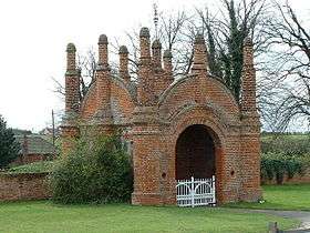
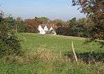
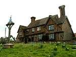
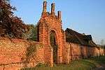
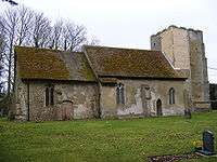
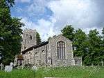
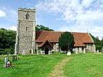
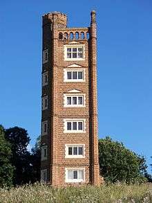
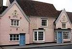
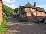
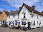
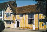
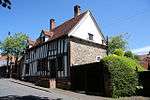
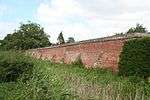
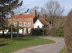
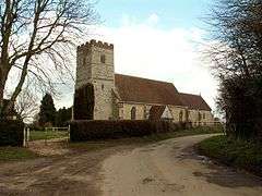
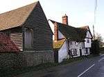
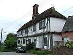
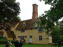
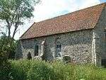
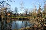
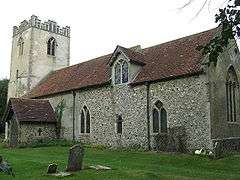
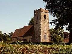
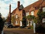
List of buildings

Name Location Type Completed [note 1]Date designated Grid ref.[note 2]
Geo-coordinates
Entry number [note 3]Image
Mill House Alpheton House 15th century 10 January 1953 TL8785349205
52°06′33″N 0°44′31″E / 52.10926°N 0.74181°E / 52.10926; 0.74181 (Mill House)
1285943
Erwarton Hall Arwarton House c.1575 23 February 1989 TM2229735122
51°58′12″N 1°14′05″E / 51.970089°N 1.234847°E / 51.970089; 1.234847 (Erwarton Hall)
1351638
Gatehouse at north approach drive to Erwarton Hall Arwarton Gatehouse c.1549 23 February 1989 TM2232535206
51°58′15″N 1°14′07″E / 51.970832°N 1.235309°E / 51.970832; 1.235309 (Gatehouse at north approach drive to Erwarton Hall)
1193599
Belstead Hall Belstead House 17th century 22 February 1955 TM1273041246
52°01′44″N 1°05′59″E / 52.028809°N 1.099592°E / 52.028809; 1.099592 (Belstead Hall)
1351648
Church of St Mary Belstead Church 14th century 22 February 1955 TM1265941098
52°01′39″N 1°05′54″E / 52.027507°N 1.098466°E / 52.027507; 1.098466 (Church of St Mary)
1194048
Bentley Hall Bentley House 18th century 22 February 1955 TM1187038395
52°00′13″N 1°05′07″E / 52.003542°N 1.085312°E / 52.003542; 1.085312 (Bentley Hall)
1351964
Meeting Hall/Stables, approximately 30 metres south of Bentley Hall Bentley Jettied house 15th/16th century 22 February 1955 TM1187738372
52°00′12″N 1°05′07″E / 52.003333°N 1.0854°E / 52.003333; 1.0854 (Meeting Hall/Stables, approximately 30 metres south of Bentley Hall)
1033423
Barn on opposite side of road and approximately 100 metres north east of Bentley Hall Bentley Barn Early 16th century 22 February 1955 TM1193738462
52°00′15″N 1°05′11″E / 52.004118°N 1.086328°E / 52.004118; 1.086328 (Barn on opposite side of road and approximately 100 metres north east of Bentley Hall)
1351965
Church of St Mary Bentley Church 12th century nave 22 February 1955 TM1186038142
52°00′05″N 1°05′06″E / 52.001275°N 1.08501°E / 52.001275; 1.08501 (Church of St Mary)
1193823
Bentley Old Hall Bentley House 13th/14th century 30 October 1990 TM1187139700
52°00′55″N 1°05′10″E / 52.015258°N 1.086133°E / 52.015258; 1.086133 (Bentley Old Hall)
1193864
Newbury Farmhouse Bildeston House 15th–16th century 23 January 1958 TL9939949075
52°06′15″N 0°54′36″E / 52.104054°N 0.910112°E / 52.104054; 0.910112 (Newbury Farmhouse)
1037409
Bec Cottage, 15 Chapel Street Bildeston House Medieval 23 January 1958 TL9921649421
52°06′26″N 0°54′28″E / 52.107227°N 0.907646°E / 52.107227; 0.907646 (Bec Cottage, 15 Chapel Street)
1351383
23–33 Chapel Street Bildeston House 15th–16th century 23 January 1958 TL9918149403
52°06′25″N 0°54′26″E / 52.107078°N 0.907125°E / 52.107078; 0.907125 (23–33 Chapel Street)
1193239
Spinners Cottage and Weavers Cottage, 35 and 37 Chapel Street Bildeston House 15th–16th century 23 January 1958 TL9917249398
52°06′25″N 0°54′25″E / 52.107036°N 0.906991°E / 52.107036; 0.906991 (Spinners Cottage and Weavers Cottage, 35 and 37 Chapel Street)
1037448
The Crown Inn Bildeston Jettied house 1495 23 January 1958 TL9931049430
52°06′26″N 0°54′32″E / 52.107274°N 0.909022°E / 52.107274; 0.909022 (The Crown Inn)
1286228
The Fleece Hotel Boxford House 18th century 23 January 1958 TL9629040564
52°01′43″N 0°51′36″E / 52.028742°N 0.859888°E / 52.028742; 0.859888 (The Fleece Hotel)
1037389
Boxted Hall Boxted House 16th century 10 January 1953 TL8276850570
52°07′24″N 0°40′06″E / 52.123221°N 0.668374°E / 52.123221; 0.668374 (Boxted Hall)
1351740
Fishers Boxted Hall house 15th century 10 January 1953 TL8076050394
52°07′20″N 0°38′20″E / 52.1223°N 0.638983°E / 52.1223; 0.638983 (Fishers)
1036708
Church of St Michael the Archangel Brantham Church 14th century 22 February 1955 TM1121634195
51°57′58″N 1°04′24″E / 51.966085°N 1.073215°E / 51.966085; 1.073215 (Church of St Michael the Archangel)
1033431
Corner Farmhouse Brent Eleigh Jettied house 16th century 23 January 1958 TL9424147879
52°05′43″N 0°50′03″E / 52.095148°N 0.834217°E / 52.095148; 0.834217 (Corner Farmhouse)
1285914
Wall and gateway southwest of Wells Hall Brent Eleigh Gate 16th century 23 January 1958 TL9457147304
52°05′24″N 0°50′19″E / 52.089869°N 0.8387°E / 52.089869; 0.8387 (Wall and gateway southwest of Wells Hall)
1037386
Old Buckenham Hall School Brettenham Park, Brettenham Country house 16th century 23 January 1958 TL9571652965
52°08′25″N 0°51′31″E / 52.140298°N 0.858643°E / 52.140298; 0.858643 (Old Buckenham Hall School)
1037349
Poplars Farmhouse Brettenham House 15th century and later 23 January 1958 TL9527052710
52°08′17″N 0°51′07″E / 52.138166°N 0.851988°E / 52.138166; 0.851988 (Poplars Farmhouse)
1351456
Great Bevills Bures St. Mary House c.1490 10 January 1953 TL9070934684
51°58′40″N 0°46′31″E / 51.977884°N 0.775369°E / 51.977884; 0.775369 (Great Bevills)
1036684
Malthouse and premises occupied by W A Church (Bures) Ltd Bures St. Mary House 16th–17th century 10 January 1953 TL9078534135
51°58′23″N 0°46′34″E / 51.972928°N 0.77617°E / 51.972928; 0.77617 (Malthouse and premises occupied by W A Church (Bures) Ltd)
1036677
Sawyer's Farmhouse Little Cornard, Bures St. Mary House 16th century 9 February 1978 TL9068737192
52°00′01″N 0°46′35″E / 52.000414°N 0.776443°E / 52.000414; 0.776443 (Sawyer's Farmhouse)
1036687
Smallbridge Hall Bures St. Mary Country house c.1550 10 January 1953 TL9293933065
51°57′45″N 0°48′25″E / 51.962576°N 0.806888°E / 51.962576; 0.806888 (Smallbridge Hall)
1194489
The Old Bakery Bures St. Mary Jettied house 16th century 10 January 1973 TL9075934171
51°58′24″N 0°46′33″E / 51.97326°N 0.775812°E / 51.97326; 0.775812 (The Old Bakery)
1351766
Boynton Hall Capel St. Mary House 16th century 16 March 1972 TM0917037231
51°59′39″N 1°02′43″E / 51.994115°N 1.045327°E / 51.994115; 1.045327 (Boynton Hall)
1033394
Church of St Mary Capel St. Mary Church 13th/14th century 22 February 1955 TM0858338242
52°00′12″N 1°02′15″E / 52.003412°N 1.037404°E / 52.003412; 1.037404 (Church of St Mary)
1285712
Church of All Saints Chattisham Church Early 14th century 22 February 1955 TM0922642150
52°02′18″N 1°02′57″E / 52.038256°N 1.049144°E / 52.038256; 1.049144 (Church of All Saints)
1351620
Princhetts Chelsworth House Probably 16th–17th century 23 January 1958 TL9827148058
52°05′43″N 0°53′35″E / 52.095328°N 0.893073°E / 52.095328; 0.893073 (Princhetts)
1037362
The Grange Chelsworth House 17th century 10 July 1980 TL9807247982
52°05′41″N 0°53′24″E / 52.094716°N 0.890128°E / 52.094716; 0.890128 (The Grange)
1037325
The Old Forge Chelsworth Jettied house 15th–16th century 23 January 1958 TL9832548085
52°05′44″N 0°53′38″E / 52.095551°N 0.893876°E / 52.095551; 0.893876 (The Old Forge)
1351422
Chilton Hall Chilton House Late 15th century 10 January 1953 TL8904342716
52°03′02″N 0°45′20″E / 52.050583°N 0.755573°E / 52.050583; 0.755573 (Chilton Hall)
1036689
Church House Cockfield Cruck house Medieval 23 January 1958 TL9037954944
52°09′36″N 0°46′55″E / 52.159933°N 0.781861°E / 52.159933; 0.781861 (Church House)
1194237
Church of St Mary Washbrook, Copdock and Washbrook Church 12th century 22 February 1955 TM1095342589
52°02′30″N 1°04′28″E / 52.041544°N 1.074556°E / 52.041544; 1.074556 (Church of St Mary)
1194408
Church of St Peter Copdock, Copdock and Washbrook Church 14th and 15th century 22 February 1955 49°46′01″N 7°33′26″W / 49.766806°N 7.55716°W / 49.766806; -7.55716 (Church of St Peter) 1194324
Bellcage to north side of churchyard East Bergholt Bell tower Late 16th century 22 February 1955 TM0704134484
51°58′13″N 1°00′46″E / 51.970249°N 1.012706°E / 51.970249; 1.012706 (Bellcage to north side of churchyard)
1033451
Bridge Cottage Flatford, East Bergholt House Late 16th century 22 February 1955 TM0758233336
51°57′35″N 1°01′12″E / 51.95974°N 1.019877°E / 51.95974; 1.019877 (Bridge Cottage)
1033472
Chaplins Gaston End, East Bergholt House Early 16th century 22 February 1955 TM0743635367
51°58′41″N 1°01′08″E / 51.978029°N 1.018981°E / 51.978029; 1.018981 (Chaplins)
1286166
Churchgate House Rectory Hill, East Bergholt House c.1500 22 February 1955 TM0708634463
51°58′12″N 1°00′48″E / 51.970044°N 1.013348°E / 51.970044; 1.013348 (Churchgate House)
1033454
Claycotts Flatford Road, East Bergholt House Early 16th century 22 February 1955 TM0776534226
51°58′04″N 1°01′23″E / 51.967663°N 1.023074°E / 51.967663; 1.023074 (Claycotts)
1351932
The Gables The Street, East Bergholt House Late 16th century 22 February 1955 TM0695834733
51°58′21″N 1°00′42″E / 51.972515°N 1.01165°E / 51.972515; 1.01165 (The Gables)
1285872
The Lodge Hadleigh Rd, East Bergholt House 18th century 22 February 1955 TM0648735428
51°58′44″N 1°00′19″E / 51.97893°N 1.005221°E / 51.97893; 1.005221 (The Lodge)
1286124
Church of St Peter Freston Church 13th–14th century 22 February 1955 TM1709639511
52°00′42″N 1°09′43″E / 52.011544°N 1.162032°E / 52.011544; 1.162032 (Church of St Peter)
1036973
Freston Tower Freston Park, Freston Watchtower c.1550 22 February 1955 TM1779239664
52°00′46″N 1°10′20″E / 52.012645°N 1.172255°E / 52.012645; 1.172255 (Freston Tower)
1203980
Angel House Glemsford Jettied house 16th century 23 March 1961 TL8287647515
52°05′45″N 0°40′06″E / 52.095749°N 0.668311°E / 52.095749; 0.668311 (Angel House)
1036656
Monks Hall Low St, Glemsford House 15th century 23 March 1961 TL8342048820
52°06′26″N 0°40′37″E / 52.107289°N 0.676945°E / 52.107289; 0.676945 (Monks Hall)
1285414
Peverells 21–25, Tye Green, Glemsford Hall house 15th–16th century 10 January 1953 TL8262348025
52°06′01″N 0°39′54″E / 52.100413°N 0.664895°E / 52.100413; 0.664895 (Peverells)
1036665
13–17, Chequers Lane Glemsford Jettied house 16th and 17th century 23 March 1961 TL8298448806
52°06′26″N 0°40′14″E / 52.107308°N 0.670578°E / 52.107308; 0.670578 (13–17, Chequers Lane)
1036649
Poplars Farmhouse Great Cornard House 15th century 10 January 1953 TL9030741094
52°02′08″N 0°46′23″E / 52.035585°N 0.773081°E / 52.035585; 0.773081 (Poplars Farmhouse)
1036630
Babergh Hall Great Waldingfield House Late 18th–early 19th century 10 January 1953 TL9031444498
52°03′58″N 0°46′30″E / 52.06615°N 0.775078°E / 52.06615; 0.775078 (Babergh Hall)
1036634
Groton Hall Groton House 18th century 23 January 1958 TL9597741658
52°02′19″N 0°51′21″E / 52.038676°N 0.855958°E / 52.038676; 0.855958 (Groton Hall)
1285612
Bank House and the White Lion Hotel 42 & 44, High St, Hadleigh House 18th century 26 April 1950 TM0271642428
52°02′35″N 0°57′16″E / 52.043169°N 0.954531°E / 52.043169; 0.954531 (Bank House and the White Lion Hotel)
1036802
Barclays Bank Hadleigh Loggia Early 19th century 26 April 1950 TM0272542421
52°02′35″N 0°57′17″E / 52.043103°N 0.954658°E / 52.043103; 0.954658 (Barclays Bank)
1351707
Benton End House Raydon Rd, Hadleigh House 18th century 26 April 1950 TM0334341357
52°02′00″N 0°57′47″E / 52.033323°N 0.963024°E / 52.033323; 0.963024 (Benton End House)
1194592
Deanery Church Walk, Hadleigh Deanery 1831 22 May 1972 TM0249442470
49°46′01″N 7°33′26″W / 49.766806°N 7.55716°W / 49.766806; -7.55716 (Deanery)
1194061
East House George St, Hadleigh House 18th century 26 April 1950 TM0287742615
52°02′41″N 0°57′25″E / 52.044789°N 0.956986°E / 52.044789; 0.956986 (East House)
1036786
Sun Court 12–16, Bridge St, Hadleigh Timber-framed house 16th century 26 April 1950 TM0233042967
52°02′53″N 0°56′57″E / 52.048149°N 0.949229°E / 52.048149; 0.949229 (Sun Court)
1193958
Sun Court 107, High St, Hadleigh House Early 16th century 26 April 1950 TM0252142695
52°02′44″N 0°57′07″E / 52.045637°N 0.951849°E / 52.045637; 0.951849 (Sun Court)
1036746
The Manse 90, Benson St, Hadleigh House 18th century 26 April 1950 TM0294541860
52°02′17″N 0°57′27″E / 52.037985°N 0.957528°E / 52.037985; 0.957528 (The Manse)
1351708
Toppesfield Bridge Hadleigh Bridge 14th century 26 April 1950 TM0257442147
52°02′27″N 0°57′08″E / 52.040698°N 0.952297°E / 52.040698; 0.952297 (Toppesfield Bridge)
1036780
White Hart Inn Hadleigh Inn 15th/16th century 26 April 1950 TM0222843055
52°02′56″N 0°56′52″E / 52.048977°N 0.947796°E / 52.048977; 0.947796 (White Hart Inn)
1193977
95, 97 and 99 Angel Street Hadleigh House 16th century 26 April 1950 TM0289242860
52°02′49″N 0°57′26″E / 52.046983°N 0.95735°E / 52.046983; 0.95735 (95, 97 and 99 Angel Street)
1193765
13 Bridge Street Hadleigh Timber-framed house 17th century 26 April 1950 TM0239642836
52°02′49″N 0°57′00″E / 52.046949°N 0.950113°E / 52.046949; 0.950113 (13 Bridge Street)
1036811
15 Bridge Street Hadleigh Timber-framed house 18th century 26 April 1950 TM0238842839
52°02′49″N 0°57′00″E / 52.046979°N 0.949998°E / 52.046979; 0.949998 (15 Bridge Street)
1036812
21 Bridge Street Hadleigh House 18th century 26 April 1950 TM0229442950
52°02′53″N 0°56′55″E / 52.04801°N 0.948695°E / 52.04801; 0.948695 (21 Bridge Street)
1193934
77–81 Benton Street Hadleigh House 18th century 26 April 1950 TM0293941936
52°02′19″N 0°57′27″E / 52.03867°N 0.957486°E / 52.03867; 0.957486 (77–81 Benton Street)
1193819
92 and 94 Benton Street Hadleigh Inn 16th century 26 April 1950 TM0299341820
52°02′15″N 0°57′30″E / 52.037609°N 0.958203°E / 52.037609; 0.958203 (92 and 94 Benton Street)
1036804
45 and 47 High Street Hadleigh Hall house Late 18th century 26 April 1950 TM0268442443
52°02′36″N 0°57′15″E / 52.043315°N 0.954074°E / 52.043315; 0.954074 (45 and 47 High Street)
1036779
46 and 48 High Street Hadleigh Shop 17th century 26 April 1950 TM0270542444
52°02′36″N 0°57′16″E / 52.043317°N 0.95438°E / 52.043317; 0.95438 (46 and 48 High Street)
1036757
49 High Street Hadleigh Timber-framed house 1774 26 April 1950 TM0267942450
52°02′36″N 0°57′14″E / 52.04338°N 0.954005°E / 52.04338; 0.954005 (49 High Street)
1036735
79–83 High Street Hadleigh Hall house 15th century 26 April 1950 TM0258442575
52°02′40″N 0°57′10″E / 52.044537°N 0.952696°E / 52.044537; 0.952696 (79–83 High Street)
1036740
91 and 93 High Street Hadleigh Timber-framed house 17th century 26 April 1950 TM0256342623
52°02′42″N 0°57′09″E / 52.044976°N 0.952418°E / 52.044976; 0.952418 (91 and 93 High Street)
1194454
97 and 99 High Street Hadleigh House 17th century 26 April 1950 TM0255042649
52°02′43″N 0°57′08″E / 52.045214°N 0.952244°E / 52.045214; 0.952244 (97 and 99 High Street)
1036744
124 and 126 High Street Hadleigh House 16th century 26 April 1950 TM0252342800
52°02′48″N 0°57′07″E / 52.046579°N 0.951941°E / 52.046579; 0.951941 (124 and 126 High Street)
1194322
108 and 110 High Street Hadleigh House 1649 26 April 1950 TM0255142732
52°02′45″N 0°57′08″E / 52.045959°N 0.952308°E / 52.045959; 0.952308 (108 and 110 High Street)
1194306
22–26 George Street Hadleigh Timber-framed house 15th–16th century 26 April 1950 TM0283242582
52°02′40″N 0°57′23″E / 52.044509°N 0.956311°E / 52.044509; 0.956311 (22–26 George Street)
1351701
28 George Street Hadleigh House 17th–18th century 26 April 1950 TM0284042579
52°02′40″N 0°57′23″E / 52.044479°N 0.956426°E / 52.044479; 0.956426 (28 George Street)
1036785
48 George Street Hadleigh Cross-wing house 15th century 26 April 1950 TM0303742686
52°02′43″N 0°57′34″E / 52.045368°N 0.959358°E / 52.045368; 0.959358 (48 George Street)
1036788
Church of St Mary Harkstead Church 12th century 22 February 1955 TM1940835280
51°58′22″N 1°11′35″E / 51.972655°N 1.192961°E / 51.972655; 1.192961 (Church of St Mary)
1286085
Church of St Mary Higham Church 13th century 22 February 1955 TM0356335232
51°58′42″N 0°57′45″E / 51.978249°N 0.96259°E / 51.978249; 0.96259 (Church of St Mary)
1351625
Service ranges, stables, former coachhouse and brewhouse attached to Hintlesham Hall Hintlesham Brewhouse 18th century 22 February 1955 TM0828243846
52°03′14″N 1°02′11″E / 52.053838°N 1.036434°E / 52.053838; 1.036434 (Service ranges, stables, former coachhouse and brewhouse attached to Hintlesham Hall)
1036918
Royal Hospital School, main range including assembly hall, dining room, gymnasium, administration and teaching accommodation Holbrook Hospital school c.1925–33 16 January 1981 TM1654335227
51°58′24″N 1°09′05″E / 51.973302°N 1.151284°E / 51.973302; 1.151284 (Royal Hospital School, main range including assembly hall, dining room, gymnasium, administration and teaching accommodation)
1036871
Chapel of the Royal Hospital School Holbrook Chapel c.1925–33 23 February 1989 TM1672635223
51°58′23″N 1°09′14″E / 51.973194°N 1.153942°E / 51.973194; 1.153942 (Chapel of the Royal Hospital School)
1036873
Church of All Saints Holbrook Church 14th century 22 February 1955 TM1704036128
51°58′52″N 1°09′33″E / 51.981196°N 1.159078°E / 51.981196; 1.159078 (Church of All Saints)
1193727
Church of St Mary Holton St. Mary Church 13th century 22 February 1955 TM0592736787
51°59′29″N 0°59′52″E / 51.99134°N 0.997894°E / 51.99134; 0.997894 (Church of St Mary)
1351596
Ailsa Cottage & Greenan Kersey Cross-wing house 15th–16th century 23 January 1958 TM0005144050
52°03′31″N 0°55′00″E / 52.0587°N 0.916674°E / 52.0587; 0.916674 (Ailsa Cottage & Greenan)
1037237
Corner House Kersey House 15th–16th century 23 January 1958 TM0000144277
52°03′39″N 0°54′58″E / 52.060756°N 0.916079°E / 52.060756; 0.916079 (Corner House)
1180414
Cressland & Kedges End Kersey House 17th century 23 January 1958 TM0002444133
52°03′34″N 0°54′59″E / 52.059455°N 0.916329°E / 52.059455; 0.916329 (Cressland & Kedges End)
1037247
Kersey Mill Kersey Mill 18th–19th century 23 January 1958 TM0117444417
52°03′42″N 0°56′00″E / 52.061589°N 0.933248°E / 52.061589; 0.933248 (Kersey Mill)
1180340
Mill House Kersey Mill house 17th century 23 January 1958 TM0003544208
52°03′36″N 0°55′00″E / 52.060124°N 0.916534°E / 52.060124; 0.916534 (Mill House)
1351458
River House Kersey House 16th century 23 January 1958 TM0007244114
52°03′33″N 0°55′01″E / 52.059267°N 0.917017°E / 52.059267; 0.917017 (River House)
1234780
The Little Manor Kersey Cross-wing house 14th–15th century 23 January 1958 TM0014143987
52°03′29″N 0°55′05″E / 52.058102°N 0.917948°E / 52.058102; 0.917948 (The Little Manor)
1351461
1 & 2 The Street Kersey Jettied house 16th–17th century 23 January 1958 TM0000444180
52°03′36″N 0°54′58″E / 52.059884°N 0.916066°E / 52.059884; 0.916066 (1 & 2 The Street)
1351485
3 & 4 The Street Kersey Jettied house 16th century 23 January 1958 TL9999944188
52°03′36″N 0°54′58″E / 52.059958°N 0.915997°E / 52.059958; 0.915997 (3 & 4 The Street)
1285468
5 & 6, The Street Kersey Jettied house 15th–16th century 23 January 1958 TL9999844202
52°03′36″N 0°54′58″E / 52.060084°N 0.915991°E / 52.060084; 0.915991 (5 & 6, The Street)
1037249
Angel Hotel Lavenham Hotel 18th century 23 January 1958 TL9161549357
52°06′34″N 0°47′48″E / 52.109335°N 0.796762°E / 52.109335; 0.796762 (Angel Hotel)
1037184
Little Hall Lavenham Cross-wing house 15th century 23 January 1958 TL9163749327
52°06′33″N 0°47′49″E / 52.109058°N 0.797066°E / 52.109058; 0.797066 (Little Hall)
1351533
Swan Hotel (that part formerly listed as No 102) Lavenham House/hotel 15th–16th century 23 January 1958 TL9153949186
52°06′28″N 0°47′44″E / 52.107826°N 0.795557°E / 52.107826; 0.795557 (Swan Hotel (that part formerly listed as No 102))
1037174
Swan Hotel (that part formerly listed as Swan Inn) Lavenham House 16th century 23 January 1958 TL9155449185
52°06′28″N 0°47′45″E / 52.107812°N 0.795775°E / 52.107812; 0.795775 (Swan Hotel (that part formerly listed as Swan Inn))
1037175
Swan Hotel (that part formerly listed as No 101) Lavenham House Probably 16th century 23 January 1958 TL9153649201
52°06′29″N 0°47′44″E / 52.107962°N 0.795522°E / 52.107962; 0.795522 (Swan Hotel (that part formerly listed as No 101))
1351529
The Barn Lavenham Barn 15th–16th century 23 January 1958 TL9169249244
52°06′30″N 0°47′52″E / 52.108294°N 0.797821°E / 52.108294; 0.797821 (The Barn)
1037216
The Great House Lavenham House 18th century 23 January 1958 TL9163049344
52°06′33″N 0°47′49″E / 52.109213°N 0.796973°E / 52.109213; 0.796973 (The Great House)
1181062
The Manor House Lavenham House 15th century 23 January 1958 TL9171849107
52°06′25″N 0°47′53″E / 52.107055°N 0.798123°E / 52.107055; 0.798123 (The Manor House)
1037129
Woolstaplers Lavenham House Early 15th (or possibly 14th) century 23 January 1958 TL9175649454
52°06′37″N 0°47′56″E / 52.110158°N 0.798873°E / 52.110158; 0.798873 (Woolstaplers)
1037190
58 Water Street Lavenham Jettied house 1425 23 January 1958 TL9169149113
52°06′26″N 0°47′52″E / 52.107118°N 0.797733°E / 52.107118; 0.797733 (58 Water Street)
1037130
No 9, Church St, including outbuilding adjoining on the north, and no 10 Lavenham House 15th century 23 January 1958 TL9153749076
52°06′25″N 0°47′44″E / 52.106839°N 0.795466°E / 52.106839; 0.795466 (No 9, Church St, including outbuilding adjoining on the north, and no 10)
1037228
Blaize House, 11 and 12 Church Street Lavenham Clothier's house 15th–16th century 23 January 1958 TL9152649062
52°06′24″N 0°47′43″E / 52.106717°N 0.795298°E / 52.106717; 0.795298 (Blaize House, 11 and 12 Church Street)
1180575
13–15 Church Street Lavenham Clothier's house 15th–16th century 23 January 1958 TL9152049054
52°06′24″N 0°47′43″E / 52.106647°N 0.795206°E / 52.106647; 0.795206 (13–15 Church Street)
1351478
81 Church Street Lavenham House c.1750 23 January 1958 TL9146849054
52°06′24″N 0°47′40″E / 52.106665°N 0.794448°E / 52.106665; 0.794448 (81 Church Street)
1351480
85 Church Street Lavenham Jettied house 16th century 23 January 1958 TL9150349073
52°06′25″N 0°47′42″E / 52.106824°N 0.794969°E / 52.106824; 0.794969 (85 Church Street)
1180676
86 Church Street Lavenham Jettied house 16th century 23 January 1958 TL9150649080
52°06′25″N 0°47′42″E / 52.106886°N 0.795016°E / 52.106886; 0.795016 (86 Church Street)
1037192
87 Church Street Lavenham Jettied house 15th–16th century 23 January 1958 TL9150849087
52°06′25″N 0°47′42″E / 52.106948°N 0.79505°E / 52.106948; 0.79505 (87 Church Street)
1351499
88 & 89 Church Street Lavenham Jettied house 15th–16th century 23 January 1958 TL9151049092
52°06′25″N 0°47′42″E / 52.106992°N 0.795082°E / 52.106992; 0.795082 (88 & 89 Church Street)
1037193
90 Church Street Lavenham Jettied house 15th–16th century 23 January 1958 TL9151449102
52°06′25″N 0°47′43″E / 52.107081°N 0.795146°E / 52.107081; 0.795146 (90 Church Street)
1037194
91 Church Street Lavenham House 16th century 23 January 1958 TL9151649119
52°06′26″N 0°47′43″E / 52.107232°N 0.795184°E / 52.107232; 0.795184 (91 Church Street)
1351500
The Willows [92 Church Street] Lavenham House c.1750 23 January 1958 TL9151449146
52°06′27″N 0°47′43″E / 52.107476°N 0.79517°E / 52.107476; 0.79517 (The Willows [92 Church Street)]
1037195
10–13 High Street Lavenham House 18th or early 19th century 23 January 1958 TL9150449271
52°06′31″N 0°47′42″E / 52.108602°N 0.795095°E / 52.108602; 0.795095 (10–13 High Street)
1285335
97 High Street Lavenham House 15th–16th century 23 January 1958 TL9153149228
52°06′30″N 0°47′44″E / 52.108206°N 0.795464°E / 52.108206; 0.795464 (97 High Street)
1351528
98–100 High Street Lavenham Cross-wing house Early 15th century 23 January 1958 TL9153449215
52°06′29″N 0°47′44″E / 52.108088°N 0.795501°E / 52.108088; 0.795501 (98–100 High Street)
1037173
Lawshall Hall Lawshall House Mid-16th century 10 January 1953 TL8633354290
52°09′20″N 0°43′21″E / 52.155439°N 0.722424°E / 52.155439; 0.722424 (Lawshall Hall)
1036593
Honey Hall Honey Tye, Leavenheath Hall house 15th century 10 January 1953 TL9559535644
51°59′05″N 0°50′49″E / 51.984808°N 0.846964°E / 51.984808; 0.846964 (Honey Hall)
1036600
Bourchier Galleries, House and Shop Long Melford House Late 17th century 23 March 1961 TL8624745487
52°04′35″N 0°42′59″E / 52.076413°N 0.716356°E / 52.076413; 0.716356 (Bourchier Galleries, House and Shop)
1033698
Bridge Street Farmhouse Bridge Street, Long Melford House Medieval 10 January 1953 TL8715348463
52°06′10″N 0°43′52″E / 52.102834°N 0.731193°E / 52.102834; 0.731193 (Bridge Street Farmhouse)
1036574
Brook House Long Melford House 16th and 17th century 10 January 1953 TL8642945909
52°04′49″N 0°43′09″E / 52.080142°N 0.719239°E / 52.080142; 0.719239 (Brook House)
1183049
Bull Hotel Long Melford Hotel 1580 or earlier 9 February 1978 TL8648745878
52°04′47″N 0°43′12″E / 52.079844°N 0.720068°E / 52.079844; 0.720068 (Bull Hotel)
1182781
Chapel at Melford Place Long Melford House 14th century 10 January 1953 TL8619644966
52°04′18″N 0°42′55″E / 52.071752°N 0.715329°E / 52.071752; 0.715329 (Chapel at Melford Place)
1183356
Dovecote to the southwest of Kentwell Hall Kentwell, Long Melford Dovecote 18th century 9 February 1978 TL8630447882
52°05′52″N 0°43′07″E / 52.097902°N 0.718494°E / 52.097902; 0.718494 (Dovecote to the southwest of Kentwell Hall)
1351844
Garden walls to Melford Hall Long Melford Garden wall c.1559 9 February 1978 TL8657646198
52°04′58″N 0°43′18″E / 52.082688°N 0.72154°E / 52.082688; 0.72154 (Garden walls to Melford Hall)
1351818
Gateway and lodges to Melford Hall Long Melford Gate lodge c.1559 16 April 1971 TL8658646294
52°05′01″N 0°43′18″E / 52.083547°N 0.721738°E / 52.083547; 0.721738 (Gateway and lodges to Melford Hall)
1033703
Summerhouse at Melford Hall Long Melford Summerhouse 16th century 10 January 1953 TL8659046257
52°05′00″N 0°43′18″E / 52.083213°N 0.721776°E / 52.083213; 0.721776 (Summerhouse at Melford Hall)
1351819
Premises occupied by Cadge and Son, Builders Long Melford Hall house Medieval 10 January 1953 TL8627245180
52°04′25″N 0°43′00″E / 52.073648°N 0.716553°E / 52.073648; 0.716553 (Premises occupied by Cadge and Son, Builders)
1351864
The Elms Long Melford House 18th century 10 January 1953 TL8627545305
52°04′29″N 0°43′00″E / 52.07477°N 0.716665°E / 52.07477; 0.716665 (The Elms)
1033641
Water conduit Long Melford Conduit 16th century 10 January 1953 TL8659746427
52°05′05″N 0°43′19″E / 52.084737°N 0.721971°E / 52.084737; 0.721971 (Water conduit)
1033704
Milden Hall Milden Timber-framed house 18th century 23 January 1958 TL9443046274
52°04′50″N 0°50′10″E / 52.08067°N 0.836058°E / 52.08067; 0.836058 (Milden Hall)
1181918
The Fenn Swingleton Green, Monks Eleigh House 16th century 23 January 1958 TL9619247312
52°05′22″N 0°51′44″E / 52.089369°N 0.862335°E / 52.089369; 0.862335 (The Fenn)
1182166
Dresden Cottage Nayland-with-Wissington House 15th century 9 February 1978 TL9748534427
51°58′24″N 0°52′26″E / 51.973212°N 0.87375°E / 51.973212; 0.87375 (Dresden Cottage)
1351862
Odd Corners Nayland-with-Wissington Jettied house 16th century 10 January 1953 TL9748934404
51°58′23″N 0°52′26″E / 51.973004°N 0.873795°E / 51.973004; 0.873795 (Odd Corners)
1033592
Wiston Mill Wiston, Nayland-with-Wissington House 18th–19th century 9 February 1978 TL9623333282
51°57′48″N 0°51′18″E / 51.963373°N 0.854893°E / 51.963373; 0.854893 (Wiston Mill)
1033616
1 Birch Street Nayland, Nayland-with-Wissington House 16th century 10 January 1953 TL9748634392
51°58′22″N 0°52′25″E / 51.972897°N 0.873745°E / 51.972897; 0.873745 (1 Birch Street)
1033591
6 and 8 Birch Street Nayland, Nayland-with-Wissington House 15th century 9 February 1978 TL9748034421
51°58′23″N 0°52′25″E / 51.97316°N 0.873674°E / 51.97316; 0.873674 (6 and 8 Birch Street)
1033633
17 and 19 Court Street Nayland, Nayland-with-Wissington Timber-framed building 14th century 9 February 1978 TL9745434152
51°58′15″N 0°52′23″E / 51.970753°N 0.873142°E / 51.970753; 0.873142 (17 and 19 Court Street)
1351850
1 and 3 High Street Nayland, Nayland-with-Wissington House 15th century 10 January 1953 TL9748434310
51°58′20″N 0°52′25″E / 51.972161°N 0.873668°E / 51.972161; 0.873668 (1 and 3 High Street)
1033572
Brickhouse Farmhouse Naughton, Nedging-with-Naughton Farmhouse 15th–16th century 10 July 1980 TM0289248998
52°06′08″N 0°57′40″E / 52.102094°N 0.960996°E / 52.102094; 0.960996 (Brickhouse Farmhouse)
1037104
Church of All Saints Newton Church Mainly 14th century 23 March 1961 TL9197141267
52°02′12″N 0°47′51″E / 52.036565°N 0.797407°E / 52.036565; 0.797407 (Church of All Saints)
1283418
Rogers Farmhouse Newton Jettied house c.1600 9 February 1978 TL9314241404
52°02′15″N 0°48′52″E / 52.037389°N 0.814534°E / 52.037389; 0.814534 (Rogers Farmhouse)
1033552
Polstead Hall Polstead Park, Polstead, Babergh House 16th century 23 January 1958 TL9881638157
52°00′22″N 0°53′43″E / 52.00623°N 0.895262°E / 52.00623; 0.895262 (Polstead Hall)
1037049
Preston Hall Preston St. Mary House 16th–17th century 23 January 1958 TL9465150231
52°06′58″N 0°50′30″E / 52.116124°N 0.841538°E / 52.116124; 0.841538 (Preston Hall)
1182472
Church of St Mary Raydon Church Late 13th–early 14th century 22 February 1955 TM0493138620
52°00′29″N 0°59′04″E / 52.008165°N 0.984504°E / 52.008165; 0.984504 (Church of St Mary)
1286247
Church of All Saints Shelley Church Early 14th century 22 February 1955 TM0308238457
52°00′27″N 0°57′27″E / 52.007381°N 0.957505°E / 52.007381; 0.957505 (Church of All Saints)
1351959
Church of St Mary Shotley Church 13th/14th century 22 February 1955 TM2370136021
51°58′39″N 1°15′21″E / 51.977596°N 1.255837°E / 51.977596; 1.255837 (Church of St Mary)
1194504
Church of All Saints Sproughton Church Early 14th century 22 February 1955 TM1251545029
52°03′46″N 1°05′56″E / 52.062853°N 1.098813°E / 52.062853; 1.098813 (Church of All Saints)
1285956
Church of St James Stanstead Church 14th century 23 March 1961 TL8433949342
52°06′42″N 0°41′26″E / 52.111672°N 0.690631°E / 52.111672; 0.690631 (Church of St James)
1033528
The Oaklands Stanstead House 16th–17th century 10 January 1953 TL8435148590
52°06′18″N 0°41′25″E / 52.104914°N 0.690399°E / 52.104914; 0.690399 (The Oaklands)
1033523
Street House Stoke-by-Nayland Jettied house 15th–16th century 10 January 1953 TL9879636286
51°59′22″N 0°53′38″E / 51.989437°N 0.893887°E / 51.989437; 0.893887 (Street House)
1033538
The Downs Farmhouse Stoke-by-Nayland Farmhouse Early 16th century 9 February 1978 TL9863436054
51°59′15″N 0°53′29″E / 51.987412°N 0.891397°E / 51.987412; 0.891397 (The Downs Farmhouse)
1200113
The Maltings Stoke-by-Nayland House 16th century and later 23 March 1961 TL9856836306
51°59′23″N 0°53′26″E / 51.989698°N 0.890583°E / 51.989698; 0.890583 (The Maltings)
1033513
The Old Guildhall (Tudor Cottages) Stoke-by-Nayland House 16th and 17th century 10 January 1953 TL9856536258
51°59′21″N 0°53′26″E / 51.989268°N 0.890511°E / 51.989268; 0.890511 (The Old Guildhall (Tudor Cottages))
1200348
Thorington Hall Stoke-by-Nayland Jettied house 17th century 10 January 1953 TM0131235465
51°58′52″N 0°55′48″E / 51.98116°N 0.929998°E / 51.98116; 0.929998 (Thorington Hall)
1200597
Lowe Hill House Stratford St. Mary House Early 16th century 22 February 1955 TM0425135021
51°58′34″N 0°58′21″E / 51.976102°N 0.972468°E / 51.976102; 0.972468 (Lowe Hill House)
1036991
Weavers House Stratford St. Mary House Early–mid-16th century 22 February 1955 TM0426033820
51°57′55″N 0°58′19″E / 51.965315°N 0.971885°E / 51.965315; 0.971885 (Weavers House)
1351601
Church of St Peter Stutton Church 15th century 22 February 1955 TM1615434462
51°58′00″N 1°08′43″E / 51.966585°N 1.145149°E / 51.966585; 1.145149 (Church of St Peter)
1285520
Crowe Hall Stutton House c.1605 22 February 1956 TM1528034214
51°57′53″N 1°07′56″E / 51.964698°N 1.132291°E / 51.964698; 1.132291 (Crowe Hall)
1036862
Garden wall and gateway attached to and enclosing a garden to north of Stutton Hall Stutton Park, Stutton Gate 16th century 23 February 1989 TM1403433746
51°57′40″N 1°06′50″E / 51.960977°N 1.113891°E / 51.960977; 1.113891 (Garden wall and gateway attached to and enclosing a garden to north of Stutton Hall)
1180369
Stutton Hall Stutton Park, Stutton House c.1553 22 February 1955 TM1403233702
51°57′38″N 1°06′50″E / 51.960583°N 1.113835°E / 51.960583; 1.113835 (Stutton Hall)
1036866
Ballingdon Hall Sudbury Timber-framed house c.1593 3 March 1952 TL8626740189
52°01′44″N 0°42′50″E / 52.028828°N 0.713762°E / 52.028828; 0.713762 (Ballingdon Hall)
1037550
Barn at St Bartholomew's Priory Farm Sudbury Grange 17th century 26 October 1971 TL8715942790
52°03′07″N 0°43′41″E / 52.051886°N 0.728171°E / 52.051886; 0.728171 (Barn at St Bartholomew's Priory Farm)
1037547
Brundon Hall Brundon, Sudbury House 18th century 3 March 1952 TL8657242180
52°02′48″N 0°43′09″E / 52.046606°N 0.719288°E / 52.046606; 0.719288 (Brundon Hall)
1037518
Chapel at St Bartholomew's Priory Farm Sudbury Chapel Early 15th century 3 March 1952 TL8709942803
52°03′07″N 0°43′38″E / 52.052023°N 0.727304°E / 52.052023; 0.727304 (Chapel at St Bartholomew's Priory Farm)
1037546
Corn Exchange & Public Library Sudbury Corn exchange 1841 26 October 1971 TL8735241252
52°02′17″N 0°43′49″E / 52.038009°N 0.73014°E / 52.038009; 0.73014 (Corn Exchange & Public Library)
1037457
Priory Gate Sudbury House c.1500 3 March 1952 TL8706241036
52°02′10″N 0°43′33″E / 52.036167°N 0.725799°E / 52.036167; 0.725799 (Priory Gate)
1285460
Stour Hall Sudbury House 17th century 3 March 1952 TL8697841250
52°02′17″N 0°43′29″E / 52.038117°N 0.724693°E / 52.038117; 0.724693 (Stour Hall)
1037437
The Red House Bullocks Lane, Sudbury House 17th/18th century 3 March 1952 TL8781841412
52°02′21″N 0°44′13″E / 52.039288°N 0.737014°E / 52.039288; 0.737014 (The Red House)
1351342
Ye Old Moot Hall Sudbury House 15th century 3 March 1952 TL8682641046
52°02′11″N 0°43′21″E / 52.036336°N 0.722368°E / 52.036336; 0.722368 (Ye Old Moot Hall)
1180344
Church of St Mary Tattingstone Church 14th century 22 May 1955 TM1360437143
51°59′30″N 1°06′35″E / 51.991639°N 1.109755°E / 51.991639; 1.109755 (Church of St Mary)
1351983
The Tattingstone Wonder Tattingstone House c.1790 22 February 1955 TM1391436285
51°59′02″N 1°06′49″E / 51.983817°N 1.113728°E / 51.983817; 1.113728 (The Tattingstone Wonder)
1033392
Thorpe Hall Thorpe Morieux House 16th century 23 January 1958 TL9432053235
52°08′36″N 0°50′18″E / 52.143215°N 0.838424°E / 52.143215; 0.838424 (Thorpe Hall)
1284474
Church of St Nicholas Wattisham Church 14th century 23 January 1958 TM0098251376
52°07′27″N 0°56′04″E / 52.124142°N 0.934551°E / 52.124142; 0.934551 (Church of St Nicholas)
1037033
Church of St John Wenham Magna Church 14th century 22 February 1955 TM0709838128
52°00′11″N 1°00′57″E / 52.002944°N 1.015733°E / 52.002944; 1.015733 (Church of St John)
1033403
Priory Farmhouse Wenham Magna House 15th century or earlier 22 February 1955 TM0726038174
52°00′12″N 1°01′05″E / 52.003297°N 1.018118°E / 52.003297; 1.018118 (Priory Farmhouse)
1351956
Wenham Place Wenham Magna House 16th century 22 February 1955 TM0719537760
51°59′59″N 1°01′01″E / 51.999604°N 1.016922°E / 51.999604; 1.016922 (Wenham Place)
1351955
Barn approximately 150 metres north of Little Wenham Castle and west of Church of St Lawrence Wenham Parva Timber-framed barn 16th century 30 October 1990 TM0803539212
52°00′44″N 1°01′48″E / 52.012327°N 1.030021°E / 52.012327; 1.030021 (Barn approximately 150 metres north of Little Wenham Castle and west of Church of St Lawrence)
1194552
Church of St Mary Wherstead Park, Wherstead Church 12th century 22 February 1955 TM1614140699
52°01′21″N 1°08′56″E / 52.022581°N 1.148889°E / 52.022581; 1.148889 (Church of St Mary)
1204027
Church of St Michael Woolverstone Park, Woolverstone Church 14th century 22 February 1955 TM1902138583
52°00′09″N 1°11′22″E / 52.002457°N 1.189443°E / 52.002457; 1.189443 (Church of St Michael)
1204060
Woolverstone House including walls attached to each side Woolverstone Jettied house 1901 16 March 1972 TM1828838758
52°00′16″N 1°10′44″E / 52.004317°N 1.178893°E / 52.004317; 1.178893 (Woolverstone House including walls attached to each side)
1204044

See also

Notes

  1. The date given is the date used by Historic England as significant for the initial building or that of an important part in the structure's description.
  2. Sometimes known as OSGB36, the grid reference is based on the British national grid reference system used by the Ordnance Survey.
  3. The "List Entry Number" is a unique number assigned to each listed building and scheduled monument by Historic England.

Media related to Grade II* listed buildings in Suffolk at Wikimedia Commons

This article is issued from Wikipedia - version of the 8/13/2016. The text is available under the Creative Commons Attribution/Share Alike but additional terms may apply for the media files.