Grade II* listed buildings in Cheshire East
There are over 20,000 Grade II* listed buildings in England. This page is a list of these buildings in the unitary authority of Cheshire East.
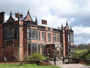
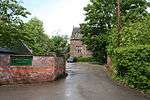
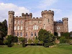
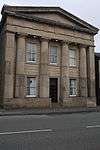
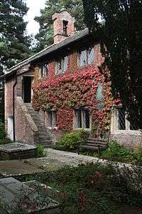
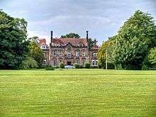
Listed buildings


_-_geograph.org.uk_-_81768.jpg)


.jpg)


.jpg)


.jpg)


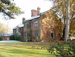
_p1.034_-_Somerford_Booths_Hall%2C_Cheshire.jpg)


Notes
- ↑ The date given is the date used by Historic England as significant for the initial building or that of an important part in the structure's description.
- ↑ Sometimes known as OSGB36, the grid reference is based on the British national grid reference system used by the Ordnance Survey.
- ↑ The "List Entry Number" is a unique number assigned to each listed building and scheduled monument by Historic England.
See also
- Grade I listed buildings in Cheshire East
- Grade II* listed buildings in Cheshire
- Grade II* listed buildings in Cheshire West and Chester
- Grade II* listed buildings in Cheshire East
- Grade II* listed buildings in Warrington
- Grade II* listed buildings in Halton (borough)
References
- ↑ Historic England, "Butterley Heyes (1136928)", National Heritage List for England, retrieved 25 March 2015
- ↑ de Figueiredo & Treuherz, pp. 60–65
- ↑ Hartwell et al., pp. 293–95
- ↑ Historic England, "Game larder to centre of service court at Combermere Abbey (1138528)", National Heritage List for England, retrieved 25 March 2015
- ↑ Hartwell et al. 2011, p. 428.
- ↑ Historic England. "Bexton Croft, Knutsford (1378495)". National Heritage List for England. Retrieved 24 April 2012.
- ↑ Hartwell et al. 2011, p. 421.
- ↑ Historic England. "Church of St Cross, Knutsford (1388414)". National Heritage List for England. Retrieved 5 May 2012.
- ↑ Hartwell et al. 2011, pp. 420–421.
- ↑ Historic England. "Church of St John the Baptist, Knutsford (1388324)". National Heritage List for England. Retrieved 1 May 2012.
- ↑ Hartwell et al. 2011, pp. 423–424.
- ↑ Historic England. "Former Kings Coffee House and Gaskell Memorial Tower, 60 King Street, Knutsford (1388360)". National Heritage List for England. Retrieved 3 May 2012.
- ↑ Hartwell et al. 2011, p. 425.
- ↑ Historic England. "Knutsford Lodge Gateway and gates to Tatton Park (1388387)". National Heritage List for England. Retrieved 3 May 2012.
- ↑ Hartwell et al. 2011, p. 422.
- ↑ Historic England. "Sessions House, Knutsford (1378501)". National Heritage List for England. Retrieved 26 April 2012.
- ↑ Historic England. "125 King Street, Knutsford (3)". National Heritage List for England. Retrieved 3 May 2012.
- 1 2 3 4 5 6 Pevsner & Hubbard, 1971, pp. 287–89
- 1 2 3 Stevenson, 1994, pp. 29–30
- ↑ Historic England, "Dysart Buildings (1249422)", National Heritage List for England, retrieved 25 March 2015
- ↑ Historic England, "Peppers, 9 Mill Street (1263769)", National Heritage List for England, retrieved 25 March 2015
- ↑ Historic England, "Townwell House, 52 Welsh Row (1263708)", National Heritage List for England, retrieved 25 March 2015
- ↑ Historic England, "Wright's Almshouses, Beam Street (1039555)", National Heritage List for England, retrieved 25 March 2015
- 1 2 Blacklay, pp. 14–23, 25–32
- ↑ Historic England, "Forecourt wall and gateway of Wright's Almshouses, London Road (1320247)", National Heritage List for England, retrieved 25 March 2015
- ↑ Historic England, "46 High Street, Nantwich (1206205)", National Heritage List for England, retrieved 25 March 2015
- ↑ Lake, 1983, p. 130
- ↑ Historic England, "83 Welsh Row, Nantwich (1249536)", National Heritage List for England, retrieved 25 March 2015
- ↑ Historic England, "Church of St Margaret, Wrenbury (1357455)", National Heritage List for England, retrieved 25 March 2015
- ↑ Salter, Mark (1995), The Old Parish Churches of Cheshire, Malvern: Folly Publications, p. 82, ISBN 1-871731-23-2
- ↑ Historic England, "Wrenbury Church Bridge (1357482)", National Heritage List for England, retrieved 25 March 2015
- ↑ Access to Archives: Shropshire Archives 1873–1986, The National Archives, retrieved 5 December 2012
- ↑ Historic England, "Wrenbury Frith Bridge (1357424)", National Heritage List for England, retrieved 25 March 2015
Notes
External links
![]() Media related to Grade II* listed buildings in Cheshire at Wikimedia Commons
Media related to Grade II* listed buildings in Cheshire at Wikimedia Commons
This article is issued from Wikipedia - version of the 9/27/2016. The text is available under the Creative Commons Attribution/Share Alike but additional terms may apply for the media files.