Babergh
Coordinates: 52°02′53″N 0°56′53″E / 52.048°N 0.948°E
| Babergh District | |
|---|---|
| Non-metropolitan district | |
 Babergh shown within Suffolk | |
| Sovereign state | United Kingdom |
| Constituent country | England |
| Region | East of England |
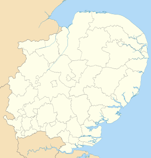
| Non-metropolitan county | Suffolk |
| Status | Non-metropolitan district |
| Admin HQ | Hadleigh |
| Incorporated | 1 April 1974 |
| Government | |
| • Type | Non-metropolitan district council |
| • Body | Babergh District Council |
| • Leadership | Alternative - Sec.31 (Conservative / Liberal Democrat / Independent) |
| • MPs | James Cartlidge |
| Area | |
| • Total | 229.8 sq mi (595.2 km2) |
| Area rank | 72nd (of 326) |
| Population (mid-2014 est.) | |
| • Total | 88,845 |
| • Rank | 268th (of 326) |
| • Density | 390/sq mi (150/km2) |
| • Ethnicity | 98.7% White |
| Time zone | GMT (UTC0) |
| • Summer (DST) | BST (UTC+1) |
| ONS code |
42UB (ONS) E07000200 (GSS) |
| OS grid reference | TM021429 |
| Website |
www |
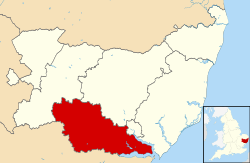
Babergh (pronounced /ˈbeɪbər/, BAY-bər[1]) is a local government district in Suffolk, England. Its council headquarters is based in Hadleigh, whilst its largest town is Sudbury.[2]
The district was formed on 1 April 1974 by the merger of the Borough of Sudbury, Hadleigh urban district, Cosford Rural District, Melford Rural District and Samford Rural District. The district did not have one party of councillors (nor a formal coalition of parties) exercising overall control until 2015.
Babergh had a population of 87,740 at the 2011 Census, and covers an area of approximately 230 square miles (600 km2).[3]
It is named after the old Babergh hundred, referred to in the Domesday Book. The southern boundary of the district is marked almost exclusively by the River Stour, which also forms the border with Essex, and it is separated from Suffolk Coastal by the River Orwell. Primarily a rural area, Babergh contains two towns of notable size: Sudbury and the administrative centre, Hadleigh.
'Constable Country' is cognate with a large tract of Babergh: drawing visitors to the conservation area Dedham Vale and the well-preserved villages of Long Melford, Lavenham and Kersey for painting, agricultural and architectural history, produce such as fruit, vegetables, cider, cheese and meat, shops, accommodation, restaurants and tea rooms.
Politics
Elections to the district are held every four years, with currently 43 councillors being elected from 26 wards. From the first election in 1973 to 2015 no party had won an overall majority on the council, but after the 2015 election, the Conservative party gained a large majority. After this election the council is composed of the following councillors:-
| year | Conservative | Independent | Liberal Democrat | Labour | Greens | UKIP |
|---|---|---|---|---|---|---|
| 2015 | 31 | 8 | 3 | 1 | 1 | 0 |
List of towns and civil parishes
- Acton
- Aldham
- Alpheton
- Arwarton
- Assington
- Belstead
- Bentley
- Bildeston
- Boxford
- Boxted
- Brantham
- Brent Eleigh
- Brettenham
- Bures St. Mary
- Burstall
- Capel St. Mary
- Chattisham
- Chelmondiston
- Chelsworth
- Chilton
- Cockfield
- Copdock and Washbrook
- East Bergholt
- Edwardstone
- Elmsett
- Freston
- Glemsford
- Great Cornard
- Great Waldingfield
- Groton
- Hadleigh
- Harkstead
- Hartest
- Higham
- Hintlesham
- Hitcham
- Holbrook
- Holton St. Mary
- Kersey
- Kettlebaston
- Lavenham
- Lawshall
- Layham
- Leavenheath
- Lindsey
- Little Cornard
- Little Waldingfield
- Long Melford
- Milden
- Monks Eleigh
- Nayland
- Nedging-with-Naughton
- Newton
- Pinewood
- Polstead
- Preston St. Mary
- Raydon
- Semer
- Shelley
- Shimpling
- Shotley
- Somerton
- Sproughton
- Stanstead
- Stoke-by-Nayland
- Stratford St. Mary
- Stutton
- Sudbury
- Tattingstone
- Thorpe Morieux
- Wattisham
- Wenham Magna
- Wenham Parva
- Whatfield
- Wherstead
- Woolverstone
See also
References
- ↑ "Babergh District Council - Summary". Archived from the original on 26 January 2010.
- ↑ Estimates of Total Populations of Areas of Suffolk Suffolk County Council
- ↑ "District population 2011". Neighbourhood Statistics. Office for National Statistics. Retrieved 15 August 2016.
External links
| Wikimedia Commons has media related to District of Babergh. |
| Boroughs or districts | |
|---|---|
| Major settlements | |
| Topics | |