Ghent (CDP), New York
| Ghent, New York | |
|---|---|
| Census-designated place | |
 Ghent Location within the state of New York | |
| Coordinates: 42°19′45″N 73°37′0″W / 42.32917°N 73.61667°WCoordinates: 42°19′45″N 73°37′0″W / 42.32917°N 73.61667°W | |
| Country | United States |
| State | New York |
| County | Columbia |
| Town | Ghent |
| Area | |
| • Total | 1.55 sq mi (4.01 km2) |
| • Land | 1.54 sq mi (3.98 km2) |
| • Water | 0.01 sq mi (0.03 km2) |
| Elevation | 407 ft (124 m) |
| Population (2010) | |
| • Total | 564 |
| • Density | 367/sq mi (141.6/km2) |
| Time zone | Eastern (EST) (UTC-5) |
| • Summer (DST) | EDT (UTC-4) |
| ZIP code | 12075 |
| Area code(s) | 518 |
| FIPS code | 36-28860 |
| GNIS feature ID | 0951055 |
Ghent is a census-designated place (CDP) in the town of Ghent in Columbia County, New York, United States. The population of the CDP was 564 at the 2010 census,[1] out of a total town population of 5,402.
The community is located northeast of the city of Hudson.
Ghent was originally the site of a Mahican Native American village known as Squampamock, Scom-pa-muck or Squampanoc.[2]
Geography
Ghent is located in the northeast part of the town of Ghent at 42°19′45″N 73°36′59″W / 42.32917°N 73.61639°W (42.329228, -73.616596),[3] bordered on the north by Kline Kill, a stream which flows north to Kinderhook Creek, a tributary of the Hudson River.
New York State Route 66 passes through Ghent, leading southwest 11 miles (18 km) to Hudson, the Columbia County seat, and northeast 2.5 miles (4.0 km) to Chatham.
According to the United States Census Bureau, the CDP has a total area of 1.5 square miles (4.0 km2), of which 0.01 square miles (0.03 km2), or 0.70%, is water.[1]
Demographics
At the 2000 census,[4] there were 586 people, 238 households and 170 families residing in the CDP. The population density was 380.6 per square mile (146.9/km²). There were 250 housing units at an average density of 162.4/sq mi (62.7/km²). The racial makeup of the CDP was 97.95% White, 1.02% Black or African American, 0.51% Native American, 0.17% Asian, and 0.34% from two or more races. Hispanic or Latino of any race were 1.02% of the population.
There were 238 households of which 29.8% had children under the age of 18 living with them, 59.7% were married couples living together, 9.7% had a female householder with no husband present, and 28.2% were non-families. 24.4% of all households were made up of individuals and 12.2% had someone living alone who was 65 years of age or older. The average household size was 2.45 and the average family size was 2.89.
22.4% of the population were under the age of 18, 6.8% from 18 to 24, 28.8% from 25 to 44, 26.6% from 45 to 64, and 15.4% who were 65 years of age or older. The median age was 40 years. For every 100 females there were 96.0 males. For every 100 females age 18 and over, there were 97.8 males.
The median household income was $51,538 and the median family income was $55,543. Males had a median income of $35,000 and females $20,750. The per capita income for the CDP was $19,471. None of the families and 3.5% of the population were living below the poverty line, including no under eighteens and 18.5% of those over 64.
References
- 1 2 "Geographic Identifiers: 2010 Demographic Profile Data (G001): Ghent CDP, New York". U.S. Census Bureau, American Factfinder. Retrieved December 15, 2014.
- ↑ William Martin Beauchamp, Aboriginal place names of New York, page 48
- ↑ "US Gazetteer files: 2010, 2000, and 1990". United States Census Bureau. February 12, 2011. Retrieved April 23, 2011.
- ↑ "American FactFinder". United States Census Bureau. Retrieved January 31, 2008.
Municipalities and communities of Columbia County, New York, United States | ||
|---|---|---|
| City | 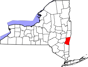 | |
| Towns | ||
| Villages | ||
| CDPs | ||
| Other hamlets | ||
| Footnotes | ‡This populated place also has portions in an adjacent county or counties | |