Chatham (town), New York
| Chatham, New York | |
|---|---|
| Town | |
|
Old Chatham | |
 Location of Chatham, New York | |
| Coordinates: 42°25′05″N 73°34′35″W / 42.41806°N 73.57639°WCoordinates: 42°25′05″N 73°34′35″W / 42.41806°N 73.57639°W | |
| Country | United States |
| State | New York |
| County | Columbia |
| Established | 1795 |
| Government | |
| • Type | Town Council |
| • Town Supervisor | Jesse DeGroodt (R) |
| • Town Council |
Members
|
| Area | |
| • Total | 53.6 sq mi (138.7 km2) |
| • Land | 53.2 sq mi (137.9 km2) |
| • Water | 0.3 sq mi (0.8 km2) |
| Elevation | 239 ft (73 m) |
| Population (2010)[1] | |
| • Total | 4,128 |
| • Density | 77/sq mi (29.9/km2) |
| Time zone | Eastern (EST) (UTC-5) |
| • Summer (DST) | EDT (UTC-4) |
| ZIP code | 12037 |
| Area code(s) | 518 |
| FIPS code | 36-14014 |
| GNIS feature ID | 0978814 |
| Website |
www |
.jpg)
Chatham /ˈtʃætəm/ is a town in Columbia County, New York, United States. The population was 4,128 at the 2010 census.[1]
The town has a village also called Chatham on its south town line. The town is at the north border of Columbia County.
History
The early settlers were Dutch, but later Quakers and New Englanders arrived. The town of Chatham was formed from the towns of Canaan and Kinderhook in 1795. Contradictory of its current condition or image, Chatham was an industrial center of multiple inter-state rail lines in the early 1900s, including the junction of the Boston and Albany Railroad for connections east and west, the Rutland Railroad for connections to Vermont to the north, and the New York Central's Harlem Line for connections to New York City. In 1887 a terminal designed by Henry Hobson Richardson was constructed.[2] Amtrak service on the Lake Shore Limited passes through, east-west, but does not stop. In later years Amtrak has planned to build a rail station in Chatham.
The Blinn-Pulver Farmhouse, Melius-Bentley House, Peck House, Riders Mills Historic District, Silvernail Homestead, Simons General Store, Spengler Bridge, St. John's Lutheran Church, James G. Van Valkenburgh House, and John S. Williams House and Farm are listed on the National Register of Historic Places.[3]
Geography
According to the United States Census Bureau, the town has a total area of 53.6 square miles (138.7 km2), of which 53.2 square miles (137.9 km2) is land and 0.31 square miles (0.8 km2), or 0.59%, is water.[1]
The north town line is the border of Rensselaer County.
The north end of the Taconic State Parkway is in the town, and Interstate 90 passes through the town.
New York State Route 66 and New York State Route 203 intersect in the town.
Adjacent towns and areas
The town of Kinderhook is to the west, and the towns of Canaan and New Lebanon are to the east. The towns of Schodack and Nassau are to the north in Rensselaer County. The towns of Austerlitz and Ghent are to the south.
Demographics
| Historical population | |||
|---|---|---|---|
| Census | Pop. | %± | |
| 1820 | 3,372 | — | |
| 1830 | 3,538 | 4.9% | |
| 1840 | 3,662 | 3.5% | |
| 1850 | 3,839 | 4.8% | |
| 1860 | 4,163 | 8.4% | |
| 1870 | 4,372 | 5.0% | |
| 1880 | 4,574 | 4.6% | |
| 1890 | 4,019 | −12.1% | |
| 1900 | 3,537 | −12.0% | |
| 1910 | 3,396 | −4.0% | |
| 1920 | 2,705 | −20.3% | |
| 1930 | 2,908 | 7.5% | |
| 1940 | 2,873 | −1.2% | |
| 1950 | 3,188 | 11.0% | |
| 1960 | 3,402 | 6.7% | |
| 1970 | 3,770 | 10.8% | |
| 1980 | 4,294 | 13.9% | |
| 1990 | 4,413 | 2.8% | |
| 2000 | 4,249 | −3.7% | |
| 2010 | 4,128 | −2.8% | |
| Est. 2014 | 4,040 | [4] | −2.1% |
As of the census[6] of 2000, there were 4,249 people, 1,762 households, and 1,196 families residing in the town. The population density was 79.8 people per square mile (30.8/km²). There were 2,110 housing units at an average density of 39.6 per square mile (15.3/km²). The racial makeup of the town was 96.00% White, 1.74% Black or African American, 0.21% Native American, 0.71% Asian, 0.16% Pacific Islander, 0.16% from other races, and 1.01% from two or more races. Hispanic or Latino of any race were 0.75% of the population.
There were 1,762 households out of which 29.4% had children under the age of 18 living with them, 56.1% were married couples living together, 8.3% had a female householder with no husband present, and 32.1% were non-families. 25.1% of all households were made up of individuals and 8.3% had someone living alone who was 65 years of age or older. The average household size was 2.41 and the average family size was 2.87.
In the town the population was spread out with 23.5% under the age of 18, 5.7% from 18 to 24, 24.6% from 25 to 44, 33.0% from 45 to 64, and 13.2% who were 65 years of age or older. The median age was 43 years. For every 100 females there were 96.0 males. For every 100 females age 18 and over, there were 93.1 males.
The median income for a household in the town was $49,234, and the median income for a family was $60,097. Males had a median income of $40,067 versus $26,452 for females. The per capita income for the town was $28,599. About 4.8% of families and 6.6% of the population were below the poverty line, including 6.6% of those under age 18 and 4.6% of those age 65 or over.
Communities and locations in the town
- Chatham – The northern half of the village of Chatham is in the town by the south town line.
- Chatham Center – A hamlet on NY-66 west of the geographic center of town and north of Chatham village.
- East Chatham – A hamlet at the east town line east of Old Chatham.
- Kinderhook Lake – A lake partly in the town by the west town line.
- Malden Bridge – A hamlet in the north part of the town, east of North Chatham.
- New Concord – A hamlet east of Rock City by the east town line.
- North Chatham – A hamlet in the northwest corner of the town. The Peck House and North Chatham Historic District are listed on the National Register of Historic Places.[3][7]
- Old Chatham – A hamlet northeast of the geographic center of the town. It is one of the earliest settlements in the town.
- Rayville – A hamlet in the northeast part of the town, northeast of Old Chatham on NY-66.
- Riders – A hamlet in the northeast quadrant of the town between Riders Mills and Rayville.
- Riders Mills – A hamlet in the northeast part of the town.
- Rock City – A hamlet south of the geographic center of the town and north of Chatham village.
Notable people
- Actor David Schramm, who portrayed Roy Biggins in the 1990s sitcom Wings, has a home in Chatham.[8]
- Moe Howard, leader of The Three Stooges comedy team, owned a home in Chatham for many years.
References
- 1 2 3 "Geographic Identifiers: 2010 Demographic Profile Data (G001): Chatham town, Columbia County, New York". U.S. Census Bureau, American Factfinder. Retrieved December 9, 2014.
- ↑ John C. Dahl, "Great Railroad Stations: Chatham, New York"
- 1 2 National Park Service (2010-07-09). "National Register Information System". National Register of Historic Places. National Park Service.
- ↑ "Annual Estimates of the Resident Population for Incorporated Places: April 1, 2010 to July 1, 2014". Retrieved June 4, 2015.
- ↑ "Census of Population and Housing". Census.gov. Archived from the original on May 11, 2015. Retrieved June 4, 2015.
- ↑ "American FactFinder". United States Census Bureau. Archived from the original on 2013-09-11. Retrieved 2008-01-31.
- ↑ "National Register of Historic Places Listings". Weekly List of Actions Taken on Properties: 9/04/12 through 9/07/12. National Park Service. 2012-09-14.
- ↑ Filichia, Peter (13 November 2008). "David Schramm stars in 'The Seafarer' at the George Street Playhouse". NJ.com. Retrieved 27 February 2015.
External links
- Town of Chatham official website
- Chatham Public Library
- Historical information about Chatham, NY
- Chatham information
- Shaker Museum, Old Chatham
- Chatham Area Business Alliance
Municipalities and communities of Columbia County, New York, United States | ||
|---|---|---|
| City | 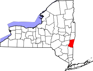 | |
| Towns | ||
| Villages | ||
| CDPs | ||
| Other hamlets | ||
| Footnotes | ‡This populated place also has portions in an adjacent county or counties | |