Georgesville, Ohio
| Georgesville, Ohio | |
|---|---|
| Unincorporated community | |
 Location of Georgesville, Ohio | |
| Coordinates: 39°53′27″N 83°13′19″W / 39.89083°N 83.22194°WCoordinates: 39°53′27″N 83°13′19″W / 39.89083°N 83.22194°W | |
| Country | United States |
| State | Ohio |
| County | Franklin |
| Township | Pleasant |
| Time zone | Eastern (EST) (UTC-5) |
| • Summer (DST) | EDT (UTC-4) |
| ZIP codes | 43119 (Galloway) |
| Area code(s) | 614 |
| GNIS feature ID | 1064712 |
Georgesville is an unincorporated community in western Pleasant Township, Franklin County, Ohio, United States. It is located southwest of Columbus, the county seat of Franklin County and the capital and largest city of Ohio.[1] Georgesville lies at the confluence of Little Darby Creek and Big Darby Creek, which are State and National Scenic Rivers[2] and tributaries of the Scioto River. Much of the swamp forest and prairie surrounding Georgesville is part of Battelle Darby Creek Park.
History
Situated across Big Darby from Georgesville, on the eastern bank below the confluence, the O.C. Voss site includes a Fort Ancient village and ceremonial mound.[3] The reconstructed mound is located along the Ancient Trail in Battelle Darby Creek Park.
In 1797, Georgesville was founded as Central Ohio's first permanent white settlement (the same year as Franklinton). The town was originally situated on the eastern bank of Big Darby, now the site of Oak Grove Cemetery. A railway station was built on the western bank of Big Darby, and Georgesville occupies this site today, although the railway station is long gone.
Alkire Road originally featured two wooden covered bridges, spanning the Big and Little Darby above their confluence. The covered bridges were replaced by steel truss bridges (a Pratt truss over Little Darby and a Camelback truss over Big Darby), which were in turn replaced by modern reinforced concrete bridges, in a new configuration, in the 1990s. Before the truss bridges were torn down tests involving maximum load were conducted. At the time these bridge types were still common throughout the Midwest. The destruction of the bridges provided a wealth of information for engineers.
Today the river around Georgesville is one of many entry points for Battelle Darby Creek Park. The Darby watershed is one of the most biologically diverse aquatic systems in the Midwest due to conservation efforts in the park and across Ohio.
The Camp Chase Multi-Use Trail now runs alongside the still active rail line running through the village. When fully completed it will be 15 miles and part of the larger Ohio to Erie Trail which will connect NE Ohio through Columbus and SW to Cincinnati.
Notable people
- George L. Converse, U.S. Representative from Ohio (1879–1881)
See also
References
- ↑ DeLorme. Ohio Atlas & Gazetteer. 5th ed. Yarmouth: DeLorme, 1999, p. 67. ISBN 0-89933-270-6.
- ↑ Big Darby Creek State and National Scenic River
- ↑ Brady-Rawlins, Kathleen. The O.C. Voss Site: Reassessing What We Know About the Fort Ancient Occupation of the Central Scioto Drainage and Its Tributaries
Municipalities and communities of Franklin County, Ohio, United States | ||
|---|---|---|
| Cities | 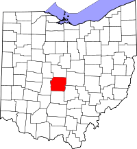 | |
| Villages | ||
| Townships | ||
| CDPs | ||
| Unincorporated communities | ||
| Footnotes | ‡This populated place also has portions in an adjacent county or counties | |