Pleasant Township, Franklin County, Ohio
| Pleasant Township, Franklin County, Ohio | |
|---|---|
| Township | |
|
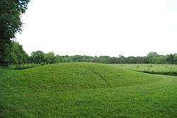
John Galbreath Mound | |
 Location of Pleasant Township in Franklin County | |
| Coordinates: 39°50′46″N 83°10′48″W / 39.84611°N 83.18000°WCoordinates: 39°50′46″N 83°10′48″W / 39.84611°N 83.18000°W | |
| Country | United States |
| State | Ohio |
| County | Franklin |
| Area | |
| • Total | 43.6 sq mi (112.9 km2) |
| • Land | 43.0 sq mi (111.3 km2) |
| • Water | 0.6 sq mi (1.6 km2) |
| Elevation[1] | 909 ft (277 m) |
| Population (2010) | |
| • Total | 6,671 |
| • Density | 155/sq mi (59.9/km2) |
| Time zone | Eastern (EST) (UTC-5) |
| • Summer (DST) | EDT (UTC-4) |
| FIPS code | 39-63254[2] |
| GNIS feature ID | 1086112[1] |
| Website |
www |
Pleasant Township is one of the seventeen townships of Franklin County, Ohio, United States. As of the 2010 census, the population was 6,671,[3] of whom 6,351 lived in the unincorporated portions of the township.[4][5]
Geography
Located in the southwestern corner of the county, it borders the following townships:
- Prairie Township - north
- Jackson Township - east
- Scioto Township, Pickaway County - southeast
- Darby Township, Pickaway County - south
- Fairfield Township, Madison County - west
- Jefferson Township, Madison County - northwest
Parts of two municipalities are located in Pleasant Township: the city of Columbus, the county seat of Franklin County, in the northeast; and the village of Harrisburg, in the south. The unincorporated communities of Darbydale and Georgesville lie in the township's south and west, respectively.
Name and history
It is one of fifteen Pleasant Townships statewide.[6]
In 1833, a gristmill and a saw mill operated on Little Darby Creek in the northern part of Pleasant Township.[7]
Government
The township is governed by a three-member board of trustees, who are elected in November of odd-numbered years to a four-year term beginning on the following January 1. Two are elected in the year after the presidential election and one is elected in the year before it. There is also an elected township fiscal officer,[8] who serves a four-year term beginning on April 1 of the year after the election, which is held in November of the year before the presidential election. Vacancies in the fiscal officership or on the board of trustees are filled by the remaining trustees.
References
- 1 2 "US Board on Geographic Names". United States Geological Survey. 2007-10-25. Retrieved 2008-01-31.
- ↑ "American FactFinder". United States Census Bureau. Retrieved 2008-01-31.
- ↑ "Geographic Identifiers: 2010 Census Summary File 1 (G001), Pleasant township, Franklin County, Ohio". American FactFinder. U.S. Census Bureau. Retrieved July 1, 2016.
- ↑ "Geographic Identifiers: 2010 Census Summary File 1 (G001), Darbydale CDP, Pleasant township, Franklin County, Ohio". American FactFinder. U.S. Census Bureau. Retrieved July 1, 2016.
- ↑ "Geographic Identifiers: 2010 Census Summary File 1 (G001), Remainder of Pleasant township, Pleasant township, Franklin County, Ohio". American FactFinder. U.S. Census Bureau. Retrieved July 1, 2016.
- ↑ "Detailed map of Ohio" (PDF). United States Census Bureau. 2000. Retrieved 2007-02-16.
- ↑ Kilbourn, John (1833). "The Ohio Gazetteer, or, a Topographical Dictionary". Scott and Wright. p. 375. Retrieved 12 December 2013.
- ↑ §503.24, §505.01, and §507.01 of the Ohio Revised Code. Accessed 4/30/2009.
External links
Municipalities and communities of Franklin County, Ohio, United States | ||
|---|---|---|
| Cities | 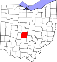 | |
| Villages | ||
| Townships | ||
| CDPs | ||
| Unincorporated communities | ||
| Footnotes | ‡This populated place also has portions in an adjacent county or counties | |